|
Maya Mountains
The Maya Mountains are a mountain range located in Belize and eastern Guatemala, in Central America. Etymology The Maya Mountains were known as the ''Cockscomb'' or ''Coxcomb Mountains'' to Baymen and later Belizeans at least until the mid-20th century. Their current appellation is thought to be in honour of the Mayan civilisation. Geography Physical Peaks The range's highest peaks are Doyle's Delight at and Victoria Peak at . Rivers Nine streams with a Strahler order greater than 1 flow from the Mountains into the Caribbean Sea, namely, five tributaries of the Belize River, two tributaries of the Monkey River, and the Sittee River and Boom Creek. Karst Prominent karstic features within the Mountains include the Chiquibul Spring and Cave System, the Vaca Plateau, the Southern and Northern Boundary Faults, and possibly an aquifer contiguous with that of the Yucatán Peninsula. Plutons The Mountains 'are the only source of igneous and metamorphic materi ... [...More Info...] [...Related Items...] OR: [Wikipedia] [Google] [Baidu] |
Doyle's Delight
Doyle's Delight is the highest peak in Belize at . It lies on the Maya Divide, the main ridge line of the Maya Mountains in southwestern Belize. The name Doyle's Delight was first coined by Sharon Matola in a 1989 report. The name is based on Sir Arthur Conan Doyle's book ''The Lost World'' (1912), which contains the quote "there must be something wild and wonderful in a country such as this, and we're the men to find it out!". This name has meanwhile achieved widespread acceptance. The official Government of Belize Website lists Doyle's Delight as the highest point in Belize. The capital of Belize, Belmopan, has a "Doyle's Delight Street". Recently there has been an attempt to rename the peak to "Kaan Witz" which is Maya for "Sky Mountain", but the new name has not gained widespread acceptance. Although Victoria Peak was for many years touted as the highest point in Belize, recent assessments determined that it is apparently slightly lower at . Victoria Peak is located east ... [...More Info...] [...Related Items...] OR: [Wikipedia] [Google] [Baidu] |
Vaca Forest Reserve
Vaca Forest Reserve is a nature reserve in the Cayo District of western Belize. The reserve covers an area of . It is bordered to the west by Guatemala, to the east by Mountain Pine Ridge Forest Reserve and Nojkaaxmeen Elijio Panti National Park, and to the south by Chiquibul National Park. It forms part of the greater Maya Mountains massif. Vaca Forest Reserve was established in 1991 and originally consisted of an estimated . In 2003, over were removed from the reserve by the Government of Belize to provide more land to farmers from the buffering communities. In 2011, an additional were removed. In recent years, the reserve has been seriously degraded by agricultural encroachment, illegal logging, and forest fires A forest fire A wildfire, forest fire, or a bushfire is an unplanned and uncontrolled fire in an area of combustible vegetation. Depending on the type of vegetation present, a wildfire may be more specifically identified as a bushfire ( in Au .... References ... [...More Info...] [...Related Items...] OR: [Wikipedia] [Google] [Baidu] |
Geologic Province
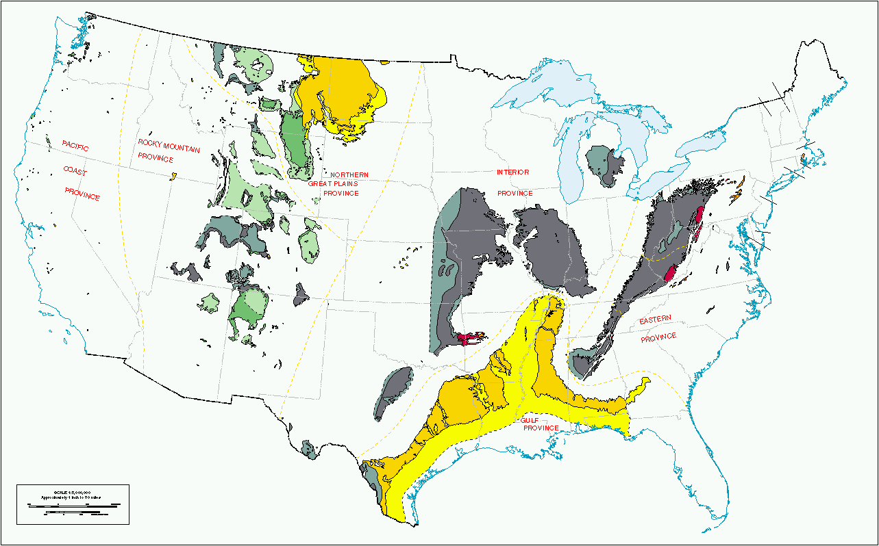
A geologic province or geological province is a spatial entity with common geologic attributes. A province may include a single dominant structural element such as a basin or a fold belt, or a number of contiguous related elements. Adjoining provinces may be similar in structure but be considered separate due to differing histories. Geologic provinces by origin Geologic provinces by resources Some studies classify provinces based upon mineral resources, such as mineral deposits. There are a particularly large number of provinces identified worldwide for petroleum and other mineral fuels, such as the Niger Delta petroleum province. See also * Physiographic province * Geomorphology * United States Geological Survey The United States Geological Survey (USGS), founded as the Geological Survey, is an agency of the U.S. Department of the Interior whose work spans the disciplines of biology, geography, geology, and hydrology. The agency was founded on Mar ... R ... [...More Info...] [...Related Items...] OR: [Wikipedia] [Google] [Baidu] |
Maya Block
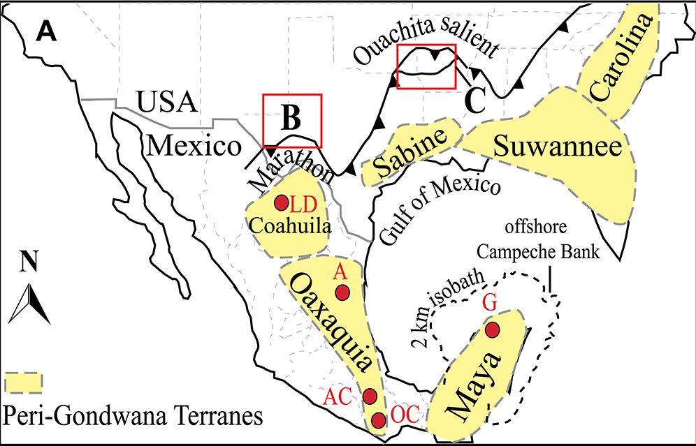
The Maya Block, also known as the Maya Terrane, Yucatan Block, or Yucatan–Chiapas Block, is a physiographic or geomorphic region and tectonic or crustal block in the southernmost portion of the North American Plate. Extent The Block is commonly delimited by the continental margin in the Gulf of Mexico to the north, in the Caribbean Sea to the east, and in the Pacific Ocean to the southwest, and further, by the Motagua–Polochic Faults to the south-southeast, and by the Isthmus of Tehuantepec to the west. The Motagua–Polochic Faults divide the Maya Block from the Chortis Block, while the Isthmus of Tehuantepec divides it from the Oaxaquia Block (i.e. the Juarez, Cuicateco, or Oaxaquia Block, Terrane, or microcontinent). The Block's subaerial limits are not widely agreed upon, in contrast to its relatively exact submarine borders. Furthermore, it has been recently suggested that the Block's western extreme may rather extend the Isthmus of Tehuantepec, along the Gu ... [...More Info...] [...Related Items...] OR: [Wikipedia] [Google] [Baidu] |
Massif
A massif () is a principal mountain mass, such as a compact portion of a mountain range, containing one or more summits (e.g. France's Massif Central). In mountaineering literature, ''massif'' is frequently used to denote the main mass of an individual mountain. As a purely scientific term in geology, however, a "massif" is separately and more specifically defined as a section of a planet's crust (geology), crust that is demarcated by geologic fault, faults or lithospheric flexure, flexures. In the plate tectonics, movement of the crust, a massif tends to retain its internal structure while being displaced as a whole. A massif is a smaller structural unit than a tectonic plate and is considered the fourth-largest driving force in geomorphology. The word "massif" originates from French (in which the word also means "massive"), where it is used to refer to a large mountain mass or compact group of connected mountains forming an independent portion of a range. The Cydonia (regi ... [...More Info...] [...Related Items...] OR: [Wikipedia] [Google] [Baidu] |
White-lipped Peccary
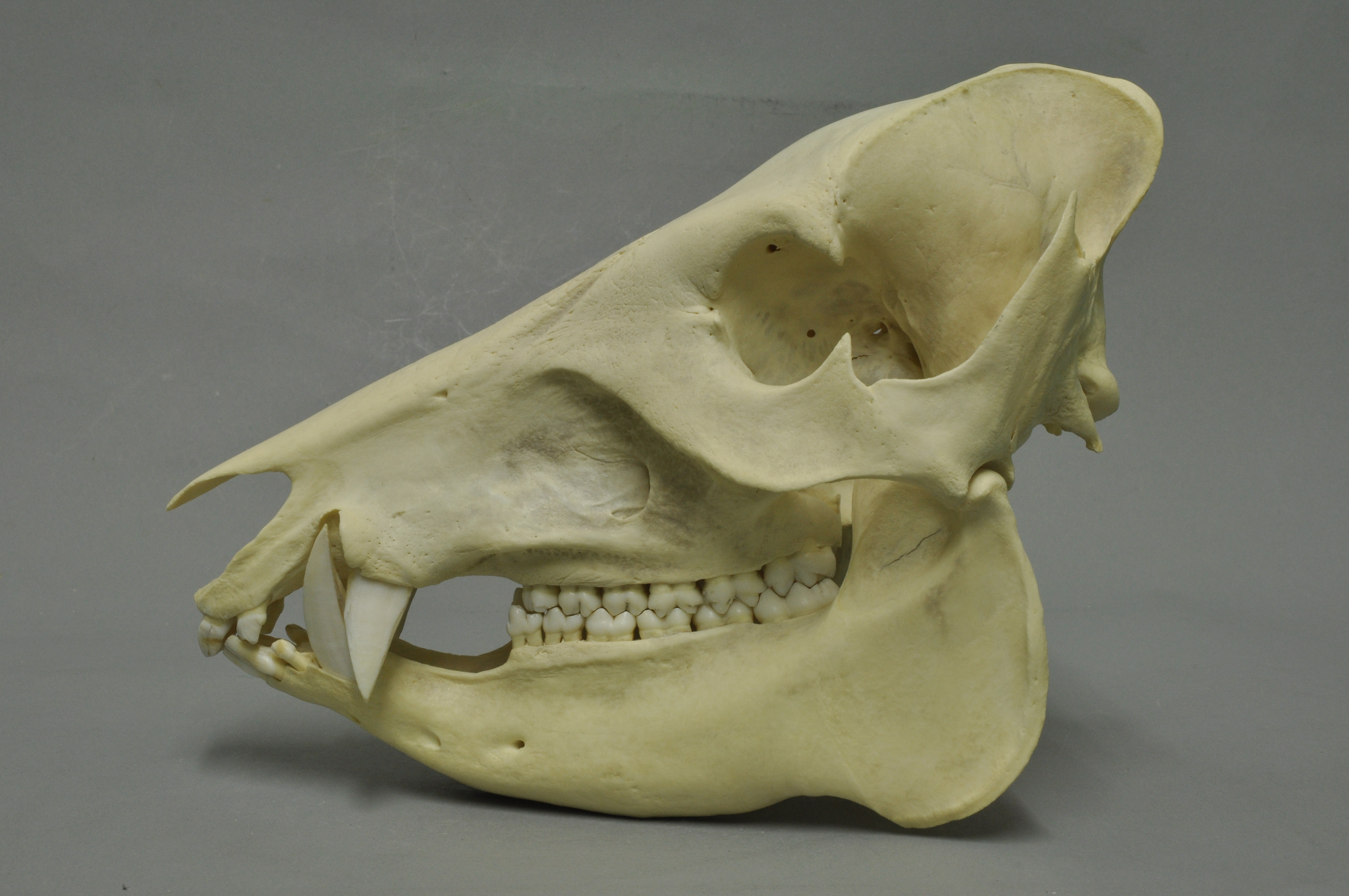
The white-lipped peccary (''Tayassu pecari'') is a species of peccary found in Central and South America and the only member of the genus ''Tayassu''. Multiple subspecies have been identified. White-lipped peccaries are similar in appearance to pigs, but covered in dark hair (except on certain regions, such as the throat, where it is cream). The range of ''T. pecari'', which extends from Mexico to Argentina, has become fragmented, and the species's population is declining overall (especially in Mexico and Central America). They can be found in a variety of habitats. Social animals, white-lipped peccaries typically forage in large groups, which can have as many as 300 peccaries. They are an important part of their ecosystem and multiple efforts are being made to preserve them in the wild. Not all disappearances are explained, but human activities play a role, with two major threats being deforestation and hunting; the latter is very common in rural areas, although it can be dan ... [...More Info...] [...Related Items...] OR: [Wikipedia] [Google] [Baidu] |
Caryota
''Caryota'' is a genus of palm trees. They are often known as fishtail palms because of the shape of their leaves. There are about 13 species native to Asia (China, India, Indonesia, etc.), northern Australia, and the South Pacific. One of the more widely known species is '' Caryota urens'', the flowers of which are used to make one type of jaggery (an unrefined sugar), and also to make palm wine. '' Caryota mitis'' is native to Indochina, but has become an invasive introduced species in the US state of Florida. They are also one of the few Arecaceae with bipinnate foliage. Many grow in mountainous areas and are adapted to warm mediterranean climates as well as subtropical and tropical climates.Govaerts, R. & Dransfield, J. (2005). World Checklist of Palms: 1-223. The Board of Trustees of the Royal Botanic Gardens, Kew. Fishtail palms contain raphides. Species Gallery File:Fishtail palm.JPG, Fishtail palm at Bhopal File:Fishtail palm1.JPG, Fishtail palm at Bhopal B ... [...More Info...] [...Related Items...] OR: [Wikipedia] [Google] [Baidu] |
Bird Migration
Bird migration is a seasonal movement of birds between breeding and wintering grounds that occurs twice a year. It is typically from north to south or from south to north. Animal migration, Migration is inherently risky, due to predation and mortality. The Arctic tern holds the long-distance migration record for birds, travelling between Arctic breeding grounds and the Antarctic each year. Some species of Procellariiformes, tubenoses, such as albatrosses, circle the Earth, flying over the southern oceans, while others such as Manx shearwaters migrate between their northern breeding grounds and the southern ocean. Shorter migrations are common, while longer ones are not. The shorter migrations include altitudinal migrations on mountains, including the Andes and Himalayas. The timing of migration seems to be controlled primarily by changes in day length. Migrating birds navigate using celestial cues from the Sun and stars, the Earth's magnetic field, and mental maps. Histor ... [...More Info...] [...Related Items...] OR: [Wikipedia] [Google] [Baidu] |
BirdLife International
BirdLife International is a global partnership of non-governmental organizations that strives to conserve birds and their habitats. BirdLife International's priorities include preventing extinction of bird species, identifying and safeguarding important sites for birds, maintaining and restoring key bird habitats, and empowering conservationists worldwide. It has a membership of more than 2.5 million people across List of BirdLife International national partner organisations, 116 country partner organizations, including the Royal Society for the Protection of Birds, the Wild Bird Society of Japan, the National Audubon Society, and American Bird Conservancy. BirdLife International has identified 13,000 Important Bird Area, Important Bird and Biodiversity Areas and is the official International Union for Conservation of Nature's IUCN Red List, Red List authority for birds. BirdLife International has established that 1,375 bird species (13% of the total) are threatened with extinc ... [...More Info...] [...Related Items...] OR: [Wikipedia] [Google] [Baidu] |
Important Bird Area
An Important Bird and Biodiversity Area (IBA) is an area identified using an internationally agreed set of criteria as being globally important for the conservation of bird populations. IBA was developed and sites are identified by BirdLife International. There are over 13,000 IBAs worldwide. These sites are small enough to be entirely conserved and differ in their character, habitat or ornithological importance from the surrounding habitat. In the United States the program is administered by the National Audubon Society. Often IBAs form part of a country's existing protected area network, and so are protected under national legislation. Legal recognition and protection of IBAs that are not within existing protected areas varies within different countries. Some countries have a National IBA Conservation Strategy, whereas in others protection is completely lacking. History In 1985, following a specific request from the European Economic Community, Birdlife International dr ... [...More Info...] [...Related Items...] OR: [Wikipedia] [Google] [Baidu] |
Cultural Triangle Yaxha-Nakum-Naranjo National Park
The Cultural Triangle Yaxha-Nakum-Naranjo National Park (Triángulo Cultural in Spanish) is a multidisciplinary project involving archaeologists, architects, restaurateurs, and biologists. It is situated in Petén, Guatemala. The project does not only work in one archaeological site, but in a region of including three gigantic sites and 14 sub-centers – the most populated area of the Classic period of the Maya civilization. History The project, founded in 1994, started with over 300 Guatemalan workers and 12 scientists. The first work carried out was at Topoxte, an island within the lake of Yaxha. Here you find the only exposed architecture of the Maya Postclassic period in the whole Petén Basin. One of the temples, so called Temple C, was near to its collapse. That’s why the team restored it during the first two years. Today the island is one of the principal points of interest in the Petén and the cooperative of the project brings many tourists by boat to the island. Y ... [...More Info...] [...Related Items...] OR: [Wikipedia] [Google] [Baidu] |
Montañas Mayas Chiquibul
Montañas Mayas Chiquibul is a biosphere reserve in the north of Guatemala. It is located in the municipalities of San Luis, Poptún, Dolores, and Melchor de Mencos in the department of El Petén EL, El or el may refer to: Arts and entertainment Fictional entities * El, a character from the manga series ''Shugo Chara!'' by Peach-Pit * Eleven (''Stranger Things'') (El), a fictional character in the TV series ''Stranger Things'' * El, fami ..., and covers an area of . References External links Parkswatch Biosphere reserves of Guatemala {{NorthAm-protected-area-stub ... [...More Info...] [...Related Items...] OR: [Wikipedia] [Google] [Baidu] |


