|
Marz (Armenia)
Armenia is subdivided into eleven administrative divisions. Of these, ten are provinces, known as () or in the singular form () in Armenian. Yerevan is treated separately and granted special administrative status as the country's capital. The chief executive in each of 10 ''marz''es is the ''marzpet'', appointed by the government of Armenia. In Yerevan, the chief executive is the mayor, elected by the Yerevan City Council. First-level administrative divisions The following is a list of the provinces with population, area, and density information. Figures are from the Statistical Committee of Armenia. The area of the Gegharkunik Province includes Lake Sevan which covers of its territory: Municipalities (''hamaynkner'') Within each province of the republic, there are municipal communities (''hamaynkner'', singular ''hamaynk''), currently considered the second-level administrative division in Armenia. Each municipality - known officially as community, either rural or ur ... [...More Info...] [...Related Items...] OR: [Wikipedia] [Google] [Baidu] |
Aragatsotn Province
Aragatsotn (, ) is a administrative divisions of Armenia, province (''Marz (country subdivision), marz'') of Armenia. It is located in the western part of the country. The capital and largest city of the province is the town of Ashtarak. The Statistical Committee of Armenia reported its population was 128,941 in the 2022 census. Etymology Literally meaning "the foot of Mount Aragats, Aragats" (the highest mountain of Armenia), it is named after the Aragatsotn canton of the historic Ayrarat province of Kingdom of Armenia (antiquity), Ancient Armenia, ruled by the Amatuni noble family under the reign of the Arsacid dynasty of Armenia, Arsacid dynasty. Geography Aragatsotn Province occupies the northwestern part of Armenia and covers an area of 2,756 km2 (9.3% of the total area of Armenia). It has internal borders with Shirak Province from the north, Lori Province from the northeast, Kotayk Province from the east, Armavir Province from the south and the city of Yerevan from ... [...More Info...] [...Related Items...] OR: [Wikipedia] [Google] [Baidu] |
Armenian Language
Armenian (endonym: , , ) is an Indo-European languages, Indo-European language and the sole member of the independent branch of the Armenian language family. It is the native language of the Armenians, Armenian people and the official language of Armenia. Historically spoken in the Armenian highlands, today Armenian is also widely spoken throughout the Armenian diaspora. Armenian is written in its own writing system, the Armenian alphabet, introduced in 405 AD by Saint Mesrop Mashtots. The estimated number of Armenian speakers worldwide is between five and seven million. History Classification and origins Armenian is an independent branch of the Indo-European languages. It is of interest to linguists for its distinctive phonological changes within that family. Armenian exhibits Centum and satem languages, more satemization than centumization, although it is not classified as belonging to either of these subgroups. Some linguists tentatively conclude that Armenian, Greek ... [...More Info...] [...Related Items...] OR: [Wikipedia] [Google] [Baidu] |
Yeghegnadzor
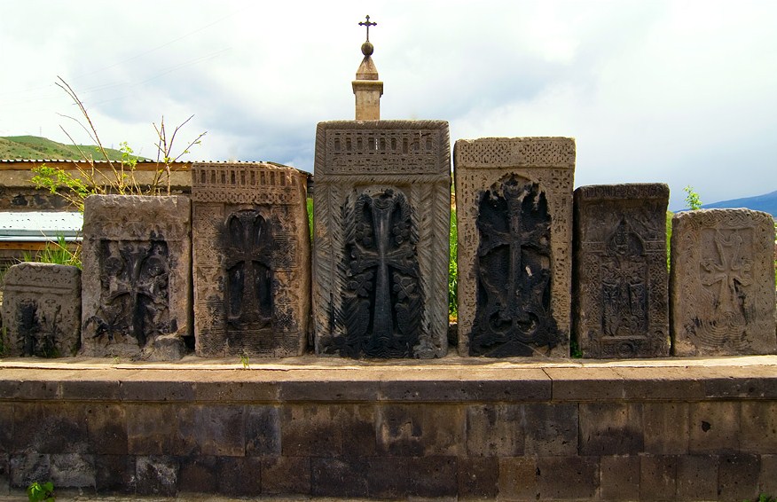
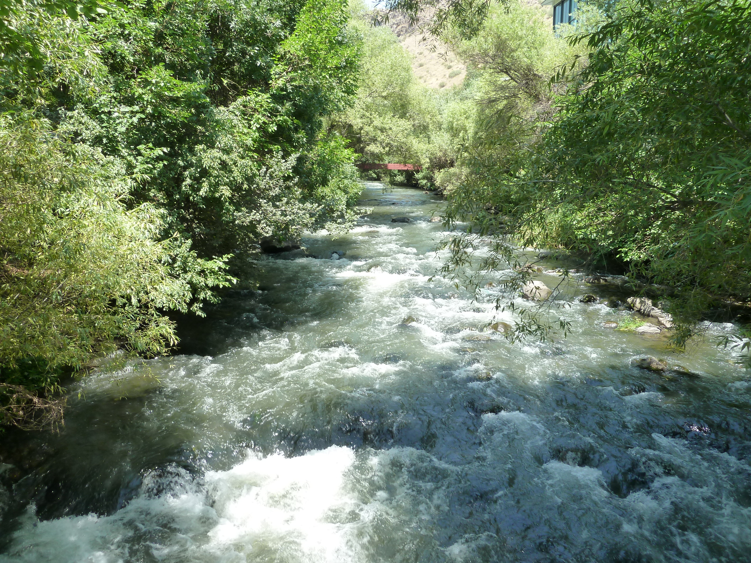
Yeghegnadzor ( ) is a town and urban municipal community in southern Armenia, serving as the provincial capital of Vayots Dzor Province and the Yeghegnadzor Municipality. It is located at a road distance of south of the capital Yerevan, on the shores of Srkghonk River (), at a height of above sea level. As per the 2016 official estimate, Yeghegnadzor had a population of around 6,600. As of the 2011 census, the population of the town was 7,944 and as of the 2022 census, the population of the town was 6,912. Yeghegnadzor is the seat of the Diocese of Vayots Dzor of the Armenian Apostolic Church. Etymology The name ''Yeghegnadzor'' consists of two Armenian words: ''yegheg'' () meaning ''cane'', and ''dzor'' () meaning ''valley''. Thus, the name of the town means "valley of canes". History The settlement was first mentioned as ''Pondzatagh'' during the 5th century. Historically, it belongs to the Vayots Dzor canton of Syunik; the 9th province of Greater Armenia (Armenia Maj ... [...More Info...] [...Related Items...] OR: [Wikipedia] [Google] [Baidu] |
Ijevan
Ijevan ( ) is a town and urban municipal community in the Ijevan Municipality of the Tavush Province of Armenia, also serving as the province's administrative centre. It is located at the center of the region, at the foot of Ijevan ridge of Gugark Mountains, on the shores of Aghstev River. Ijevan is the seat of the Diocese of Tavush of the Armenian Apostolic Church. Ijevan is located at a road distance of 137 km northeast of Yerevan. The Yerevan-Tbilisi highway passes through Ijevan. As of the 2011 census, the population of the town was 21,081, making it the most populated town in the province. Ijevan is also famous for its beautiful mountains. As of the 2022 census, the population of the town was 18,689. Etymology The town's current name ''Ijevan'', and its former name ''Karavansara'' (until 1919), both mean "inn" (caravanserai), in Armenian and Persian, respectively. The area of modern-day Ijevan used to have many roadside inns known as caravanserais that served travel ... [...More Info...] [...Related Items...] OR: [Wikipedia] [Google] [Baidu] |
Kapan
Kapan ( ) is a town in southeast Armenia, serving as the administrative centre of the Kapan Municipality and also as the provincial capital of Syunik Province. It is located in the valley of the Voghji (river), Voghji River and is on the northern slopes of Khustup, Mount Khustup. Kapan is the most populous town in the Syunik Province as well as the entire region of southern Armenia. According to the 2011 census, the population of Kapan was 43,190, a slight decline from 45,711 in the 2001 census. According to the 2022 census, the current population of the town is around 32,780. Etymology The name Kapan derives from the Classical Armenian common noun (wikt:կապան, կապան), meaning (related to the verb ). In later centuries, the name evolved into (), which was in use until 1991, when the older form of the name was restored. History Ancient history and Middle Ages The area of modern-day Kapan was first mentioned in the 5th century as a small settlement within the proper ... [...More Info...] [...Related Items...] OR: [Wikipedia] [Google] [Baidu] |
Gyumri
Gyumri (, ) is an urban municipal community and the List of cities and towns in Armenia, second-largest city in Armenia, serving as the administrative center of Shirak Province in the northwestern part of the country. By the end of the 19th century, when the city was known as Alexandropol, it became the largest city of Russian-ruled Eastern Armenia with a population above that of Yerevan. The city became renowned as a cultural hub, while also carrying significance as a major center of Russian troops during Russo-Turkish wars of the 19th century. The city underwent a tumultuous period during and after World War I. While Russian forces withdrew from the South Caucasus due to the October Revolution, the city became host to large numbers of Armenian refugees fleeing the Armenian genocide, in particular hosting 22,000 orphaned children in around 170 orphanage buildings. It was renamed Leninakan during the Soviet period and became a major industrial and textile center in Soviet Armenia. ... [...More Info...] [...Related Items...] OR: [Wikipedia] [Google] [Baidu] |
Vanadzor
Vanadzor (, ) is an urban municipal community and the third largest city in Armenia, serving as the capital of Lori Province in the northern part of the country. It is located about north of the capital Yerevan. As of the 2011 census, the city had a population of 86,199, down from 148,876 reported at the 1979 official census. Currently, the town has a population of approximately 75,186 as of the 2022 census. Vanadzor is the seat of the Diocese of Gougark of the Armenian Apostolic Church. Etymology In the official records of the Russian Empire, the city was labelled as (). Following the Sovietization of Armenia, the city was renamed (, alternatively ') in 1926 after Armenian Bolshevik revolutionary Alexander Miasnikian. In 1935, it was renamed ''Kirovakan'', after the Russian Bolshevik leader Sergey Kirov. A close associate of Miasnikian and Aghasi Khanjian, Kirov had been assassinated on December 1 of the previous year. On 25 June 1992, after Armenia gained its independe ... [...More Info...] [...Related Items...] OR: [Wikipedia] [Google] [Baidu] |
Hrazdan
Hrazdan ( ) is a town and urban municipal community in Armenia serving as the administrative centre of Kotayk Province, located northeast of the capital Yerevan. As of the 2011 census, the population of the town is 44,231. During the Soviet Union, Soviet period, Hrazdan was one of the industrialized centres of the Armenian SSR. The prelacy of the Diocese of Kotayk of the Armenian Apostolic Church is headquartered in Hrazdan. Etymology The town is named after the Hrazdan River, which flows through the town from north to south. The name ''Hrazdan'' itself is derived from the Middle-Persian name ''Frazdān,'' which is related to the Zoroastrian Persian mythology, mythology. ''Frazdān'' is the name of the lake mentioned in the Avesta while referring to Vishtaspa, Goshtasb's war with two of its enemies. Zoroastrianism in Armenia, Armenians were predominantly Zoroastrian before embracing Christianity, and Zoroastrian names were maintained in the geography of Armenia. History A ... [...More Info...] [...Related Items...] OR: [Wikipedia] [Google] [Baidu] |
Gavar
Gavar ( ) is a town in Armenia serving as the administrative centre of the Gavar Municipality and the Gegharkunik Province. It is situated among the high mountains of Gegham range to the west of Lake Sevan, with an average height of 1982 meters above sea level. Located 98 kilometers east of the capital Yerevan, the town had a population of 20,765 as per the 2011 census. As per the 2022 census, the population of Gavar is 17,741. Gavar is the seat of the Diocese of Gegharkounik of the Armenian Apostolic Church. Etymology The town was known as ''Nor Bayаzet'' (Նոր Բայազետ) or ''Novo-Bayazet'' () until 1959, named after the Western Armenian town of Bayazet (historically known as ''Daroynk'' and ''Arshakavan''). Between 1959 and 1995, the town was known as ''Kamo'', named after the Bolshevik revolutionary Kamo (Simon Ter-Petrosian). On December 4, 1995, the town was renamed back to its ancient name of ''Gavar'', meaning ''county'' in the Armenian language. However, ... [...More Info...] [...Related Items...] OR: [Wikipedia] [Google] [Baidu] |
Armavir, Armenia
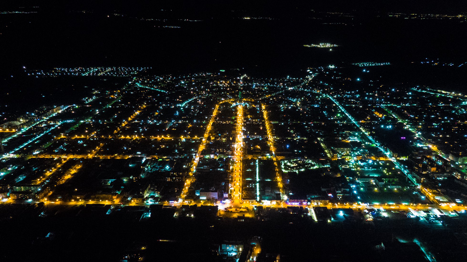
Armavir ( ), is a town and urban municipal community located in the west of Armenia serving as the administrative centre of Armavir Province. It was founded in 1931 by the government of the Armenian Soviet Socialist Republic. As of the 2011 census, the population of the town is 29,319, down from 46,900 as reported in the 1989 census. As of the 2022 census, the population of the town is 27,470. Currently, the town has a population of 38,495 as per the 2023 official estimate. The town was known as Sardarapat before 1935, and Hoktemberyan from 1935 to 1995. Currently, Armavir is the seat of the Diocese of Armavir of the Armenian Apostolic Church. Etymology Founded in 1931 as Sardarapat, the town was known as Hoktemberyan (meaning the ''city of October'') between 1935 and 1995, named in honor of the October Revolution. In 1992, the town was named Armavir by the government of independent Armenia, after the nearby ancient city of Armavir, that was founded in the 8th century BC b ... [...More Info...] [...Related Items...] OR: [Wikipedia] [Google] [Baidu] |
Artashat, Armenia
Artashat ( ) is a town and administrative center of the Artashat Municipality and the Ararat Province of Armenia. It is located on the Azat River in the Ararat Plain, 30 km southeast of Yerevan. Artashat was originally a village called Ghamarlu, established by Armenian migrants from Iran in 1828–29. It grew into a large village by the late 19th and early 20th centuries. In 1945, it was renamed after the ancient city of Artashat (Artaxata), the ruins of which are located southeast of the city. It received the status of an urban-type settlement in 1946 and that of a city in 1962, growing into an important industrial center in subsequent years. Artashat is located on the Yerevan- Goris-Stepanakert highway and the currently inoperative Yerevan- Nakhchivan-Baku and Nakhchivan-Tabriz railway. As of the 2022 census, the town had a population of 19,020. Name Modern Artashat is named after the ancient city of Artashat (also known as Artaxata), the ruins of which are located ar ... [...More Info...] [...Related Items...] OR: [Wikipedia] [Google] [Baidu] |
Ashtarak
Ashtarak ( ) is a town in the Ashtarak Municipality of the Aragatsotn Province of Armenia, located on the left bank of Kasagh River along the gorge, 20 kms northwest of the capital Yerevan. It is the administrative centre of the province and an important crossroad of routes for the Yerevan–Gyumri–Vanadzor triangle. The town plays a great role in the national economy as well as the cultural life of Armenia through several industrial enterprises and cultural institutions. It has developed as a satellite town of Yerevan. The nearby village of Mughni is part of the Ashtarak municipality. As of the 2011 census, the population of the town was 18,834. However, as per the 2016 official estimate, the population of Ashtarak is 18,000. As of the 2022 census, the population of the town was 15,686. The prelacy of the Diocese of Aragatsotn of the Armenian Apostolic Church is headquartered in Ashtarak. Etymology The name of Ashtarak is the Armenian language, Armenian word for ''tower'' or ... [...More Info...] [...Related Items...] OR: [Wikipedia] [Google] [Baidu] |


