|
Yeghegnadzor
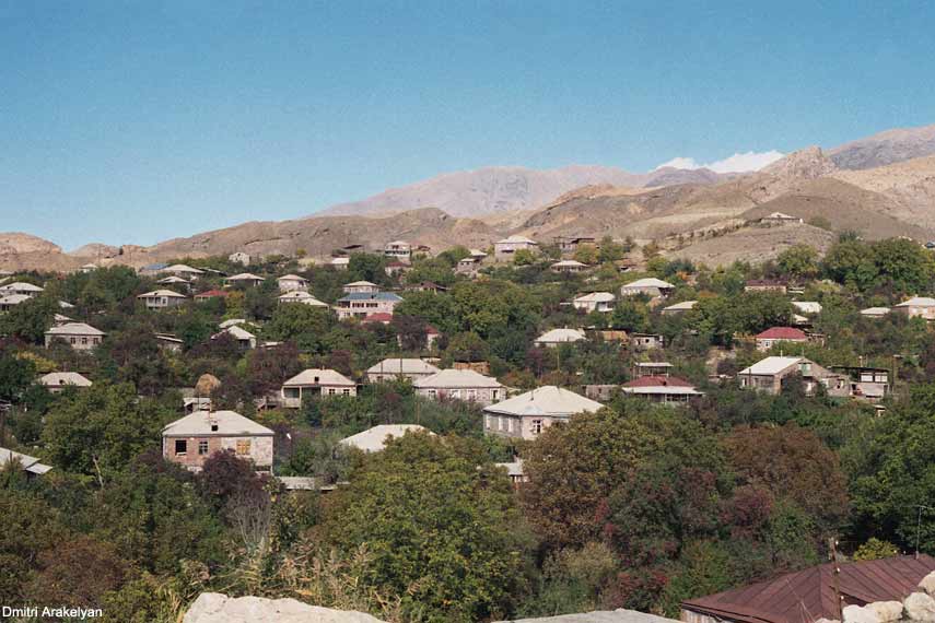
Yeghegnadzor ( ) is a town and urban municipal community in southern Armenia, serving as the provincial capital of Vayots Dzor Province and the Yeghegnadzor Municipality. It is located at a road distance of south of the capital Yerevan, on the shores of Srkghonk River (), at a height of above sea level. As per the 2016 official estimate, Yeghegnadzor had a population of around 6,600. As of the 2011 census, the population of the town was 7,944 and as of the 2022 census, the population of the town was 6,912. Yeghegnadzor is the seat of the Diocese of Vayots Dzor of the Armenian Apostolic Church. Etymology The name ''Yeghegnadzor'' consists of two Armenian words: ''yegheg'' () meaning ''cane'', and ''dzor'' () meaning ''valley''. Thus, the name of the town means "valley of canes". History The settlement was first mentioned as ''Pondzatagh'' during the 5th century. Historically, it belongs to the Vayots Dzor canton of Syunik; the 9th province of Greater Armenia (Armenia Maj ... [...More Info...] [...Related Items...] OR: [Wikipedia] [Google] [Baidu] |
Vayots Dzor Province
Vayots Dzor (, ) is a province (''marz'') of Armenia. It lies at the southeastern end of the country, bordering the Nakhchivan exclave of Azerbaijan to the west and the Kalbajar District of Azerbaijan to the east. It covers an area of . With a population of only 52,324 (2011 census), it is the most sparsely populated province in the country. The capital and largest city of the province is the town of Yeghegnadzor. A major wine-producing region in Armenia, Vayots Dzor is home to many ancient landmarks and historical attractions. Among them are the Areni-1 cave complex and Areni-1 winery of the Chalcolithic period, the 8th-century Tanahat Monastery, the 10th-century fortress of Smbataberd, and the 13th-century monastery of Noravank. The province is also home to the spa-town of Jermuk and the village of Gladzor, known for the 13th and 14th-century University of Gladzor. Etymology The province is named after the Vayots Dzor canton of historic Syunik, the ninth province of ... [...More Info...] [...Related Items...] OR: [Wikipedia] [Google] [Baidu] |
Yeghegnadzor Municipality
Vayots Dzor (, ) is a province (''marz'') of Armenia. It lies at the southeastern end of the country, bordering the Nakhchivan exclave of Azerbaijan to the west and the Kalbajar District of Azerbaijan to the east. It covers an area of . With a population of only 52,324 (2011 census), it is the most sparsely populated province in the country. The capital and largest city of the province is the town of Yeghegnadzor. A major wine-producing region in Armenia, Vayots Dzor is home to many ancient landmarks and historical attractions. Among them are the Areni-1 cave complex and Areni-1 winery of the Chalcolithic period, the 8th-century Tanahat Monastery, the 10th-century fortress of Smbataberd, and the 13th-century monastery of Noravank. The province is also home to the spa-town of Jermuk and the village of Gladzor, known for the 13th and 14th-century University of Gladzor. Etymology The province is named after the Vayots Dzor canton of historic Syunik, the ninth province of Ancie ... [...More Info...] [...Related Items...] OR: [Wikipedia] [Google] [Baidu] |
Diocese Of Vayots Dzor
Diocese of Vayots Dzor ( ''Vayots Dzori t'em''), is one of the newest dioceses of the Armenian Apostolic Church covering the Vayots Dzor Province of Armenia. The diocesan headquarters are located in the town of Yeghegnadzor. The seat of the bishop is the 12th-century Holy Mother of God Cathedral of Yeghegnadzor. The diocese was established in 2010, when it was separated from the Diocese of Syunik. The prelacy building is located on the Grigor Narekatsi Street in the town of Yeghagndzor. Structure The primate of the diocese is archbishop Abraham Mkrtchyan who is in service since the formation of the diocese in December 2010. The vicar is archimandrite Zareh Kabaghyan, while the remaining 5 priests are serving the 17 acting places of worship within the Vayots Dzor Province. The diocese has the following departments: *Administration *Media *Christian education centre *Youth union *Creativity group Active churches Here is the list of churches (10), monasteries (5) and chapels (2) ... [...More Info...] [...Related Items...] OR: [Wikipedia] [Google] [Baidu] |
Municipalities Of Armenia
A municipality in Armenia referred to as community ( ''hamaynk'', plural: ''hamaynkner''), is an administrative subdivision consisting of a settlement ( ''bnakavayr'') or a group of settlements ( ''bnakavayrer'') that enjoys local self-government. The settlements are classified as either towns ( ''kaghakner'', singular ''kaghak'') or villages ( ''gyugher'', singular ( ''gyugh''). The administrative centre of a community could either be an urban settlement (town) or a rural settlement (village). Two-thirds of the population are now urbanized. As of 2017, 63.6% of Armenians live in urban areas as compared to 36.4% in rural. As of the end of 2017, Armenia has 503 municipal communities (including Yerevan) of which 46 are urban and 457 are rural. The capital, Yerevan, also has the status of a community. Each municipality bears the same name as its administrative centre, with the exception of 7 municipalities, of which 4 are located in Shirak Province (Ani Municipality with its c ... [...More Info...] [...Related Items...] OR: [Wikipedia] [Google] [Baidu] |
Provinces Of Armenia
Armenia is subdivided into eleven administrative divisions. Of these, ten are provinces, known as () or in the singular form () in Armenian. Yerevan is treated separately and granted special administrative status as the country's capital. The chief executive in each of 10 ''marz''es is the ''marzpet'', appointed by the government of Armenia. In Yerevan, the chief executive is the mayor, elected by the Yerevan City Council. First-level administrative divisions The following is a list of the provinces with population, area, and density information. Figures are from the Statistical Committee of Armenia. The area of the Gegharkunik Province includes Lake Sevan which covers of its territory: Municipalities (''hamaynkner'') Within each province of the republic, there are municipal communities (''hamaynkner'', singular ''hamaynk''), currently considered the second-level administrative division in Armenia. Each municipality - known officially as community, either rural or ... [...More Info...] [...Related Items...] OR: [Wikipedia] [Google] [Baidu] |
List Of Cities And Towns In Armenia
This is a list of cities and towns in Armenia ordered by population by the Statistical Committee of Armenia (ArmStat). Armenia has 46 municipalities designated as urban communities ( ''k’aghak’ayin hamaynk’ner'') as of 2017. However, a city/town (քաղաք, ''k’aghak’ '') in Armenia is not defined based on the size of its population. The other 457 municipalities in Armenia are considered rural communities (գյուղական համայնքներ, ''gyughakan hamaynk’ner''). Two-thirds of the population are now urbanized. Statistically, 63.6% of Armenians live in urban areas as compared to 36.4% in rural, as of 2017. Yerevan, Gyumri, and Vanadzor are the three largest urban settlements of the republic, currently having populations of more than 50,000. They were considered as "cities of republican subordination" (հանրապետական ենթակայության քաղաքներ) during the Soviet period. The rest of the towns have populations less than 50,000. Aga ... [...More Info...] [...Related Items...] OR: [Wikipedia] [Google] [Baidu] |
Syunik (historic Province)
Syunik () was a region of historical Armenia and the ninth province (') of the Kingdom of Armenia from 189 BC until 428 AD. From the 7th to 9th centuries, it fell under Arab control. In 821, it formed two Armenian principalities: Kingdom of Syunik and principality of Khachen, which around the year 1000 was proclaimed the Kingdom of Artsakh, becoming one of the last medieval eastern Armenian kingdoms and principalities to maintain its autonomy following the Turkic invasions of the 11th to 14th centuries.Hewsen. ''Armenia'', pp. 118-121. Name The name Syunik is ancient and appears in the earliest Armenian written sources. ', a later name for the province of Iranian origin, first appears in the 6th-century Syriac chronicle of Pseudo-Zacharias; it is first mentioned in Armenian sources in the history of Movses Khorenatsi, who explains this name as deriving from Sisak, the name of one of the descendants of the legendary Armenian progenitor Hayk. Strabo mentions a region of Arm ... [...More Info...] [...Related Items...] OR: [Wikipedia] [Google] [Baidu] |
Sharur-Daralayaz Uezd
The Sharur-Daralayaz ''uezd'' was a county (''uezd'') of the Erivan Governorate of the Caucasus Viceroyalty of the Russian Empire. It bordered the governorate's Erivan and Nor Bayazet ''uezds'' to the north, the Nakhichevan uezd to the south, the Zangezur and Jevanshir ''uezds'' of the Elizavetpol Governorate to the east, and Persia to the southwest. It included most of the Vayots Dzor Province of present-day Armenia and the Sharur District of the Nakhchivan exclave of present-day Azerbaijan. The administrative centre of the county was Bashnorashen (present-day Sharur). Economy Armenians were mostly concentrated in mountainous Daralayaz, while lowland Sharur was overwhelmingly Tatar. The population in Daralayaz was engaged primarily in cattlebreeding while the residents of Sharur were engaged in agricultural farming and gardening. Manufacturing was not developed in this part of the governorate. Only 47 winemaking enterprises, 299 mills, 89 cotton-cleaning, 4 rice-cleanin ... [...More Info...] [...Related Items...] OR: [Wikipedia] [Google] [Baidu] |
Armenia
Armenia, officially the Republic of Armenia, is a landlocked country in the Armenian Highlands of West Asia. It is a part of the Caucasus region and is bordered by Turkey to the west, Georgia (country), Georgia to the north and Azerbaijan to the east, and Iran and the Azerbaijani exclave of Nakhchivan Autonomous Republic, Nakhchivan to the south. Yerevan is the Capital city, capital, largest city and Economy of Armenia, financial center. The Armenian Highlands has been home to the Hayasa-Azzi, Shupria and Nairi. By at least 600 BC, an archaic form of Proto-Armenian language, Proto-Armenian, an Indo-European languages, Indo-European language, had diffused into the Armenian Highlands.Robert Drews (2017). ''Militarism and the Indo-Europeanizing of Europe''. Routledge. . p. 228: "The vernacular of the Great Kingdom of Biainili was quite certainly Armenian. The Armenian language was obviously the region's vernacular in the fifth century BC, when Persian commanders and Greek writers ... [...More Info...] [...Related Items...] OR: [Wikipedia] [Google] [Baidu] |
Caravanserai
A caravanserai (or caravansary; ) was an inn that provided lodging for travelers, merchants, and Caravan (travellers), caravans. They were present throughout much of the Islamic world. Depending on the region and period, they were called by a variety of names including ''khan'', ''funduq'' and ''wikala.'' Caravanserais supported the flow of commerce, information, and people across the network of trade routes covering Asia, North Africa and Southeast Europe, most notably the Silk Road. In the countryside, they were typically built at intervals equivalent to a day's journey along important roads, where they served as a kind of Stage station, staging post. Urban versions of caravanserais were historically common in cities where they could serve as inns, depots, and venues for conducting business. The buildings were most commonly rectangular structures with one protected entrance. Inside, a central courtyard was surrounded by an array of rooms on one or more levels.'''' In additio ... [...More Info...] [...Related Items...] OR: [Wikipedia] [Google] [Baidu] |
Russian Empire
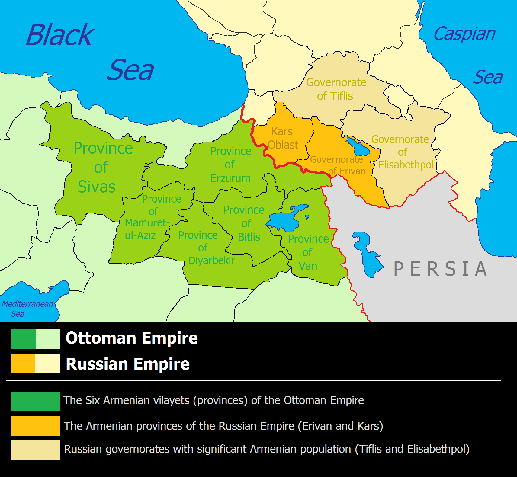
The Russian Empire was an empire that spanned most of northern Eurasia from its establishment in November 1721 until the proclamation of the Russian Republic in September 1917. At its height in the late 19th century, it covered about , roughly one-sixth of the world's landmass, making it the list of largest empires, third-largest empire in history, behind only the British Empire, British and Mongol Empire, Mongol empires. It also Russian colonization of North America, colonized Alaska between 1799 and 1867. The empire's 1897 census, the only one it conducted, found a population of 125.6 million with considerable ethnic, linguistic, religious, and socioeconomic diversity. From the 10th to 17th centuries, the Russians had been ruled by a noble class known as the boyars, above whom was the tsar, an absolute monarch. The groundwork of the Russian Empire was laid by Ivan III (), who greatly expanded his domain, established a centralized Russian national state, and secured inde ... [...More Info...] [...Related Items...] OR: [Wikipedia] [Google] [Baidu] |
Eastern Armenia
Eastern Armenia (Armenian: Արևելյան Հայաստան, ''Arevelyan Hayastan'') refers to the eastern portion of the Armenian Highlands, historically inhabited by the Armenian people. Throughout history, Eastern Armenia has been contested and ruled by various empires, including the Sasanian, Arab Caliphates, Safavid and Qajar Persia, the Russian Empire, and the Soviet Union. Today, it forms the core of the independent Republic of Armenia. The term gained more precise meaning after the 17th century, particularly following the Treaty of Zuhab (1639), which formalized the division of Armenian territories between the Ottoman Empire (Western Armenia) and Persia (Eastern Armenia). This distinction was reinforced in the 19th century with the Russian Empire’s annexation of Persian-controlled Eastern Armenian lands. Historical Partitions of Armenia Armenia was divided four major times during the medieval and early modern periods: * First Partition (387): Peace of Acilise ... [...More Info...] [...Related Items...] OR: [Wikipedia] [Google] [Baidu] |


