|
Luguvalium
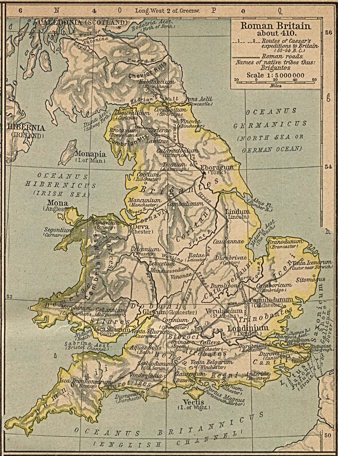
Luguvalium (or ''Luguvalium Carvetiorum'') was an ancient Roman Empire, Roman city in northern Roman Britain, Britain located within present-day Carlisle, Cumbria, Carlisle, Cumbria, and may have been the capital of the 4th-century Roman province, province of Valentia (Roman Britain), Valentia. It was the northernmost city of the Roman Empire. Location The city was located on a crossroads of major Roman north-south and east-west roads and situated near to the Roman frontier, first defined by the Stanegate road and then by Hadrian's Wall, leading to Luguvalium’s development as a supply base and major military and commercial centre. It also protected a strategic location and trade route overlooking the confluence of the River Caldew, Caldew and River Eden, Cumbria, Eden rivers. Today the Roman city is located mainly under the modern city of Carlisle, but the Roman fort around which the settlement developed is mainly beneath the grounds of the later Carlisle Castle. Name Th ... [...More Info...] [...Related Items...] OR: [Wikipedia] [Google] [Baidu] |
Carlisle, Cumbria
Carlisle ( , ; from ) is a city in the Cumberland (unitary authority), Cumberland district of Cumbria, England. Carlisle's early history is marked by the establishment of a settlement called Luguvalium to serve castra, forts along Hadrian's Wall in Roman Britain. Due to its proximity to Scotland (being located south of the current Anglo-Scottish border), Carlisle Castle and the city became an important military stronghold in the Middle Ages. The castle served as a prison for Mary, Queen of Scots in 1568 and currently hosts the Duke of Lancaster's Regiment and the Border Regiment Museum. A priory was built in the early 12th century, which subsequently became Carlisle Cathedral in 1133 on the creation of the Diocese of Carlisle. As the seat of a diocese, Carlisle therefore gained city status in the United Kingdom, city status. Carlisle also served as the county town of the Historic counties of England, historic county of Cumberland from the county's creation in the 12th century ... [...More Info...] [...Related Items...] OR: [Wikipedia] [Google] [Baidu] |
Stanegate
The Stanegate (meaning "stone road" in Northumbrian dialect) was an important Roman road and early frontier built in what is now northern England. It linked many forts including two that guarded important river crossings: Corstopitum (Corbridge) on the River Tyne in the east (situated on Dere Street) and Luguvalium (Carlisle) (on the River Eden) in the west. The Stanegate ran through the natural gap formed by the valleys of the River Tyne in Northumberland and the River Irthing in Cumbria. It predated the Hadrian's Wall frontier by several decades; the Wall would later follow a similar route, albeit slightly to the north. The Stanegate should not be confused with the two Roman roads called Stane Street in the south of England, namely Stane Street (Chichester) and Stane Street (Colchester). In both these cases the meaning is the same as for the northern version, indicating a stone or paved road. The Stanegate differed from most other Roman roads in that it often followed ... [...More Info...] [...Related Items...] OR: [Wikipedia] [Google] [Baidu] |
Roman Britain
Roman Britain was the territory that became the Roman province of ''Britannia'' after the Roman conquest of Britain, consisting of a large part of the island of Great Britain. The occupation lasted from AD 43 to AD 410. Julius Caesar invaded Britain in 55 and 54 BC as part of his Gallic Wars. According to Caesar, the Britons had been overrun or culturally assimilated by the Belgae during the British Iron Age and had been aiding Caesar's enemies. The Belgae were the only Celtic tribe to cross the sea into Britain, for to all other Celtic tribes this land was unknown. He received tribute, installed the friendly king Mandubracius over the Trinovantes, and returned to Gaul. Planned invasions under Augustus were called off in 34, 27, and 25 BC. In 40 AD, Caligula assembled 200,000 men at the Channel on the continent, only to have them gather seashells () according to Suetonius, perhaps as a symbolic gesture to proclaim Caligula's victory over th ... [...More Info...] [...Related Items...] OR: [Wikipedia] [Google] [Baidu] |
Carlisle Castle
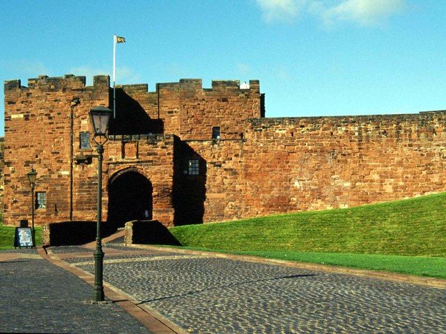
Carlisle Castle is a stone keep medieval fortress located in the city of Carlisle near the ruins of Hadrian's Wall. First built during the reign of William II in 1092 and rebuilt in stone under Henry I in 1122, the castle is over 930 years old and has been the scene of many episodes in British history. This Castle played an extremely important part in the wars between England and Scotland ( the Wars of Scottish Independence). It has been the centre of many wars and invasions. During the Jacobite Rising of 1745–6, Carlisle became the last English fortress to undergo a siege. The castle was listed as a Scheduled Ancient Monument on 7 August 1996. Today the property is managed by English Heritage and is open to the public. Until 2006, the castle was the administrative headquarters of the former King's Own Royal Border Regiment and until 2019 it was the county headquarters to the Duke of Lancaster's Regiment. A museum to the regiment is within the castle walls. Hist ... [...More Info...] [...Related Items...] OR: [Wikipedia] [Google] [Baidu] |
Carvetii
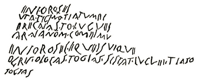
The Carvetii (Common Brittonic: *''Carwetī'') were a Brittonic Celtic tribe living in what is now Cumbria, in North-West England during the Iron Age, and were subsequently identified as a ''civitas'' (canton) of Roman Britain. Etymology The suffix ''carv-'' is related to Welsh ''carw'', Breton ''karv'' and Irish ''carow'' ('deer'). Richard von Kienle has proposed the translation "''those who belong to the deer''". Location Historical speculation has the Carvetii occupying the Solway Plain, the area immediately south of Hadrian's Wall, the Eden Valley, and possibly the Lune Valley. The Setantii may have occupied North Lancashire and south Cumbria. Evidence of existence The Carvetii are not mentioned in Ptolemy's ''Geography'', nor in any other classical text, and are known only from three Roman (third and fourth century AD) inscriptions, one of which is now lost. One was in Old Penrith, (the Voreda Roman fort) north of the present Penrith, on a tombstone. The others wer ... [...More Info...] [...Related Items...] OR: [Wikipedia] [Google] [Baidu] |
Lugus
Lugus (sometimes Lugos or Lug) is a Celtic god whose worship is attested in the epigraphic record. No depictions of the god are known. Lugus perhaps also appears in Ancient Rome, Roman sources and medieval Insular Celts, Insular mythology. Various dedications, concentrated in Iberia and dated to between the 1st century BCE and the 3rd century CE, attest to the worship of the god Lugus. However, these predominately describe the god in the plural, as the Lugoves. The nature of these deities, and their relationship to Lugus, has been much debated. Only one, early inscription from Peñalba de Villastar, Spain is widely agreed to attest to Lugus as a singular entity. The god Lugus has also been cited in the etymologies of several Celtic personal and place-names incorporating the element "Lug(u)-" (for example, the Roman settlement Lugdunum). Julius Caesar's description in his ''Commentaries on the Gallic War'' of an important pre-Roman Gaulish god (whom Caesar interpretatio romana, ... [...More Info...] [...Related Items...] OR: [Wikipedia] [Google] [Baidu] |
Roman Conquest Of Britain
The Roman conquest of Britain was the Roman Empire's conquest of most of the island of Great Britain, Britain, which was inhabited by the Celtic Britons. It began in earnest in AD 43 under Emperor Claudius, and was largely completed in the southern half of Britain (most of what is now called England and Wales) by AD 87, when the Stanegate was established. The conquered territory became the Roman Roman Britain, province of Britannia. Following Julius Caesar's invasions of Britain in 54 BC, some southern British chiefdoms had become Roman client kingdoms in Britain, allies of the Romans. The exile of their ally Verica gave the Romans a pretext for invasion. The Roman army was recruited in Roman Italy, Italia, Hispania, and Gaul and used the newly-formed fleet ''Classis Britannica''. Under their general Aulus Plautius, the Romans pushed inland from the southeast, defeating the Britons in the Battle of the Medway. By AD 47, the Romans held the lands southeast of the Fosse Way. ... [...More Info...] [...Related Items...] OR: [Wikipedia] [Google] [Baidu] |
Valentia (Roman Britain)
Valentia (Latin for "Land of Valens") was probably one of the Roman provinces of the Diocese of "the Britains" in late Antiquity. Its position, capital, and even existence remain a matter of scholarly debate. It was not mentioned in the Verona List compiled around AD 312 and so was probably formed out of one or more of the other provinces established during the Diocletian Reforms. Some scholars propose Valentia was a new name for the entire diocese, but the List of Offices names it as a consular-rank province along with Maxima Caesariensis and the other equestrian-ranked provinces. Hypotheses for the placement of Valentia include Wales, with its capital at Deva (Chester); Cumbria south of Hadrian's Wall, with its capital at Luguvalium (Carlisle),S.S. Frere, ''Britannia: a history of Roman Britain'' (3rd edn, Guild Publishing, London 1987), 200. the lands between the Antonine Wall and Hadrian's Wall, possibly with a capital at Habitancum ( Risingham),, although the latt ... [...More Info...] [...Related Items...] OR: [Wikipedia] [Google] [Baidu] |
Clifton Dykes
Clifton is a small linear village and civil parish in Cumbria, England. Historically part of Westmorland, it lies south east of Penrith. Geography The civil parish of Clifton has its western boundary defined by the River Lowther, to the north and east lie the civil parishes of Brougham and Great Strickland, to the south is the civil parish of Lowther. The village of Clifton has a church, primary school, and a pub. Most of the hamlet of Clifton Dykes (on the C3047 road) also lies within the parish. The name of this was shown as ''Longchimney'' on the first edition Ordnance Survey map of 1897, and then as ''Clifton Dikes'' on the later second edition. The current spelling was settled on more recently. History Clifton Dykes has been suggested as the (pre-Roman conquest) centre of the Carvetii, an Iron Age and Roman-period 'tribe', one that possibly led a resistance against Roman forces in 69 A.D. under the leadership of Venutius. This is based upon the evidence of a lar ... [...More Info...] [...Related Items...] OR: [Wikipedia] [Google] [Baidu] |
Hadrian's Wall
Hadrian's Wall (, also known as the ''Roman Wall'', Picts' Wall, or ''Vallum Aelium'' in Latin) is a former defensive fortification of the Roman province of Roman Britain, Britannia, begun in AD 122 in the reign of the Emperor Hadrian. Running from Wallsend on the River Tyne in the east to Bowness-on-Solway in the west of what is now northern England, it was a stone wall with large ditches in front and behind, stretching across the whole width of the island. Soldiers were garrisoned along the line of the wall in large Castra, forts, smaller milecastles, and intervening Turret (Hadrian's Wall), turrets. In addition to the wall's defensive military role, its gates may have been customs posts. Hadrian's Wall Path generally runs close along the wall. Almost all the standing masonry of the wall was removed in early modern times and used for local roads and farmhouses. None of it stands to its original height, but modern work has exposed much of the footings, and some segments d ... [...More Info...] [...Related Items...] OR: [Wikipedia] [Google] [Baidu] |
Caer
Caer (; or ') is a placename element in Welsh meaning "stronghold", "fortress", or "citadel", roughly equivalent to an Old English suffix (''-ceaster'') now variously written as , , and .Allen, Grant"Casters and Chesters" in ''The Cornhill Magazine'', Vol. XLV, pp. 419 ff.Smith, Elder, & Co. (London), 1882. In modern Welsh orthography, caer is usually written as a prefix, although it was formerly—particularly in Latin—written as a separate word. The Breton equivalent is ''kêr'', which is present in many Breton placenames as the prefix ''Ker-''. Etymology The term is thought to have derived from the Brittonic *''kagro-'' and to be cognate with ''cae'' ("field, enclosed piece of land"). Although stone castles were largely introduced to Wales by the invading Normans, "caer" was and remains used to describe the settlements around some of them as well. An example is the Roman fort at Caernarfon, formerly known in Welsh as ' from its position on the Se ... [...More Info...] [...Related Items...] OR: [Wikipedia] [Google] [Baidu] |
Old English
Old English ( or , or ), or Anglo-Saxon, is the earliest recorded form of the English language, spoken in England and southern and eastern Scotland in the Early Middle Ages. It developed from the languages brought to Great Britain by Anglo-Saxon settlers in the mid-5th century, and the first Old English literature dates from the mid-7th century. After the Norman Conquest of 1066, English was replaced for several centuries by Anglo-Norman language, Anglo-Norman (a langues d'oïl, type of French) as the language of the upper classes. This is regarded as marking the end of the Old English era, since during the subsequent period the English language was heavily influenced by Anglo-Norman, developing into what is now known as Middle English in England and Early Scots in Scotland. Old English developed from a set of Anglo-Frisian or Ingvaeonic dialects originally spoken by Germanic tribes traditionally known as the Angles (tribe), Angles, Saxons and Jutes. As the Germanic settlers ... [...More Info...] [...Related Items...] OR: [Wikipedia] [Google] [Baidu] |


