|
Lugalannemundu
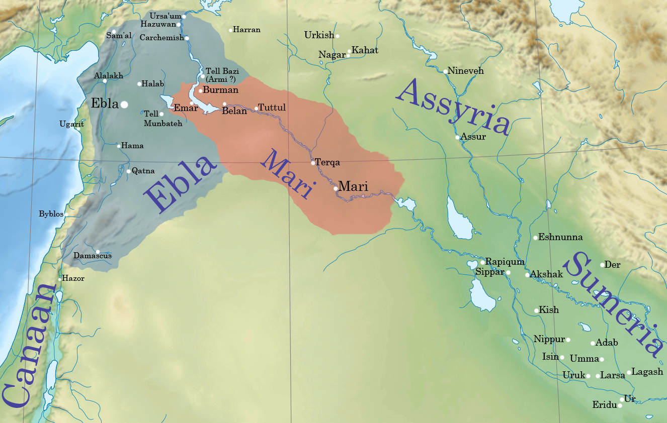
Lugal-Anne-Mundu (, , ) was the most important king of the city-state of Adab in Sumer. The ''Sumerian king list'' claims he reigned for 90 years, following the defeat of Mesh-ki-ang-Nanna II, son of Nanni, of Ur. There are few authentic contemporary inscriptions for Lugal-Anne-Mundu's reign; he is known mainly from a much later text, purporting to be copied from one of his inscriptions. His empire, perhaps the first in recorded history, collapsed upon his death. Following this, the king list indicates that the "kingship" (i.e. the Nippur-based hegemony) fell to a dynasty from Mari, beginning with Anbu; however, it has been suggested that more likely, only the last of these Mari kings, Sharrumiter, held the hegemony after Lugal-Anne-Mundu. With the break-up of the Adab kingdom, other prominent cities appear to have concurrently regained their independence, including Lagash (Lugalanda), Akshak (which not long afterward won the kingship from Mari, perhaps under Puzur-Nirah), ... [...More Info...] [...Related Items...] OR: [Wikipedia] [Google] [Baidu] |
King Of The Four Corners
King of the Four Corners of the World (Sumerian language, Sumerian: ''lugal-an-ub-da-limmu-ba'', Akkadian language, Akkadian: ''šarru kibrat arbaim'', ''šar kibrāti arbaʾi'', or ''šar kibrāt erbetti''), alternatively translated as King of the Four Quarters of the World, King of the Heaven's Four Corners or King of the Four Corners of the Universe and often shortened to simply King of the Four Corners, was a title of great prestige claimed by powerful monarchs in ancient Mesopotamia. Though the term "four corners of the world" does refer to specific geographical places within and near Mesopotamia itself, these places were (at the time the title was first used) thought to represent locations near the actual edges of the world and as such, the title should be interpreted as Merism, something equivalent to "King of all the known world", a claim to universal rule over the entire world and everything within it. The title was first used by Naram-Sin of Akkad, Naram-Sin of the Akka ... [...More Info...] [...Related Items...] OR: [Wikipedia] [Google] [Baidu] |
Adab (city)
Adab (Sumerian language, Sumerian: ''Adab''ki, spelled UD.NUNKI) was an ancient Sumerian city between Girsu and Nippur, lying about 35 kilometers southeast of the latter. It was located at the site of modern Bismaya or Bismya in the Al-Qādisiyyah Governorate of Iraq. The site was occupied at least as early as the 3rd Millenium BC, through the Early Dynastic, Akkadian Empire, and Ur III empire periods, into the Kassite dynasty, Kassite period in the mid-2nd millennium BC. It is known that there were temples of Ninhursag, Ninhursag/Digirmah, Iskur, Asgi, Inanna and Enki at Adab and that the city-god of Adab was Parag'ellilegarra (Panigingarra) "The Sovereign Appointed by Ellil". Not to be confused with the small, later (Old Babylonian and Sassanian periods) archaeological site named Tell Bismaya, 9 kilometers east of the confluence of the Diyala and the Tigris rivers, excavated by Iraqi archaeologists in the 1980s or Dur-Kurigalzu#Tell_Basmaya, Tell Basmaya, southeast of mode ... [...More Info...] [...Related Items...] OR: [Wikipedia] [Google] [Baidu] |
Fertile Crescent
The Fertile Crescent () is a crescent-shaped region in the Middle East, spanning modern-day Iraq, Israel, Jordan, Lebanon, Palestine, and Syria, together with northern Kuwait, south-eastern Turkey, and western Iran. Some authors also include Cyprus and northern Egypt. The Fertile Crescent is believed to be the first region where agriculture, settled farming emerged as people started the process of clearance and modification of natural vegetation to grow newly domesticated plants as crops. Early human civilizations such as Sumer in Prehistory of Mesopotamia, Mesopotamia flourished as a result. Technological advances in the region include the Origins of agriculture in West Asia, development of agriculture and the use of Irrigation#History, irrigation, of History of writing#Bronze Age writing, writing, the Wheel#History, wheel, and history of glass, glass, most emerging first in Mesopotamia. Terminology The term "Fertile Crescent" was popularized by archaeologist James Henry Br ... [...More Info...] [...Related Items...] OR: [Wikipedia] [Google] [Baidu] |
Lebanon
Lebanon, officially the Republic of Lebanon, is a country in the Levant region of West Asia. Situated at the crossroads of the Mediterranean Basin and the Arabian Peninsula, it is bordered by Syria to the north and east, Israel to the south, and the Mediterranean Sea to the west; Cyprus lies a short distance from the coastline. Lebanon has a population of more than five million and an area of . Beirut is the country's capital and largest city. Human habitation in Lebanon dates to 5000 BC. From 3200 to 539 BC, it was part of Phoenicia, a maritime civilization that spanned the Mediterranean Basin. In 64 BC, the region became part of the Roman Empire and the subsequent Byzantine Empire. After the seventh century, it Muslim conquest of the Levant, came under the rule of different Islamic caliphates, including the Rashidun Caliphate, Rashidun, Umayyad Caliphate, Umayyad and Abbasid Caliphate, Abbasid. The 11th century saw the establishment of Christian Crusader states, which fell ... [...More Info...] [...Related Items...] OR: [Wikipedia] [Google] [Baidu] |
Amorites
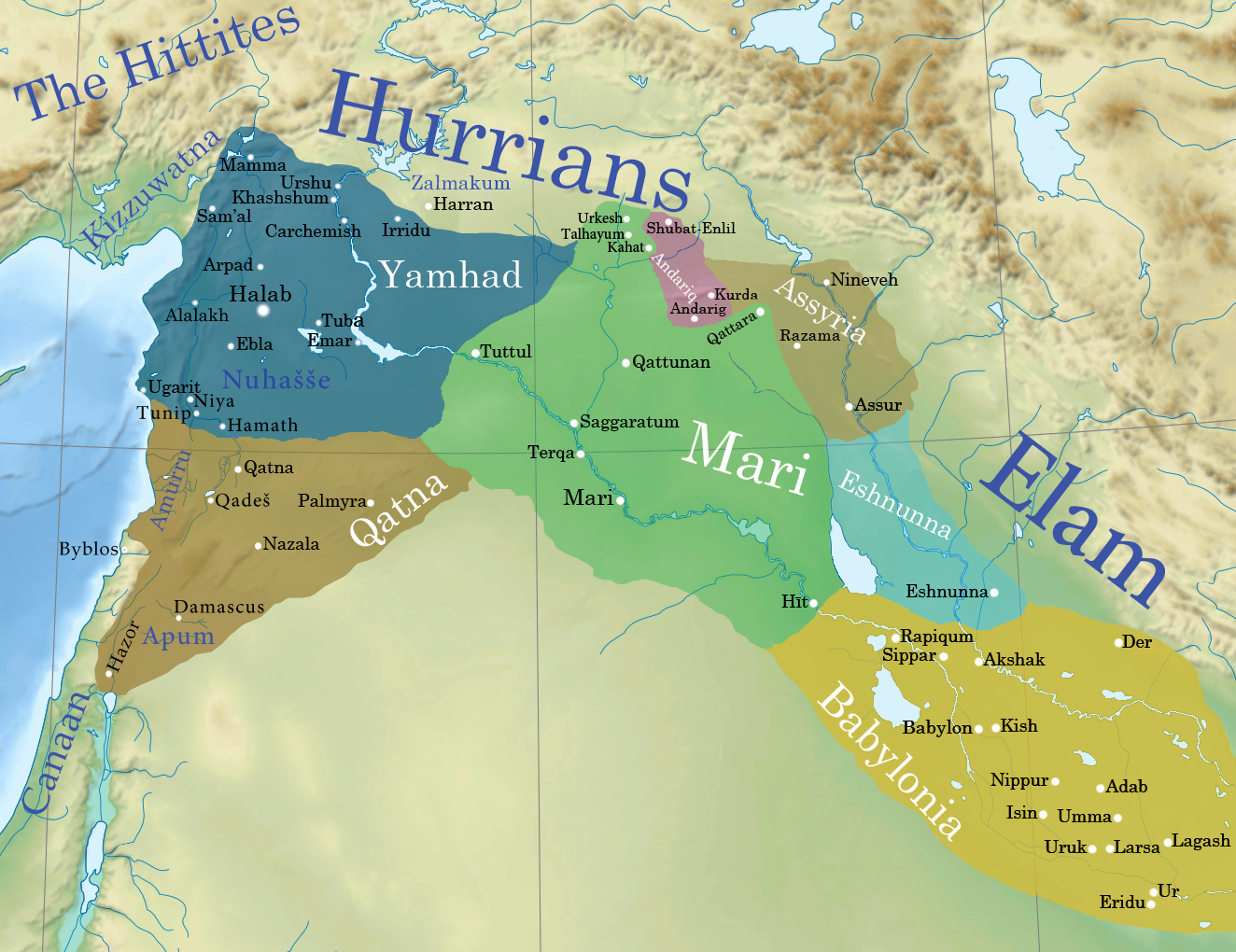
The Amorites () were an ancient Northwest Semitic languages, Northwest Semitic-speaking Bronze Age people from the Levant. Initially appearing in Sumerian records c. 2500 BC, they expanded and ruled most of the Levant, Mesopotamia and parts of Egypt from the 21st century BC to the late 17th century BC. The Amorites established several prominent city-states in various locations, such as Isin, Kurda, Larsa, Mari, Syria, Mari, and Ebla, and later founded Babylon and the Old Babylonian Empire. They also founded the Fourteenth Dynasty of Egypt during the fragmented era of the Second Intermediate Period of Egypt, Second Intermediate Period in the Nile Delta, which was characterized by rulers bearing Amorite names such as Yakbim Sekhaenre, and were likely part of the later Hyksos. The term in Akkadian and Sumerian texts refers to the Amorites, Amurru (god), their principal deity, and Amurru kingdom, an Amorite kingdom. The Amorites are mentioned in the Hebrew Bible as inhabitants of Ca ... [...More Info...] [...Related Items...] OR: [Wikipedia] [Google] [Baidu] |
Subartu
The land of Subartu (, Assyrian: '' mât Šubarri'') or Subar (, ) is mentioned in Bronze Age literature. The name also appears as ''Subari'' in the Amarna letters, and, in the form ''Šbr'', in Ugarit. Subartu was apparently a kingdom in Upper Mesopotamia, at the upper Tigris and later it referred to a region of Mesopotamia. Most scholars suggest that ''Subartu'' is an early name for people of upper Mesopotamia proper on the Tigris and westward, although there are various other theories placing it sometimes a little farther to the east and/or north. Its precise location has not been identified. From the point of view of the Akkadian Empire, Subartu marked the northern geographical horizon, just as Amurru, Elam and Sumer marked "west", "east" and "south", respectively, functioning as a term to mean 'north'. History The earliest references to the "four-quarters" by the kings of Akkad name Subartu as one of these quarters around Akkad, along with Martu, Elam, and Sumer. Sub ... [...More Info...] [...Related Items...] OR: [Wikipedia] [Google] [Baidu] |
Gutium
The Guti (), also known by the derived exonyms Gutians or Guteans, were a people of the ancient Near East who both appeared and disappeared during the Bronze Age. Their homeland was known as Gutium ( Sumerian: , ''GutūmKI'' or , ''GutiumKI''). Conflict between people from Gutium and the Akkadian Empire has been linked to the collapse of the empire, towards the end of the The Guti subsequently overran southern Mesopotamia and formed the short lived Gutian dynasty of Sumer. The Sumerian king list suggests that the Guti ruled over Sumer for several generations following the fall of the Akkadian Empire. By the mid use of the name "Gutium", by the people of lowland Mesopotamia, was extended to include all foreigners from northwestern Iran, between the Zagros Mountains and the Tigris River. Various tribes and places to the east and northeast, regardless of ethnicity, were often referred to as ''Gutians'' or ''Gutium''. For example, Assyrian royal annals use the term Gutians in ... [...More Info...] [...Related Items...] OR: [Wikipedia] [Google] [Baidu] |
Marhashi
Marhaši (Sumerian language, Sumerian: ''Mar-ḫa-šiKi (cuneiform), Ki'' , ''Marhashi'', ''Marhasi'', ''Parhasi'', ''Barhasi''; in earlier sources Waraḫše) was an important ancient Near East polity situated in the region near Elam. It is generally assumed, though not certain, that the Paraḫšum/Baraḫšum ( ''pa2-ra-ah-shum2-ki'') of the Akkadian Empire period referred to Marhaši. This equivalence has been challenged. It is known from 3rd millennium BC and early 2nd millennium BC Mesopotamian sources. Its precise location has not been identified but the current thinking places it on the eastern side of the Iranian plateau. The language of Marhaši is considered to be different from that of Simaški, and only minimally Elamite-related. Marhaši is known to have been the source of a number exotic trade goods for Mesopotamia including the "bear of Marhaši". Other trade goods were lapis lazuli and carnelian. One lexical list includes a mention of "Carnelian which is speckl ... [...More Info...] [...Related Items...] OR: [Wikipedia] [Google] [Baidu] |
Elam
Elam () was an ancient civilization centered in the far west and southwest of Iran, stretching from the lowlands of what is now Khuzestan and Ilam Province as well as a small part of modern-day southern Iraq. The modern name ''Elam'' stems from the Sumerian language, Sumerian transliteration ''elam(a)'', along with the later Akkadian language, Akkadian ''elamtu'', and the Elamite ''haltamti.'' Elamite states were among the leading political forces of the Ancient Near East. In classical literature, Elam was also known as Susiana ( ; ''Sousiānḗ''), a name derived from its capital Susa. Elam was part of the early Cities of the Ancient Near East, urbanization of the Near East during the Chalcolithic period (Copper Age). The emergence of written records from around 3000 BC also parallels Sumerian history, where slightly earlier records have been found. In the Old Elamite period (Bronze Age, Middle Bronze Age), Elam consisted of kingdoms on the Iranian plateau, centered in Ansha ... [...More Info...] [...Related Items...] OR: [Wikipedia] [Google] [Baidu] |
Ebla
Ebla (Sumerian language, Sumerian: ''eb₂-la'', , modern: , Tell Mardikh) was one of the earliest kingdoms in Syria. Its remains constitute a Tell (archaeology), tell located about southwest of Aleppo near the village of Mardikh. Ebla was an important center throughout the and in the first half of the Its discovery proved the Levant was a center of ancient, centralized civilization equal to Ancient Egypt, Egypt and Mesopotamia and ruled out the view that the latter two were the only important centers in the Ancient Near East, Near East during the Early Bronze Age. The first Eblaite kingdom has been described as the first recorded world power. Starting as a small settlement in the Early Bronze Age ( ), Ebla developed into a trading empire and later into an expansionist power that imposed its hegemony over much of northern and eastern Syria. Ebla was destroyed during the It was then rebuilt and was mentioned in the records of the Third Dynasty of Ur. The second Ebla w ... [...More Info...] [...Related Items...] OR: [Wikipedia] [Google] [Baidu] |
Inscription Of Lugal-Anne-Mundu (inscription No 130)
Epigraphy () is the study of inscriptions, or epigraphs, as writing; it is the science of identifying graphemes, clarifying their meanings, classifying their uses according to dates and cultural contexts, and drawing conclusions about the writing and the writers. Specifically excluded from epigraphy are the historical significance of an epigraph as a document and the artistic value of a literary composition. A person using the methods of epigraphy is called an ''epigrapher'' or ''epigraphist''. For example, the Behistun inscription is an official document of the Achaemenid Empire engraved on native rock at a location in Iran. Epigraphists are responsible for reconstructing, translating, and dating the trilingual inscription and finding any relevant circumstances. It is the work of historians, however, to determine and interpret the events recorded by the inscription as document. Often, epigraphy and history are competences practised by the same person. Epigraphy is a primary t ... [...More Info...] [...Related Items...] OR: [Wikipedia] [Google] [Baidu] |
Zagros Mountains
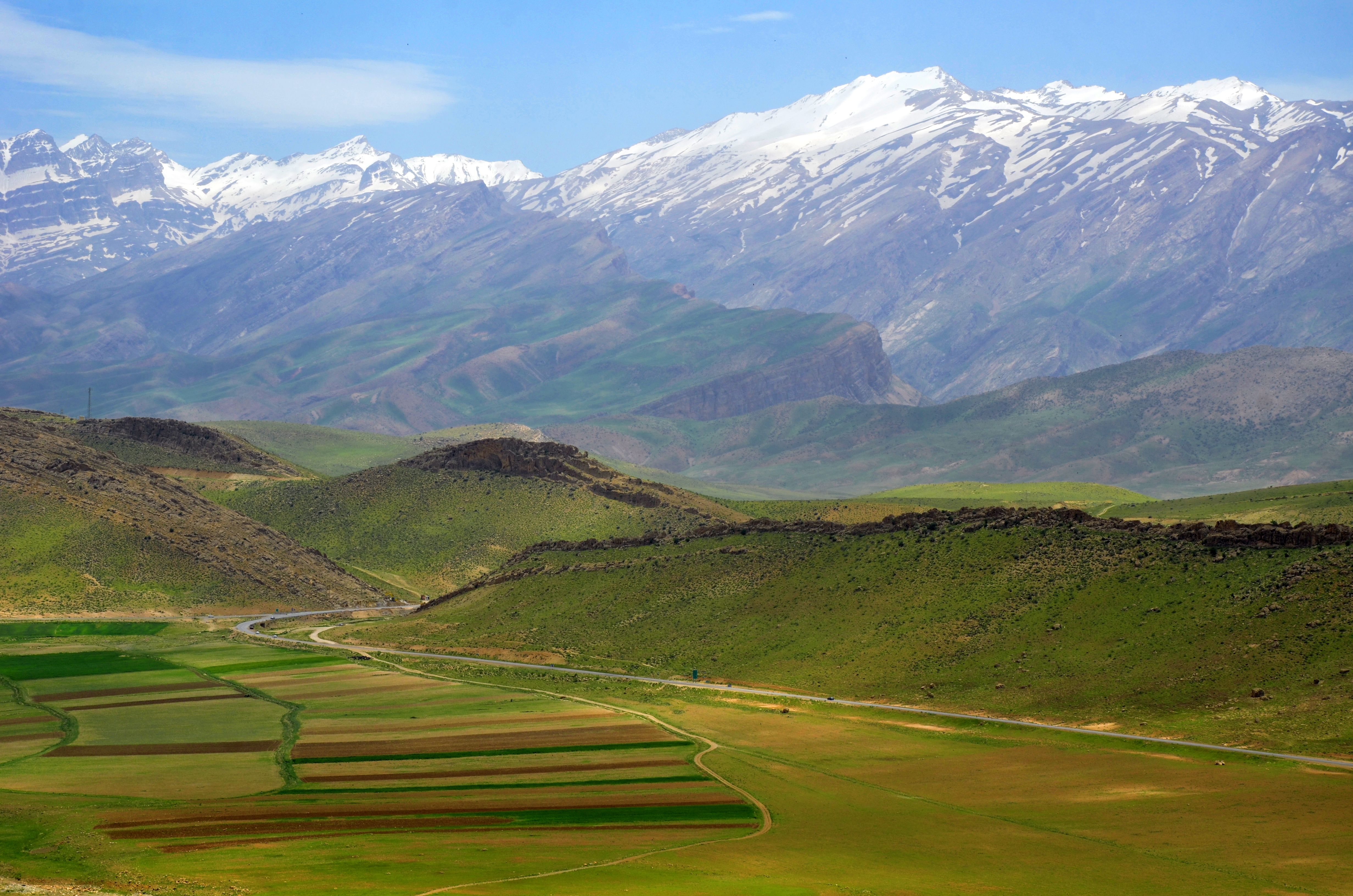
The Zagros Mountains are a mountain range in Iran, northern Iraq, and southeastern Turkey. The mountain range has a total length of . The Zagros range begins in northwestern Iran and roughly follows Iran's western border while covering much of southeastern Turkey and northeastern Iraq. From this border region, the range continues southeast to the waters of the Persian Gulf. It spans the southern parts of the Armenian highlands, and the whole length of the western and southwestern Iranian plateau, ending at the Strait of Hormuz. The highest point is Mount Dena, at . Geology The Zagros fold and thrust belt was mainly formed by the collision of two tectonic plates, the Eurasian Plate and the Arabian Plate. This collision mainly happened during the Miocene (about 25–5 mya or million years ago) and folded the entirety of the rocks that had been deposited from the Paleozoic (541–242 mya) to the Cenozoic (66 mya – present) in the passive continental margin on the Ar ... [...More Info...] [...Related Items...] OR: [Wikipedia] [Google] [Baidu] |


