|
Kuugaaluk
Kuugaaluk (Inuktitut syllabics: ''ᑰᒑᓗᒃ'') formerly Kogalu River is a river on the eastern coast of Baffin Island in the Qikiqtaaluk Region of Nunavut, Canada. The river outflows from Ayr Lake and travels before reaching Baffin Bay. The nearest settlement, Clyde River, Nunavut, Clyde River, is approximately away. See also *List of rivers of Nunavut *Geography of Nunavut References Rivers of Qikiqtaaluk Region {{Nunavut-river-stub ... [...More Info...] [...Related Items...] OR: [Wikipedia] [Google] [Baidu] |
Ayr Lake
Tasialuk (Inuktitut syllabics: ''ᑕᓯᐊᓗᒃ'') formerly Ayr Lake is a land-locked freshwater lake, structurally a fjord, on Baffin Island's northeastern coast in the Qikiqtaaluk Region of Nunavut, Canada. The Inuit settlement of Pond Inlet is to the northwest and Clyde River is to the east. Geography Tasialuk is located east of the Kangiqtualuk Uqquqti and Arviqtujuq Kangiqtua fjords. It stretches roughly from the northeast to the southwest for about . The Kuugaaluk flows out of the northern end of the lake and discharges its waters in the Baffin Bay a further to the northeast. There are spectacular landscapes in Tasialuk, with massive nearly high summits rising their ramparts close to the shore, especially in its central part.GoogleEarth In the inner area the Ayr Pass connects with the Arviqtujuq Kangiqtua to the west. See also *List of lakes of Nunavut This is an incomplete list of lakes of Nunavut, a territory of Canada. Larger lake statistics "The total area ... [...More Info...] [...Related Items...] OR: [Wikipedia] [Google] [Baidu] |
Provinces And Territories Of Canada
Within the geographical areas of Canada, the ten provinces and three territories are sub-national administrative divisions under the jurisdiction of the Canadian Constitution. In the 1867 Canadian Confederation, three provinces of British North America—New Brunswick, Nova Scotia, and the Province of Canada (which upon Confederation was divided into Ontario and Quebec)—united to form a federation, becoming a fully independent country over the next century. Over its history, Canada's international borders have changed several times as it has added territories and provinces, making it the world's second-largest country by area. The major difference between a Canadian province and a territory is that provinces receive their power and authority from the '' Constitution Act, 1867'' (formerly called the '' British North America Act, 1867''), whereas territorial governments are creatures of statute with powers delegated to them by the Parliament of Canada. The powers flowing ... [...More Info...] [...Related Items...] OR: [Wikipedia] [Google] [Baidu] |
Nunavut
Nunavut ( , ; iu, ᓄᓇᕗᑦ , ; ) is the largest and northernmost territory of Canada. It was separated officially from the Northwest Territories on April 1, 1999, via the '' Nunavut Act'' and the '' Nunavut Land Claims Agreement Act'', which provided this territory to the Inuit for independent government. The boundaries had been drawn in 1993. The creation of Nunavut resulted in the first major change to Canada's political map in half a century since the province of Newfoundland was admitted in 1949. Nunavut comprises a major portion of Northern Canada and most of the Arctic Archipelago. Its vast territory makes it the fifth-largest country subdivision in the world, as well as North America's second-largest (after Greenland). The capital Iqaluit (formerly Frobisher Bay), on Baffin Island in the east, was chosen by a capital plebiscite in 1995. Other major communities include the regional centres of Rankin Inlet and Cambridge Bay. Nunavut also includes Elle ... [...More Info...] [...Related Items...] OR: [Wikipedia] [Google] [Baidu] |
Baffin Island
Baffin Island (formerly Baffin Land), in the Canadian territory of Nunavut, is the largest island in Canada and the fifth-largest island in the world. Its area is , slightly larger than Spain; its population was 13,039 as of the 2021 Canadian census; and it is located at . It also contains the city of Iqaluit, the capital of Nunavut. Name The Inuktitut name for the island is , which means "very big island" ( "island" + "very big") and in Inuktitut syllabics is written as . This name is used for the administrative region the island is part of ( Qikiqtaaluk Region), as well as in multiple places in Nunavut and the Northwest Territories, such as some smaller islands: Qikiqtaaluk in Baffin Bay and Qikiqtaaluk in Foxe Basin. Norse explorers referred to it as ("stone land"). In 1576, English seaman Martin Frobisher made landfall on the island, naming it "Queen Elizabeth's Foreland" and Frobisher Bay is named after him. The island is named after English explorer William B ... [...More Info...] [...Related Items...] OR: [Wikipedia] [Google] [Baidu] |
Baffin Bay
Baffin Bay (Inuktitut: ''Saknirutiak Imanga''; kl, Avannaata Imaa; french: Baie de Baffin), located between Baffin Island and the west coast of Greenland, is defined by the International Hydrographic Organization as a marginal sea of the Arctic Ocean. It is sometimes considered a sea of the North Atlantic Ocean. It is connected to the Atlantic via Davis Strait and the Labrador Sea. The narrower Nares Strait connects Baffin Bay with the Arctic Ocean. The bay is not navigable most of the year because of the ice cover and high density of floating ice and icebergs in the open areas. However, a polynya of about , known as the North Water, opens in summer on the north near Smith Sound. Most of the aquatic life of the bay is concentrated near that region. Extent The International Hydrographic Organization defines the limits of Baffin Bay as follows: History The area of the bay has been inhabited since BC. Around AD 1200, the initial Dorset settlers were rep ... [...More Info...] [...Related Items...] OR: [Wikipedia] [Google] [Baidu] |
Inuktitut Syllabics
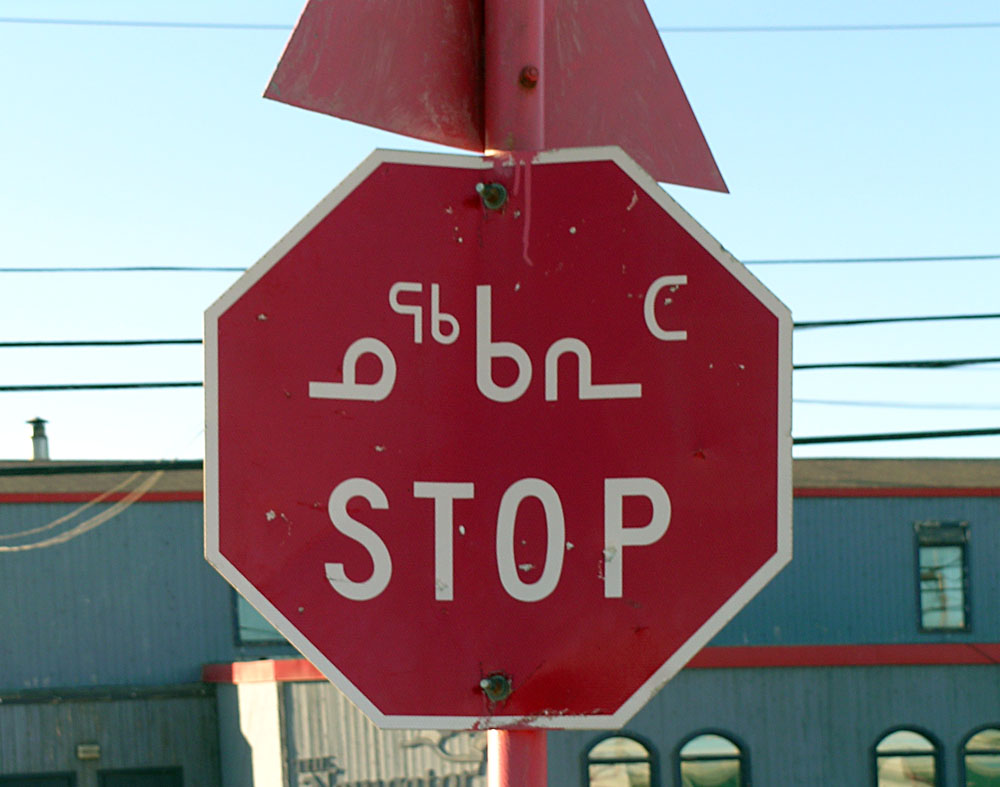
Inuktitut syllabics ( iu, ᖃᓂᐅᔮᖅᐸᐃᑦ, qaniujaaqpait, or , ) is an abugida-type writing system used in Canada by the Inuktitut-speaking Inuit of the territory of Nunavut and the Nunavik and Nunatsiavut regions of Quebec and Labrador, respectively. In 1976, the Language Commission of the Inuit Cultural Institute made it the co-official script for the Inuit languages, along with the Latin script. The name derives from the root , meaning "mouth". The alternative, Latin-based writing system is named (), and it derives from , a word describing the markings or the grain in rocks. meaning "new writing system" is to be seen in contrast to (), the "old syllabics" used before the reforms of 1976. History The first efforts to write Inuktitut came from Moravian missionaries in Greenland and Labrador in the mid-19th century using Latin script. The first book printed in Inuktitut using Cree script was an 8-page pamphlet known as ''Selections from the Gospels in the dia ... [...More Info...] [...Related Items...] OR: [Wikipedia] [Google] [Baidu] |
Qikiqtaaluk Region
The Qikiqtaaluk Region, Qikiqtani Region (Inuktitut syllabics: ᕿᑭᖅᑖᓗᒃ ) or Baffin Region is the easternmost, northernmost, and southernmost administrative region of Nunavut, Canada. Qikiqtaaluk is the traditional Inuktitut name for Baffin Island. Although the Qikiqtaaluk Region is the most commonly used name in official contexts, several notable public organizations, including Statistics Canada prefer the older term Baffin Region. With a population of 18,988 and an area of , it is the largest and most populated of the three regions. The region consists of Baffin Island, the Belcher Islands, Akimiski Island, Mansel Island, Prince Charles Island, Bylot Island, Devon Island, Baillie-Hamilton Island, Cornwallis Island, Bathurst Island, Amund Ringnes Island, Ellef Ringnes Island, Axel Heiberg Island, Ellesmere Island, the Melville Peninsula, the eastern part of Melville Island, and the northern parts of both Prince of Wales Island and Somerset Island, p ... [...More Info...] [...Related Items...] OR: [Wikipedia] [Google] [Baidu] |
Clyde River, Nunavut
Clyde River ( Syllabics: ᑲᖏᖅᑐᒑᐱᒃ, Inuktitut: ''Kanngiqtugaapik'' "nice little inlet") is an Inuit hamlet located on the shore of Baffin Island's Patricia Bay, off Kangiqtugaapik, an arm of Davis Strait in the Qikiqtaaluk Region, of Nunavut, Canada. It lies in the Baffin Mountains which in turn form part of the Arctic Cordillera mountain range. The community is served by air and by annual supply sealift. The community is served by Quluaq School, the Northern Stores, an arena, a community hall, an Anglican church (the Church of the Redeemer), a health centre, hotel and Clyde River Airport with regular flights to Iqaluit and Pond Inlet. Geography It is located on a flood plain, surrounded by spectacular fjords that stretch all the way into the Barnes Ice Cap. The mountains, icebergs and glaciers in the Clyde River area attract rock and ice climbers from around the world. There is also a multitude of animals to be seen, including barren-ground caribou, narwhal ... [...More Info...] [...Related Items...] OR: [Wikipedia] [Google] [Baidu] |
List Of Rivers Of Nunavut
This is a list of rivers that are in whole or partly in Nunavut, Canada: By watershed Arctic watershed *Beaufort Sea **Great Bear Lake (Northwest Territories) *** Bloody River *** Dease River ** Horton River *Viscount Melville Sound **Nanook River (Victoria Island) *Amundsen Gulf **Hornaday River **Roscoe River ** Croker River **Harding River ** Kagloryuak River (Victoria Island) *Dolphin and Union Strait **Hoppner River *Coronation Gulf ** Rae River ** Richardson River **Coppermine River ** Asiak River ** Tree River ** Hood River ** Kugaryuak River ***James River ** Burnside River ***Mara River ** Western River ** Napaaktoktok River *Dease Strait **Ekalluk River ** Hargrave River *Queen Maud Gulf **Ellice River ** Perry River (''Kuukyuak'') ** Armark River ** Simpson River ** McNaughton River ** Kaleet River *Rasmussen Basin ** Back River *** Bullen River *** Consul River *** Baillie River **Castor and Pollux River **Hayes River ** Murchison River *Gulf of Boothia **Arrowsmith Rive ... [...More Info...] [...Related Items...] OR: [Wikipedia] [Google] [Baidu] |
Geography Of Nunavut
The Canadian territory of Nunavut covers about 1.9 million square kilometres (733,594 sq. miles) of land and water including part of the mainland, most of the Arctic islands, and all of the islands in Hudson Bay, James Bay, and Ungava Bay (including the Belcher Islands) which belonged to the Northwest Territories. This makes it the fifth largest country subdivision in the world. If Nunavut were a country, it would rank 13th in area, after the Democratic Republic of the Congo. Nunavut has land borders with Manitoba, the Northwest Territories on several islands as well as the mainland, and a tiny land border with Newfoundland and Labrador on Killiniq Island. Physical geography The mountains on the easternmost coasts of Nunavut are part of the Arctic Cordillera which stretches from northernmost Ellesmere Island to the northernmost tip of Labrador. The highest point is Barbeau Peak which offers some of the world's most spectacular scenery. Geologically, Nunavut lies on the Canadia ... [...More Info...] [...Related Items...] OR: [Wikipedia] [Google] [Baidu] |


