|
Kostiantynivka
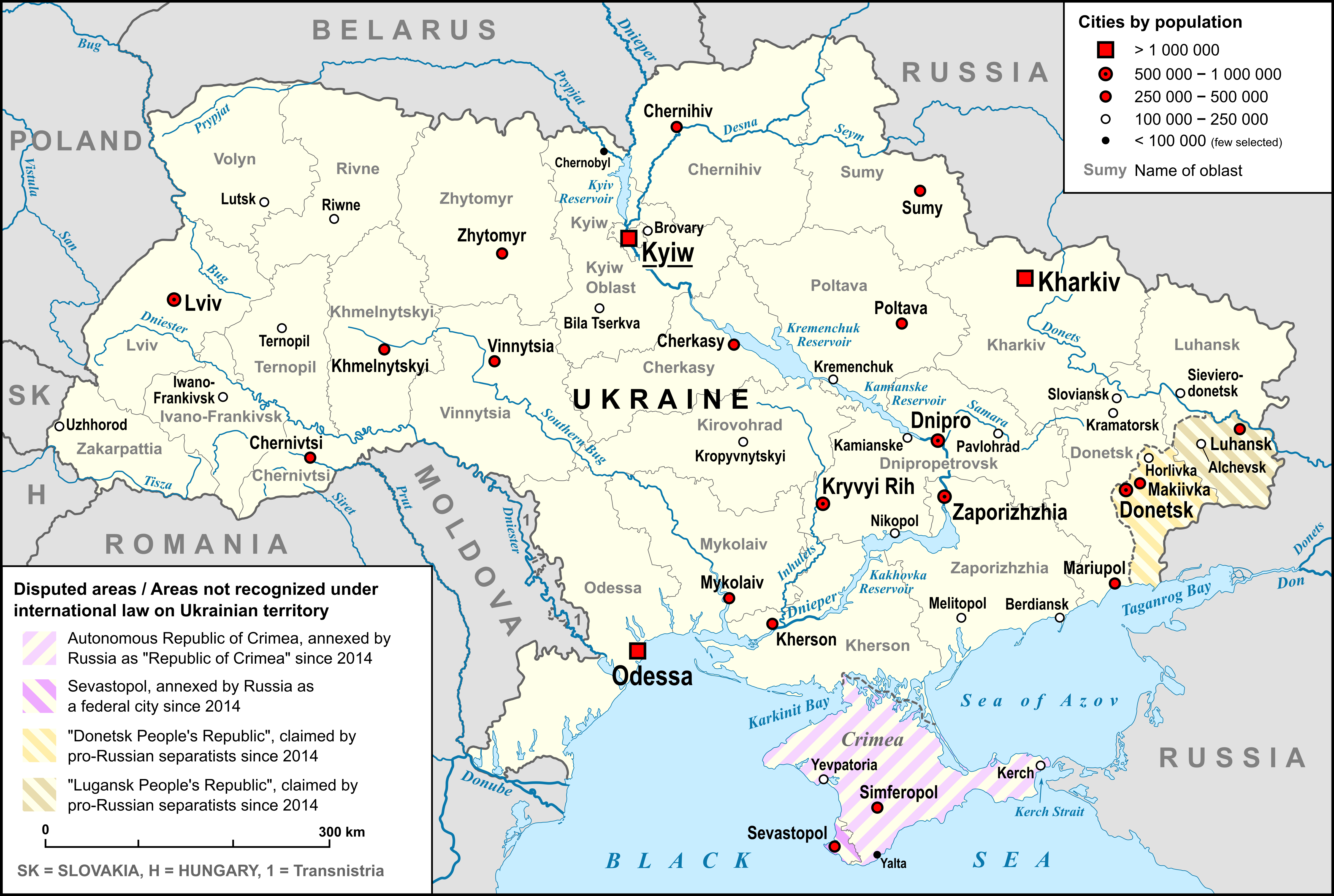
Kostiantynivka (, ; ) is an industrial city in Donetsk Oblast, eastern Ukraine. It is situated on the Kryvyi Torets river. During the History of the Soviet Union, Soviet era, the city developed into a major centre for the production of iron, zinc, steel, and glass. Administratively, it is incorporated as a City of regional significance (Ukraine), city of oblast significance. It was the administrative center of the Kostiantynivka Raion until 2020, although it did not belong to it. After the raion was abolished, Kostiantynivka was incorporated into the Kramatorsk Raion. Its population is approximately 15,000 (2025 estimate). History In 1870, Kostiantynivka was founded by a landowner named Nomikossov, who built the settlement in honor of his oldest son, Kostiantyn. At the beginning of the 20th century, Kostiantynivka developed into an industrial settlement, and was later elevated to the rank of an urban settlement in 1926. In 1932, Kostyantynivka was granted city status, municipa ... [...More Info...] [...Related Items...] OR: [Wikipedia] [Google] [Baidu] |
Kostiantynivka Raion
Kostiantynivka Raion (; ) was one of the administrative raions (a ''district'') of Donetsk Oblast in eastern Ukraine. It covered approximately 4.4 percent of the oblast's total area. The raion was created on 7 March 1923 as part of the Ukrainian Soviet Socialist Republic. Its administrative center was the city of Kostiantynivka, although the city itself was not administratively part of the Kostiantynivka Raion and was incorporated as a city of oblast significance. The raion was abolished on 18 July 2020 as part of the administrative reform of Ukraine, which reduced the number of raions of Donetsk Oblast to eight, of which only five were controlled by the government. The last estimate of the raion population was The 2001 Ukrainian Census gave the population of 21,132. Administrative divisions Kostiantynivka Raion was divided in a way that follows the general administrative scheme in Ukraine. Local government was also organized along a similar scheme nationwide. Consequently, ... [...More Info...] [...Related Items...] OR: [Wikipedia] [Google] [Baidu] |
Kostiantynivka Urban Hromada
Kostiantynivka urban hromada () is a hromada of Ukraine, located in Kramatorsk Raion, Donetsk Oblast. Its administrative center is the city Kostiantynivka. It has an area of and a population of 73,979, as of 2020. The hromada contains 24 settlements: 1 city (Kostiantynivka), 18 villages: And 5 rural-type settlements: Bezymyane, Molocharka, Novodmytrivka, Stinky and Chervone. See also * List of hromadas of Ukraine There are 1,469 hromadas (, ) in Ukraine. They were formed in 2020 (there are no hromadas in Kyiv, Sevastopol and in the Autonomous Republic of Crimea). A hromada is designated ''urban hromada'' if its administration is located in a city; ''set ... References {{Donetsk Oblast Hromadas of Kramatorsk Raion 2020 establishments in Ukraine States and territories established in 2020 * ... [...More Info...] [...Related Items...] OR: [Wikipedia] [Google] [Baidu] |
Kramatorsk Raion
Kramatorsk Raion (; ) is a Raions of Ukraine, raion (district) of Donetsk Oblast, Ukraine. It was created in July 2020 as part of the reform of administrative divisions of Ukraine. The center of the raion is the town of Kramatorsk. Population: The 2020 administrative reform increased the raion in size merging with Oleksandrivka Raion, Donetsk Oblast, Oleksandrivka Raion, Lyman Raion, Donetsk Oblast, Lyman Raion, Kostiantynivka Raion, and Sloviansk Raion. All cities of regional significance within those raions were brought under the raion administration, including Kramatorsk, Sloviansk, Kostiantynivka, Druzhkivka, and Lyman, Ukraine, Lyman. Subdivisions The raion consists of 12 hromadas: * Andriivka rural hromada * Cherkaske settlement hromada * Druzhkivka urban hromada * Illinivka rural hromada * Kostiantynivka urban hromada * Kramatorsk urban hromada * Lyman urban hromada * Mykolaivka urban hromada * Novodonetske settlement hromada * Oleksandrivka settlement hromada * Sviatohir ... [...More Info...] [...Related Items...] OR: [Wikipedia] [Google] [Baidu] |
Kryvyi Torets
The Kryvyi Torets (; ) is a river in eastern Ukraine. The river travels in the Pokrovsk, Horlivka, and Kramatorsk Districts in the Donetsk Oblast, and is a right tributary of the Kazennyi Torets. Characteristics The river has a total length of , and a basin size of . The river begins in the village of Riasne, near the city of Makiivka. The river flows through the cities of Niu-York, Toretsk, and Kostiantynivka before flowing into the Kazennyi Torets in the city of Druzhkivka. Ecology The water in the river is highly polluted. According to data collected in 2005, the iron content in a section near Kostiantynivka exceeded regulation by more than threefold, and sulfate The sulfate or sulphate ion is a polyatomic anion with the empirical formula . Salts, acid derivatives, and peroxides of sulfate are widely used in industry. Sulfates occur widely in everyday life. Sulfates are salts of sulfuric acid and many ... by almost two. In addition, there is a burial site for r ... [...More Info...] [...Related Items...] OR: [Wikipedia] [Google] [Baidu] |
Sloviansk
Sloviansk is a city in Donetsk Oblast, northern part of the Donbas region of eastern Ukraine. The city was known as ''Tor'' until 1784. While it did not actually belong to the raion itself, Sloviansk served as the administrative center of the Sloviansk Raion (district) until its abolition on 18 July 2020. Sloviansk was one of the focal points in the early stages of the war in Donbas, in 2014, as it was one of the first cities to be seized and controlled by Russian-backed rebels (separatists), in mid-April 2014. Ukrainian forces then retook control of the city in July 2014, and since then, Sloviansk has been under Ukrainian control. The 2001 population of Sloviansk was 141,066. Largely due to the ongoing war in Donbas, by early 2022 this was down to 105,141. Following the 2022 Russian invasion of Ukraine, the city's population fell markedly, to around 24,000 by July 2022, due to shelling, and ongoing war, according to Ukrainian authorities. In April 2023, The Financial Times est ... [...More Info...] [...Related Items...] OR: [Wikipedia] [Google] [Baidu] |
City Of Regional Significance (Ukraine)
A city of regional significance () in Ukraine was a type of second-level Administrative divisions of Ukraine, administrative division or municipality, the other type being Raions of Ukraine, raions (districts). In the first-level division of Oblasts of Ukraine, oblasts, they were referred to as ''cities of oblast significance''; in the first-level autonomous republic of Autonomous Republic of Crimea, Crimea, they were ''cities of republican significance''. The designation was created with the introduction of oblasts in 1932. It was abolished in a 2020 reform that merged raions together and integrated the city municipalities into them. Such city municipality was complex and usually combined the city proper and adjacent populated places. The city of regional (oblast) significance was governed by a city council known as ''mis'krada'', which was chaired by a mayor. There were instances where a municipality might have included only the city alone (city proper), while in others instanc ... [...More Info...] [...Related Items...] OR: [Wikipedia] [Google] [Baidu] |
Kramatorsk
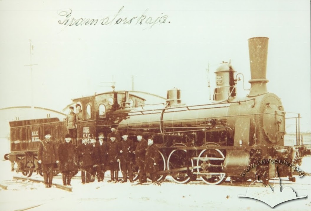
Kramatorsk (, ; ) is a city and the administrative centre of Kramatorsk Raion in Donetsk Oblast of the Donbas region of eastern Ukraine. Prior to 2020, Kramatorsk was a city of oblast significance. Since October 2014, Kramatorsk has been the provisional seat of Donetsk Oblast, following the events surrounding the war in Donbas. Its population is It is an important industrial and mechanical engineering center in Ukraine. Kramatorsk is on the banks of the Kazennyi Torets, a right tributary of the Siverskyi Donets. Since the start of the Russian invasion of Ukraine, Kramatorsk has been hit by Russian shelling multiple times. Etymology According to Doctor of Philology Yevhen Otin from Dnipro who specializes in onomastics, the name of the city comes from a toponymic phrase that has not been preserved: ''Krom Torov'' or ''Krom Torskaya'' 'border along the Tor River'. The word ''kroma'' means 'edge, frontier, border', and ''Tor'' is the old name for the Kazennyi Torets River. Ho ... [...More Info...] [...Related Items...] OR: [Wikipedia] [Google] [Baidu] |
2014 Insurgency In Donbass
The war in Donbas, or the Donbas war, was a phase of the Russo-Ukrainian War in the eastern Donbas region of Ukraine. The war Timeline of the war in Donbas (2014), began in April 2014, when Russian separatist forces in Ukraine, Russian paramilitaries seized several towns. Ukraine's military launched an operation against them, but failed to fully retake the territory. Covertly, Russia's military were #Russian involvement, directly involved, and the separatists were largely under Russian control. The war continued until subsumed by the Russian invasion of Ukraine in 2022. In March 2014, following Ukraine's Revolution of Dignity, Russia Russian occupation of Crimea, occupied Crimea. Anti-revolution and 2014 pro-Russian unrest in Ukraine, pro-Russian protests began in Ukraine's Donetsk Oblast, Donetsk and Luhansk Oblast, Luhansk provinces, collectively 'the Donbas'. On 12 April, a commando unit led by Russian citizen Igor Girkin, Igor 'Strelkov' Girkin seized Siege of Sloviansk, ... [...More Info...] [...Related Items...] OR: [Wikipedia] [Google] [Baidu] |
List Of Cities In Ukraine
There are 463 populated places in Ukraine, populated places in Ukraine that have been officially granted city status () by the Verkhovna Rada, the country's parliament, as of 23 April 2025. Settlements with more than 10,000 people are eligible for city status although the status is typically also granted to settlements of historical or regional importance. Smaller settlements are Populated places in Ukraine#Rural settlements, rural settlements () and villages (). Historically, there were systems of city rights, granted by the territorial lords, which defined the status of a place as a ''misto'' or ''selo''. In the past, cities were self-governing and had several privileges. The list of cities is roughly ordered by population and the 2022 estimates are compared to the 2001 Ukrainian census, except for Chernobyl for which the population is an unofficial estimate. The City with special status, cities with special status are shown in ''italic''. The average population size is 62,000. ... [...More Info...] [...Related Items...] OR: [Wikipedia] [Google] [Baidu] |
Iron
Iron is a chemical element; it has symbol Fe () and atomic number 26. It is a metal that belongs to the first transition series and group 8 of the periodic table. It is, by mass, the most common element on Earth, forming much of Earth's outer and inner core. It is the fourth most abundant element in the Earth's crust, being mainly deposited by meteorites in its metallic state. Extracting usable metal from iron ores requires kilns or furnaces capable of reaching , about 500 °C (900 °F) higher than that required to smelt copper. Humans started to master that process in Eurasia during the 2nd millennium BC and the use of iron tools and weapons began to displace copper alloys – in some regions, only around 1200 BC. That event is considered the transition from the Bronze Age to the Iron Age. In the modern world, iron alloys, such as steel, stainless steel, cast iron and special steels, are by far the most common industrial metals, due to their mechan ... [...More Info...] [...Related Items...] OR: [Wikipedia] [Google] [Baidu] |


