|
Kolyma Hydroelectric Station
Kolyma Hydroelectric Station is located on the Kolyma River in the village of Sinegorye, Yagodninsky District, Magadan Oblast Russia. It has an installed power generation capacity of 900 MW. Kolyma HPP is the basis of the energy system of Magadan Oblast; it produces about 95% of the electricity in the region. It is the upper stage of the Kolyma cascade. The lower one (Ust-Srednekan Hydroelectric Plant), with an installed capacity of 570 MW, was completed in 2024. Construction began in 1974 and the first generator was commissioned in 1982, the last in 1994. The facility was placed into permanent operation in 2007. Construction of the Kolyma HPP was carried out in the harsh climatic conditions in the zone of permafrost. At , it is the highest earth filled dam in Russia. It is also the most powerful hydroelectric plant in the country with an underground power station. Structural design Kolyma Hydroelectric Station is a high-head dam-type power plant. Its main structures includ ... [...More Info...] [...Related Items...] OR: [Wikipedia] [Google] [Baidu] |
Sinegorye
Sinegorye (; lit. ''region of blue mountains'') is an urban locality (an urban-type settlement) in Yagodninsky District of Magadan Oblast, Russia, located on the Kolyma River, from Kolyma Hydroelectric Station. Population: Geography Sinegorye lies around 280 km north-west of the oblast capital of Magadan, on the left bank of the Kolyma near its confluence with the Bakhapcha. The settlement is located downstream of the Kolyma Reservoir, in Yagodninsky District, just over 70 km south-east of the administrative centre Yagodnoye. History The youngest town in the Kolyma region, Sinegorye was built in the period 1971 to 1981 to house workers for the construction of the nearby dam and hydroelectric power station on the Kolyma River. Sinegorye received status as an urban-type settlement in 1972. The settlement was planned to house up to 10,000 inhabitants, however after the eventual completion of the dam and power plant construction project, the majority of the town ... [...More Info...] [...Related Items...] OR: [Wikipedia] [Google] [Baidu] |
Permafrost
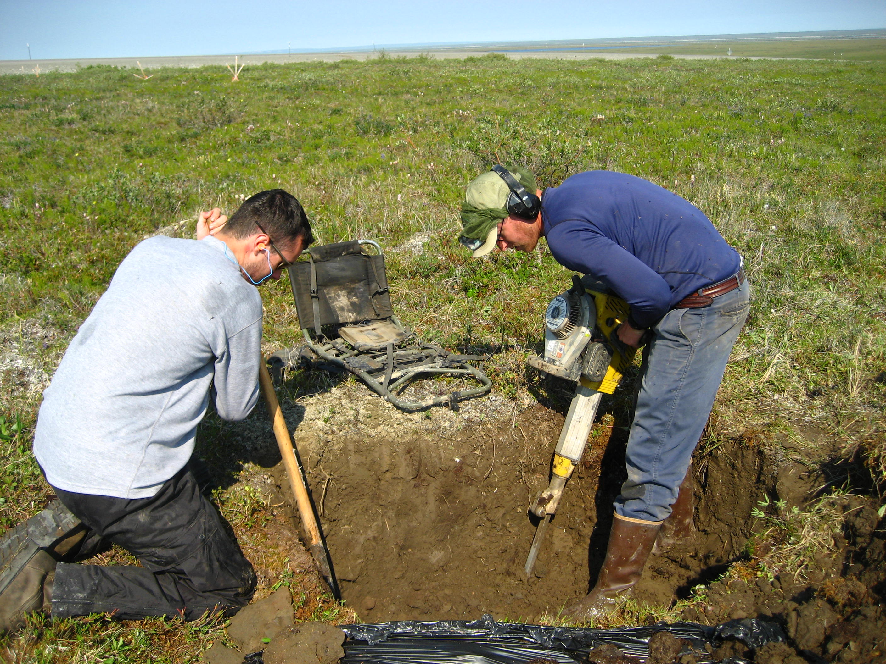
Permafrost () is soil or underwater sediment which continuously remains below for two years or more; the oldest permafrost has been continuously frozen for around 700,000 years. Whilst the shallowest permafrost has a vertical extent of below a meter (3 ft), the deepest is greater than . Similarly, the area of individual permafrost zones may be limited to narrow mountain summits or extend across vast Arctic regions. The ground beneath glaciers and ice sheets is not usually defined as permafrost, so on land, permafrost is generally located beneath a so-called active layer of soil which freezes and thaws depending on the season. Around 15% of the Northern Hemisphere or 11% of the global surface is underlain by permafrost, covering a total area of around . This includes large areas of Alaska, Canada, Greenland, and Siberia. It is also located in high mountain regions, with the Tibetan Plateau being a prominent example. Only a minority of permafrost exists in the Southern Hemi ... [...More Info...] [...Related Items...] OR: [Wikipedia] [Google] [Baidu] |
Hydroelectric Power Stations In Russia
Hydroelectricity, or hydroelectric power, is electricity generated from hydropower (water power). Hydropower supplies 15% of the world's electricity, almost 4,210 TWh in 2023, which is more than all other renewable sources combined and also more than nuclear power. Hydropower can provide large amounts of low-carbon electricity on demand, making it a key element for creating secure and clean electricity supply systems. A hydroelectric power station that has a dam and reservoir is a flexible source, since the amount of electricity produced can be increased or decreased in seconds or minutes in response to varying electricity demand. Once a hydroelectric complex is constructed, it produces no direct waste, and almost always emits considerably less greenhouse gas than fossil fuel-powered energy plants. [...More Info...] [...Related Items...] OR: [Wikipedia] [Google] [Baidu] |
Dams In Russia
A dam is a barrier that stops or restricts the flow of surface water or underground streams. Reservoirs created by dams not only suppress floods but also provide water for activities such as irrigation, human consumption, industrial use, aquaculture, and navigability. Hydropower is often used in conjunction with dams to generate electricity. A dam can also be used to collect or store water which can be evenly distributed between locations. Dams generally serve the primary purpose of retaining water, while other structures such as floodgates or levees (also known as dikes) are used to manage or prevent water flow into specific land regions. The word ''dam'' can be traced back to Middle English, and before that, from Middle Dutch, as seen in the names of many old cities, such as Amsterdam and Rotterdam. Ancient dams were built in Mesopotamia and the Middle East for water control. The earliest known dam is the Jawa Dam in Jordan, dating to 3,000 BC. Egyptians also built dams, ... [...More Info...] [...Related Items...] OR: [Wikipedia] [Google] [Baidu] |
Taskan
The Taskan () is a river in the Susuman and Yagodninsky districts of Magadan Oblast, Russia. It is a left hand tributary of the Kolyma. Its length is , with a drainage basin of . The Taskan was first mapped in the 19th century by explorer Jan Czerski. Perch, ruffe, gudgeon and burbot are found in the waters of the river. Course The Taskan River begins in the southeastern slopes of high Mount Shoguchan, at the eastern end of the Chersky Range in an area of ice fields, the largest of which is . It heads roughly southeastwards across permafrost terrain covered by tundra vegetation interspersed with sparse taiga. Finally it joins the left bank of the Kolyma between the Kolyma Dam and the Ust-Srednekan Dam,Google Earth from its mouth. The Taskan is located in a sparsely populated region of severe cold winters. Its main tributaries are the Mylga and the Sudar. The only populated places by the river were the now abandoned villages of Taskan and Elgen, as well as the also abando ... [...More Info...] [...Related Items...] OR: [Wikipedia] [Google] [Baidu] |
Kolyma Reservoir
KolymaReservoir () is an artificial lake which was created by the construction of the Kolyma Hydroelectric Station on the Kolyma. It was designed by Lenhydroproject. Filling began in 1980 and it was commissioned in 1995. Description The Kolyma Reservoir is in the Upper Kolyma Highlands. The town of Sinegorye, Yagodninsky District, is located downstream from the dam. The total length of the reservoir is and the width at its widest point is . The height of the water's edge is above sea level. Besides the Kolyma, rivers Tenka and Kongo flow into the reservoir.Google Earth After filling the reservoir of farmland were flooded, as well as several workers' settlements, including Sibik-Tyllah, Vetreny, Yasnaya Polyana, Tyoply, Yubileiny and Kongo. An Old Stone Age archaeological site located by the mouth of the Kongo was also flooded by the waters of the Kolyma reservoir. It belonged to the Paleolithic The Paleolithic or Palaeolithic ( years ago) ( ), also called the Old St ... [...More Info...] [...Related Items...] OR: [Wikipedia] [Google] [Baidu] |
Uptar
Uptar () is an urban locality (an ''urban-type settlement'') under the administrative jurisdiction of the Town of Magadan in Magadan Oblast, Russia Russia, or the Russian Federation, is a country spanning Eastern Europe and North Asia. It is the list of countries and dependencies by area, largest country in the world, and extends across Time in Russia, eleven time zones, sharing Borders .... Population: References Urban-type settlements in Magadan Oblast {{MagadanOblast-geo-stub ... [...More Info...] [...Related Items...] OR: [Wikipedia] [Google] [Baidu] |
Thermal Power Plant
A thermal power station, also known as a thermal power plant, is a type of power station in which the heat energy generated from various fuel sources (e.g., coal, natural gas, nuclear fuel, etc.) is converted to electrical energy. The heat from the source is converted into mechanical energy using a thermodynamic power cycle (such as a Diesel cycle, Rankine cycle, Brayton cycle, etc.). The most common cycle involves a working fluid (often water) heated and boiled under high pressure in a pressure vessel to produce high-pressure steam. This high pressure-steam is then directed to a turbine, where it rotates the turbine's blades. The rotating turbine is mechanically connected to an electric generator which converts rotary motion into electricity. Fuels such as natural gas or oil can also be burnt directly in gas turbines ( internal combustion), skipping the steam generation step. These plants can be of the open cycle or the more efficient combined cycle type. The majorit ... [...More Info...] [...Related Items...] OR: [Wikipedia] [Google] [Baidu] |
Nameplate Capacity
Nameplate capacity, also known as the rated capacity, nominal capacity, installed capacity, maximum effect or gross capacity, IAEA-PRIS is the intended full-load sustained output of a facility such as a ,Energy glossary '' Energy Information Administration''. Retrieved: 23 September 2010. [...More Info...] [...Related Items...] OR: [Wikipedia] [Google] [Baidu] |
Switchgear
In an electric power system, a switchgear is composed of electrical disconnect switches, fuses or circuit breakers used to control, protect and isolate electrical equipment. Switchgear is used both to de-energize equipment to allow work to be done and to clear faults downstream. This type of equipment is directly linked to the reliability of the electricity supply. The earliest central power stations used simple open knife switches, mounted on insulating panels of marble or asbestos. Power levels and voltages rapidly escalated, making opening manually operated switches too dangerous for anything other than isolation of a de-energized circuit. Oil-filled switchgear equipment allows arc energy to be contained and safely controlled. By the early 20th century, a switchgear line-up would be a metal-enclosed structure with electrically operated switching elements using oil circuit breakers. Today, oil-filled equipment has largely been replaced by air-blast, vacuum, or SF6 equ ... [...More Info...] [...Related Items...] OR: [Wikipedia] [Google] [Baidu] |
Floodgate
Floodgates, also called stop gates, are adjustable gates used to control water flow in flood barriers, reservoir, river, stream, or levee systems. They may be designed to set spillway crest heights in dams, to adjust flow rates in sluices and canals, or they may be designed to stop water flow entirely as part of a levee or storm surge system. Since most of these devices operate by controlling the water surface elevation being stored or routed, they are also known as crest gates. In the case of flood bypass systems, floodgates sometimes are also used to lower the water levels in a main river or canal channels by allowing more water to flow into a flood bypass or detention basin when the main river or canal is approaching a flood stage. Types Valves Valves used in floodgate applications have a variety of design requirements and are usually located at the base of dams. Often, the most important requirement (besides regulating flow) is energy dissipation. Since water is very ... [...More Info...] [...Related Items...] OR: [Wikipedia] [Google] [Baidu] |
Water Supply System
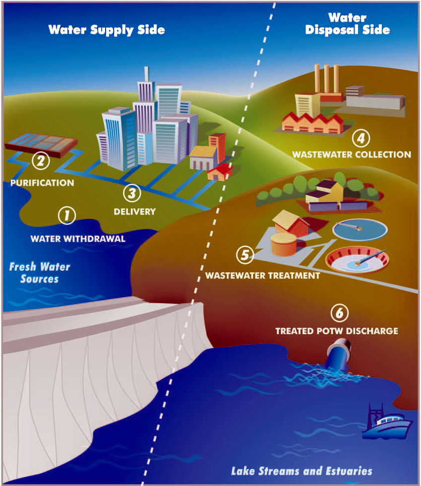
A water supply network or water supply system is a system of engineered hydrologic and hydraulic components that provide water supply. A water supply system typically includes the following: # A drainage basin (see water purification – sources of drinking water) # A raw water collection point (above or below ground) where the water accumulates, such as a lake, a river, or groundwater from an underground aquifer. Raw water may be transferred using uncovered ground-level aqueducts, covered tunnels, or underground water pipes to water purification facilities. # Water purification facilities. Treated water is transferred using water pipes (usually underground). # Water storage facilities such as reservoirs, water tanks, or water towers. Smaller water systems may store the water in cisterns or pressure vessels. Tall buildings may also need to store water locally in pressure vessels in order for the water to reach the upper floors. # Additional water pressurizing components s ... [...More Info...] [...Related Items...] OR: [Wikipedia] [Google] [Baidu] |


