|
Kidmi Gestet
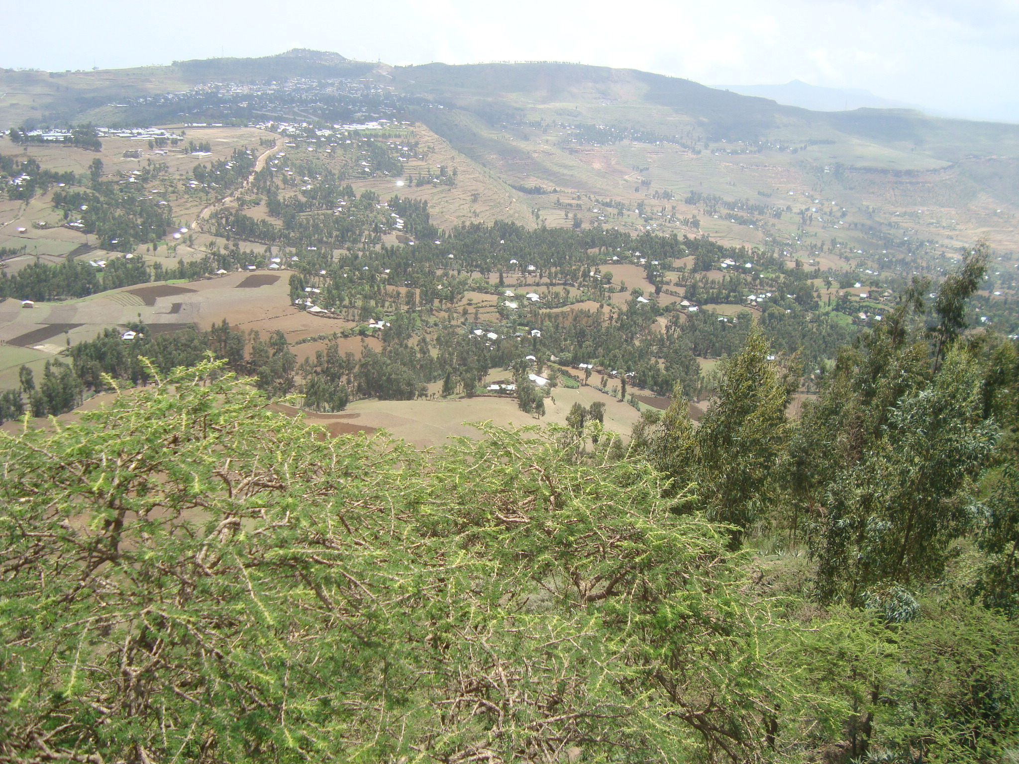
Kidmi Gestet is an exclosure located in the Dogu'a Tembien ''woreda'' of the Tigray Region in Ethiopia. Environmental characteristics Source: * Area: 46 ha * Average slope gradient: 48% * Minimum altitude: 2015 metres * Maximum altitude: 2131 metres * Lithology: Antalo Limestone * 2017: support by the EthioTrees project Management Cattle ranging and wood harvesting are prohibited in Kidmi Gestet. The grasses are harvested once yearly and taken to the homesteads of the village to feed livestock. Benefits for the community Setting aside such areas fits with the long-term vision of the communities: ''hiza’iti'' lands are set aside for use by the future generations. This also has direct benefits for the community, including: * improved ground water availability * honey production * climate ameliorator (temperature, moisture) * the sequestered carbon is certified using the Plan Vivo voluntary carbon standard, after which carbon credits are sold * the revenues are then reinvested ... [...More Info...] [...Related Items...] OR: [Wikipedia] [Google] [Baidu] |
Amanit
Amanit is a ''tabia'' or municipality in the Dogu'a Tembien district of the Tigray Region of Ethiopia. The ''tabia'' centre is Addi Qeshofo village, located approximately 15 km to the southeast of the ''woreda'' town Hagere Selam (as the crow flies). Geography The ''tabia'' stretches down southbound over an elongated ridge between Inda Sillasie River and Addi Keshofo River towards Giba River. The highest place is a hill east of Gudeli (2230 m a.s.l.) and the lowest place at the junction of Inda Sillasie and Giba Rivers (1448 m a.s.l.). Geology The two main geological formations are Antalo Limestone in most of the ''tabia'', and Adigrat Sandstone on the slopes towards the river gorges. Quaternary alluvium and freshwater tufa occur in the valley bottoms. Geomorphology and soils The main geomorphic units, with corresponding soil types are: * Gently rolling Antalo Limestone plateau, holding cliffs and valley bottoms on limestone ** Associated soil types *** shallow st ... [...More Info...] [...Related Items...] OR: [Wikipedia] [Google] [Baidu] |
Degua Tembien
Dogu'a Tembien (, "Upper Tembien", sometimes transliterated as Degua Tembien or Dägʿa Tämben) is a districts of Ethiopia, woreda in Tigray Region, Ethiopia. It is named in part after the former province of Tembien Province, Tembien. Nowadays, the mountainous district is part of the Debub Misraqawi Zone, Southeastern Tigray Zone. The administrative centre of this woreda is Hagere Selam (Degua Tembien), Hagere Selam. History Dogu’a Tembien holds numerous prehistoric sites, which have been dated to the Middle Stone Age in Ayninbirkekin, or Pastoral Neolithic in Aregen and Menachek. Geography Topography and landscapes Major mountains :* Tsatsen, 2815 metres, a wide mesa between Hagere Selam (Degua Tembien), Hagere Selam and Inda Maryam Qorar () :* Ekli Imba, 2799 metres, summit of the Arebay massif in Arebay ''tabia'' or district () :* Imba Zuw’ala, 2710 metres, near Hagere Selam (Degua Tembien), Hagere Selam () :* Aregen, 2660 metres, in Aregen ''tabia'' () :* Dabba Sela ... [...More Info...] [...Related Items...] OR: [Wikipedia] [Google] [Baidu] |
Ethiopia
Ethiopia, officially the Federal Democratic Republic of Ethiopia, is a landlocked country located in the Horn of Africa region of East Africa. It shares borders with Eritrea to the north, Djibouti to the northeast, Somalia to the east, Kenya to the south, South Sudan to the west, and Sudan to the northwest. Ethiopia covers a land area of . , it has around 128 million inhabitants, making it the List of countries and dependencies by population, thirteenth-most populous country in the world, the List of African countries by population, second-most populous in Africa after Nigeria, and the most populous landlocked country on Earth. The national capital and largest city, Addis Ababa, lies several kilometres west of the East African Rift that splits the country into the African Plate, African and Somali Plate, Somali tectonic plates. Early modern human, Anatomically modern humans emerged from modern-day Ethiopia and set out for the Near East and elsewhere in the Middle Paleolithi ... [...More Info...] [...Related Items...] OR: [Wikipedia] [Google] [Baidu] |
Hagere Selam (Degua Tembien)
Hagere Selam (Tigrinya language, Tigrinya: ሃገረ ሰላም) is a town in northern Ethiopia. Located on the Mekelle-Abiy Addi regional road, it is located at an elevation of 2650 metres above sea level. The town is the administrative center of the Degua Tembien, Dogu'a Tembien woreda. The weekly market is on Saturdays. Hagere Selam is located on the saddle point between two of the higher points in Tigray (Imba Zuw'ala and Tsatsen). The regional road from Mekelle to Abiy Addi climbs towards Hagere Selam, before going down to the Abergele (woreda), Abergele lowlands. The area is categorized as highland or ''dega''. The local economy is dependent on trading, agriculture, with barley being the main crop grown in the area, and on milk production and apiculture. Demographics Based on figures from the census in 2007, Hagere Selam had a total population of 8,130 of whom 3,702 were men and 4,428 were women. The 1994 census reported a total population of 3,932. The functional agglome ... [...More Info...] [...Related Items...] OR: [Wikipedia] [Google] [Baidu] |
Exclosure
An exclosure, in an area being used extensively for grazing, is a limited area from which unwanted browsing (herbivory), browsing animals, such as domestic cattle or wildlife such as deer, are excluded by fencing or other means. Environmental protection Most commonly, exclosures are areas that are set aside for regreening. Wood harvesting and livestock range are not allowed there. Effects on environment The establishment of an exclosure has positive effects on: * biodiversity * water infiltration * protection from flooding * sediment deposition * carbon sequestration Economic benefits In developing countries, people commonly have economic benefits from these exclosures through grass harvesting, beekeeping and other non-timber forest products. The local inhabitants also consider it as “land set aside for future generations”. Carbon credits Exclosures have as an additional benefit that the surrounding communities may receive carbon credits for the Carbon sequestratio ... [...More Info...] [...Related Items...] OR: [Wikipedia] [Google] [Baidu] |
Dogu'a Tembien
Dogu'a Tembien (, "Upper Tembien", sometimes transliterated as Degua Tembien or Dägʿa Tämben) is a woreda in Tigray Region, Ethiopia. It is named in part after the former province of Tembien. Nowadays, the mountainous district is part of the Southeastern Tigray Zone. The administrative centre of this woreda is Hagere Selam. History Dogu’a Tembien holds numerous prehistoric sites, which have been dated to the Middle Stone Age in Ayninbirkekin, or Pastoral Neolithic in Aregen and Menachek. Geography Topography and landscapes Major mountains :* Tsatsen, 2815 metres, a wide mesa between Hagere Selam and Inda Maryam Qorar () :* Ekli Imba, 2799 metres, summit of the Arebay massif in Arebay ''tabia'' or district () :* Imba Zuw’ala, 2710 metres, near Hagere Selam () :* Aregen, 2660 metres, in Aregen ''tabia'' () :* Dabba Selama, 2630 metres, in Haddinnet ''tabia'' () (not to be confused with the homonymous monastery) :* Imba Dogu’a, 2610 metres, in Mizane Birhan ... [...More Info...] [...Related Items...] OR: [Wikipedia] [Google] [Baidu] |
Tigray Region
The Tigray Region (or simply Tigray; officially the Tigray National Regional State) is the northernmost Regions of Ethiopia, regional state in Ethiopia. The Tigray Region is the homeland of the Tigrayan, Irob people, Irob and Kunama people. Its capital and largest city is Mekelle. Tigray is the fifth-largest by area, the fourth-most populous, and the fifth-most densely populated of the 11 regional states. Tigray is bordered by Eritrea to the north, the Amhara Region to the south, the Afar Region to the east, and Sudan to the west. Tigray's official language is Tigrinya language, Tigrinya, similar to that of southern Eritrea. The Tigray region had an estimated pre-war population of 7,070,260. The majority of the population (c. 80%) are farmers, contributing 46% to the regional gross domestic product (2009). The highlands have the highest population density, especially in Misraqawi Zone, eastern and Maekelay Zone, central Tigray. The much less densely populated lowlands comprise ... [...More Info...] [...Related Items...] OR: [Wikipedia] [Google] [Baidu] |
Antalo Limestone
The Antalo Limestone, also known as the Antalo Sequence, is a geological formation in Ethiopia. It is between 300 and 800 metres thick and comprises fossiliferous limestones and marls that were deposited in a reef. Marine microfossils have shown an age between 165 and 150 million years. Name and definition The Antalo Supersequence includes two main stratigraphic units: the Antalo Sequence and the Agula Group. The Antalo Sequence, or Antalo Limestone has been named after the town of Hintalo in Tigray Region, Tigray, Ethiopia. The name of the formation was coined by geologist William Thomas Blanford, who accompanied the British Expedition to Abyssinia in 1868. At that time, Hintalo was a major town on the route of the invading British army. So far the nomenclature has not been proposed for recognition to the International Commission on Stratigraphy. Geographical extent The sedimentary succession is found in Ethiopia, in the Mekelle Outlier, in the Blue Nile gorge, in the Harra ... [...More Info...] [...Related Items...] OR: [Wikipedia] [Google] [Baidu] |
EthioTrees
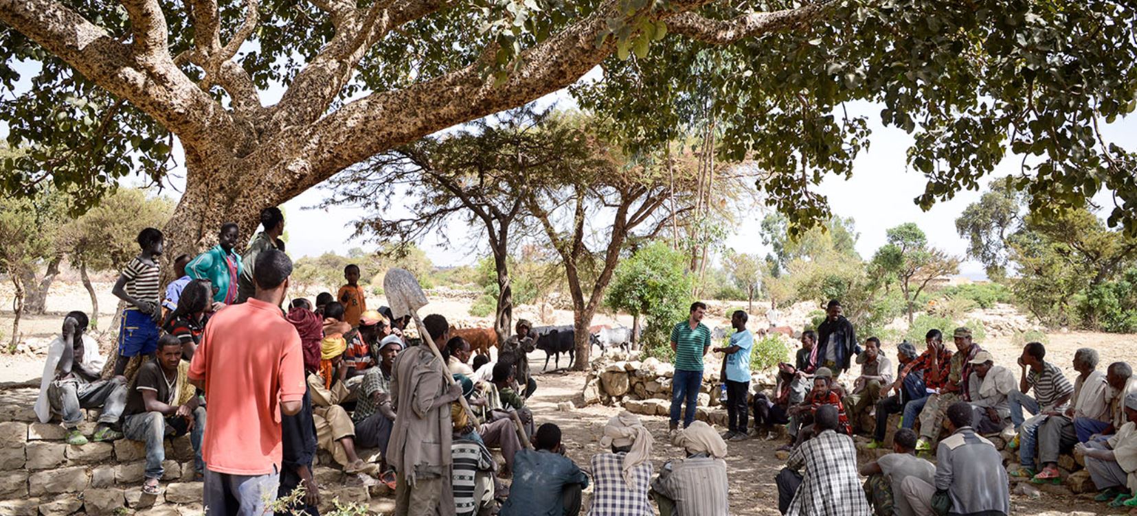
The EthioTrees Ecosystem Restoration Association, in short EthioTrees, established in 2016, is a project for environmental rehabilitation and woodland restoration in Dogu’a Tembien (Ethiopia). The association manages exclosures (land protected from grazing) with the intent of improving the ecosystem and sequestering carbon. In 2018, it managed 18 exclosures comprising over 1500 ha. Context For many years, there has been severe land degradation and desertification in Tigray and the area became also impoverished; however, a lot of efforts are done to rehabilitate these semi-arid mountain landscapes. Since 1994, researchers, students, and field assistants have studied the environment of Dogu’a Tembien. To contribute to the ongoing effort for rehabilitation, they initiated development projects that addressed in the first place land conservation, ecosystem services, and livelihood. EthioTrees is one of these projects. Objectives EthioTrees has as objectives: * to enhance comm ... [...More Info...] [...Related Items...] OR: [Wikipedia] [Google] [Baidu] |
Ground Water
Groundwater is the water present beneath Earth's surface in rock and soil pore spaces and in the fractures of rock formations. About 30 percent of all readily available fresh water in the world is groundwater. A unit of rock or an unconsolidated deposit is called an ''aquifer'' when it can yield a usable quantity of water. The depth at which soil pore spaces or fractures and voids in rock become completely saturated with water is called the ''water table''. Groundwater is recharged from the surface; it may discharge from the surface naturally at springs and seeps, and can form oases or wetlands. Groundwater is also often withdrawn for agricultural, municipal, and industrial use by constructing and operating extraction wells. The study of the distribution and movement of groundwater is ''hydrogeology'', also called groundwater hydrology. Typically, groundwater is thought of as water flowing through shallow aquifers, but, in the technical sense, it can also contain soil mois ... [...More Info...] [...Related Items...] OR: [Wikipedia] [Google] [Baidu] |
Honey
Honey is a sweet and viscous substance made by several species of bees, the best-known of which are honey bees. Honey is made and stored to nourish bee colonies. Bees produce honey by gathering and then refining the sugary secretions of plants (primarily floral nectar) or the secretions of other insects, like the honeydew of aphids. This refinement takes place both within individual bees, through regurgitation and enzymatic activity, and during storage in the hive, through water evaporation that concentrates the honey's sugars until it is thick and viscous. Honey bees stockpile honey in the hive. Within the hive is a structure made from wax called honeycomb. The honeycomb is made up of hundreds or thousands of hexagonal cells, into which the bees regurgitate honey for storage. Other honey-producing species of bee store the substance in different structures, such as the pots made of wax and resin used by the stingless bee. Honey for human consumption is collected ... [...More Info...] [...Related Items...] OR: [Wikipedia] [Google] [Baidu] |
Carbon Offset
Carbon offsetting is a carbon trading mechanism that enables entities to compensate for offset greenhouse gas emissions by investing in projects that reduce, avoid, or remove emissions elsewhere. When an entity invests in a carbon offsetting program, it receives carbon credit or offset credit, which account for the net climate benefits that one entity brings to another. After certification by a government or independent certification body, credits can be traded between entities. One carbon credit represents a reduction, avoidance or removal of one metric tonne of carbon dioxide or its carbon dioxide-equivalent (CO2e). A variety of greenhouse gas reduction projects can qualify for offsets and credits depending on the scheme. Some include forestry projects that avoid logging and plant saplings, renewable energy projects such as wind farms, biomass energy, biogas digesters, hydroelectric dams, as well as energy efficiency projects. Further projects include carbon dioxide rem ... [...More Info...] [...Related Items...] OR: [Wikipedia] [Google] [Baidu] |


