|
EthioTrees
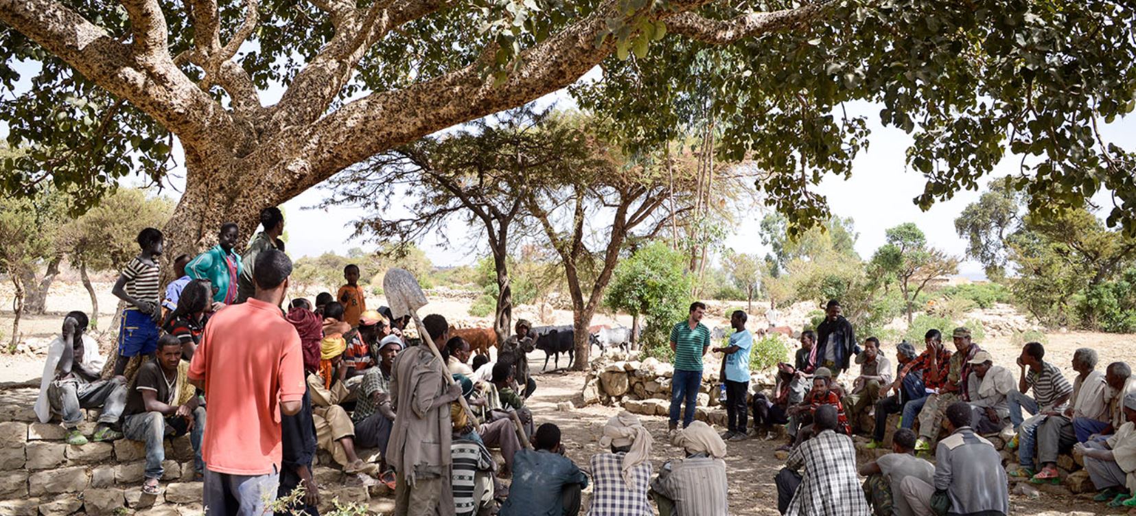
The EthioTrees Ecosystem Restoration Association, in short EthioTrees, established in 2016, is a project for environmental rehabilitation and woodland restoration in Dogu’a Tembien (Ethiopia). Context Since many years, there has been severe land degradation and desertification in Tigray and the area became also impoverished; however, a lot of efforts are done to rehabilitate these semi-arid mountain landscapes. Since 1994, researchers, students, and field assistants have studied the environment of Dogu’a Tembien. To contribute to the ongoing effort for rehabilitation, they initiated development projects that addressed in the first place land conservation, ecosystem services, and livelihood. EthioTrees is one of these projects. Objectives EthioTrees has as objectives: * to enhance community-driven woodland restoration in exclosures * to sequester carbon in exclosures, both as above-ground biomass and soil organic matter * to develop and valorise ecosystem services, includi ... [...More Info...] [...Related Items...] OR: [Wikipedia] [Google] [Baidu] |
May Be'ati (exclosure)
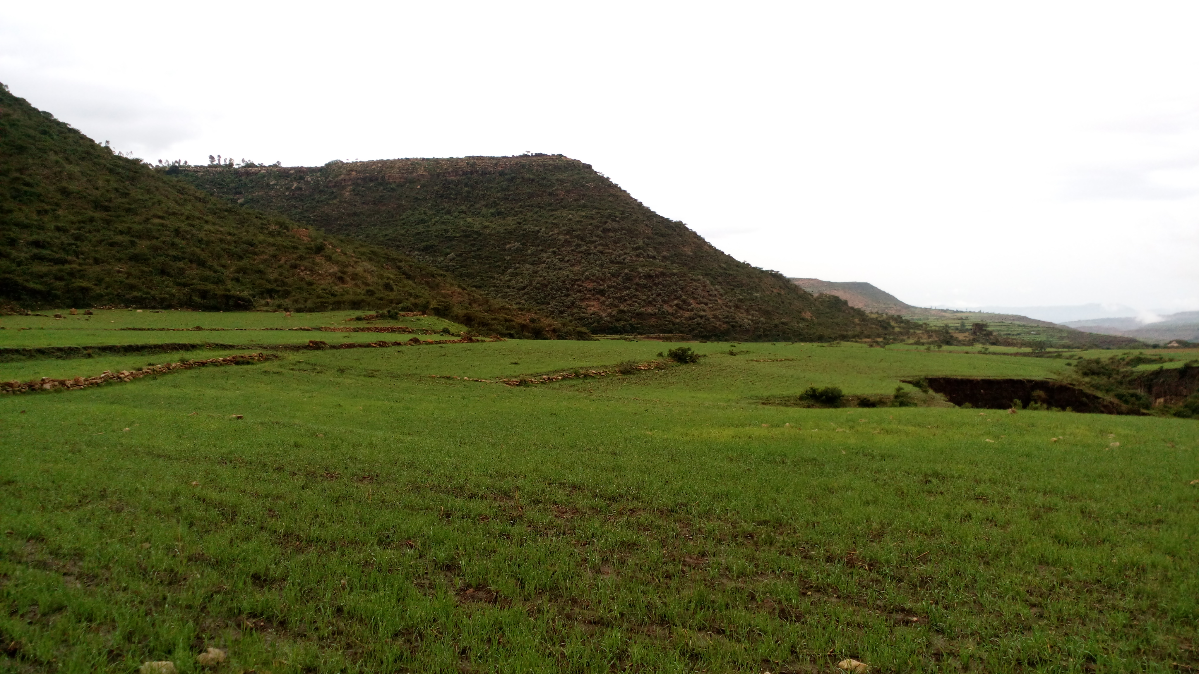
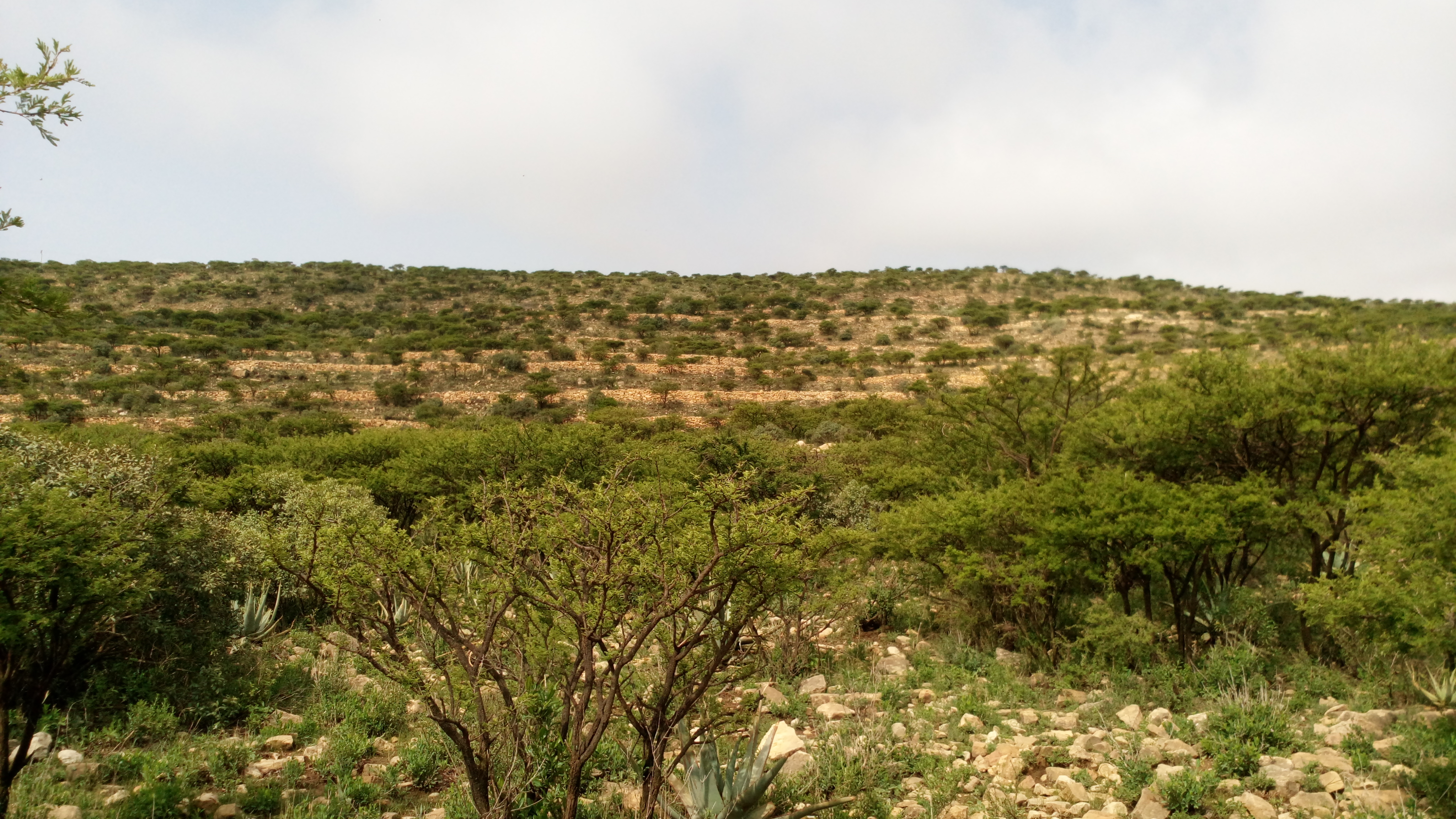
May Be’ati is an exclosure located in the Dogu'a Tembien ''woreda'' of the Tigray Region in Ethiopia. The area has been protected since 1968 by the local community. Timeline * 1968: established as exclosure by the community * 2017: support by the EthioTrees project Environmental characteristics * Area: 46 ha * Average slope gradient: 53% * Aspect: the exclosure is oriented towards the south * Minimum altitude: 2268 metres * Maximum altitude: 2428 metres * Lithology: Antalo Limestone, partly covered by non-calcareous sediments Management As a general rule, cattle ranging and wood harvesting are not allowed. The grasses are harvested once yearly and taken to the homesteads of the village to feed livestock. Physical soil and water conservation has been implemented to enhance infiltration, and vegetation growth. There are four guards to protect the exclosure. Field observations showed that however some illegal grazing occurred in the exclosure in 2018. Benefits for the communi ... [...More Info...] [...Related Items...] OR: [Wikipedia] [Google] [Baidu] |
Lafa (exclosure)
Lafa is an exclosure located in the Dogu'a Tembien ''woreda'' of the Tigray Region in Ethiopia. The area has been protected since 1988 by the local community. Timeline * 1988: established as exclosure by the community * 2017: support by the EthioTrees project Environmental characteristics * Area: 45 ha * Average slope gradient: 41% * Aspect: the exclosure is oriented towards the south * Minimum altitude: 2008 metres * Maximum altitude: 2088 metres * Lithology: Antalo Limestone Management As a general rule, cattle ranging and wood harvesting are not allowed. The grasses are harvested once yearly and taken to the homesteads of the village to feed livestock. There are two guards to protect the exclosure. Field observations showed that however some illegal grazing occurred in the exclosure in 2018. Benefits for the community Setting aside such areas fits with the long-term vision of the communities were ''hiza’iti'' lands are set aside for use by the future generations. It has ... [...More Info...] [...Related Items...] OR: [Wikipedia] [Google] [Baidu] |
Kidmi Gestet
Kidmi Gestet is an exclosure located in the Dogu'a Tembien ''woreda'' of the Tigray Region in Ethiopia. Environmental characteristics * Area: 46 ha * Average slope gradient: 48% * Minimum altitude: 2015 metres * Maximum altitude: 2131 metres * Lithology: Antalo Limestone * 2017: support by the EthioTrees project Management Cattle ranging and wood harvesting are prohibited in Kidmi Gestet. The grasses are harvested once yearly and taken to the homesteads of the village to feed livestock. Benefits for the community Setting aside such areas fits with the long-term vision of the communities: ''hiza’iti'' lands are set aside for use by the future generations. This also has direct benefits for the community, including: * improved ground water availability * honey production * climate ameliorator (temperature, moisture) * the sequestered carbon is certified using the Plan Vivo voluntary carbon standard, after which carbon credits are sold * the revenues are then reinvested in the v ... [...More Info...] [...Related Items...] OR: [Wikipedia] [Google] [Baidu] |
Gemgema
Gemgema is an exclosure located in the Dogu'a Tembien ''woreda'' of the Tigray Region in Ethiopia. The area has been protected since 1992 by the local community. Timeline * 1992: established as exclosure by the community * 2017: support by the EthioTrees project Environmental characteristics * Area: 92 ha * Average slope gradient: 59% * Aspect: the exclosure is oriented towards the west * Minimum altitude: 2124 metres * Maximum altitude: 2288 metres * Lithology: Antalo Limestone Management As a general rule, cattle ranging and wood harvesting are not allowed. The grasses are harvested once yearly and taken to the homesteads of the village to feed livestock. Physical soil and water conservation has been implemented to enhance infiltration, and vegetation growth. There are five guards to protect the exclosure. Field observations showed that however some illegal grazing occurred in the exclosure in 2018. Benefits for the community Setting aside such areas fits with the long- ... [...More Info...] [...Related Items...] OR: [Wikipedia] [Google] [Baidu] |
Ch'elaqo (exclosure)
Ch’elaqo is an exclosure located in the Dogu'a Tembien ''woreda'' of the Tigray Region in Ethiopia. Environmental characteristics * Area: 50 ha * Average slope gradient: 46% * Aspect: the exclosure is oriented towards the southwest * Minimum altitude: 2169 metres * Maximum altitude: 2336 metres * Lithology: Antalo Limestone * 2018: support by the EthioTrees project Management As a general rule, cattle ranging and wood harvesting are not allowed. The grasses are harvested once yearly and taken to the homesteads of the village to feed livestock. Field observations showed that no illegal grazing occurred in the exclosure in 2018. Benefits for the community Setting aside such areas fits with the long-term vision of the communities were ''hiza’iti'' lands are set aside for use by the future generations. It has also direct benefits for the community: * improved ground water availability * honey Honey is a sweet and viscous substance made by several bees, the best-known ... [...More Info...] [...Related Items...] OR: [Wikipedia] [Google] [Baidu] |
Afedena (exclosure)
Afedena is an exclosure located in the Dogu'a Tembien ''woreda'' of the Tigray Region in Ethiopia. The area has been protected since 2008 by the local community. Timeline * 2008: established as exclosure by the community * 2017: support by the EthioTrees project Environmental characteristics * Area: 70 ha * Average slope gradient: 25% * Aspect: the exclosure is oriented towards the northeast and east * Minimum altitude: 2068 metres * Maximum altitude: 2232 metres * Lithology: Antalo Limestone Management As a general rule, cattle ranging and wood harvesting are not allowed. The grasses are harvested once yearly and taken to the homesteads of the village to feed livestock. Physical soil and water conservation has been implemented to enhance infiltration, and vegetation growth. There are three guards to protect the exclosure. Field observations showed that however, some illegal grazing occurred in the exclosure in 2018. Biodiversity With vegetation growth, biodiversity in th ... [...More Info...] [...Related Items...] OR: [Wikipedia] [Google] [Baidu] |
Addilal (exclosure)
Addilal is an exclosure located in the Dogu'a Tembien ''woreda'' of the Tigray Region in Ethiopia. The area has been protected since 1992 by the local community. Timeline * 1992: established as exclosure by the community * 2017: support by the EthioTrees project Environmental characteristics * Area: 145 ha * Average slope gradient: 21% * Aspect: the exclosure is oriented towards the south and the west * Minimum altitude: 2030 metres * Maximum altitude: 2212 metres * Lithology: Antalo Limestone Management As a general rule, cattle ranging and wood harvesting are not allowed. The grasses are harvested once yearly and taken to the homesteads of the village to feed livestock. There are two guards to protect the exclosure. Field observations showed that no illegal grazing occurred in the exclosure in 2018. Benefits for the community Setting aside such areas fits with the long-term vision of the communities were ''hiza’iti'' lands are set aside for use by the future generations ... [...More Info...] [...Related Items...] OR: [Wikipedia] [Google] [Baidu] |
Addi Meles
Addi Meles is an exclosure located in the Dogu'a Tembien ''woreda'' of the Tigray Region in Ethiopia. The area is protected by the local community. Environmental characteristics * Area: 65 ha * Average slope gradient: 20% * Aspect: the exclosure is oriented, on both sides of a ridge towards the east and the west * Minimum altitude: 2163 metres * Maximum altitude: 2259 metres * Lithology: Antalo Limestone * 2018: support by the EthioTrees project Management As a general rule, cattle ranging and wood harvesting are not allowed. The grasses are harvested once yearly and taken to the homesteads of the village to feed livestock. Physical soil and water conservation has been implemented to enhance infiltration, and vegetation growth. Field observations showed that some illegal grazing occurred in the exclosure in 2018. Benefits for the community Setting aside such areas fits with the long-term vision of the communities were ''hiza’iti'' lands are set aside for use by the future g ... [...More Info...] [...Related Items...] OR: [Wikipedia] [Google] [Baidu] |
Addi Lihtsi (exclosure)
Addi Lihtsi is an exclosure located in the Dogu'a Tembien ''woreda'' of the Tigray Region in Ethiopia. The area is protected by the local community. Environmental characteristics * Area: 412 ha * Average slope gradient: 30% * Aspect: the exclosure is oriented towards the south * Minimum altitude: 1491 metres * Maximum altitude: 1874 metres * Lithology: Antalo Limestone and Adigrat Sandstone * 2017: support by the EthioTrees project Management As a general rule, cattle ranging and wood harvesting are not allowed. The grasses are harvested once yearly and taken to the homesteads of the village to feed livestock. Field observations showed that no illegal grazing occurred in the exclosure in 2018. Benefits for the community Setting aside such areas fits with the long-term vision of the communities were ''hiza’iti'' lands are set aside for use by the future generations. It has also direct benefits for the community: * improved ground water availability * honey production * ince ... [...More Info...] [...Related Items...] OR: [Wikipedia] [Google] [Baidu] |
Mizane Birhan
Mizane Birhan is a ''tabia'' or municipality in the Dogu'a Tembien district of the Tigray Region of Ethiopia. The ''tabia'' centre is in Ma’idi village, located approximately 13 km to the southeast of the ''woreda'' town Hagere Selam (as the crow flies). Geography The ''tabia'' is astride the Imba Dogu’a ridge, between valleys of Rubaksa and Ruba Bich’i Rivers. The highest peak is Imba Dogu’a (2620 m a.s.l.) and the lowest place at east is along Ruba Bich’i (1960 m a.s.l.) and at west 2020 m, down from Addi Welo. Geology From the higher to the lower locations, the following geological formations are present: * Mekelle Dolerite, forming the large Imba Dogu’a batholite that dominates Mizane Birhan * Upper basalt * Interbedded lacustrine deposits * Lower basalt * Amba Aradam Formation * Agula Shale * Antalo Limestone: a large quarry south of Ma’idi * Quaternary alluvium and freshwater tufa Geomorphology and soils The main geomorphic u ... [...More Info...] [...Related Items...] OR: [Wikipedia] [Google] [Baidu] |
Gestet
Amanit is a ''tabia'' or municipality in the Dogu'a Tembien district of the Tigray Region of Ethiopia. The ''tabia'' centre is Addi Qeshofo village, located approximately 15 km to the southeast of the ''woreda'' town Hagere Selam (as the crow flies). Geography The ''tabia'' stretches down southbound over an elongated ridge between Inda Sillasie River and Addi Keshofo River towards Giba River. The highest place is a hill east of Gudeli (2230 m a.s.l.) and the lowest place at the junction of Inda Sillasie and Giba Rivers (1448 m a.s.l.). Geology The two main geological formations are Antalo Limestone in most of the ''tabia'', and Adigrat Sandstone on the slopes towards the river gorges. Quaternary alluvium and freshwater tufa occur in the valley bottoms. Geomorphology and soils The main geomorphic units, with corresponding soil types are: * Gently rolling Antalo Limestone plateau, holding cliffs and valley bottoms on limestone ** Associated soil types *** shallow sto ... [...More Info...] [...Related Items...] OR: [Wikipedia] [Google] [Baidu] |


