|
Kempe Gowda I
Kempe Gowda I (27 June 1510 – 1569) locally venerated as Nadaprabhu Kempe Gowda, or commonly known as Kempe Gowda, was a governor under the Vijayanagara Empire in History of India, early-modern India. He is famous for the development of Bengaluru Pete in the 16th century. Kempegowda erected many Kannada inscriptions across the region. Early life Hiriya Kempe Gowda (Hiriya meaning elder in Kannada) was born in the Yelahanka suburb of Bangalore in the Vokkaliga#Morasu Vokkaliga, Morasu Vokkaliga community to Kempananje Gowda, the ruler of Yelhanka for more than 70 years. The Morasu Vokkaligas were Vijayanagara vassals at Yelahanka. Kempe Gowda, who is reputed to have shown leadership skills during his childhood, was educated for nine years at a gurukula in Aivarukandapura (or Aigondapura), a village near Hesaraghatta Lake, Hesaraghatta. Reign Fourth in succession from Rana Bhairave Gowda, founder of the dynasty of the Avati Nadu and great grandson of Jaya Gowda, a separat ... [...More Info...] [...Related Items...] OR: [Wikipedia] [Google] [Baidu] |
Kempegowda International Airport
Kempegowda International Airport is an international airport serving Bengaluru, the capital of the Indian state of Karnataka. Spread over , it is located about north of the city near the suburb of Devanahalli. It is owned and operated by Bengaluru International Airport Limited (BIAL), a public–private consortium. The airport opened in May 2008 as an alternative to the increasingly congested HAL Airport, the original commercial airport serving the city. It is named after Kempe Gowda I, the founder of Bengaluru. Kempegowda International Airport became Karnataka's first fully solar powered airport, developed by CleanMax Solar. The airport is the third-busiest in India, behind the airports in Delhi and Mumbai. It is the 26th busiest airport in Asia and the 54th busiest airport in the world as of 2024. In FY2024-25, the airport handled over 41.87 million passengers and of cargo. The airport offers connecting flights to all six inhabited continents, and direct flights t ... [...More Info...] [...Related Items...] OR: [Wikipedia] [Google] [Baidu] |
Shivanasamudra Falls
Shivanasamudra Falls is a cluster of waterfalls on the borders of Malavalli, Mandya and Kollegala, Chamarajanagara, in Karnataka, India, situated along the river Kaveri. The falls form the contour between the districts of Chamarajanagara and Mandya. The Bharachukki Falls in Kollegala, with a height of 69 metres, and the Gaganachukki Falls in Malavalli, with a height of 90 metres, collectively form the Shivanasamudra Falls. Shivanasamudra Falls is home to one of the first hydro-electric power stations in Asia, which was set up in 1902. The idea of tapping power from the falls to supply power for the machinery at the Kolar Gold Fields was suggested in 1898 by Alain Chartier Joly de Lotbiniere. The project was designed by Dewan Sir. Sheshadri Iyer and Chief Engineer Sir M. Visvesvaraya. Waterfalls The Shivanasamudra Falls is on the Kaveri River after the river has found its way through the rocks and ravines of the Deccan Plateau and drops off to form waterfalls. The island ... [...More Info...] [...Related Items...] OR: [Wikipedia] [Google] [Baidu] |
Varthur
Varthur is a suburb situated in the Eastern periphery of Bangalore City and part of the internationally famous Whitefield township. Varthur is a Hobli and part of the Bruhat Bangalore Mahanagara Palike. Varthur was a Legislative Assembly in the state of Karnataka but was split into three legislative assemblies C.V.Raman Nagar, Mahadevapura and Krishnarajapura in the year 2008. It is also one of the wards of BBMP. It is located in South-Eastern Bangalore between old Airport road and Sarjapur road. Varthur is very close to ITPB. There are many IT companies in Varthur Hobli. The head office of one of the largest IT companies, Wipro Technologies is situated here. Some other companies such as Cisco Systems, ARM, and Aricent Group, are situated in Varthur Hobli. At Varthur, people celebrate Brahmarathotsava of Sri Chennaraya Swamy, which happens on the day of Ratha Saptami. It is one of the famous events that takes place in this area. Two days later is Karaga of Sri Draupat ... [...More Info...] [...Related Items...] OR: [Wikipedia] [Google] [Baidu] |
Begur, Bangalore
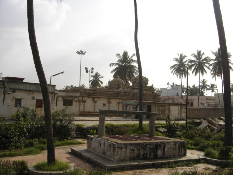
Begur or Begūru is a suburb of Bengaluru in the Indian state of Karnataka. It is located off Bengaluru-Hosur highway. It is said to have been a prominent place during the rule of the Western Ganga Dynasty and later the Chola Kingdom. Begur Fort Panchalingeshwara temple is located in the centre of Begur. It has a 1100 years old inscription which is the oldest existing reference to a place called 'Bengaluru'. The area was ruled by the Western Ganga Dynasty Western Ganga was an important ruling dynasty of ancient Karnataka in India which lasted from about 350 to 999 CE. They are known as "Western Gangas" to distinguish them from the Eastern Ganga Dynasty, Eastern Gangas who in later centuries r ... and in the 10th century the Cholas had acquired the territory. The Nageshwara temple was built by Ereganga Neetimarga around 9th century and Panchaligeshwara temple was built by Akthiyar of the Chola Kingdom. Near the temple, there exists a tiny circular fort, about 1.4&nb ... [...More Info...] [...Related Items...] OR: [Wikipedia] [Google] [Baidu] |
Ulsoor
Halasuru, known as Ulsoor during the British Raj, British Rule, is one of the oldest neighbourhoods in the city of Bengaluru. It is in central Bengaluru, and begins near the eastern terminus of M G Road, Bangalore, Mahatma Gandhi Raste. It is renowned for its numerous temples and market. History and name The village of Bangalore is said to have been gifted to Kempe Gowda I (1513–1569) by the Vijayanagar Empire, Vijayanagara emperors. The Halasuru Lake was built by his successor, Kempe Gowda II, and is the only surviving tank built by the Gowda kings in Bangalore. The first British Empire, British military station was established in Halasuru in 1807. The Hindu. 22 Mar. 2005 There used to be a jackfruit orchard near the Halasuru Lake, and the Kannada name for jackfruit being 'Halasina Hannu', the area came to be known as ''Halasuru''. During the British colonial rule, the name was corrupted to ''Ulsoor''. Location in Context Bengaluru Metro Rail There are two Namma Metr ... [...More Info...] [...Related Items...] OR: [Wikipedia] [Google] [Baidu] |
Sadasiva Raya
Sadasiva Raya (reigned 1542–1570) was the last Emperor of Vijayanagara from the Tuluva dynasty, and reigned from 1542 until his death in 1570. During most of his reign, Rama Raya was the de facto ruler of the state and created strategic alliances with the Deccan sultanates, who later formed an alliance against Vijayanagara and decisively defeated Rama Raya at the Battle of Talikota in 1565. After the defeat, the capital Vijayanagara was burned down and Sadasiva Raya retreated to Penukonda, the new capital of the empire, where he died in 1570. Reign When the Vijayanagara Emperor Achyuta Raya died in 1542, his son, Venkata I succeeded him. However, Venkata I was assassinated six months later. Sadasiva Raya, who was the nephew (sister-in-law's son) of Achyuta Raya, became the new Emperor in accordance with the Aliya succession laws prevalent among the Tuluvas The Tulu people or Tuluvas are an ethno-linguistic and ethno-cultural group from Southern India. They are nat ... [...More Info...] [...Related Items...] OR: [Wikipedia] [Google] [Baidu] |
Channapatna
Channapattana or Chennapattana is a city and taluk headquarters in Bengaluru South District, Karnataka, India. Channapatna is approximately 60 km from Bangalore and 80 km from Mysore. Channapatna toys are popular all over the world and have geographical indication tag. Geography Channapatna has an average elevation of 739 metres (2424 ft). Total length of roads is 108.20 km. Total water supply is 70.50 litres per capita per day. This means a per capita water supply of 65.50 litres. In summer the temperature is 32 °C. In winter it is 19 °C. Channapatna is located on the Bangalore - Mysore highway. It is about 60 km from Bangalore,75 km from Mysore and 36 km from Mandya . Demographics As of 2011 India census, Channapatna City Municipal Council has population of 71,942 of which 36,098 are males while 35,844 are females as per report released by Census India 2011. Notable People * D Javaregowda-Popular Kannada writer * B S ... [...More Info...] [...Related Items...] OR: [Wikipedia] [Google] [Baidu] |
Polygar
Palaiyakkarars, or Poligar, Palegara (as the British referred to them) in Andhra, Karnataka and Tamil Nadu were the holders of a small kingdom as a feudatory to a greater sovereign. Under this system, ''palayam'' was given for valuable military services rendered by any individual. The word ''pālayam'' means domain, a military camp, or a small kingdom. This type of Palayakkarars system was in practice during the rule of Pratapa Rudhra of Warangal in the Kakatiya Dynasty, Kakatiya kingdom. The system was put in place in Tamil Nadu by Viswanatha Nayak, when he became the Nayak ruler of Madurai in 1529, with the support of his minister Ariyanatha Mudaliar. Traditionally there were supposed to be 72 Palayakkarars. The majority of those Palaiyakkarar, who during the late 17th- and 18th-centuries controlled much of the Telugu people, Telugu region as well as the Tamil area, had themselves come from the Kallar (caste), Kallar, Maravar and Vatuka communities. Most palayakkars in western ... [...More Info...] [...Related Items...] OR: [Wikipedia] [Google] [Baidu] |
Penukonda
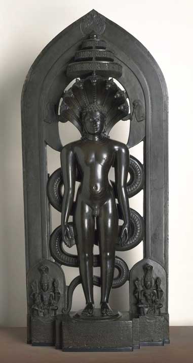
Penukonda also called Penugonda is a town in the Sri Sathya Sai district of Andhra Pradesh, India. It is 70 km away from Anantapur town. Demography According to ''The Imperial Gazetteer of India'', Penukonda was a subdivision and taluk of Anantapur district in Madras province. It contains 96 villages covering an area of 677 square miles. The population in 1901 was 92,482 compared with 81,104 in 1891. Penukonda was the headquarters with a population of 6,806. The Penner River flows along its western and Chitravati river along its eastern boundary. History This region was controlled at different points in history by the Hoysalas, Chalukyas, Vijayanagar, Nawabs, Maratha chieftain Murari Rao, Tipu Sultan, Nizam and eventually came under British rule after it was ''ceded'' to the British by the Nizam of Hyderabad. It was a melting pot of different religions but the town and fort were established by early Hoysala kings, who were practitioners of Jainism. After Krishn ... [...More Info...] [...Related Items...] OR: [Wikipedia] [Google] [Baidu] |
Bangalore Fort
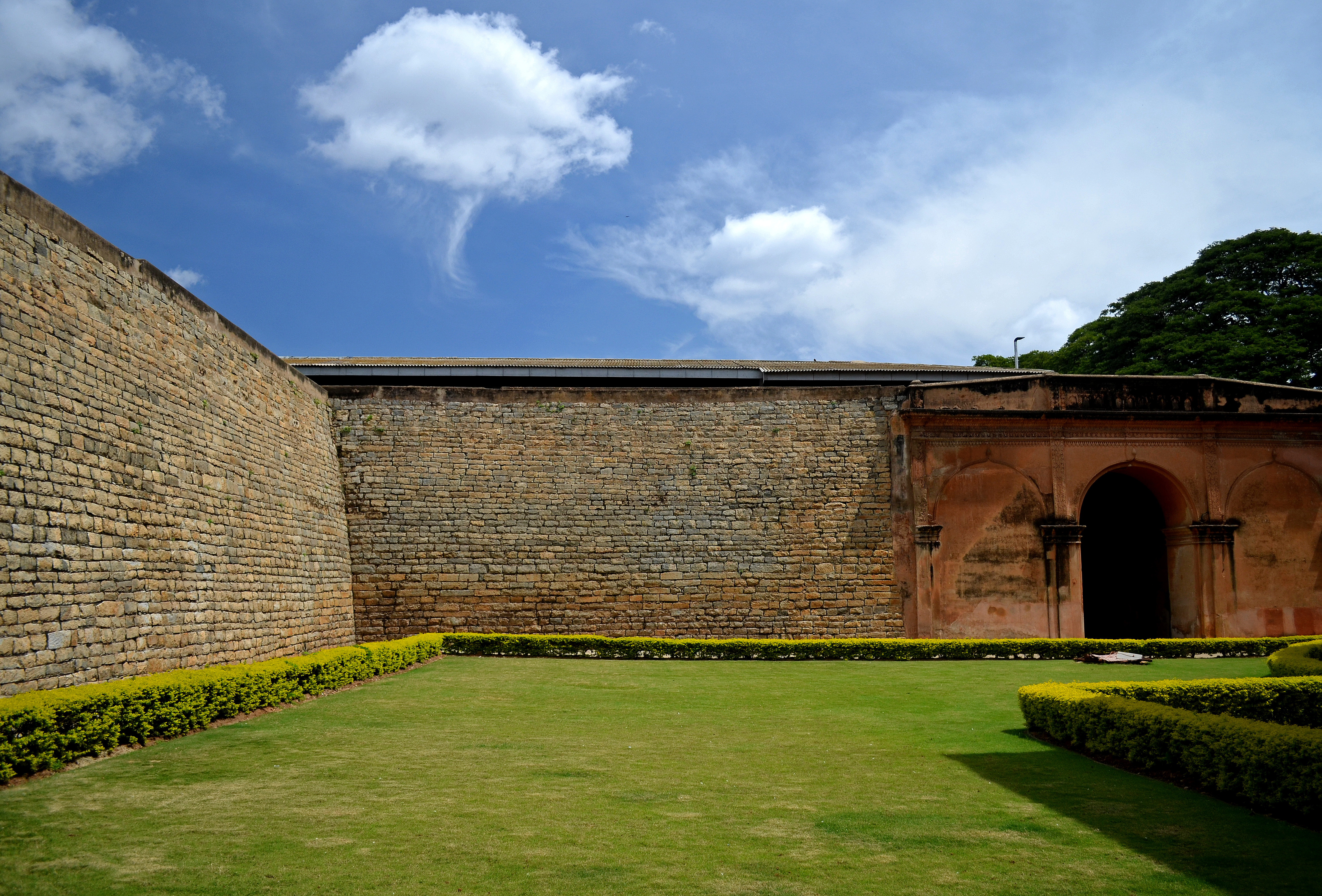
Bangalore Fort began in 1537 as a mud fort. The builder was Kempe Gowda I, a vassal of the Vijaynagar Empire and the founder of Bangalore. King Hyder Ali in 1761 replaced the mud fort with a stone fort and it was further improved by his son King Tipu Sultan in the late 18th century. Though damaged during an Anglo-Mysore war in 1791, it still remains a good example of 18th-century military fortification. The army of the British East India Company, led by Lord Cornwallis on 21 March 1791 captured the fort in the siege of Bangalore during the Third Mysore War (1790–1792). At the time the fort was a stronghold for King Tipu Sultan. Today, the fort's Delhi gate, on Krishnarajendra Road, and two bastions are the primary remains of the fort. A marble plaque commemorates the spot where the British breached the fort's wall, leading to its capture. The old fort area also includes King Tipu Sultan's Summer Palace, and his armoury. The fort provided the setting for the treasure hunt i ... [...More Info...] [...Related Items...] OR: [Wikipedia] [Google] [Baidu] |
Dasarahalli
Dasarahalli is a northwestern suburb of Bangalore in Bangalore Urban district in the state of Karnataka, India. The place is well known for its religious establishments such as Jalahalli Sree Ayyappan Temple, Shri Kari Maramma Devi Temple, Bagalgunte Maramma temple (100+ years old), Mallasandra Sri Prasanna Anjenya temple, Kaliyamma Temple, CSI Holy Cross Church, and St Dionysius Orthodox Church. Residential areas like Vaishnavi Rathnam, Casa Serene, Shantiniketan Apartments, Sobha ruby apartments, Ayyappa Nagar, Pipeline road, Grape Garden and Prashanth Nagar S.M road that includes the main Parayil Verghese family home. Police stations in the locality are Bagalgunte PS, Peenya PS and Gangammagudi PS. Nearby Hospitals are People tree Hospital, GJM Hospital, Prakriya Hospitals and Sree Ayyappan Temple Medical Center. Demographics India census, Dasarahalli had a population of 263,636. Males constitute 54% of the population and females 46%. Dasarahalli has an average literacy rate ... [...More Info...] [...Related Items...] OR: [Wikipedia] [Google] [Baidu] |
Achyuta Deva Raya
Achyuta Deva Raya (r. 1529 - 1542 CE) was a emperor of Vijayanagara who succeeded his older brother, Krishnadevaraya, after the latter's death in 1529 CE. During his reign, Fernao Nuniz, a Portuguese-Jewish traveller, chronicler and horse trader visited India and spent three years in Vijayanagara. Achyutaraya patronised the Kannada poet Chatu Vittalanatha, the great composer and singer Purandaradasa, one of the major proponents of Carnatic music, and the Sanskrit scholar Rajanatha Dindima II. Upon his death, the succession was disputed. His son Venkata I succeeded him but ruled for a very short period and was killed in a chaotic succession dispute in which many claimants to the throne were killed. The dispute ended when his nephew, (younger brother's son) Sadasiva Raya, finally became the emperor while yet a child, under the regency of Rama Raya, a son-in-law of Krishnadevaraya. His wife's name was probably Varadambika. Sadasiva Raya was probably the son of Varadambika's ... [...More Info...] [...Related Items...] OR: [Wikipedia] [Google] [Baidu] |


