|
Kemerburgaz
Kemerburgaz is a village in the Eyüp district of Istanbul Province, Turkey. Toponymy Kemerburgaz is a historic settlement located southwest of Belgrad Forest between the aqueducts Kurt Kemeri ("Wolf's Aqueduct") and Uzun Kemer ("Long Aqueduct"). During the Byzantine era ( 330–1453), its name was Pyrgos (, for 'tower' or 'bastion'). After the conquest of Istanbul in 1453, it was renamed , the Turkish language translation for bastion. Local people changed its name to , a concatenation of ('aqueduct') and , when the renowned architect Mimar Sinan ( 1489/1490–1588) repaired the ruined Byzantine aqueducts and built new waterways in the area. Demographics The ethnographic structure of the village remained quite unchanged during the Ottoman era after the conquest (1453–1923). According to the first census conducted after the Turkish War of Independence, the village had 360 Greek-origin and ten Turkish households. The Turkish residents were immigrants from Bulgaria during ... [...More Info...] [...Related Items...] OR: [Wikipedia] [Google] [Baidu] |
Göktürk, Istanbul
Göktürk or Göktürk Merkez, formerly known as Pektinaxôrion or Petnahor, is a neighbourhood in the municipality and district of Eyüpsultan, Istanbul Province, Turkey. Its population is 39,639 (as of 2022). It was an independent municipality until it was merged into the municipality of Eyüp in 2008. Resmî Gazete, 22 March 2008. Transportation Metro Göktürk has a metro station on the M11 line of the .Bus Lines Göktürk is served by the public bus lines. *48: Göktürk -[...More Info...] [...Related Items...] OR: [Wikipedia] [Google] [Baidu] |
Belgrad Forest
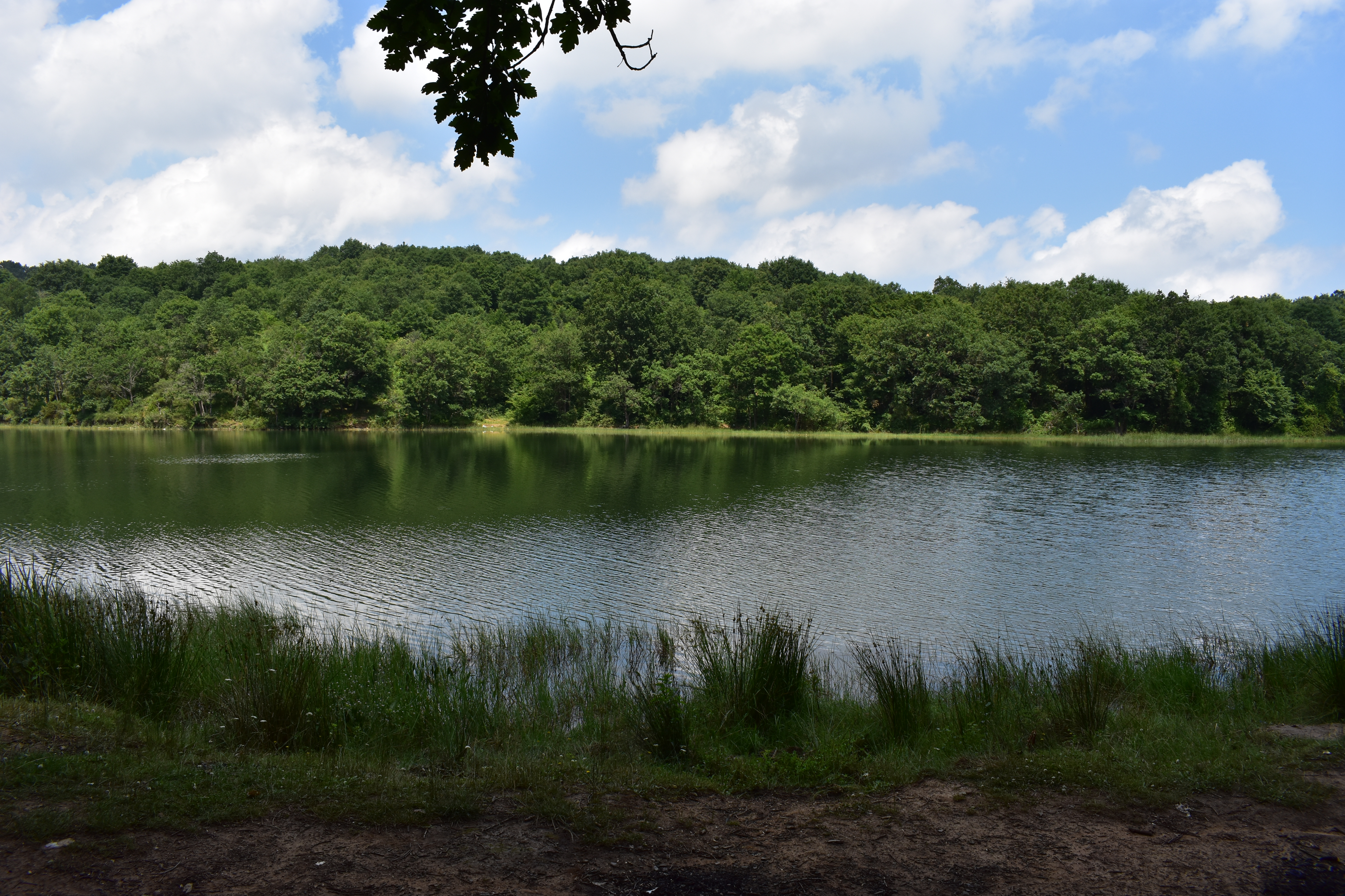
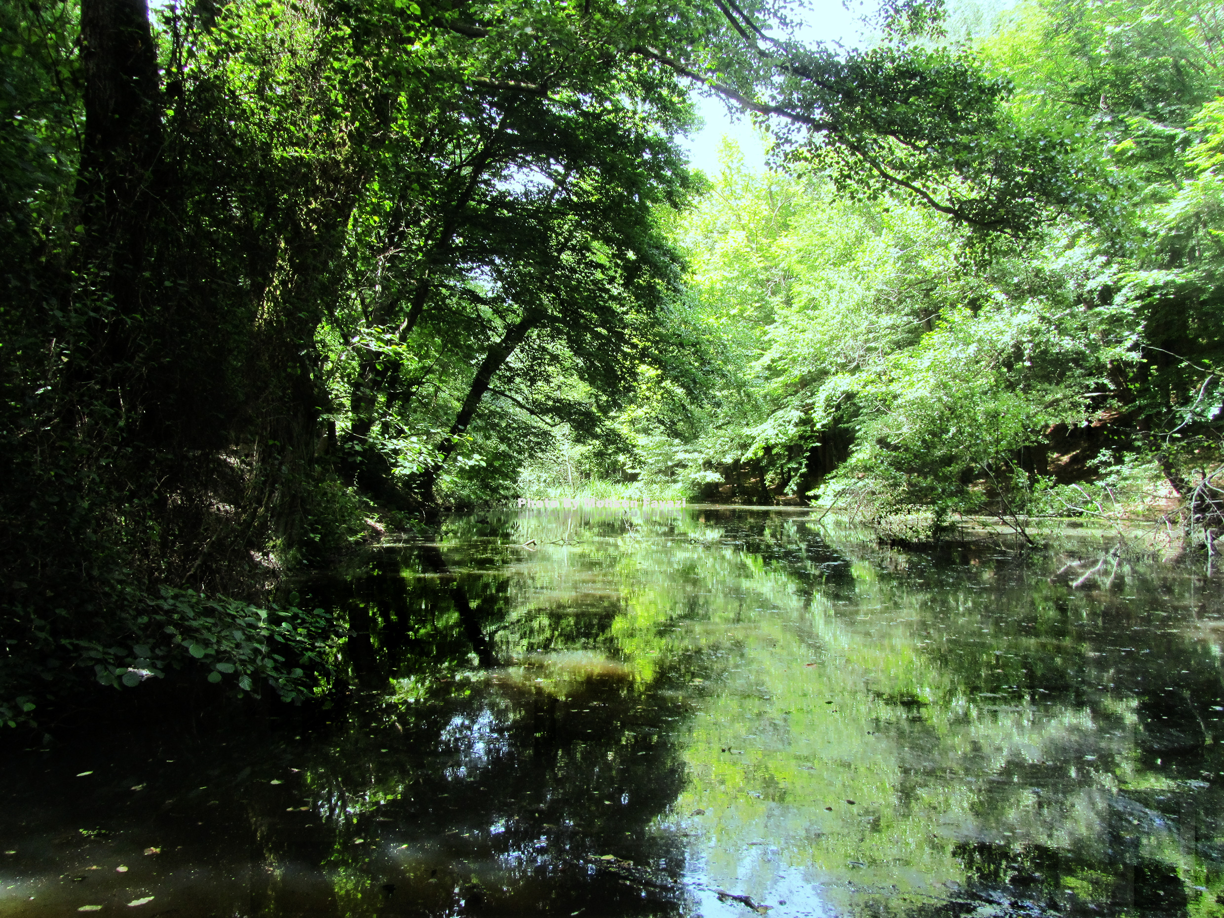
Belgrad Forest () is a mixed deciduous forest lying adjacent to Istanbul, Turkey. It is named after the village next to the forest, settled by thousands of Serbs who were deported to the capital Constantinople from the city of Belgrade in 1521, when Siege of Belgrade (1521), it fell to the Ottoman Empire, Ottomans. Geographically, the forest is located at the easternmost point of the Thracian Peninsula. Forest terrain is divided between Sarıyer and Eyüp districts. Several historical Reservoir, reservoirs lie within the forest. History This forest was one of the important water resources of Constantinople in the period of the Eastern Roman Empire, and after the fall of Constantinople Turks have respected and protected it. The Thracian village of Belgrad (from which the forest takes its name) was named after the thousands of Serbs that Suleiman the Magnificent had transferred to Thrace after the Siege of Belgrade (1521), 1521 Siege of Belgrade. Size and composition of the forest ... [...More Info...] [...Related Items...] OR: [Wikipedia] [Google] [Baidu] |
List Of Sovereign States
The following is a list providing an overview of sovereign states around the world with information on their status and recognition of their sovereignty. The 205 listed states can be divided into three categories based on membership within the United Nations System: 193 member states of the United Nations, UN member states, two United Nations General Assembly observers#Current non-member observers, UN General Assembly non-member observer states, and ten other states. The ''sovereignty dispute'' column indicates states having undisputed sovereignty (188 states, of which there are 187 UN member states and one UN General Assembly non-member observer state), states having disputed sovereignty (15 states, of which there are six UN member states, one UN General Assembly non-member observer state, and eight de facto states), and states having a political status of the Cook Islands and Niue, special political status (two states, both in associated state, free association with New ... [...More Info...] [...Related Items...] OR: [Wikipedia] [Google] [Baidu] |
Ottoman Empire
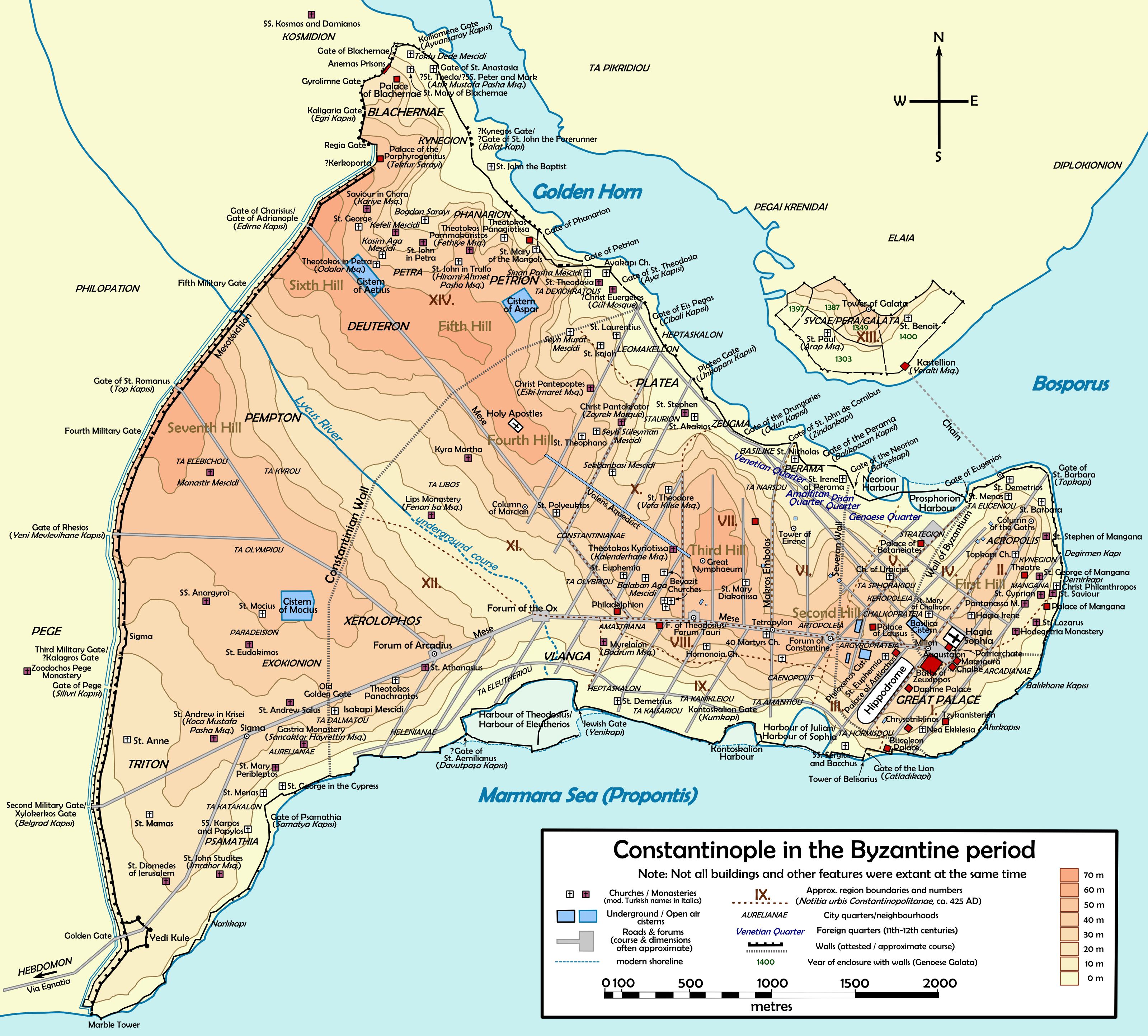
The Ottoman Empire (), also called the Turkish Empire, was an empire, imperial realm that controlled much of Southeast Europe, West Asia, and North Africa from the 14th to early 20th centuries; it also controlled parts of southeastern Central Europe, between the early 16th and early 18th centuries. The empire emerged from a Anatolian beyliks, ''beylik'', or principality, founded in northwestern Anatolia in by the Turkoman (ethnonym), Turkoman tribal leader Osman I. His successors Ottoman wars in Europe, conquered much of Anatolia and expanded into the Balkans by the mid-14th century, transforming their petty kingdom into a transcontinental empire. The Ottomans ended the Byzantine Empire with the Fall of Constantinople, conquest of Constantinople in 1453 by Mehmed II. With its capital at History of Istanbul#Ottoman Empire, Constantinople (modern-day Istanbul) and control over a significant portion of the Mediterranean Basin, the Ottoman Empire was at the centre of interacti ... [...More Info...] [...Related Items...] OR: [Wikipedia] [Google] [Baidu] |
Arnavutköy (district)
Arnavutköy (meaning " Albanian village" in Turkish "Europäische Migranten sind verantwortlich für Ortsnamen wie Arnavutköy («Albanerdorf»)" ) is a municipality and district of Istanbul Province, Turkey. Its area is 453 km2, and its population is 326,452 (2022). It is located on the European side of Istanbul and borders the Black Sea. Istanbul Airport is in the district. The mayor is Ahmet Haşim Baltacı of the AK Party. Arnavutköy borders Çatalca to the west, Büyükçekmece to the southwest, Esenyurt and Başakşehir to the south, and Eyüp to the east. Karaburun is a seaside resort on the Black Sea. In 2008 the district Arnavutköy was created from parts of the districts Çatalca Çatalca () is a municipality and Districts of Turkey, district of Istanbul Province, Istanbul Province, Turkey. Its area is 1142 km2, making it the largest district in Istanbul Province by area. Its population is 77,468 (2022). It is in Eas ... and Gaziosmanpaşa. The urba ... [...More Info...] [...Related Items...] OR: [Wikipedia] [Google] [Baidu] |
Eminönü
Eminönü, historically known as Pérama, is a predominantly commercial waterfront area of Istanbul within the Fatih district near the confluence of the Golden Horn with the southern entrance of the Bosphorus strait and the Sea of Marmara. It is located in the part of Istanbul known as the historical peninsula, connected to Karaköy (historic Galata) via the Galata Bridge across the Golden Horn. It was administered as part of the Sultanahmet district from 1928 to 2009 when Sultanahmet was absorbed into Fatih. Eminönü, which was a district municipality until March 7, 2008, was abolished on this date and connected to Fatih district by law. It is completely located within the city wall, the historical core of the city, and forms one of the most vibrant areas of the central area. Eminönü's busy main square is overlooked by the New Mosque (Yeni Cami in Turkish) and the Spice Bazaar (Mısır Çarşısı in Turkish). Eminönü is an important transport hub. Several ferries have te ... [...More Info...] [...Related Items...] OR: [Wikipedia] [Google] [Baidu] |
Mecidiyeköy
Mecidiyeköy ( is a neighbourhood in the municipality and district of Şişli, Istanbul Province, Turkey. Its population is 20,006 (2022). It is a heavily built-up residential and business neighbourhood, squeezed in between the Fulya, Kuştepe, Gültepe, Esentepe, and Gülbahar neighbourhoods. Mecidiyeköy means "Mecid's Village" in Turkish, a name it acquired because it was during the reign of the Ottoman sultan Abdülmecid I that it started to be settled. Attractions Mecidiyeöy barely features on the sightseeing radar although there are a couple of things to attract the curious, most obviously the Abide-i Hürriyet (Liberty Monument) isolated amid the traffic chaos where Halaskargazi Street meets the D100 flyover. The monument commemorates the so-called 31 March incident when counter-revolutionaries attempted to overturn the new Young Turk government and return Sultan Abdülhamid II to the throne. Their effort failed and shortly afterwards the sultan was removed from ... [...More Info...] [...Related Items...] OR: [Wikipedia] [Google] [Baidu] |
IETT
The Istanbul Electricity, Tram and Tunnel Establishments () or İETT is the transportation authority in Istanbul connected to the Istanbul Metropolitan Municipality specializing in public transportation. History After nationalizing various companies and combining them in 1939 with law 3645, the “Istanbul Electric Tram and Tunnel General Directorate” reached the status it has today. In 1945 the Yedikule Gasworks, Yedikule and Hasanpaşa Gasworks, Hasanpaşa Coal gas factories and the pipes fed by this factory that distributed coal gas to Istanbul and Anatolia were handed over to the IETT. trolleybuses that were implemented in 1961 continued servicing citizens until 1984. A law passed in 1982 gave all authority and right over electricity to the Turkish Electricity Administration (TEK). Coal gas production and distribution was ended in 1993. Today, the IETT only handles public transportation including buses, trams and tunnels as well as the administration, management and supe ... [...More Info...] [...Related Items...] OR: [Wikipedia] [Google] [Baidu] |
Euboea
Euboea ( ; , ), also known by its modern spelling Evia ( ; , ), is the second-largest Greek island in area and population, after Crete, and the sixth largest island in the Mediterranean Sea. It is separated from Boeotia in mainland Greece by the narrow Euripus Strait (only at its narrowest point). In general outline it is a long and narrow island; it is about long, and varies in breadth from to . Its geographic orientation is from northwest to southeast, and it is traversed throughout its length by a mountain range, which forms part of the chain that bounds Thessaly on the east, and is continued south of Euboia in the lofty islands of Andros, Tinos and Mykonos. It forms most of the regional unit of Euboea, which also includes Skyros and a small area of the Greek mainland. Name Like most of the Greek islands, Euboea was known by other names in antiquity, such as ''Macris'' (Μάκρις) and ''Doliche'' (Δολίχη) from its elongated shape, or ''Ellopia'' (after El ... [...More Info...] [...Related Items...] OR: [Wikipedia] [Google] [Baidu] |
Thessaloniki
Thessaloniki (; ), also known as Thessalonica (), Saloniki, Salonika, or Salonica (), is the second-largest city in Greece (with slightly over one million inhabitants in its Thessaloniki metropolitan area, metropolitan area) and the capital city, capital of the geographic regions of Greece, geographic region of Macedonia (Greece), Macedonia, the administrative regions of Greece, administrative region of Central Macedonia and the Decentralized Administration of Macedonia and Thrace. It is also known in Greek as , literally "the co-capital", a reference to its historical status as the "co-reigning" city () of the Byzantine Empire alongside Constantinople. Thessaloniki is located on the Thermaic Gulf, at the northwest corner of the Aegean Sea. It is bounded on the west by the Axios Delta National Park, delta of the Axios. The Thessaloniki (municipality), municipality of Thessaloniki, the historical centre, had a population of 319,045 in 2021, while the Thessaloniki metropolitan are ... [...More Info...] [...Related Items...] OR: [Wikipedia] [Google] [Baidu] |


