|
Kelsey Peak
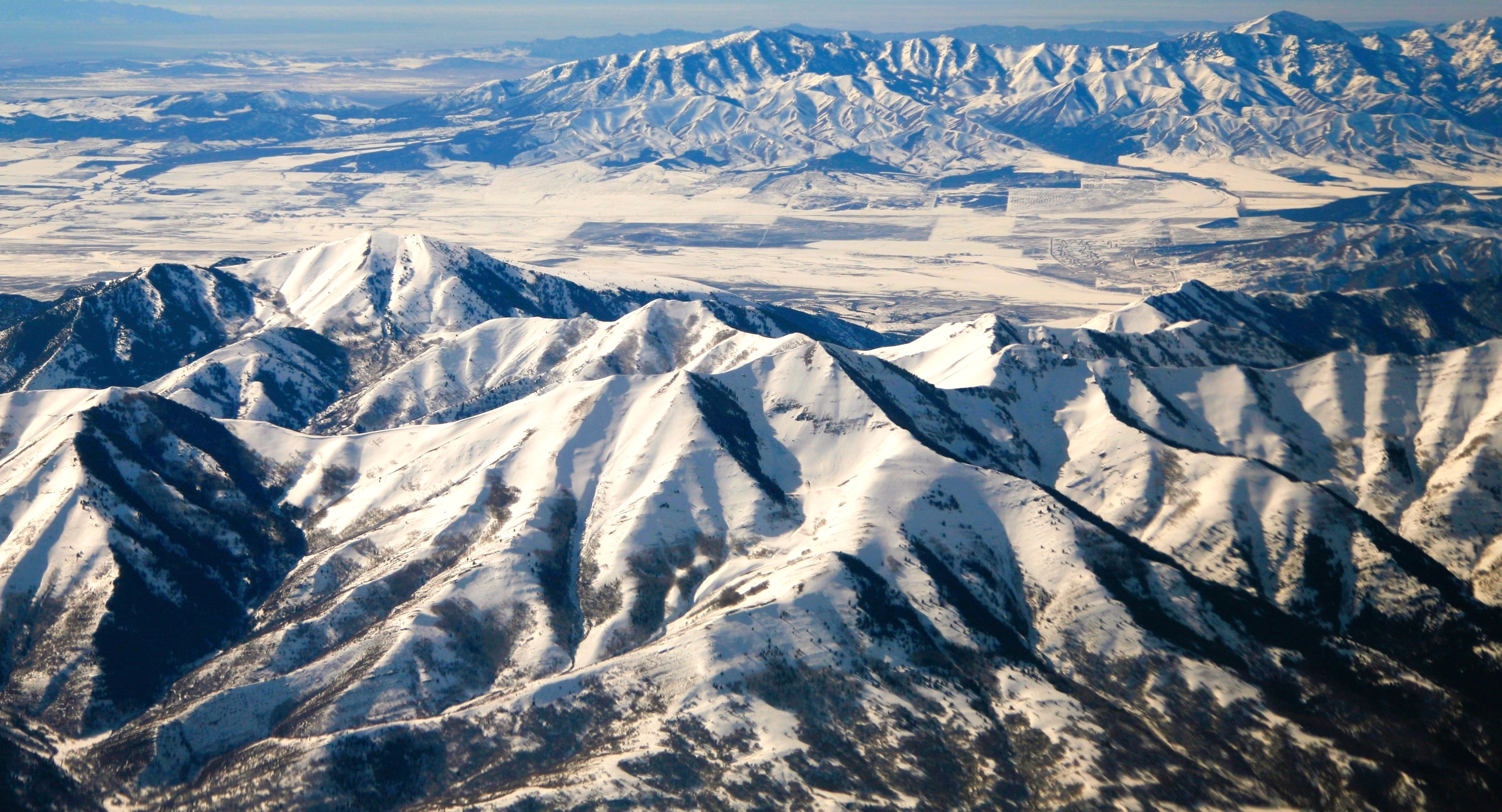
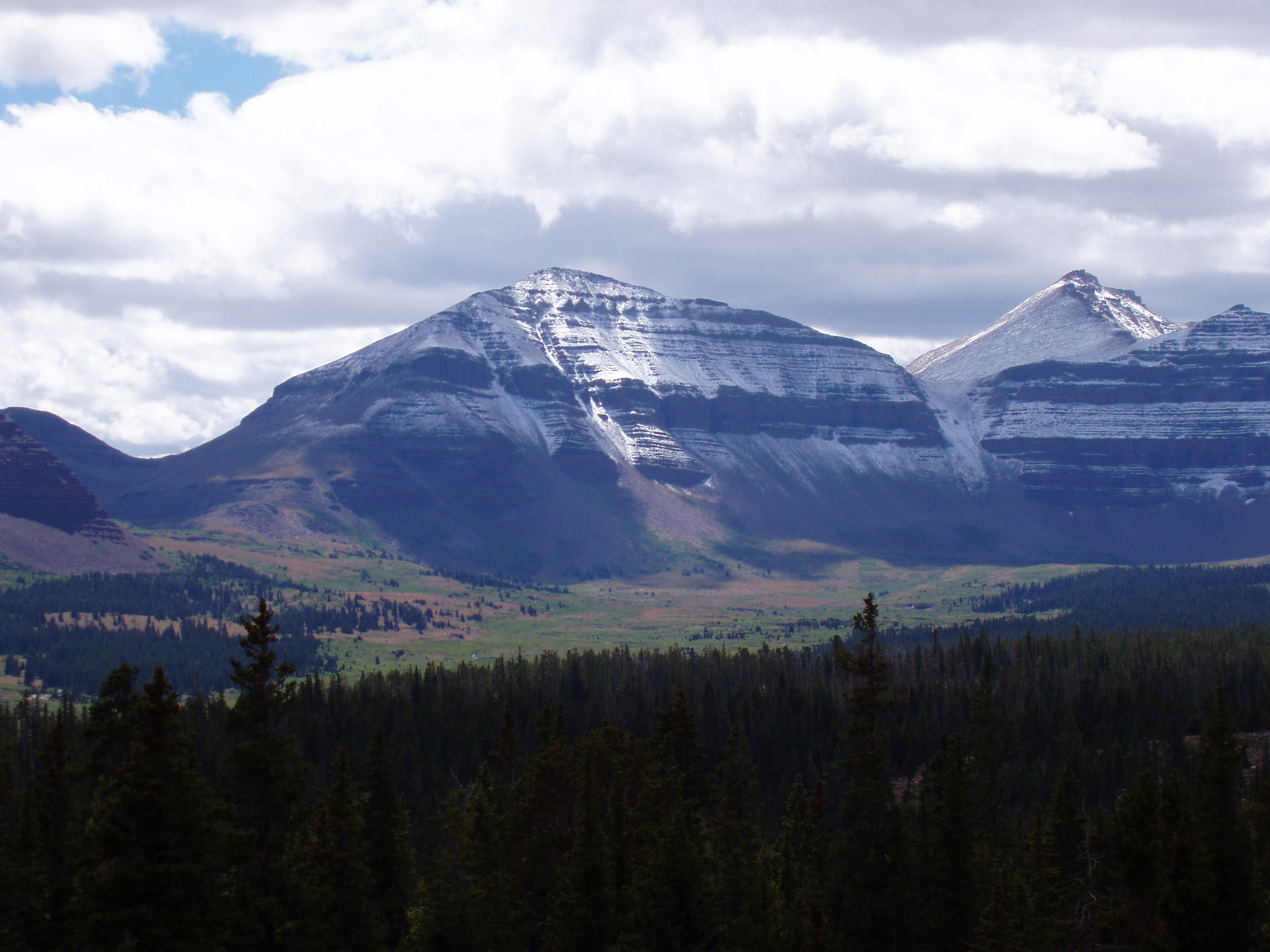
Kelsey Peak is a mountain summit located on the common boundary that Tooele County shares with Utah County in Utah, United States. Description Kelsey Peak is located southwest of downtown Salt Lake City and southeast of Tooele in the Oquirrh Mountains which are part of the Great Basin Ranges. It ranks as the fourth-highest summit in the Oquirrh Mountains, and eighth-highest in Tooele County. Precipitation runoff from the mountain's west slope drains to Settlement Canyon Reservoir near Tooele via Right Hand Fork Kelsey Canyon and Settlement Canyon, whereas the east slope drains to Utah Lake via West Canyon Wash. Topographic relief is significant as the summit rises above West Canyon in 1.6 mile (2.6 km). This mountain's toponym was officially adopted in 1976 by the United States Board on Geographic Names to honor Eli B. Kelsey (1819–1885), Tooele County legislator, prosecuting attorney, real estate dealer, mining owner and developer. [...More Info...] [...Related Items...] OR: [Wikipedia] [Google] [Baidu] |
Lowe Peak (Utah)
Lowe Peak is a mountain summit located on the common boundary that Tooele County, Utah, Tooele County shares with Utah County, Utah, Utah County in Utah, United States. Description Lowe Peak is located southwest of downtown Salt Lake City and west of Lehi, Utah, Lehi in the Oquirrh Mountains which are part of the Basin and Range Province, Great Basin Ranges. It ranks as the second-highest summit in the Oquirrh Mountains, and sixth-highest in Tooele County. Precipitation runoff from the mountain's west slope drains to Rush Valley via Ophir Creek, whereas the east slope drains to Utah Lake via West Canyon Wash. Topographic relief is significant as the summit rises above Left Fork West Canyon in two miles (3.2 km). In 1988, two people perished when their small plane crashed at 9,700 feet on the west face of the peak. [...More Info...] [...Related Items...] OR: [Wikipedia] [Google] [Baidu] |
Utah Lake
Utah Lake is a shallow freshwater lake in the center of Utah County, Utah, United States. It lies in Utah Valley, surrounded by the Provo- Orem metropolitan area. The lake's only river outlet, the Jordan River, is a tributary of the Great Salt Lake. Evaporation accounts for 42% of the lake's outflow, which leaves the lake slightly saline. The elevation of the lake is at above sea level. If the lake's water level rises above that, the pumps and gates on the Jordan River are left open. The first European to see Utah Lake was Father Silvestre Vélez de Escalante in 1776. He stayed with the Timpanogots band of Ute Tribe for three days. Mormon settlers later settled near the lake beginning in 1849, with the Timpanogots becoming mostly displaced from the area by 1872. The native fish species of the lake were overharvested by the settlers and subsequently restocked with non-native species. Although thirteen species of fish were native to the lake, only the Utah sucker and ... [...More Info...] [...Related Items...] OR: [Wikipedia] [Google] [Baidu] |
Mountains Of Utah County, Utah
A mountain is an elevated portion of the Earth's crust, generally with steep sides that show significant exposed bedrock. Although definitions vary, a mountain may differ from a plateau in having a limited summit area, and is usually higher than a hill, typically rising at least above the surrounding land. A few mountains are isolated summits, but most occur in mountain ranges. Mountains are formed through tectonic forces, erosion, or volcanism, which act on time scales of up to tens of millions of years. Once mountain building ceases, mountains are slowly leveled through the action of weathering, through slumping and other forms of mass wasting, as well as through erosion by rivers and glaciers. High elevations on mountains produce colder climates than at sea level at similar latitude. These colder climates strongly affect the ecosystems of mountains: different elevations have different plants and animals. Because of the less hospitable terrain and climate, mountains t ... [...More Info...] [...Related Items...] OR: [Wikipedia] [Google] [Baidu] |
Three-thousanders Of The United States
Three-thousanders are mountains with a height of between , but less than above sea level. Similar terms are commonly used for mountains of other height brackets e. g. four-thousanders or eight-thousanders. In Britain, the term refers to mountains above . Climatological significance In temperate latitudes three-thousanders play an important role, because even in summer they lie below the zero degree line for weeks. Thus the chains of three-thousanders always form important climatic divides and support glaciation - in the Alps the contour is roughly the general limit of the "nival step"; only a few glaciated mountains are under (the Dachstein, the easternmost glaciated mountain in the Alps, is, at , not a three-thousander). In the Mediterranean, however, the three-thousanders remain free of ice and, in the tropics, they are almost insignificant from a climatic perspective; here the snow line lies at around to , and in the dry continental areas (Trans-Himalayas, Andes) it m ... [...More Info...] [...Related Items...] OR: [Wikipedia] [Google] [Baidu] |
Mountains Of Utah
A mountain is an elevated portion of the Earth's crust, generally with steep sides that show significant exposed bedrock. Although definitions vary, a mountain may differ from a plateau in having a limited summit area, and is usually higher than a hill, typically rising at least above the surrounding land. A few mountains are inselberg, isolated summits, but most occur in mountain ranges. mountain formation, Mountains are formed through tectonic plate, tectonic forces, erosion, or volcanism, which act on time scales of up to tens of millions of years. Once mountain building ceases, mountains are slowly leveled through the action of weathering, through Slump (geology), slumping and other forms of mass wasting, as well as through erosion by rivers and glaciers. High elevations on mountains produce Alpine climate, colder climates than at sea level at similar latitude. These colder climates strongly affect the Montane ecosystems, ecosystems of mountains: different elevations hav ... [...More Info...] [...Related Items...] OR: [Wikipedia] [Google] [Baidu] |
Great Basin
The Great Basin () is the largest area of contiguous endorheic watersheds, those with no outlets to the ocean, in North America. It spans nearly all of Nevada, much of Utah, and portions of California, Idaho, Oregon, Wyoming, and Baja California. It is noted for both its arid climate and the basin and range topography that varies from the North American low point at Badwater Basin in Death Valley to the highest point of the contiguous United States, less than away at the summit of Mount Whitney. The region spans several physiographic divisions, biomes, ecoregions, and deserts. Definition The term "Great Basin" is applied to hydrographic, biological, floristic, physiographic, topographic, and ethnographic geographic areas. The name was originally coined by John C. Frémont, who, based on information gleaned from Joseph R. Walker as well as his own travels, recognized the hydrographic nature of the landform as "having no connection to the ocean". The hydrographic defi ... [...More Info...] [...Related Items...] OR: [Wikipedia] [Google] [Baidu] |
List Of Mountains In Utah
Mountains in Utah are numerous and have varying elevations and prominences. Kings Peak (Utah), Kings Peak, in the Uinta Mountains in Duchesne County, Utah, is the highest point in the state and has the greatest prominence. It has elevation and prominence . It also has topographic isolation of , highest amongst summits of Utah having at least 500 meters of prominence. For lists of the top 50 peaks in Utah by elevation, prominence, and topographic isolation, see List of mountain peaks of Utah. This "List of mountains in Utah" should include all of those (but does not yet) and more. To see locations of all mountains having coordinates in this article (primarily from just three counties in the state, so far) together in one map, click on "Map all coordinates using OpenStreetMap, OSM" at the right side of this page. Partial lists of mountains in just a few of List of counties in Utah, Utah's 29 counties are below. Salt Lake County Mountains in Salt Lake County, Utah ... [...More Info...] [...Related Items...] OR: [Wikipedia] [Google] [Baidu] |
Diurnal Temperature Variation
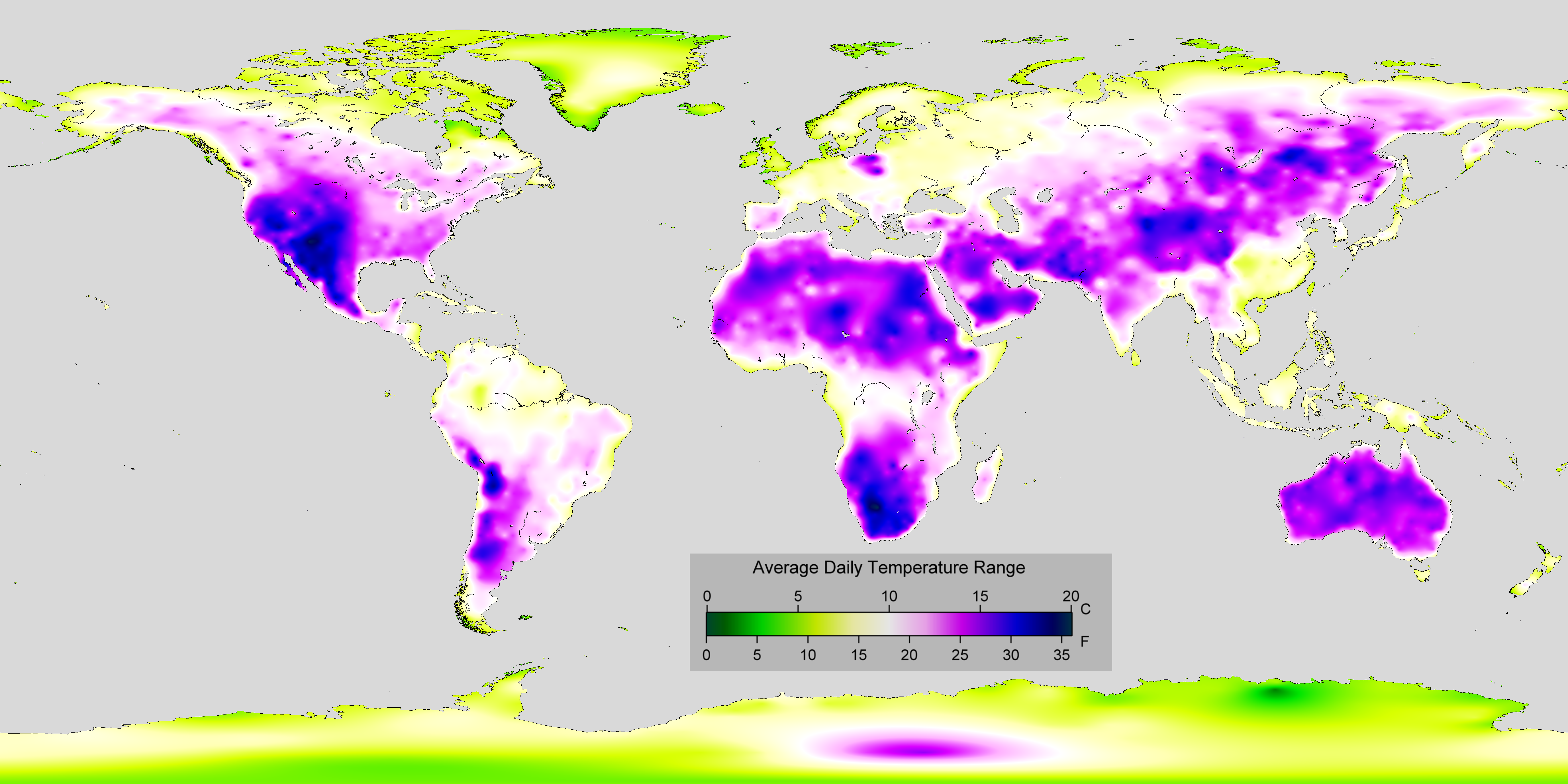
In meteorology, diurnal temperature variation is the variation between a high air temperature and a low temperature that occurs during the same day. Temperature lag Temperature lag, also known as thermal inertia, is an important factor in diurnal temperature variation. Peak daily temperature generally occurs ''after'' noon, as air keeps absorbing net heat for a period of time from morning through noon and some time thereafter. Similarly, minimum daily temperature generally occurs substantially after midnight, indeed occurring during early morning in the hour around dawn, since heat is lost all night long. The analogous annual phenomenon is seasonal lag. As solar energy strikes the Earth's surface each morning, a shallow layer of air directly above the ground is heated by conduction. Heat exchange between this shallow layer of warm air and the cooler air above is very inefficient. On a warm summer's day, for example, air temperatures may vary by from just above the ground t ... [...More Info...] [...Related Items...] OR: [Wikipedia] [Google] [Baidu] |
Desert Climate
The desert climate or arid climate (in the Köppen climate classification ''BWh'' and ''BWk'') is a dry climate sub-type in which there is a severe excess of evaporation over precipitation. The typically bald, rocky, or sandy surfaces in desert climates are dry and hold little moisture, quickly evaporating the already little rainfall they receive. Covering 14.2% of Earth's land area, hot deserts are the second-most common type of climate on Earth after the Polar climate. There are two variations of a desert climate according to the Köppen climate classification: a hot desert climate (''BWh''), and a cold desert climate (''BWk''). To delineate "hot desert climates" from "cold desert climates", a mean annual temperature of is used as an isotherm so that a location with a ''BW'' type climate with the appropriate temperature above this isotherm is classified as "hot arid subtype" (''BWh''), and a location with the appropriate temperature below the isotherm is classified as "cold a ... [...More Info...] [...Related Items...] OR: [Wikipedia] [Google] [Baidu] |
Great Basin Desert
The Great Basin Desert is part of the Great Basin between the Sierra Nevada and the Wasatch Range in the western United States. The desert is a geographical region that largely overlaps the Great Basin shrub steppe defined by the World Wildlife Fund, and the Central Basin and Range ecoregion defined by the U.S. Environmental Protection Agency and United States Geological Survey. It is a temperate desert with hot, dry summers and snowy winters. The desert spans large portions of Nevada and Utah, and extends into eastern California. The desert is one of the four biologically defined deserts in North America, in addition to the Mojave Desert, Mojave, Sonoran Desert, Sonoran, and Chihuahuan Deserts. Basin and range topography characterizes the desert: wide valleys bordered by parallel mountain ranges generally oriented north–south. There are more than 33 peaks within the desert with summits higher than , but valleys in the region are also high, most with elevations above . The biol ... [...More Info...] [...Related Items...] OR: [Wikipedia] [Google] [Baidu] |
United States Board On Geographic Names
The United States Board on Geographic Names (BGN) is a Federal government of the United States, federal body operating under the United States Secretary of the Interior. The purpose of the board is to establish and maintain uniform usage of geography, geographic names throughout the federal government of the United States. History Following the American Civil War, more and more American pioneer, American settlers began moving westward, prompting the Federal government of the United States, U.S. federal government to pursue some sort of consistency for referencing landmarks on maps and in official documents. As such, on January 8, 1890, Thomas Corwin Mendenhall, superintendent of the United States Coast and Geodetic Survey Office, wrote to 10 noted geographers "to suggest the organization of a Board made up of representatives from the different Government services interested, to which may be referred any disputed question of geographical orthography." President Benjamin Harrison si ... [...More Info...] [...Related Items...] OR: [Wikipedia] [Google] [Baidu] |
Topographic Relief
Terrain (), alternatively relief or topographical relief, is the dimension and shape of a given surface of land. In physical geography, terrain is the lay of the land. This is usually expressed in terms of the elevation, slope, and orientation of terrain features. Terrain affects surface water flow and distribution. Over a large area, it can affect weather and climate patterns. Bathymetry is the study of underwater relief, while hypsometry studies terrain relative to sea level. Importance The understanding of terrain is critical for many reasons: * The terrain of a region largely determines its suitability for human settlement: flatter alluvial plains tend to have better farming soils than steeper, rockier uplands. * In terms of environmental quality, agriculture, hydrology and other interdisciplinary sciences; understanding the terrain of an area assists the understanding of watershed boundaries, drainage characteristics, drainage systems, groundwater systems, water ... [...More Info...] [...Related Items...] OR: [Wikipedia] [Google] [Baidu] |


