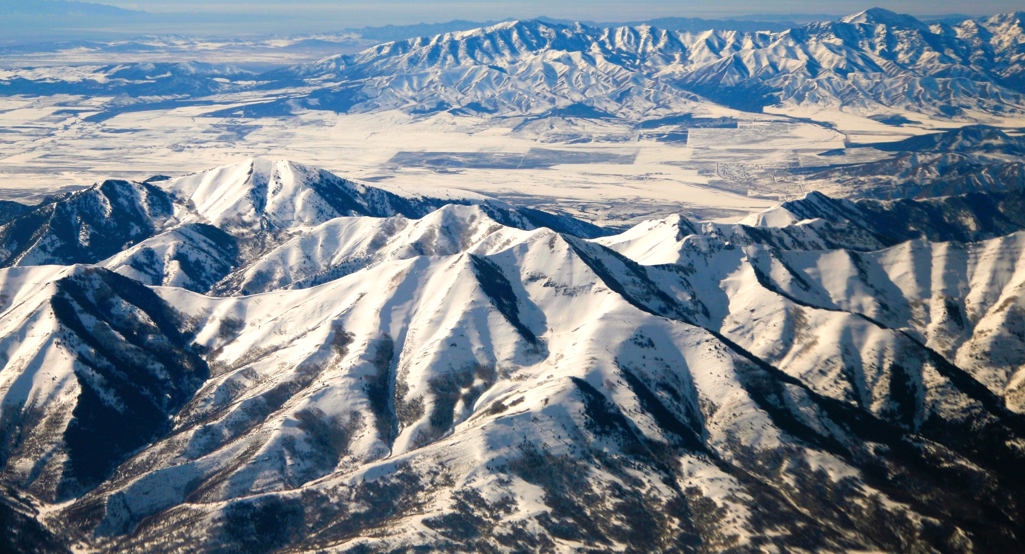
Lowe Peak (Utah) on:
[Wikipedia]
[Google]
[Amazon]
Lowe Peak is a mountain
''2 Die in Oquirrh Mountain Plane Crash''
Deseret News, November 16, 1988. This mountain's toponym has been officially adopted by the

weather
National Geodetic Survey Data Sheet
{{Portal bar, Geography, Geology, Mountains Mountains of Utah Three-thousanders of the United States Mountains of Utah County, Utah Mountains of Tooele County, Utah Mountains of the Great Basin
summit
A summit is a point on a surface that is higher in elevation than all points immediately adjacent to it. The topographic terms acme, apex, peak (mountain peak), and zenith are synonymous.
The term (mountain top) is generally used only for ...
located on the common boundary that Tooele County
Tooele County ( ) is a county in the U.S. state of Utah. As of the 2020 United States census, the population was 72,698. Its county seat and largest city is Tooele. The county was created in 1850 and organized the following year. Tooele Coun ...
shares with Utah County
Utah County is the second-most populous county in the U.S. state of Utah. The county seat and largest city is Provo, which is the state's fourth-largest city, and the largest outside of Salt Lake County. As of the 2020 United States census ...
in Utah
Utah is a landlocked state in the Mountain states, Mountain West subregion of the Western United States. It is one of the Four Corners states, sharing a border with Arizona, Colorado, and New Mexico. It also borders Wyoming to the northea ...
, United States.
Description
Lowe Peak is located southwest of downtownSalt Lake City
Salt Lake City, often shortened to Salt Lake or SLC, is the capital and most populous city of the U.S. state of Utah. It is the county seat of Salt Lake County, the most populous county in the state. The city is the core of the Salt Lake Ci ...
and west of Lehi in the Oquirrh Mountains
The Oquirrh Mountains ( ) is a mountain range that runs north–south for approximately 30 miles (50 km) to form the west side of Utah's Salt Lake Valley, separating it from Tooele Valley. The range runs from northwestern Utah County– ...
which are part of the Great Basin Ranges. It ranks as the second-highest summit in the Oquirrh Mountains, and sixth-highest in Tooele County. Precipitation runoff from the mountain's west slope drains to Rush Valley
Rush Valley is a long north-trending valley in the southeast of Tooele County, Utah. It lies adjacent to and attached to the south of Tooele Valley; the separation point is the low point of the valley at Rush Lake, and lies at the southeast ...
via Ophir Creek, whereas the east slope drains to Utah Lake
Utah Lake is a shallow freshwater lake in the center of Utah County, Utah, United States. It lies in Utah Valley, surrounded by the Provo- Orem metropolitan area. The lake's only river outlet, the Jordan River, is a tributary of the Great Sa ...
via West Canyon Wash. Topographic relief
Terrain (), alternatively relief or topographical relief, is the dimension and shape of a given surface of land. In physical geography, terrain is the lay of the land. This is usually expressed in terms of the elevation, slope, and orientati ...
is significant as the summit rises above Left Fork West Canyon in two miles (3.2 km). In 1988, two people perished when their small plane crashed at 9,700 feet on the west face of the peak.Deseret News, November 16, 1988.
United States Board on Geographic Names
The United States Board on Geographic Names (BGN) is a Federal government of the United States, federal body operating under the United States Secretary of the Interior. The purpose of the board is to establish and maintain uniform usage of geogr ...
.
Climate
Lowe Peak is set within theGreat Basin Desert
The Great Basin Desert is part of the Great Basin between the Sierra Nevada and the Wasatch Range in the western United States. The desert is a geographical region that largely overlaps the Great Basin shrub steppe defined by the World Wildlife ...
which has hot summers and cold winters. The desert is an example of a cold desert climate
The desert climate or arid climate (in the Köppen climate classification ''BWh'' and ''BWk'') is a dry climate sub-type in which there is a severe excess of evaporation over precipitation. The typically bald, rocky, or sandy surfaces in desert ...
as the desert's elevation makes temperatures cooler than lower elevation deserts. Due to the high elevation and aridity, temperatures drop sharply after sunset. Summer nights are comfortably cool. Winter highs are generally above freezing, and winter nights are bitterly cold, with temperatures often dropping well below freezing.
See also
*List of mountains in Utah
Mountains in Utah are numerous and have varying elevations and prominences.
Kings Peak (Utah), Kings Peak, in the Uinta Mountains in Duchesne County, Utah, is the highest point in the state and has the greatest prominence. It has elevation an ...
* Great Basin
The Great Basin () is the largest area of contiguous endorheic watersheds, those with no outlets to the ocean, in North America. It spans nearly all of Nevada, much of Utah, and portions of California, Idaho, Oregon, Wyoming, and Baja Californi ...

References
External links
* Lowe Peakweather
National Geodetic Survey Data Sheet
{{Portal bar, Geography, Geology, Mountains Mountains of Utah Three-thousanders of the United States Mountains of Utah County, Utah Mountains of Tooele County, Utah Mountains of the Great Basin