|
Karimabad (Hunza)
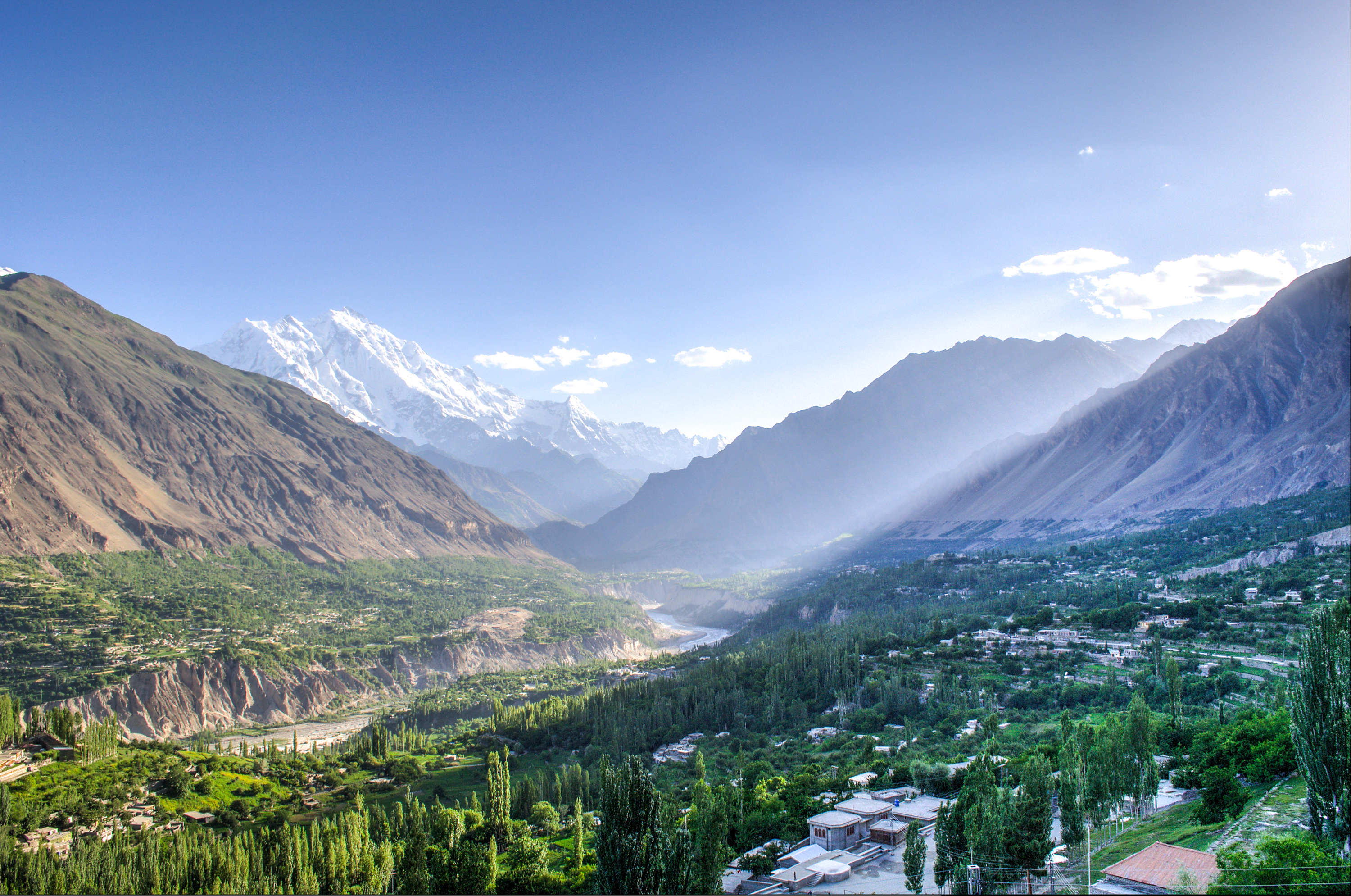
Karimabad (), formerly known as Baltit, is the capital of the Hunza District in Pakistan-administered Gilgit-Baltistan in the disputed Kashmir region. Etymology Karimabad was named in honour of Karim Aga Khan, the late spiritual leader of the Shia Ismaili Nizari community. Geography Karimabad town is situated on the western bank of the Hunza River, opposite Nagar Valley nestled in the lower Hunza Valley. It lies at an elevation of 8,200 feet (2,500 meters) above sea level. The town is characterized by its construction on stone-walled and steep-sloping terraces. Historically, Karimabad served as a caravan stop for travelers journeying through the Hindu Kush mountains en route to the Vale of Kashmir. The town is framed by deep gorges and is set against the backdrop of snow-clad mountain peaks like Rakaposhi, which stands at an altitude of approximately 25,000 feet (7,600 meters), Diran, Golden Peak and Ultar Peak. All four peaks have dedicated view points in and around ... [...More Info...] [...Related Items...] OR: [Wikipedia] [Google] [Baidu] |
Town
A town is a type of a human settlement, generally larger than a village but smaller than a city. The criteria for distinguishing a town vary globally, often depending on factors such as population size, economic character, administrative status, or historical significance. In some regions, towns are formally defined by legal charters or government designations, while in others, the term is used informally. Towns typically feature centralized services, infrastructure, and governance, such as municipal authorities, and serve as hubs for commerce, education, and cultural activities within their regions. The concept of a town varies culturally and legally. For example, in the United Kingdom, a town may historically derive its status from a market town designation or City status in the United Kingdom, royal charter, while in the United States, the term is often loosely applied to incorporated municipality, municipalities. In some countries, such as Australia and Canada, distinction ... [...More Info...] [...Related Items...] OR: [Wikipedia] [Google] [Baidu] |
Shia
Shia Islam is the second-largest branch of Islam. It holds that Muhammad designated Ali ibn Abi Talib () as both his political successor (caliph) and as the spiritual leader of the Muslim community (imam). However, his right is understood to have been usurped by a number of Muhammad's companions at the meeting of Saqifa where they appointed Abu Bakr () as caliph instead. As such, Sunni Muslims believe Abu Bakr, Umar (), Uthman () and Ali to be ' rightly-guided caliphs' whereas Shia Muslims only regard Ali as the legitimate successor. Shia Muslims assert imamate continued through Ali's sons Hasan and Husayn, after whom different Shia branches have their own imams. They revere the , the family of Muhammad, maintaining that they possess divine knowledge. Shia holy sites include the shrine of Ali in Najaf, the shrine of Husayn in Karbala and other mausoleums of the . Later events such as Husayn's martyrdom in the Battle of Karbala (680 CE) further influenced the ... [...More Info...] [...Related Items...] OR: [Wikipedia] [Google] [Baidu] |
Ganish
Ganish (, , also Ganesh or Ganish Khun) is a village in the Hunza District within the Gilgit Baltistan region of Pakistan. Ganish also collectively refers to multiple villages in and around the area. It is the oldest and first settlement on the ancient Silk Road in the Hunza Valley, and is the site of various ancient watchtowers, traditional mosques, religious centers, and a reservoir. The settlement is at least a 1,000 years old and was awarded the UNESCO Asia-Pacific Heritage Award for Culture Heritage Conservation in 2003. Etymology The word "Ganish" is unknown but according to the local scholars, it is derived from the Burushaski word "گنش", (Ganish) which means gold. Ganish has been a major town for travelers since the days of the Silk Road - now the Karakorum Highway. Location Ganish is a historic settlement at the banks of the Hunza river dating back to around a 1,000 years. Ganish was a stop on the ancient Silk Route and its strategic location has allowed the settle ... [...More Info...] [...Related Items...] OR: [Wikipedia] [Google] [Baidu] |
Altit Fort
Altit Fort () is an ancient fort in the Altit town in the Hunza valley in Gilgit Baltistan, Pakistan. It was originally home to the hereditary rulers of the Hunza state who carried the title of 'Mir', although they moved to the somewhat younger Baltit fort nearby three centuries later. Altit Fort and in particular the Shikari tower is around 1100 years old, which makes it the oldest monument in the Gilgit–Baltistan. The fort has received the UNESCO Asia Pacific Heritage Award for Cultural Heritage Conservation in 2011. History The word 'Altit' means this side down''' and the area around the fort is inhabited by Burusho people. In the 16th century the local prince married a princess from Baltistan who brought master Balti craftsmen to build two forts (Altit and Baltit forts). The local language, Burushaski, is a language isolate which has no demonstrated link to any other known language. There are several theories about their origin but local indigenous origin holds much value ... [...More Info...] [...Related Items...] OR: [Wikipedia] [Google] [Baidu] |
Aliabad, Hunza
Aliabad (Burushaski/) is the administrative and commercial center of the Hunza District in Gilgit–Baltistan region of Pakistan. Location The town is located in a relatively wide section of the Hunza Valley, in the northeastern corner of the Karakoram range, between two forks of the Hunza River. In May 2010 government officials warned that the nearby Attabad lake was close to flooding the area. Like most localities in Hunza–Nagar, Aliabad lies along the Karakoram Highway, which crosses this mountainous district. The town serves as a key transit hub connecting several regions, including Nagar and Gojal. It is also a major transportation center, with multiple bus companies operating routes between Hunza and major cities across the country, notably Gilgit, Rawalpindi, and Karachi. Climate With virtually no rainfall during the year, Aliabad features a cold desert climate (''BWk'') under the Köppen climate classification. The average temperature in Aliabad is 11.0 °C, wh ... [...More Info...] [...Related Items...] OR: [Wikipedia] [Google] [Baidu] |
Ultar Peak
Ultar (also Ultar Sar , Ultar II, Bojohagur Duanasir II) is the southeasternmost major peak of the Batura Muztagh, a subrange of the Karakoram range. It lies about northeast of the Karimabad, a town on the Karakoram Highway in the Hunza Valley, part of the Hunza District of Gilgit–Baltistan, Pakistan. __NOTOC__ Notable features and climbing history While not one of the highest peaks of the Karakoram, Ultar Sar is notable for its dramatic rise above local terrain. Its south flank rises over 5,300 metres (17,388 feet) above the Hunza River near Karimabad, in only about of horizontal distance. Combined with its strategic position at the end of the Batura Muztagh, with the Hunza River bending around it, this makes Ultar a visually striking peak. Ultar Sar also gained fame in the 1990s as supposedly the world's highest unclimbed independent peak. This was incorrect, as Gangkhar Puensum in Bhutan is higher, and remains unclimbed (and off-limits) as of 2007 (two other higher ... [...More Info...] [...Related Items...] OR: [Wikipedia] [Google] [Baidu] |
Golden Peak
Spantik, also known as Golden Peak, is a mountain situated in the Spantik-Sosbun Mountains, Spantik-Sosbun subrange within the Karakoram range. It is located in the Shigar District, within the Gilgit-Baltistan region administered by Pakistan. The northwest face of Spantik is dominated by a pronounced pillar of creamy yellow marble which reaches up its north face to 300 m below the summit. Its distinctive appearance has given the peak its Buruskaski name, "Ganesh Chish" or Golden Peak. This outcropping is renowned for its exceptionally challenging climbing route, famously referred to as the "Golden Pillar."Andy Fanshawe and Stephen Venables, ''Himalaya Alpine-Style'', Hodder and Stoughton, 1995, . Spantik is positioned to the east of Diran and northeast of Malubiting.Jerzy Wala, ''Orographical Sketch Map of the Karakoram'', Swiss Foundation for Alpine Research, Zurich, 1990. There are various routes leading to the mountain, including paths from the Arandu village in Shigar District ... [...More Info...] [...Related Items...] OR: [Wikipedia] [Google] [Baidu] |
Diran
Diran () is a mountain in the Karakoram range in Bagrot Valley, Gilgit-Baltistan, Pakistan. This , pyramid-shaped mountain lies to the east of Rakaposhi (7,788m). Diran was first climbed in 1968 by three Austrian mountaineers: Rainer Goeschl, Rudolph Pischinger and Hanns Schell. Earlier attempts by a British expedition in 1958, a German expedition in 1959, and an Austrian expedition in 1964 had been unsuccessful, driven back by bad weather, deep snow and avalanches. See also * List of mountains in Pakistan Pakistan is home to 108 peaks above 7,000 metres and 4555 above 6,000 m. There is no count of the peaks above 5,000 and 4,000 m. Five of the 14 highest independent peaks in the world (the eight-thousanders) are in Pakistan (four of which lie in ... * List of mountains by elevation References External links * {{Authority control Seven-thousanders of the Karakoram Mountains of Gilgit-Baltistan ... [...More Info...] [...Related Items...] OR: [Wikipedia] [Google] [Baidu] |
Rakaposhi
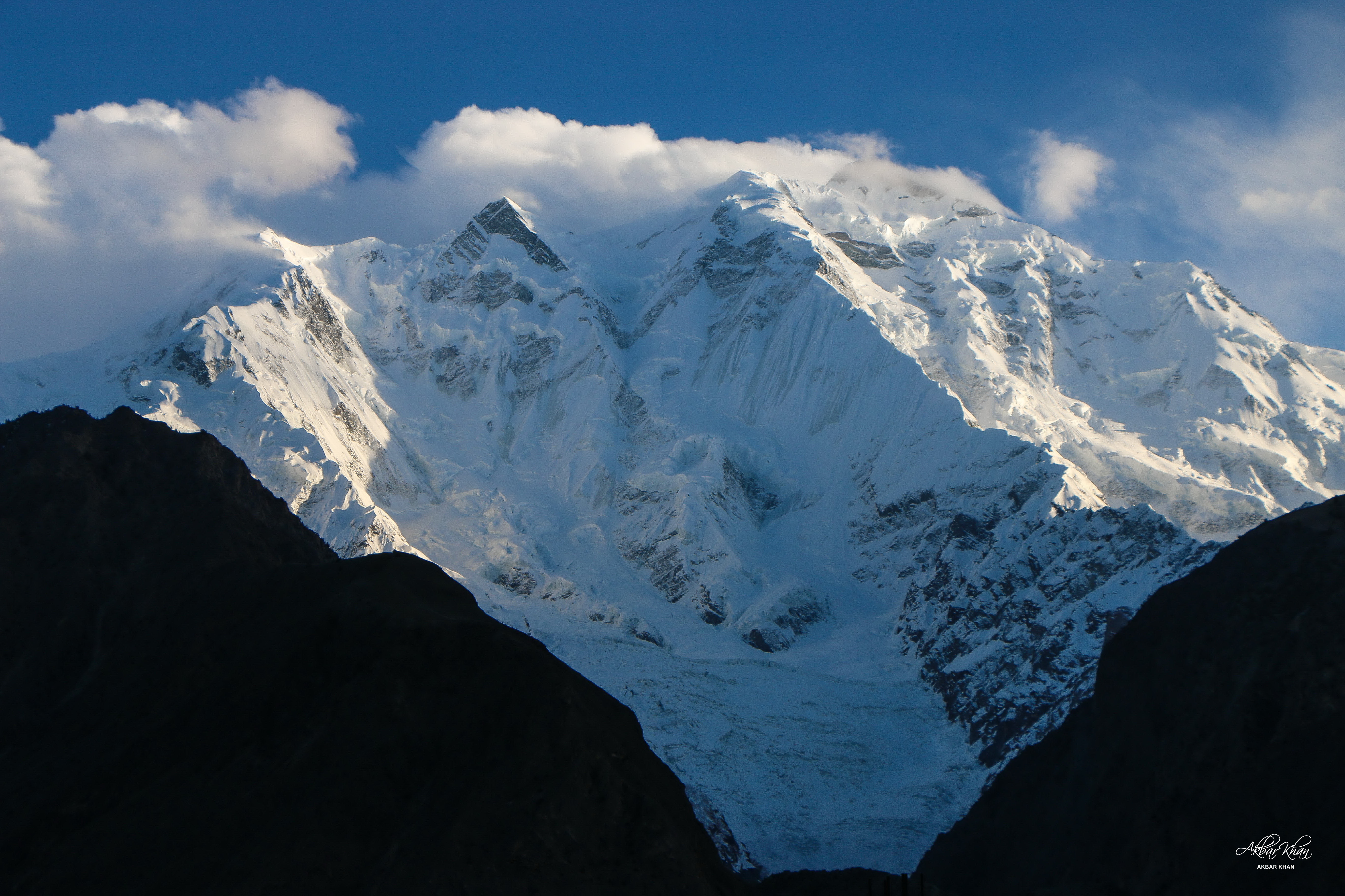
Rakaposhi (; ) also known as Dumani () is a mountain within the Karakoram range in Gilgit-Baltistan in Pakistan. It is situated in the middle of the Nagar and Bagrote valleys. The mountain is extremely broad, measuring almost from east to west. It is the only peak on earth that descends directly and without interruption for almost 6,000 meters from its summit to its base. Geography Rakaposhi is a mountain in the Karakoram mountain range in the Gilgit-Baltistan region of Pakistan, about north of the city of Gilgit. It is the 27th-highest mountain in the world and ranked 122nd by prominence. Rakaposhi rises over the Nagar Valley. The first successful recorded ascent was in 1958 by Mike Banks and Tom Patey, members of a British expedition, via the southwest Spur/Ridge route. It was over 20 years before another team succeeded in reaching the summit, in 1979. Park Rakaposhi is also known as Dumani ("Mother of Mist" or "Mother of Clouds"). The people of Nagar and Bagrot Val ... [...More Info...] [...Related Items...] OR: [Wikipedia] [Google] [Baidu] |
Nagar Valley
Nagar Valley once a princely state, now stands as one of the ten districts within the Gilgit-Baltistan region of Pakistan. This valley is situated along the renowned Karakoram Highway, as one travels northward from the city of Gilgit. The valley is home to many high mountain peaks including Rakaposhi (7788m), Diran Peak (7265m), Golden Peak and Rush Peak. The Nagar valley is administratively divided into two tehsils: Nagar-I and Nagar-II. All the villages of upper Nagar including Shayar, Askurdas, Sumayar, Nagarkhas, Hoper Valley, and Hispar come under Nagar-I, which collectively form Sas Valley. The villages of lower Nagar including Chalt Paeen, Chalt Bala, Sonikot, Akbarabad, Rabat, Bar, Buddalas, Chaprote, Sikandarabad, Jafarabad, Nilt, Thol, Ghulmet, Pisan, Minapin, Miachar, Dadhimal, Phakker, and Hakuchar are part of Nagar-II. Both tehsils are also commonly referred to by their size. Nagar-I is called as 'Chota Nagar' (چھوٹا نگر) in Urdu, meaning Smal ... [...More Info...] [...Related Items...] OR: [Wikipedia] [Google] [Baidu] |
Hunza River
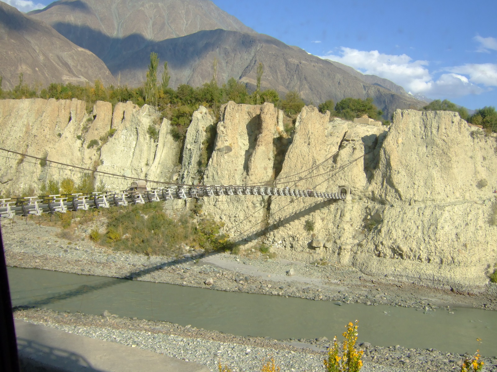
Hunza River () is the principal river within the Hunza region in Gilgit–Baltistan, Pakistan. It is formed by the confluence of the Chapursan and Khunjerab ''nalas'' (gorges) which are fed by glaciers. It is also joined by the Gilgit River and the Naltar River, before it flows into the Indus River. The river cuts through the Karakoram range, flowing from north to south. The Karakoram Highway (N-35) runs along the Hunza River valley, switching to the Khunjerab River valley at the point of confluence, eventually reaching the Khunjerab Pass at the border with China at Xinjiang Xinjiang,; , SASM/GNC romanization, SASM/GNC: Chinese postal romanization, previously romanized as Sinkiang, officially the Xinjiang Uygur Autonomous Region (XUAR), is an Autonomous regions of China, autonomous region of the China, People' .... The river is dammed for part of its route. The Attabad landslide disaster in January 2010 completely blocked the Hunza Valley. The blocked Hunza Riv ... [...More Info...] [...Related Items...] OR: [Wikipedia] [Google] [Baidu] |
Attabad Lake, Hunza Pakistan
Attabad (), also spelled Atabad, is a town in Gilgit-Baltistan, Pakistan. It lies at 36°19'0"N 74°48'0"E, at an altitude of and is best known as the location of the Attabad Lake, which formed in January 2010 following a major landslide. See also * Attabad Lake Attabad Lake () also known as Hunza Lake, is a lake located in the Gojal region of Gilgit-Baltistan, a region within the disputed territory of Jammu and Kashmir administered by Pakistan. It was formed in January 2010 when a significant landslide ... References Populated places in Hunza District {{NorthernAreas-geo-stub ... [...More Info...] [...Related Items...] OR: [Wikipedia] [Google] [Baidu] |


