|
Karakol
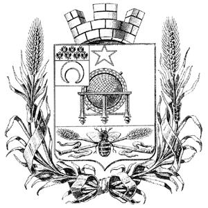
Karakol (; , ), formerly Przhevalsk ( rus, Пржевальск, p=pr̩ʐɨˈvalʲsk), is the fourth-largest city in Kyrgyzstan, near the eastern tip of Lake Issyk-Kul, about from the Kyrgyzstan–China border and from the capital Bishkek. It is the administrative capital of Issyk-Kul Region. Its area is , and its resident population was 84,351 in 2021 (both including Pristan'-Przheval'sk). To the north, on highway A363, is Tüp, and to the southwest Jeti-Ögüz resort. History A Russian military outpost founded on 1 July 1869, Karakol grew in the 19th century after explorers came to map the peaks and valleys separating Kyrgyzstan from China. In the 1880s Karakol's population surged with an influx of Dungans, Chinese Muslims fleeing warfare in China. In 1888, the Russian explorer Nikolay Przhevalsky died in Karakol of typhoid, while preparing for an expedition to Tibet. By order of Tsar Alexander III on 23 March 1889 the city was renamed Przhevalsk in the explorer's hon ... [...More Info...] [...Related Items...] OR: [Wikipedia] [Google] [Baidu] |
Holy Trinity Church, Karakol
The Holy Trinity Church (, ) is a Russian Orthodox wooden church building in Karakol in Kyrgyzstan. The building was constructed between 1894 and 1895, replacing an earlier church that was destroyed by an earthquake. The church is located 12 kilometers from the shores of Issyk-Kul. The church is located at an altitude of 1758 meters above sea level. History In the middle of the 19th century, a wave of immigration from Russia and Ukraine brought significant cultural and historical changes to Turkestan. Representatives of the Orthodox clergy, having settled in the area, began to advocate for the establishment of local prayer houses and churches. Wooden churches began to be constructed in Kyrgyzstan due to their increased earthquake resistance. Established in 1869 as a chapel for military personnel in the garrison town of Karakol, the church was originally a small brick building on stone foundations. In 1889, the original church in Karakol was destroyed by an earthquake, and a new ... [...More Info...] [...Related Items...] OR: [Wikipedia] [Google] [Baidu] |
Issyk-Kul Region
Issyk-Kul (, ) is one of the regions of Kyrgyzstan. Its capital is Karakol. It is surrounded by Almaty Region, Kazakhstan to the north, Chüy Region to the west, Naryn Region to the southwest, and Xinjiang, China to the southeast. It takes its name from Lake Issyk-Kul, the world's second-largest high altitude lake. Its total area is . The resident population of the region was 501,933 as of January 2021. The region has a sizeable Russian (8.0% in 2009) minority. Geography The north is dominated by the eye-shaped Issyk-Kul lake, surrounded by the ridges of the Tian Shan mountain system: the Kyungey Ala-Too mountains to the north and the Terskey Alatau to the south (the 'sunny' and 'shady' Alatau, respectively). To the south are mountains and 'jailoos' (mountain meadows used for summer grazing). The highest peaks of the Tian Shan mountains, including Khan Tengri, are located in the easternmost part of the region. Most of the population of the region lives around the lak ... [...More Info...] [...Related Items...] OR: [Wikipedia] [Google] [Baidu] |
Dungan People
Dungan, , Xiao'erjing: ; , ''Dungane''; , ''Duñgandar'', دۇنغاندار; , ''Düñgender'', دٷڭگەندەر is a term used in territories of the former Soviet Union to refer to a group of Muslim people of Hui origin. Turkic-speaking peoples in Xinjiang also sometimes refer to Hui Muslims as Dungans. In both China and the former Soviet republics where they reside, however, members of this ethnic group call themselves Hui because Dungans are descendants of historical Hui groups that migrated to Central Asia. In the censuses of the countries of the former Soviet Union, the Dungans (enumerated separately from Chinese) are found in Kazakhstan (36,900 according to the 1999 census), Kyrgyzstan (58,409 according to the 2009 census) and Russia (801 according to the 2002 census). [...More Info...] [...Related Items...] OR: [Wikipedia] [Google] [Baidu] |
Kyrgyzstan
Kyrgyzstan, officially the Kyrgyz Republic, is a landlocked country in Central Asia lying in the Tian Shan and Pamir Mountains, Pamir mountain ranges. Bishkek is the Capital city, capital and List of cities in Kyrgyzstan, largest city. Kyrgyzstan is bordered by Kazakhstan to the Kazakhstan–Kyrgyzstan border, north, Uzbekistan to the Kyrgyzstan–Uzbekistan border, west, Tajikistan to the Kyrgyzstan–Tajikistan border, south, and China to the China–Kyrgyzstan border, east and southeast. Ethnic Kyrgyz people, Kyrgyz make up the majority of the country's over 7 million people, followed by significant minorities of Uzbeks and Russians. Kyrgyzstan's history spans a variety of cultures and empires. Although geographically isolated by its highly mountainous terrain, Kyrgyzstan has been at the crossroads of several great civilizations as part of the Silk Road along with other commercial routes. Inhabited by a succession of tribes and clans, Kyrgyzstan has periodically fallen unde ... [...More Info...] [...Related Items...] OR: [Wikipedia] [Google] [Baidu] |
Issyk-Kul
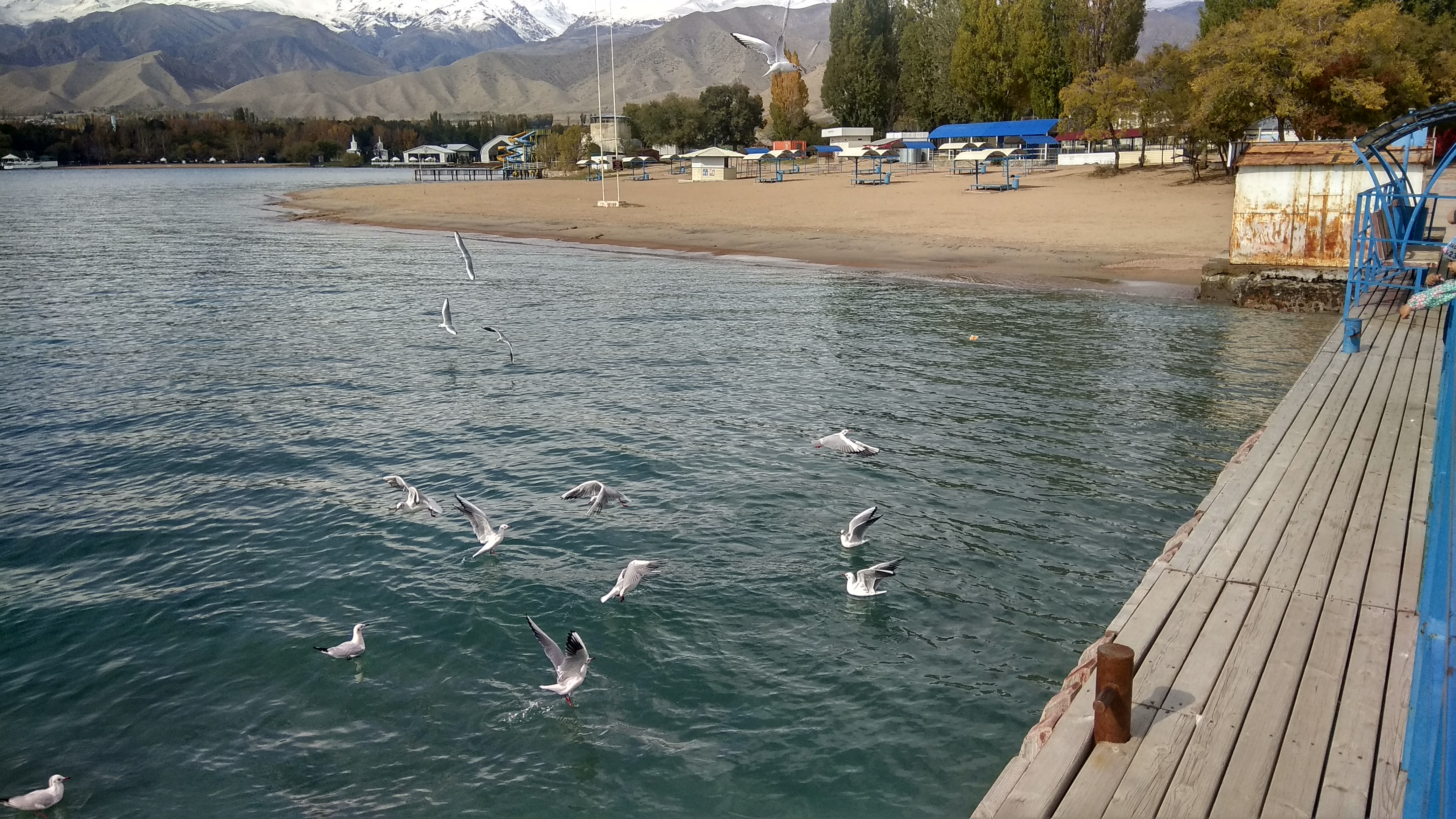
Issyk-Kul () or Ysyk-Köl (, ; ) is an endorheic saline lake in the western Tianshan Mountains in eastern Kyrgyzstan, just south of a dividing range separating Kyrgyzstan from Kazakhstan. It is the eighth-deepest lake in the world, the eleventh-largest lake in the world by volume (though not in surface area), the deepest lake whose deepest point is above sea level (939 meters or 3,080 feet), and the third-largest saline lake. Although it is located at a lofty elevation of and subject to severe cold during winter, it rarely freezes over due to high salinity, hence its name, which in the Kyrgyz language means "warm lake". The lake is a Ramsar site of globally significant biodiversity and forms part of the Issyk-Kul Biosphere Reserve. Geography Issyk-Kul Lake is long, up to wide and its surface area is . It is the second-largest mountain lake in the world behind Lake Titicaca in South America. It is at an altitude of and reaches in depth. About 118 rivers and streams f ... [...More Info...] [...Related Items...] OR: [Wikipedia] [Google] [Baidu] |
Pristan'-Przheval'sk
Pristan'-Przheval'sk is an urban-type settlement in the Issyk-Kul Region of Kyrgyzstan. Administratively, it is part of the city Karakol. The town was named after the Russian geographer, Nikolay Przhevalsky, Nikolai Mikhailovich Przhevalsky, who is buried nearby. It lies 12 km north west of Karakol. Its population was 2,829 in 2021. Kyrgyz people, Kyrgyz and Dungan people, Dungan rebels attacked Przheval'sk during the 1916 Basmachi movement, Basmachi revolt. This was met by repression and in Przheval'sk 70% of the Kyrgyz died along with 90% of their cattle. by Spyros Plakoudas, p 81 |
Nikolay Przhevalsky
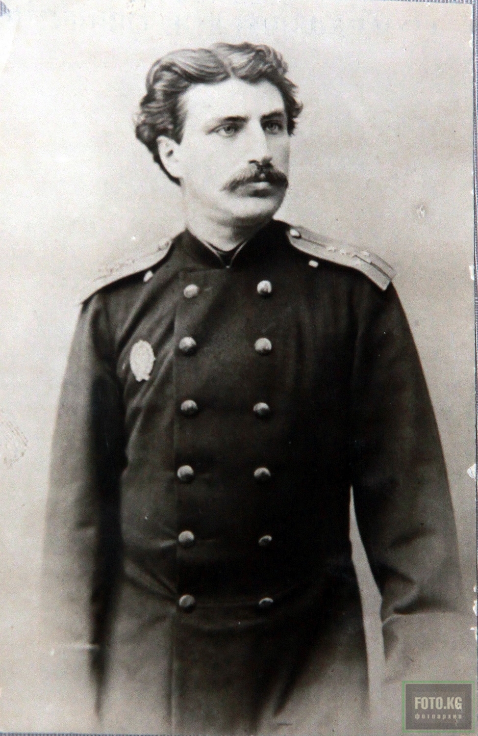
Nikolay Mikhaylovich Przhevalsky (or Prjevalsky;; , . – ) was a Russian geographer and a renowned explorer of Central and East Asia. Although he never reached his ultimate goal, the city of Lhasa in Tibet, he still travelled through regions then unknown to Westerners, such as northern Tibet (modern Tibet Autonomous Region), Amdo (now Qinghai) and Dzungaria (now northern Xinjiang). He contributed substantially to European knowledge of Central Asian geography. Przhevalsky described several species previously unknown to European science, such as Przewalski's horse, Przewalski's gazelle, and the wild Bactrian camel, all of which are now endangered. He was also a mentor of the explorer Pyotr Kozlov. Biography Przhevalsky was born in the Kimborovo family estate (in the Smolensky Uyezd of the Smolensk Governorate of the Russian Empire) which belonged to his grandfather from his mother's side, a Russian nobleman Aleksei Stepanovich Karetnikov, and his wife Ksenia Davydovna Karet ... [...More Info...] [...Related Items...] OR: [Wikipedia] [Google] [Baidu] |
Tian Shan
The Tian Shan, also known as the Tengri Tagh or Tengir-Too, meaning the "Mountains of God/Heaven", is a large system of mountain ranges in Central Asia. The highest peak is Jengish Chokusu at high and located in Kyrgyzstan. Its lowest point is at the Turpan Depression, which is below sea level. The Tian Shan is sacred in Tengrism. Its second-highest peak is known as Khan Tengri, which can be translated as "Lord of the Spirits". At the 2013 Conference on World Heritage, the eastern portion of Tian Shan in western China's Xinjiang Region was listed as a World Heritage Site. The western portion in Kyrgyzstan, Kazakhstan, and Uzbekistan was then listed in 2016. Geography Tian Shan with the ancient Silk Road The Tian Shan range is located north and west of the Taklamakan Desert and directly north of the Tarim Basin. It straddles the border regions of Kazakhstan, Kyrgyzstan, Uzbekistan and Xinjiang in Northwest China. To the south, it connects with the Pamir Mountains ... [...More Info...] [...Related Items...] OR: [Wikipedia] [Google] [Baidu] |
Kalmyks
Kalmyks (), archaically anglicised as Calmucks (), are the only Mongolic ethnic group living in Europe, residing in the easternmost part of the European Plain. This dry steppe area, west of the lower Volga River, known among the nomads as Itil/Idjil, a basin on the northwest shore of the Caspian Sea, was the most suitable land for nomadic pastures. Itil or Idjil, the ancient name of the Volga River, written in the archaic Oirat script, means exactly that: the "pastures". The ancestors of Kalmyks were nomadic groups of Oirat-speaking Mongols, who migrated from Western Mongolia to Eastern Europe three times: in early medieval times, establishing in the 6th–8th centuries the Avar Khanate; in medieval times, establishing the Ulus of Juchi and Il-Kanate as Khuda-in-laws of Genghis Khan; and finally, in early modern times, establishing the Kalmyk Khanate in the 17th century. The Oirat language belongs to the western branch of the Mongolic language family, whose speakers inc ... [...More Info...] [...Related Items...] OR: [Wikipedia] [Google] [Baidu] |
Jeti-Ögüz Resort
Jeti-Ögüz () is a balneotherapic resort located at the Jeti-Ögüz Rocks near Issyk Kul in the Jeti-Ögüz District of Issyk-Kul Region of Kyrgyzstan, about 28 km west of Karakol, and near Jeti-Ögüz village. Its population was 337 in 2021. History The thermal springs of Jeti-Ögüz were known to local inhabitants since antiquity. The place became known to Europe after 1856 when Semenov-Tian-Shanskii first visited it. Since 1965 the resort operates year-round. In 1991, an important meeting between Boris Yeltsin and Askar Akayev took place in Jeti-Ögüz. Places of interest This resort is a common destination of interest for citizens of Kyrgyzstan, as well as a popular destination for tourists to Kyrgyzstan. The Jeti-Ögüz Rocks The Jeti-Ögüz Rocks is a geological protected area (nature monument) located in Jeti-Ögüz District of Issyk-Kul Region of Kyrgyzstan. It was established in 1975 with a purpose of conservation of a unique geological formation – ... [...More Info...] [...Related Items...] OR: [Wikipedia] [Google] [Baidu] |
Tüp
Tüp () or Tyup () is a large village in the Issyk-Kul Region of Kyrgyzstan, and the center of the Tüp District. It was established as village Preobrazhenskoye in 1870. Its population was 12,355 in 2021. Tüp is a road junction town at the northeast corner of Lake Issyk Kul. To the west on A363 is Anan'yevo and to the south Karakol. To the east, A362 leads up the Karkara valley to Kazakhstan. The ''Karkara ('black crane') Valley'' leads east from here about 60 km to Kazakhstan between the Kyungey Ala-Too to the north and the Central Tian Shan to the south. There is an annual horse festival. Halfway up the valley is the village of San-Tash (counting stones). It is said that Tamerlane Timur, also known as Tamerlane (1320s17/18 February 1405), was a Turco-Mongol tradition, Turco-Mongol conqueror who founded the Timurid Empire in and around modern-day Afghanistan, Iran, and Central Asia, becoming the first ruler of the Timuri ... once ordered each of his soldiers to ... [...More Info...] [...Related Items...] OR: [Wikipedia] [Google] [Baidu] |


