|
Kalonga (title)
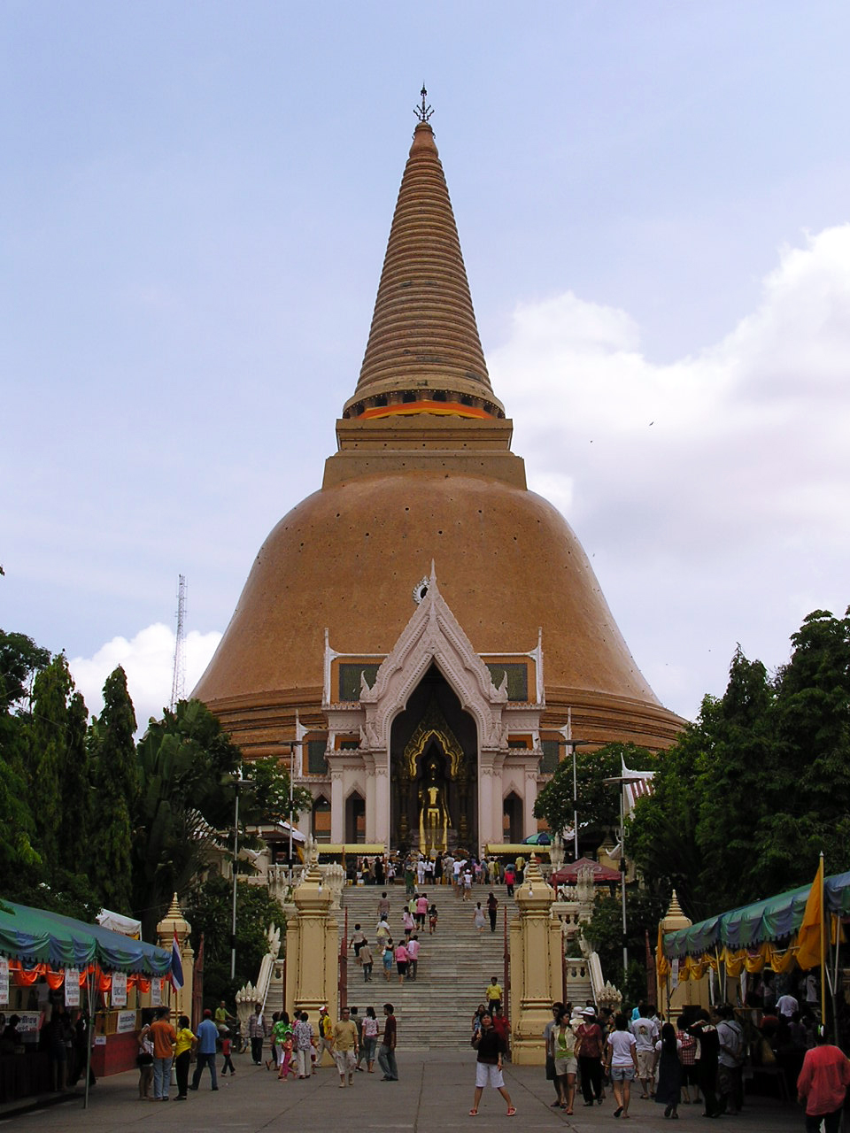
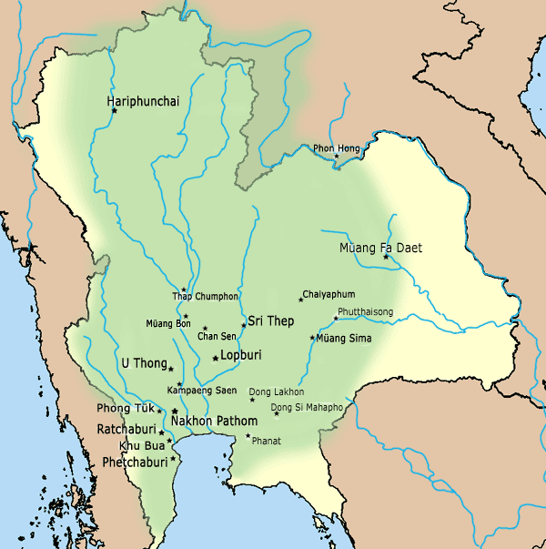
Kamalanka (''Chia-mo-lang-chia'', ''Lang-chia'', ''Lang-ya-hsiu'') or Kolo (''Gē Luó'') in the Chinese texts, or Balangka/Kalonga in the ''Geographike Hyphegesis'' of Ptolemy, or Mevilimbangam in the Tanjore Inscription, was an ancient political entity located in the west Chao Phraya River basin in central Thailand. It existed from the late 1st or early 2nd century CE to 1058. Its chief city, located at the ancient Nakhon Pathom, was possibly destroyed by the troops of Pagan's Anawrahta in 1058 during his Menam invasion to attack the Lavo Kingdom. This marks the ending of Kamalanka. Previously, it was raided by the Chola Empire during the South-East Asia campaign of Rajendra I in 1030. Its successor, Chen Li Fu centered at ''Suvarnapura'', appeared around the 12th century, 90 kilometers northward in the present-day Don Chedi, Suphan Buri province. Chen Li Fu later evolved to Suphannabhum, which was then merged into the Ayutthaya Kingdom in the 14th century. Several Tha ... [...More Info...] [...Related Items...] OR: [Wikipedia] [Google] [Baidu] |
Chen Li Fu
Chên Li Fu (; ) or Suvarnapura was a political entity located on the north shore of the Gulf of Siam, west of Chenla. It centered at the ancient Mueang Uthong. The area encompassed the western Chao Phraya River, Chao Phraya Basin, present-day Phetchaburi province, and Prachuap Khiri Khan province of Thailand, bordering ''Po-Ssu-lan'' to the southeast and Tambralinga to the south. Chên Li Fu sent tribute to the Chinese court in 1200 and 1205. Later, it evolved to Suphannabhum and was then merged into the Ayutthaya Kingdom in the 14th century. Chên Li Fu was supposed to be one of the main polities under the Dvaravati civilization, together with the Lavo Kingdom in the eastern basin. Modern scholars believe Chen Li Fu was Siamese Suphannabhum. Chên Li Fu was a short-lived polity, as mentioned in the Nakhòn Si Thammarat source, which states that King Mahesvastidrādhirājakṣatriya of Phip Phli (Phetchaburi), expanded his territory northward to Phraek Si Racha (in present-day Ch ... [...More Info...] [...Related Items...] OR: [Wikipedia] [Google] [Baidu] |
South-East Asia Campaign Of Rajendra I
Inscriptions and historical sources assert that the Medieval Chola Emperor Rajendra I sent a naval expedition to Indochina, the Indonesia and Malay Peninsula in 1025 in order to subdue Srivijaya. Kulke, p 212 The Thiruvalangadu plates, the Leyden grant, and the Tamil stele of Rajendra I are the principal sources of information about the campaign. Sources The most detailed source of information on the campaign is the Tamil stele of Rajendra I. Sastri, p 211 The stele states: The Thiruvalangadu plates, from the fourteenth year of Rajendra Chola I, mentions his conquest of Kadaram but does not go into the details. The first attempt by someone from outside India to identify the places associated with the campaign was made by epigraphist E. Hultzsch, who had published the stele in 1891. Sastri, p 212 Hultzsch identified the principalities mentioned in the inscription with places ruled by the Pandyan Dynasty. In 1903, he rescinded his theory and stated that the stele described Raj ... [...More Info...] [...Related Items...] OR: [Wikipedia] [Google] [Baidu] |
Chola Empire
The Chola Empire, which is often referred to as the Imperial Cholas, was a medieval thalassocratic empire based in southern India that was ruled by the Chola dynasty, and comprised overseas dominions, protectorates and spheres of influence in southeast Asia. The power and the prestige the Cholas had among political powers in South, Southeast, and East Asia at its peak is evident in their expeditions to the Ganges, naval raids on cities of the Srivijaya Empire on the island of Sumatra, and their repeated embassies to China. K. A. Nilakanta Sastri, ''A History of South India'', p. 158 The Chola fleet represented the peak of ancient Indian maritime capacity. Around 1070, the Cholas began to lose almost all of their overseas territories but the later Cholas (1070–1279) continued to rule portions of southern India. The Chola empire went into decline at the beginning of the 13th century with the rise of the Pandyan dynasty, which ultimately caused the Chola's downfall. K. A ... [...More Info...] [...Related Items...] OR: [Wikipedia] [Google] [Baidu] |
Lavo Kingdom
The Lavo Kingdom () was a political entity (Mandala (Southeast Asian political model), mandala) on the left bank of the Chao Phraya River in the Upper Chao Phraya valley from the end of Dvaravati civilization, in the 7th century, until 1388. The original center of Lavo was Lopburi, Lavapura and was shifted to Ayodhya (Xiān) in the 1080s. However, since both Ayodhya or Xiān and Lavo separately sent embassies to the Chinese court in the late 1200s, these two polities were potentially individual states. Before the 9th century, Lavo, together with other supra-regional settlements, such as Si Thep Historical Park, Si Thep, , Phimai Historical Park, Phimai, Nakhon Pathom, and others were the centers of the Mandala (political model), mandala-style polities of Dvaravati. Due to several circumstances, including climate changes and the invasions of the surrounding polities, several Dvaravati centers lost their prosperity, and the mandalas in the Chao Phraya River, Menam Valley was then s ... [...More Info...] [...Related Items...] OR: [Wikipedia] [Google] [Baidu] |
Anawrahta
Anawrahta Minsaw (, ; 11 May 1014 – 11 April 1077) was the founder of the Pagan Empire. Considered the father of the Burmese nation, Anawrahta turned a small principality in the dry zone of Upper Burma into the first Burmese Empire that formed the basis of modern-day Burma (Myanmar).Harvey 1925: 34Htin Aung 1967: 38 Historically verifiable Burmese history begins with his accession to the Pagan throne in 1044.Coedès 1968: 133, 148–149, 155 Anawrahta unified the entire Irrawaddy valley for the first time in history, and placed peripheral regions such as the Shan States and Arakan (Rakhine) under Pagan's suzerainty. He successfully stopped the advance of the Khmer Empire into the Tenasserim coastline and into the Upper Menam valley, making Pagan one of the two great kingdoms in mainland Southeast Asia. A strict disciplinarian, Anawrahta implemented a series of key social, religious and economic reforms that would have a lasting impact in Burmese history. His soci ... [...More Info...] [...Related Items...] OR: [Wikipedia] [Google] [Baidu] |
Central Thailand
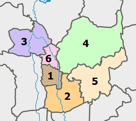
Central Thailand (Central Plain) (historically also known as Siam or Dvaravati) is one of the regions of Thailand, covering the broad alluvial plain of the Chao Phraya River. It is separated from northeast Thailand (Isan) by the Phetchabun Mountains, Phetchabun mountain range. The Tenasserim Hills separate it from Myanmar to the west. In the north it is bounded by the Phi Pan Nam Range, one of the hilly systems of northern Thailand. The area was the heartland of the Ayutthaya Kingdom (at times referred to as Siam) and is still the dominant area of Thailand since it contains the world's most primate city#Examples, primate city, Bangkok. Definition The grouping of Thai provinces into regions follow two major systems in which Thailand is divided into either Regions of Thailand, four or six regions. In the six-region system, commonly used in geographical studies, central Thailand extends from Sukhothai Province, Sukhothai and Phitsanulok Province, Phitsanulok Provinces in the north t ... [...More Info...] [...Related Items...] OR: [Wikipedia] [Google] [Baidu] |
Tamil Inscriptions In Malay World
A number of medieval inscriptions written in Tamil language and script that have been found in Southeast Asia and China, mainly in Sumatra and peninsular Thailand. These texts arose directly from trade links between south India and certain parts of Southeast Asia and China, which involved the residence in those regions of Tamil-speaking Indians. Several of these overseas Tamil inscriptions mention well-known medieval Indian merchant associations. A good number of Tamil inscriptions, as well as Hindu and Buddhist icons emanating from South India, have been found in Southeast Asia (and even in Quanzhou in China). On the Malay Peninsula, inscriptions have been found at Takuapa, not far from the Vishnuite statues of Khao Phra Narai in Southern Thailand. It is a short inscription indicating that an artificial lake named ''Avani-naranam'' was dug by ''Nangur-Udaiyan'', which is the name of an individual who possessed a military fief at Nangur, being famous for his abilities as a warrio ... [...More Info...] [...Related Items...] OR: [Wikipedia] [Google] [Baidu] |
Ptolemy
Claudius Ptolemy (; , ; ; – 160s/170s AD) was a Greco-Roman mathematician, astronomer, astrologer, geographer, and music theorist who wrote about a dozen scientific treatises, three of which were important to later Byzantine science, Byzantine, Islamic science, Islamic, and Science in the Renaissance, Western European science. The first was his astronomical treatise now known as the ''Almagest'', originally entitled ' (, ', ). The second is the ''Geography (Ptolemy), Geography'', which is a thorough discussion on maps and the geographic knowledge of the Greco-Roman world. The third is the astrological treatise in which he attempted to adapt horoscopic astrology to the Aristotelian physics, Aristotelian natural philosophy of his day. This is sometimes known as the ' (, 'On the Effects') but more commonly known as the ' (from the Koine Greek meaning 'four books'; ). The Catholic Church promoted his work, which included the only mathematically sound geocentric model of the Sola ... [...More Info...] [...Related Items...] OR: [Wikipedia] [Google] [Baidu] |
Geography (Ptolemy)
The ''Geography'' (, , "Geographical Guidance"), also known by its Latin names as the ' and the ', is a gazetteer, an atlas (book), atlas, and a treatise on cartography, compiling the geographical knowledge of the 2nd-century Roman Empire. Originally written by Claudius Ptolemy in Ancient Greek, Greek at Alexandria around 150 AD, the work was a revision of a now-lost atlas by Marinus of Tyre using additional Roman and Parthian Empire, Persian gazetteers and new principles. Its translation – Al-Khwarizmi#Geography, Kitab Surat al-Ard – into Classical Arabic, Arabic by Al-Khwarizmi, Al-Khwarismi in the 9th century was highly influential on the geographical knowledge and cartographic traditions of the Geography and cartography in medieval Islam, Islamic world. Alongside the works of Islamic scholars – and the commentary containing revised and more accurate data by Alfraganus – Ptolemy's work was subsequently highly influential on Middle Ages, Medieval and Renaissanc ... [...More Info...] [...Related Items...] OR: [Wikipedia] [Google] [Baidu] |


