|
Jhinjhuwada
Zinzuwada, also spelled Jhinjhuvada or Jhinjhuwada is a town in Dasada Taluka of Surendranagar district, Gujarat, India. History According to a legend the town was founded by Zanz Lambariya. He had advised Mayanalla Devi, wife of Chaulukya ruler Karna, to take blessings from a hermit living on an island in the Rann of Kutch. She later gave birth to Jayasimha Siddharaja who named the place where he lived as Zinzuwada after him. The core town is surrounded by 11th century fort built during the rule of Chaulukya dynasty. There are inscriptions on the walls of the fort ascribed to Udayana, a minister of Jayasimha Siddharaja. It was a non-salute princely state on Saurashtra peninsula during British Raj. The princely state in Jhalawar prant. In 1901, it comprised 18 villages, covering 165 square miles, with a population of 11,732, yielding 73,343 Rupees state revenue (1903-4, mostly from land), paying 11,075 Rupees tribute to the British.https://dsal.uchicago.edu/referenc ... [...More Info...] [...Related Items...] OR: [Wikipedia] [Google] [Baidu] |
Jayasimha Siddharaja
Jayasiṃha, who assumed the title Siddharāja, ruled the Kingdom of Gujarat between 1092 and 1142. He was a member of the Chaulukya (also called Solanki) dynasty. Jayasimha's capital was located at Anahilapataka (modern Patan) in present-day Gujarat. Besides large parts of Gujarat, his control also extended to parts of Rajasthan: he subdued the Shakambhari Chauhans king Arnoraja, and the former Naddula Chahamana ruler Asharaja acknowledged his suzerainty. Jayasimha also annexed a part of Malwa (in present-day Madhya Pradesh) by defeating the Paramaras. He also waged an inconclusive war against the Chandela king Madanavarman. Jayasimha's daughter Kanchana married Arnoraja. The couple's son Someshvara (the father of Prithviraj Chauhan) was brought up by Jayasimha at the Chaulukya court. Early life Jayasimha was a son of the Chaulukya king Karna and his Kadamba queen Mayanalladevi. According to folklore, he was born in Palanpur, but there is no historical evidence of ... [...More Info...] [...Related Items...] OR: [Wikipedia] [Google] [Baidu] |
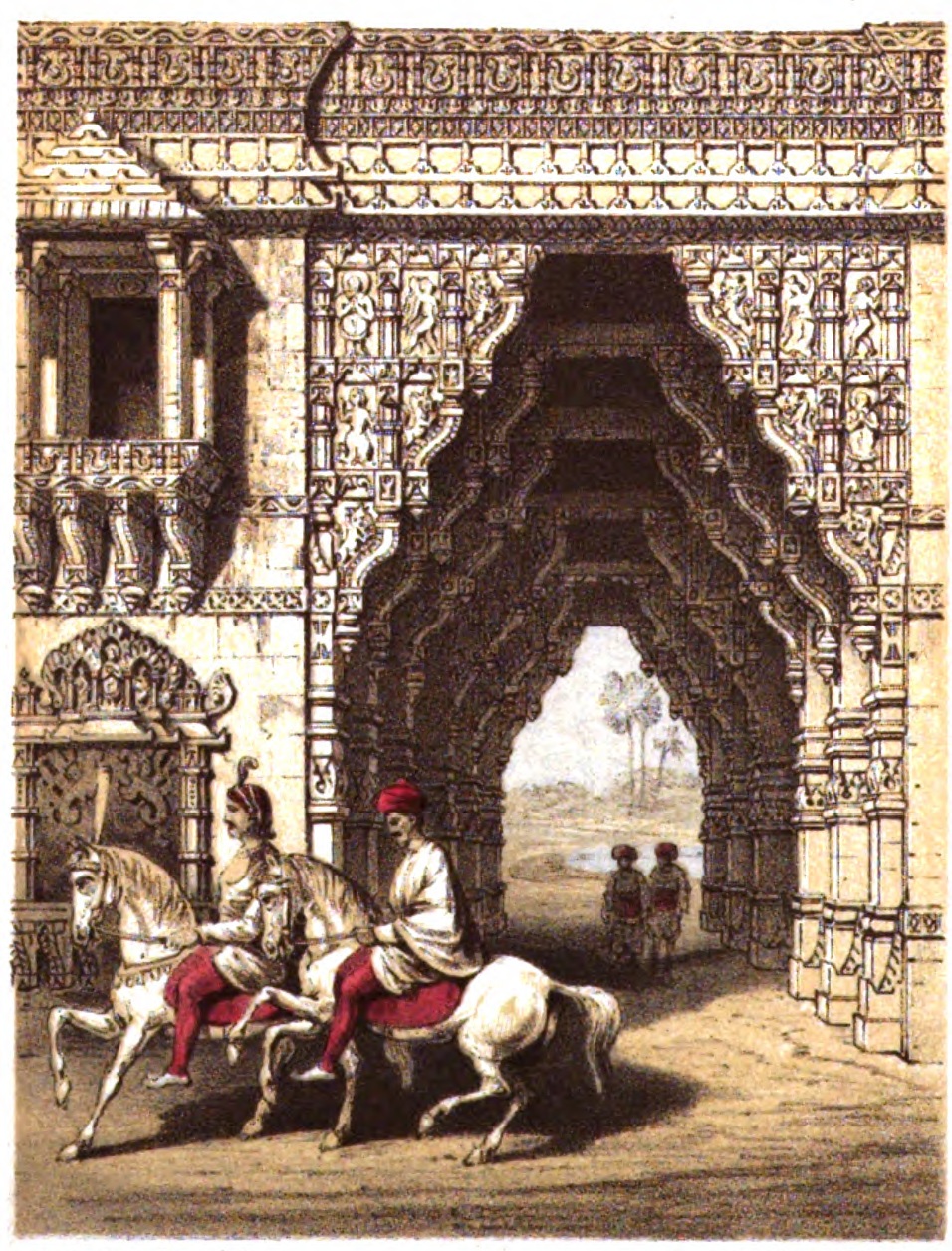
Gate At Zinzuwada Gujarat
A gate or gateway is a point of entry to or from a space enclosed by walls. The word is derived from Proto-Germanic language, Proto-Germanic ''*gatan'', meaning an opening or passageway. Synonyms include yett (which comes from the same root word) and portal (architecture), portal. The concept originally referred to the gap or hole in the wall or fence, rather than a Barricade, barrier which closed it. Gates may prevent or control the entry or exit of individuals, or they may be merely decorative. The moving part or parts of a gateway may be considered "Door, doors", as they are fixed at one side whilst opening and closing like one. A gate may have a latch (hardware), latch that can be raised and lowered to both open a gate or prevent it from swinging. Gate operation can be either Electric gate, automated or manual. Locks are also used on gates to increase security. Larger gates can be used for a whole building, such as a castle or fortified town. Doors can also be considered ... [...More Info...] [...Related Items...] OR: [Wikipedia] [Google] [Baidu] |
British Raj
The British Raj ( ; from Hindustani language, Hindustani , 'reign', 'rule' or 'government') was the colonial rule of the British The Crown, Crown on the Indian subcontinent, * * lasting from 1858 to 1947. * * It is also called Crown rule in India, * * * * or direct rule in India. * Quote: "Mill, who was himself employed by the British East India company from the age of seventeen until the British government assumed direct rule over India in 1858." * * The region under British control was commonly called India in contemporaneous usage and included areas directly administered by the United Kingdom of Great Britain and Ireland, United Kingdom, which were collectively called ''Presidencies and provinces of British India, British India'', and areas ruled by indigenous rulers, but under British British paramountcy, paramountcy, called the princely states. The region was sometimes called the Indian Empire, though not officially. As ''India'', it was a founding member of th ... [...More Info...] [...Related Items...] OR: [Wikipedia] [Google] [Baidu] |
Māru-Gurjara Style
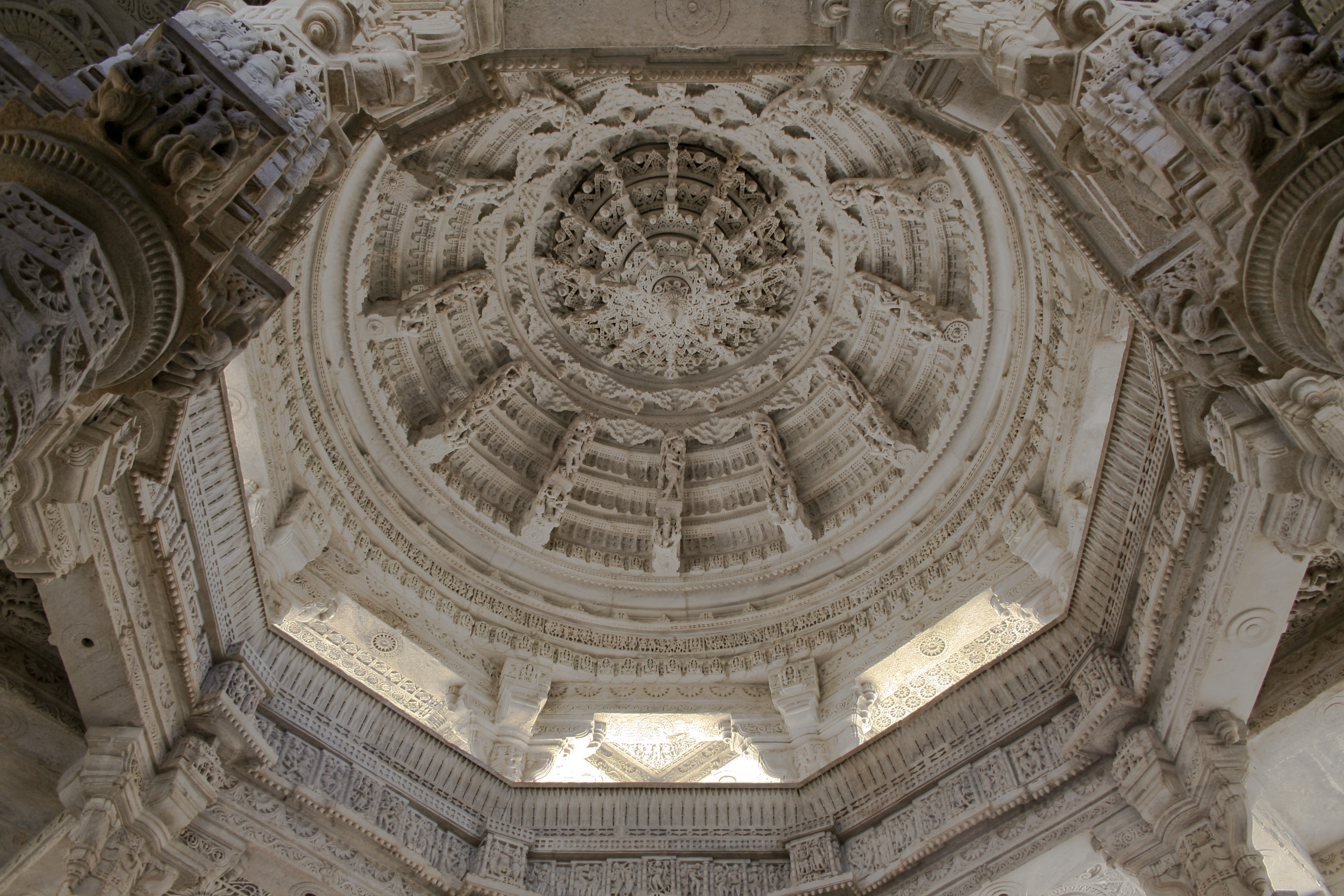
Māru-Gurjara architecture or Solaṅkī style, is the style of West Indian temple architecture that originated in Gujarat and Rajasthan from the 11th to 13th centuries, under the Chaulukya dynasty (also called Solaṅkī dynasty). Although originating as a regional style in Hindu temple architecture, it became especially popular in Jain temples, and mainly under Jain patronage later spread across India, then later to diaspora communities around the world. On the exteriors, the style of Māru-Gurjara architecture is distinguished from other North Indian temple styles of the period in "that the external walls of the temples have been structured by increasing numbers of projections and recesses, accommodating sharply carved statues in niches. These are normally positioned in superimposed registers, above the lower bands of moldings. The latter display continuous lines of horse riders, elephants, and kīrttimukhas. Hardly any segment of the surface is left unadorned." The main shi ... [...More Info...] [...Related Items...] OR: [Wikipedia] [Google] [Baidu] |
Dabhoi
Dabhoi is a town and a municipality in the Vadodara district in the state of Gujarat, India. Dabhoi has a big popular sunni masjid (mosque) named Kaziwad Masjid. History Dabhoi was historically known as Darbhavati, Darbikagrama, Darbhavatipura, and Dabhohi. It is first mentioned in the sixth century astronomical treatise ''Romaka Siddhanta''. It was an important pilgrim site for Hindus due to the Kalika temple and for Jains as well. It is also mentioned in several Jain works, such as Hemachandra's ''Yogartrevritti'' and Ramchandra's ''Vikramcharitra''. The town and its surroundings were under Chavda dynasty, Chavda and later under Chaulukya dynasty, Chaulukya rulers who built few buildings and temples from the ninth century. The fortification of it is ascribed to the Chaulukya dynasty, Chaulukya king of Gujarat, Jayasimha Siddharaja (1093-1143 AD), who made this his frontier fortress. The architectural style and the exquisite Masonry, stone carving and iconography on the ... [...More Info...] [...Related Items...] OR: [Wikipedia] [Google] [Baidu] |
Plan And Elevation Of Corner Tower Of The Fortress Of Zinzuwada Gujarat
A plan is typically any diagram or list of steps with details of timing and resources, used to achieve an objective to do something. It is commonly understood as a temporal set of intended actions through which one expects to achieve a goal. For spatial or planar topologic or topographic sets see map. Plans can be formal or informal: * Structured and formal plans, used by multiple people, are more likely to occur in projects, diplomacy, careers, economic development, military campaigns, combat, sports, games, or in the conduct of other business. In most cases, the absence of a well-laid plan can have adverse effects: for example, a non-robust project plan can cost the organization time and money. * Informal or ad hoc plans are created by individuals in all of their pursuits. The most popular ways to describe plans are by their breadth, time frame, and specificity; however, these planning classifications are not independent of one another. For instance, there is a close ... [...More Info...] [...Related Items...] OR: [Wikipedia] [Google] [Baidu] |
Jhalawar Prant
Kingdom of Jhalavad was a kingdom present in the Kathiawar region of Gujarat. The kingdom came to be known as the Dhrangadhra State after it became a princely state in the nineteenth century. The town of Dhrangadhra served as its capital. It was also known as Halvad-Dhrangadhra State. Halvad once had been the capital of this state. It was ruled by the Jhala clan of Rajputs. History The state was founded as Jhalawad/Zalawad in 1090 by Rajput ruler Harpadeva. The Grandson of Harpaldeva, Durjansal was appointed as ''Grihadyaksha'', ''Ran-su-ran'' (chief of nobles) and ''Mahamandaleshwara'' of the Chaulukya dynasty, he fought the Battle of Kasahrada on behalf of young Mularaja and defeated the Ghurids led by Muhammad Ghuri. In 1742, Dhrangadhra, a new capital was founded and renamed the state. Among the earlier names were Kuwa and Halwad; the state is still sometimes styled Halwad(-Dhrangadhra). Under the British Raj, the colonial Eastern Kathiawar Agency was in charg ... [...More Info...] [...Related Items...] OR: [Wikipedia] [Google] [Baidu] |
Saurashtra (region)
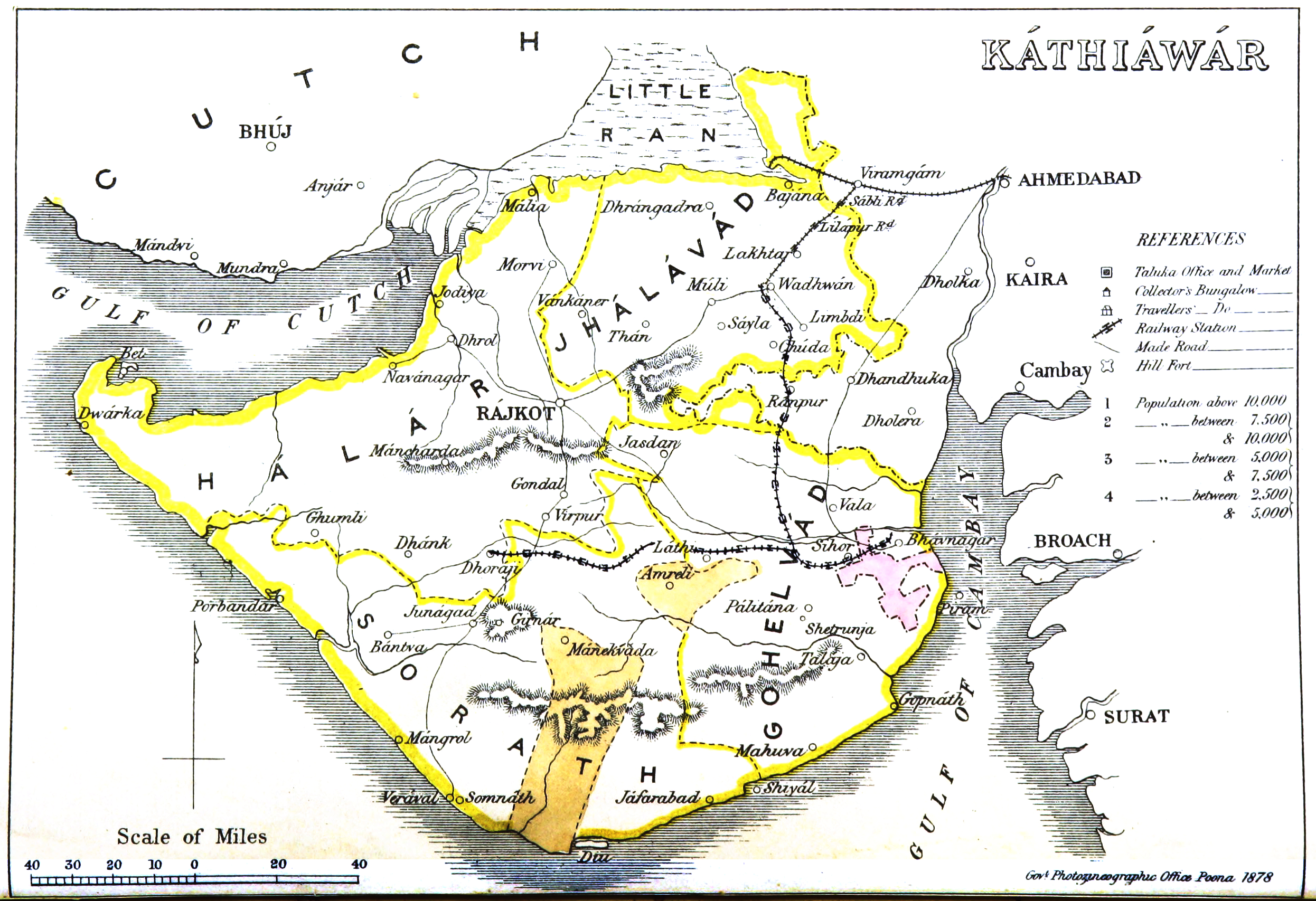
Kathiawar (), also known as Saurashtra, is a peninsula in the south-western Gujarat state in India, bordering the Arabian Sea and covering about . It is bounded by the Kutch district in the north, the Gulf of Kutch in the northwest, and by the Gulf of Khambhat in the east. In the northeast, it is connected to the rest of the state and borders on the low, fertile hinterland of Ahmedabad. It is crossed by two belts of hill country and is drained radially by nine rivers which have little natural flow aside from in monsoon months, thus dams have been built on some of these. Kathiawar ports have been flourishing centres of trade and commerce since at least the 16th century. It was formerly a state of India. Etymology and history The name Kathiawad seems to have been derived from the early settlements of Kathikas or Kathis who entered Gujarat from Sindh in early centuries of the Common Era. The name "Saurashtra" itself is from Sanskrit (, ), the vṛddhi form of (, ), deri ... [...More Info...] [...Related Items...] OR: [Wikipedia] [Google] [Baidu] |
Surendranagar District
Surendranagar is an administrative district in Saurashtra region of Gujarat state in India. It has a population of approximately 1.7 million people. Surendranagar, along with the twin city of Wadhwan, has a total of 400,000 inhabitants, and is known as "Camp". Etymology Surendranagar district takes its name from its headquarters Surendranagar. Originally it was the place where the British political agent for Wadhwan lived and became known as Wadhwan Camp. After the agent left in 1946, Wadhwan Camp was renamed after Surendrasinhji Jorawarsinhji (1922–1983), then-ruler of Wadhwan, and became known as Surendranagar. Even today the city is still called the 'Camp' locally from its old name. The district overall, when the various princely states had been merged, was known as 'Jhalavad', the land of the Jhala Rajputs, who held many of the states. Their name derives from an apocryphal incident in the palace of Harpaldev, their ancestor. A wild elephant had burst into a courty ... [...More Info...] [...Related Items...] OR: [Wikipedia] [Google] [Baidu] |
Bhopal
Bhopal (; ISO 15919, ISO: Bhōpāl, ) is the capital (political), capital city of the Indian state of Madhya Pradesh and the administrative headquarters of both Bhopal district and Bhopal division. It is known as the ''City of Lakes,'' due to presence of various natural and artificial lakes near the city boundary. It is also one of the greenest cities in India. It is the List of cities in India by population#1 to 50, 16th largest city in India and 131st in the world. After the formation of Madhya Pradesh, Bhopal was part of the Sehore district. It was bifurcated in 1972 and a new district, Bhopal, was formed. Flourishing around 1707, the city was the capital of the former Bhopal State, a princely state of the British ruled by the Nawabs of Bhopal until India's independence in 1947. India achieved independence on 15 August 1947. Bhopal was one of the last states to sign the ‘Instrument of Accession’. The ruler of Bhopal acceded to the Indian government, and Bhopal became an ... [...More Info...] [...Related Items...] OR: [Wikipedia] [Google] [Baidu] |


