|
Hirwaun
Hirwaun is a village and community at the north end of the Cynon Valley in the County Borough of Rhondda Cynon Taf, South Wales. It is NW of the town of Aberdare, and comes under the Aberdare post town. At the 2001 census, Hirwaun had a population of 4,851. increasing at the 2011 census to 4,990. The village is on the Heads of the Valleys Road and at the southern edge of the Brecon Beacons National Park. Etymology Hirwaun (also formerly spelled as Hirwain and Herwain) derives from two common Welsh toponyms "Hir" meaning long and "Gwaun" meaning moorland. Writing in 1887, Rev. Thomas Morgan stated that the correct name is ''Hirwaun Gwrgant'', meaning Gwrgan's "Waun". This name comes from its association with Gwrgan ab Ithel (1033 - 1070), a king of Morgannwg who is said to have freely given a portion of the waun (named "Y Waun Hir") to his poor subjects and all other Welshmen for raising corn, and the breeding of sheep and cattle. Morgan further states that in olden times the ... [...More Info...] [...Related Items...] OR: [Wikipedia] [Google] [Baidu] |
Heads Of The Valleys
The A465 is a trunk road that runs from Bromyard in Herefordshire, England to Llandarcy near Swansea in South Wales. The western half is known officially as the Neath to Abergavenny Trunk Road, but the section from Abergavenny to the Vale of Neath is more commonly referred to as the Heads of the Valleys Road because it links the northern heads of the South Wales Valleys. Approximately following the southern boundary of the Brecon Beacons National Park, the Ordnance Survey ''Pathfinder'' guide describes it as the unofficial border between rural and industrial South Wales. The A465 provides an alternative route between England and the counties in South West Wales and to the ferries to Ireland. Route The A465 runs south-west from Bromyard towards the River Lugg, from where it runs concurrently with the A4103 for a short distance before entering Hereford. After a short distance on the A49, it crosses the River Wye, the River Monnow and the border into Wales. The A465 meets the ... [...More Info...] [...Related Items...] OR: [Wikipedia] [Google] [Baidu] |
Hirwaun, Penderyn And Rhigos
Hirwaun, Penderyn and Rhigos (formerly two separate wards Hirwaun and Rhigos) is the northernmost electoral ward in Rhondda Cynon Taf, Wales. It covers the communities of Hirwaun (including the village of Penderyn) and Rhigos. The ward elects two county borough councillors to the Rhondda Cynon Taf County Borough Council Rhondda Cynon Taf County Borough Council ( cy, Cyngor Bwrdeistref Sirol Rhondda Cynon Taf) is the governing body for Rhondda Cynon Taf, one of the Principal Areas of Wales. The council headquarters are located in the community of Cwm Clydach .... It is the largest ward in Rhondda Cynon Taf. While being the largest ward in Rhondda Cynon Taf, Rhigos was also one of the least populous. According to the 2011 census the population of the Rhigos ward was 1,700. 2022 ward changes The area around the village of Hirwaun was formerly an electoral ward in its own right. Following a local government boundary review, Hirwaun was merged with the much larger Rhigos war ... [...More Info...] [...Related Items...] OR: [Wikipedia] [Google] [Baidu] |
Aberdare
Aberdare ( ; cy, Aberdâr) is a town in the Cynon Valley area of Rhondda Cynon Taf, Wales, at the confluence of the Rivers Dare (Dâr) and Cynon. Aberdare has a population of 39,550 (mid-2017 estimate). Aberdare is south-west of Merthyr Tydfil, north-west of Cardiff and east-north-east of Swansea. During the 19th century it became a thriving industrial settlement, which was also notable for the vitality of its cultural life and as an important publishing centre. Etymology The name ''Aberdare'' means "mouth/confluence of the river dare", as the town is located where the Dare river ( cy, Afon Dâr) meets the Cynon ( cy, afon Cynon). While the town's Welsh spelling uses formal conventions, the English spelling of the name reflects the town's pronunciation in the local Gwenhwyseg dialect of South East Wales. ''Dâr'' is an archaic Welsh word for oaks (the plural of ''derwen''), and the valley was noted for its large and fine oaks as late as the nineteenth century. In ancie ... [...More Info...] [...Related Items...] OR: [Wikipedia] [Google] [Baidu] |
Tower Colliery
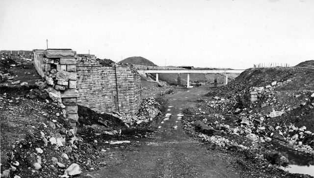
Tower Colliery ( Welsh: Glofa'r Tŵr) was the oldest continuously working deep- coal mine in the United Kingdom, and possibly the world, until its closure in 2008. It was the last mine of its kind to remain in the South Wales Valleys. It was located near the villages of Hirwaun and Rhigos, north of the town of Aberdare in the Cynon Valley of South Wales. History With coal located so close to the surface, it was known by locals to be possible to drift mine coal from Hirwaun common. This activity increased from 1805, until in 1864 the first drift named Tower was started, named after the nearby Crawshay's Tower, a folly built in 1848 and named after Richard Crawshay. In 1941, a new shaft was sunk to a depth of 160 metres. From 1943 until closure, this shaft was used as the main "return" ventilation shaft and for the transport of men. In 1958 Tower No. 3 was driven to meet the No. 4 colliery workings, and was used as the main "intake" airway, conveying coal to the surface a ... [...More Info...] [...Related Items...] OR: [Wikipedia] [Google] [Baidu] |
Cynon Valley (UK Parliament Constituency)
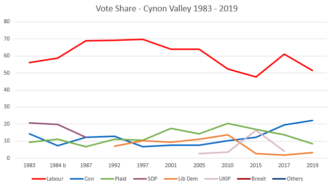
Cynon Valley ( cy, Cwm Cynon) is a constituency represented in the House of Commons of the UK Parliament since 2019 by Beth Winter of the Labour Party. The Cynon Valley Senedd constituency was created with the same boundaries in 1999 (as an Assembly constituency). Boundaries 1983–2010: The Borough of Cynon Valley. 2010–present: The Rhondda Cynon Taff County Borough electoral divisions of Aberaman North, Aberaman South, Abercynon, Aberdare East, Aberdare West/Llwydcoed, Cilfynydd, Cwmbach, Glyncoch, Hirwaun, Mountain Ash East, Mountain Ash West, Penrhiwceiber, Pen-y-waun, Rhigos, and Ynysybwl. The constituency encompasses the towns of Aberdare, Mountain Ash, Cilfynydd, Abercynon and Hirwaun. Members of Parliament Elections Elections in the 1980s * Death of Ioan Evans 10 February 1984 Elections in the 1990s Elections in the 2000s Elections in the 2010s ... [...More Info...] [...Related Items...] OR: [Wikipedia] [Google] [Baidu] |
Rhondda Cynon Taf County Borough Council
Rhondda Cynon Taf County Borough Council ( cy, Cyngor Bwrdeistref Sirol Rhondda Cynon Taf) is the governing body for Rhondda Cynon Taf, one of the Principal Areas of Wales. The council headquarters are located in the community of Cwm Clydach on the outskirts of Tonypandy. History The council was established on 1 April 1996 under the Local Government (Wales) Act 1994, covering the area of the three former districts of Rhondda, Cynon Valley, and Taff-Ely (except Pentyrch, which went to Cardiff). As well as taking over the functions of the abolished district councils, the new authority also took over the functions of the abolished Mid Glamorgan County Council in the area. The new county borough was described in the 1994 Act with different spellings in English and Welsh: Rhondda Cynon Taff (English) / Rhondda Cynon Taf (Welsh). The council now uses the latter spelling for both languages. Political control The first election to the council was held in 1995, initially operatin ... [...More Info...] [...Related Items...] OR: [Wikipedia] [Google] [Baidu] |
William Thomas Lewis, 1st Baron Merthyr
William Thomas Lewis, 1st Baron Merthyr (5 August 1837 – 27 August 1914), known as Sir William Lewis, 1st Baronet, from 1896 to 1911, was a Welsh coal mining magnate. Early life Lewis was born in 1837 in Merthyr Tydfil, Glamorganshire, the second son of Thomas William Lewis, an engineer at the Plymouth, and his wife Mary Anne. He was educated at a local school run by Taliesin Williams until the age of thirteen when he was apprenticed to his father as an engineer. In 1855 Lewis was appointed as an assistant to W. S. Clark, the chief mining engineer of John Crichton-Stuart, 3rd Marquess of Bute (1847–1890). He spent ten years in that post before succeeding Clark in 1864. Lewis was given the occupancy of Mardy House as part of his job, which became his long-term residence in Aberdare. The same year he married Anne Rees, daughter of William Rees, and granddaughter of Lucy Thomas, the legendary "mother of the Welsh steam-coal trade". Lewis and Anne had two sons and six daughters ... [...More Info...] [...Related Items...] OR: [Wikipedia] [Google] [Baidu] |
Cynon Valley
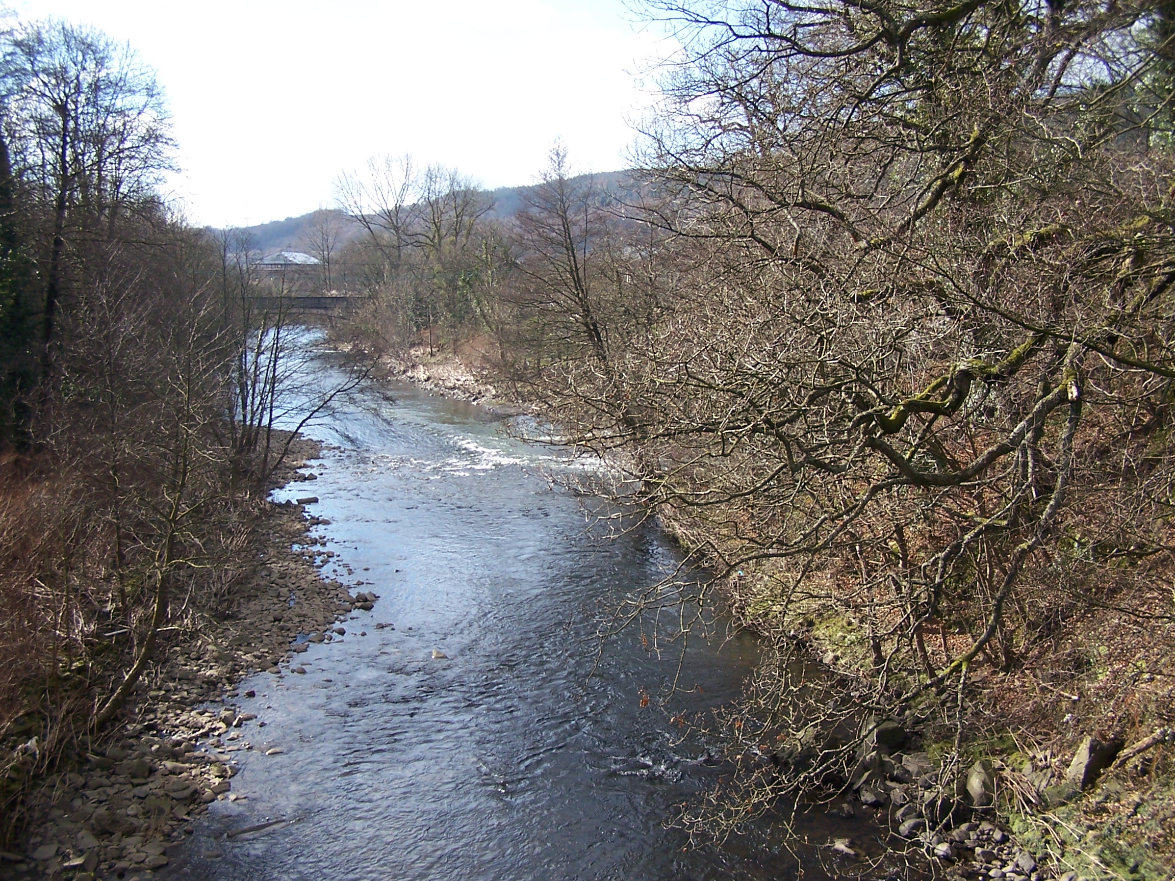
Cynon Valley () is a former coal mining valley in Wales. Cynon Valley lies between Rhondda and the Merthyr Valley and takes its name from the River Cynon. Aberdare is located in the north of the valley and Mountain Ash is in the south of the valley. From 1974 to 1996 Cynon Valley was a local government district. According to the 2001 census, the Cynon Valley has a population of 63,512. In 2001 12.1% of the inhabitants were recorded as Welsh speakers. In common with some of the other South Wales Valleys, Cynon Valley had a high percentage of Welsh speakers until the early 20th century. Former district From 1974 to 1996 the Borough of Cynon Valley was one of thirty-seven districts of Wales. The district was formed from the Aberdare and Mountain Ash urban districts, the parish of Rhigos from Neath Rural District and the parish of Penderyn from Brecknockshire. It was one of six districts of Mid Glamorgan, and in 1996 was merged into the larger unitary authority of ... [...More Info...] [...Related Items...] OR: [Wikipedia] [Google] [Baidu] |
Rhondda Cynon Taf
Rhondda Cynon Taf (; RCT; also spelt as Rhondda Cynon Taff) is a county borough in the south-east of Wales. It consists of five valleys: the Rhondda Fawr, Rhondda Fach, Cynon, Taff (Welsh: ''Taf'') and Ely valleys, plus a number of towns and villages away from the valleys. Results from the 2011 census showed 19.1% of its 234,410 residents self-identified as having some ability in the use of the Welsh language. The county borough borders Merthyr Tydfil County Borough and Caerphilly County Borough to the east, Cardiff and the Vale of Glamorgan to the south, Bridgend County Borough and Neath Port Talbot to the west and Powys to the north. Its principal towns are - Aberdare, Llantrisant with Talbot Green and Pontypridd, with other key settlements/towns being - Maerdy, Ferndale, Hirwaun, Llanharan, Mountain Ash, Porth, Tonypandy, Tonyrefail and Treorchy. The most populous individual town in Rhondda Cynon Taf is Aberdare ( cy, Aberdâr) with a population of 39,550 (2011), ... [...More Info...] [...Related Items...] OR: [Wikipedia] [Google] [Baidu] |
Electoral Ward
A ward is a local authority area, typically used for electoral purposes. In some countries, wards are usually named after neighbourhoods, thoroughfares, parishes, landmarks, geographical features and in some cases historical figures connected to the area (e.g. William Morris Ward in the London Borough of Waltham Forest, England). It is common in the United States for wards to simply be numbered. Origins The word “ward”, for an electoral subdivision, appears to have originated in the Wards of the City of London, where gatherings for each ward known as “wardmotes” have taken place since the 12th century. The word was much later applied to divisions of other cities and towns in England and Wales and Ireland. In parts of northern England, a ''ward'' was an administrative subdivision of a county, very similar to a hundred in other parts of England. Present day In Australia, Canada, New Zealand, Sri Lanka, South Africa, the United Kingdom, and the United States, w ... [...More Info...] [...Related Items...] OR: [Wikipedia] [Google] [Baidu] |
Aberdare Urban District Council
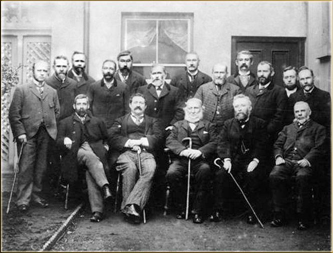
Aberdare Urban District Council was a local authority in Aberdare, Wales. History It was created in 1894 as a result of the 1894 Local Government of England and Wales Act and the 1894 Aberdare Urban District Council election saw the election of the first members of the authority. The Council existed until 1973 and replaced the Aberdare Local Board of Health which had functioned since the 1840s. Its boundaries were identical to those of the original parish of Aberdare. Initially, the Council had fifteen members but this was increased to twenty in 1906, as a result of the increase in population. There were five wards, namely Aberaman (also known as No. 5 Ward), Blaengwawr (also known as No. 4 Ward), Gadlys (also known as No. 2 Ward), Llwydcoed (also known as No. 1 Ward), and the Town Ward (also known as No. 3 Ward). The first councillors were elected at the 1894 elections. Most of the first members of the authority had served on the Local Board, including the first chairma ... [...More Info...] [...Related Items...] OR: [Wikipedia] [Google] [Baidu] |
Macmillan Cancer Support
Macmillan Cancer Support is one of the largest British charities and provides specialist health care, information and financial support to people affected by cancer. It also looks at the social, emotional and practical impact cancer can have, and campaigns for better cancer care. Macmillan Cancer Support's goal is to reach and improve the lives of everyone who has cancer in the UK. History The charity was founded 1911 as the Society for the Prevention and Relief of Cancer, by Douglas Macmillan following the death of his father from the disease. In 1924, the name was changed to the National Society for Cancer Relief, which it retained until 1989 when it was changed to Cancer Relief Macmillan Fund, later changed again to Macmillan Cancer Relief. From 5 April 2006, Macmillan Cancer Relief became known as Macmillan Cancer Support, as this more accurately describes its role in supporting people who have cancer. It has adapted the principles of being a "source of support" and a "fo ... [...More Info...] [...Related Items...] OR: [Wikipedia] [Google] [Baidu] |


