|
Cynon Valley
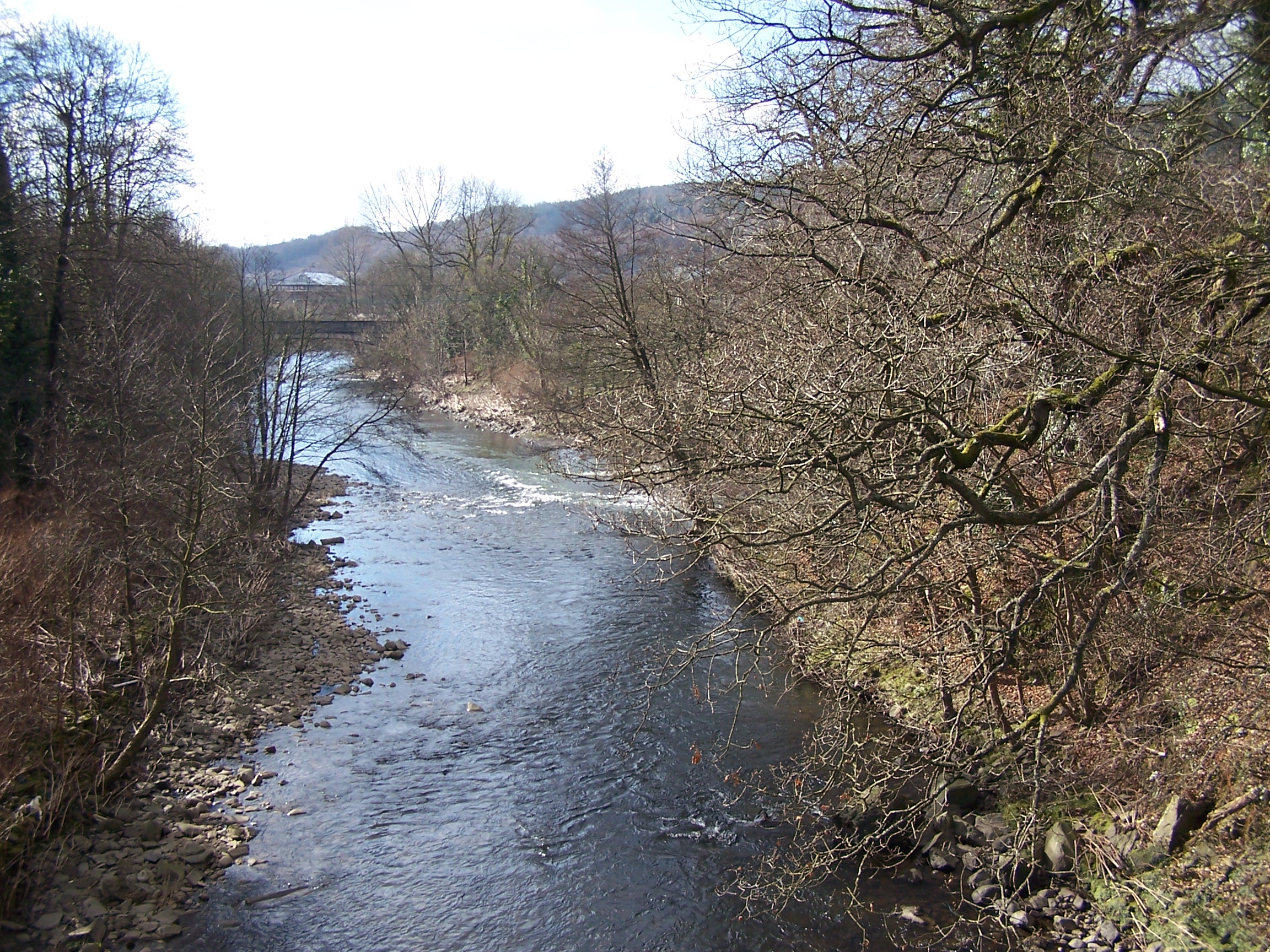
Cynon Valley () is a former coal mining valley in Wales. Cynon Valley lies between Rhondda and the Merthyr Valley and takes its name from the River Cynon. Aberdare is located in the north of the valley and Mountain Ash is in the south of the valley. From 1974 to 1996 Cynon Valley was a local government district. According to the 2001 census, the Cynon Valley has a population of 63,512. In 2001 12.1% of the inhabitants were recorded as Welsh speakers. In common with some of the other South Wales Valleys, Cynon Valley had a high percentage of Welsh speakers until the early 20th century. Former district From 1974 to 1996 the Borough of Cynon Valley was one of thirty-seven districts of Wales. The district was formed from the Aberdare and Mountain Ash urban districts, the parish of Rhigos from Neath Rural District and the parish of Penderyn from Brecknockshire. It was one of six districts of Mid Glamorgan, and in 1996 was merged into the larger unitary authority of ... [...More Info...] [...Related Items...] OR: [Wikipedia] [Google] [Baidu] |
Aberdare
Aberdare ( ; cy, Aberdâr) is a town in the Cynon Valley area of Rhondda Cynon Taf, Wales, at the confluence of the Rivers Dare (Dâr) and Cynon. Aberdare has a population of 39,550 (mid-2017 estimate). Aberdare is south-west of Merthyr Tydfil, north-west of Cardiff and east-north-east of Swansea. During the 19th century it became a thriving industrial settlement, which was also notable for the vitality of its cultural life and as an important publishing centre. Etymology The name ''Aberdare'' means "mouth/confluence of the river dare", as the town is located where the Dare river ( cy, Afon Dâr) meets the Cynon ( cy, afon Cynon). While the town's Welsh spelling uses formal conventions, the English spelling of the name reflects the town's pronunciation in the local Gwenhwyseg dialect of South East Wales. ''Dâr'' is an archaic Welsh word for oaks (the plural of ''derwen''), and the valley was noted for its large and fine oaks as late as the nineteenth century. In ancie ... [...More Info...] [...Related Items...] OR: [Wikipedia] [Google] [Baidu] |
Brecknockshire
, image_flag= , HQ= Brecon , Government= Brecknockshire County Council (1889-1974) , Origin= Brycheiniog , Status= , Start= 1535 , End= 1974 , Code= BRE , CodeName= Chapman code , Replace= Brecknock, Powys , Motto= Undeb Hedd Llwyddiant (Unity, Peace, Prosperity) , Divisions= , DivisionsNames= , DivisionsMap= , Image= , Map= , Arms= , Civic= , PopulationFirst= 47,763Vision of Britain 1831 Census/ref> , PopulationFirstYear= 1831 , AreaFirst= , AreaFirstYear= 1831 , DensityFirst= 0.1/acre , DensityFirstYear= 1831 , PopulationSecond= 54,213 , PopulationSecondYear= 1901 , AreaSecond= , AreaSecondYear= 1911 , ... [...More Info...] [...Related Items...] OR: [Wikipedia] [Google] [Baidu] |
Abernant, Rhondda Cynon Taf
Abernant (or Abernant-y-Wenallt) is a small village north-east of the town of Aberdare, Rhondda Cynon Taf, Wales. Like many in the South Wales Valleys, it was once a coal-mining village. Etymology Abernant is a shortening of the name "Abernant-y-Wenallt", and the area is recorded under this name in an 1800 lease of the land. While the place-name element ''Aber'' is easily understand as a confluence of watercourses, (here referring to meeting of the Nant y Wenallt and the Cynon) the rest of the name is more debatable. The element ''-wen'' may refer to the colour white, or as an indicator that the place was in some way "blessed" or "holy". Similarly, the termination ''-allt'' commonly refers to an area of sloping hillside but can also denote an the area as heavily wooded. Finally, In the language of South East Wales, ''nant'' refers to the watercourse itself, rather than the valley it sits in, therefore the name may be translated as either "the mouth of the white brook on the wo ... [...More Info...] [...Related Items...] OR: [Wikipedia] [Google] [Baidu] |
Abercwmboi
Abercwmboi is a village in the Welsh county borough of Rhondda Cynon Taf in Wales, United Kingdom. Location Abercwmboi is one of the last remaining villages in the Cynon Valley. It has retained its identity and not been developed as have many other Cynon Valley villages. As a result, is a close and friendly community. The village lies on the B4275 Cardiff Road - the old main route to Cardiff before the A4059 road was built - between Aberdare and Mountain Ash. It is the most south-easterly named settlement that, for postal reasons, is included in the town of Aberdare. Name Abercwmboi - earlier Abercynfoi, translated: 'mouth of the Cynfoi'. Cynfoi is the name of the stream. Aberconfoi Ycha/Issa 1570 were farms named after the stream that enters the Cynon river there. Before 1905 the village was named Capcoch (red cap). The primary school and local pub / inn still have the name. The remains of the original Cap Coch Inn, can be found on the mountainside, above the village. T ... [...More Info...] [...Related Items...] OR: [Wikipedia] [Google] [Baidu] |
Aberaman
Aberaman is a village near Aberdare in the county borough of Rhondda Cynon Taf, south Wales. It was heavily dependent on the coal industry and the population, as a result, grew rapidly in the late nineteenth century. Most of the industry has now disappeared and a substantial proportion of the working population travel to work in Cardiff and the M4 corridor. Many residents also work in the nearby towns of Aberdare and Pontypridd. History Aberaman, to the south of Aberdare, was an agricultural area until the early nineteenth century. Prior to the industrial revolution, Aberaman was the home of the Mathew family, local gentry who owned land throughout Glamorgan and who came to prominence in the seventeenth century when three members of the family served as High Sheriff of Glamorgan. The family seat was at Aberaman Isha, later known as Aberaman House (and which still exists in 2014 but is much altered). The last of the Mathew family, Edward Mathew, died in 1788 and the estate was b ... [...More Info...] [...Related Items...] OR: [Wikipedia] [Google] [Baidu] |
2010 United Kingdom General Election
The 2010 United Kingdom general election was held on Thursday 6 May 2010, with 45,597,461 registered voters entitled to vote to elect members to the House of Commons. The election took place in 650 constituencies across the United Kingdom under the first-past-the-post system. The election resulted in a large swing to the Conservative Party similar to that seen in 1979, the last time a Conservative opposition had ousted a Labour government. The Labour Party lost the 66-seat majority it had previously enjoyed, but no party achieved the 326 seats needed for a majority. The Conservatives, led by David Cameron, won the most votes and seats, but still fell 20 seats short. This resulted in a hung parliament where no party was able to command a majority in the House of Commons. This was only the second general election since the Second World War to return a hung parliament, the first being the February 1974 election. For the leaders of all three major political parties, this wa ... [...More Info...] [...Related Items...] OR: [Wikipedia] [Google] [Baidu] |
Welsh Assembly
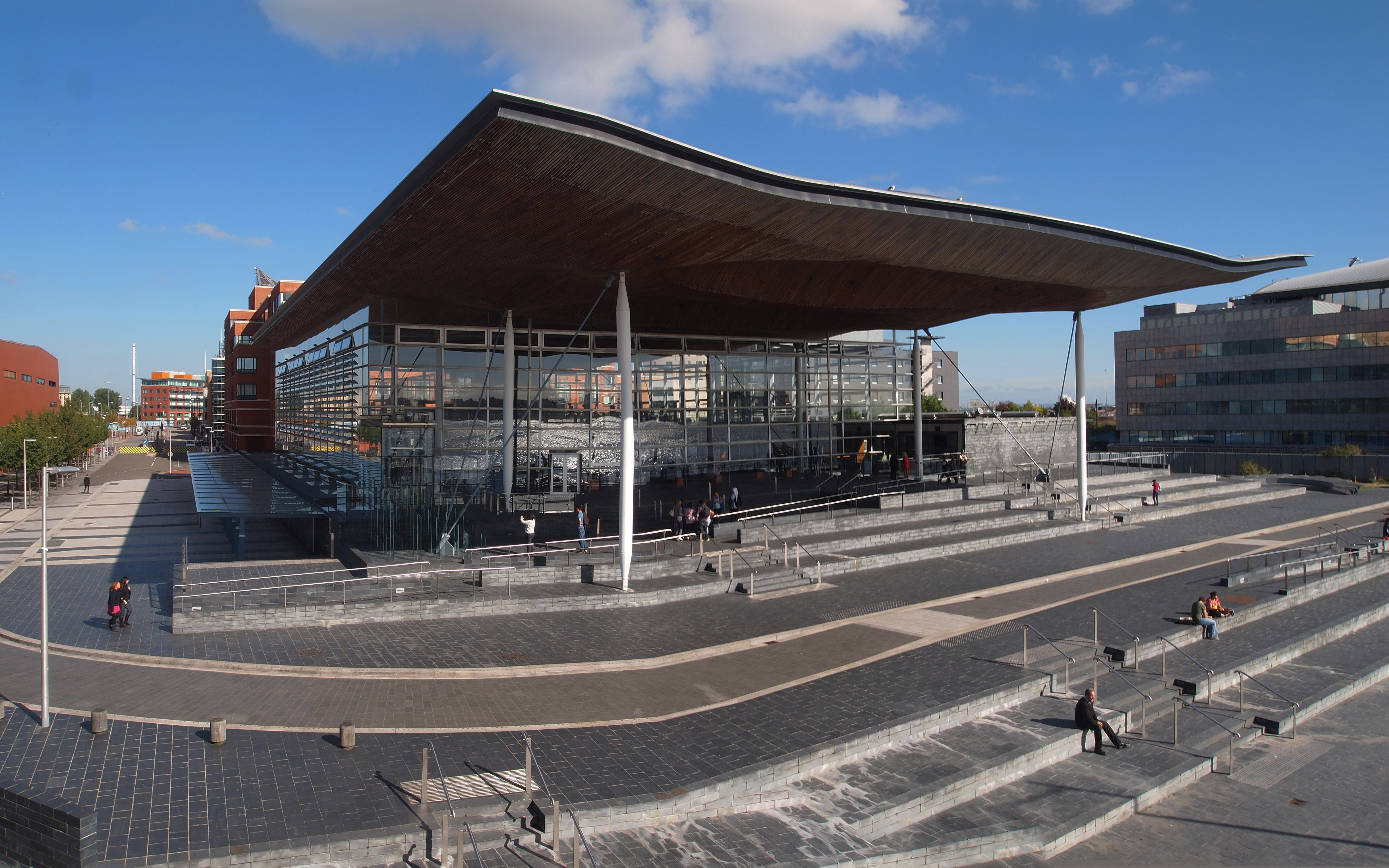
The Senedd (; ), officially known as the Welsh Parliament in English and () in Welsh, is the devolved, unicameral legislature of Wales. A democratically elected body, it makes laws for Wales, agrees certain taxes and scrutinises the Welsh Government. It is a bilingual institution, with both Welsh and English being the official languages of its business. From its creation in May 1999 until May 2020, the Senedd was known as the National Assembly for Wales ( cy, Cynulliad Cenedlaethol Cymru, lang, link=no). The Senedd comprises 60 members who are known as Members of the Senedd (), abbreviated as "MS" (). Since 2011, members are elected for a five-year term of office under an additional member system, in which 40 MSs represent smaller geographical divisions known as "constituencies" and are elected by first-past-the-post voting, and 20 MSs represent five "electoral regions" using the D'Hondt method of proportional representation. Typically, the largest party in the Senedd fo ... [...More Info...] [...Related Items...] OR: [Wikipedia] [Google] [Baidu] |
United Kingdom House Of Commons
The House of Commons is the lower house of the Parliament of the United Kingdom. Like the upper house, the House of Lords, it meets in the Palace of Westminster in London, England. The House of Commons is an elected body consisting of 650 members known as members of Parliament (MPs). MPs are elected to represent constituencies by the first-past-the-post system and hold their seats until Parliament is dissolved. The House of Commons of England started to evolve in the 13th and 14th centuries. In 1707 it became the House of Commons of Great Britain after the political union with Scotland, and from 1800 it also became the House of Commons for Ireland after the political union of Great Britain and Ireland. In 1922, the body became the House of Commons of the United Kingdom of Great Britain and Northern Ireland after the independence of the Irish Free State. Under the Parliament Acts 1911 and 1949, the Lords' power to reject legislation was reduced to a delaying power. The go ... [...More Info...] [...Related Items...] OR: [Wikipedia] [Google] [Baidu] |
Cynon Valley (UK Parliament Constituency)
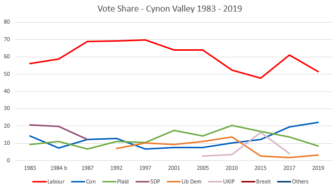
Cynon Valley ( cy, Cwm Cynon) is a constituency represented in the House of Commons of the UK Parliament since 2019 by Beth Winter of the Labour Party. The Cynon Valley Senedd constituency was created with the same boundaries in 1999 (as an Assembly constituency). Boundaries 1983–2010: The Borough of Cynon Valley. 2010–present: The Rhondda Cynon Taff County Borough electoral divisions of Aberaman North, Aberaman South, Abercynon, Aberdare East, Aberdare West/Llwydcoed, Cilfynydd, Cwmbach, Glyncoch, Hirwaun, Mountain Ash East, Mountain Ash West, Penrhiwceiber, Pen-y-waun, Rhigos, and Ynysybwl. The constituency encompasses the towns of Aberdare, Mountain Ash, Cilfynydd, Abercynon and Hirwaun. Members of Parliament Elections Elections in the 1980s * Death of Ioan Evans 10 February 1984 Elections in the 1990s Elections in the 2000s Elections in the 2010s ... [...More Info...] [...Related Items...] OR: [Wikipedia] [Google] [Baidu] |
Parliamentary Constituency
An electoral district, also known as an election district, legislative district, voting district, constituency, riding, ward, division, or (election) precinct is a subdivision of a larger state (a country, administrative region, or other polity) created to provide its population with representation in the larger state's legislative body. That body, or the state's constitution or a body established for that purpose, determines each district's boundaries and whether each will be represented by a single member or multiple members. Generally, only voters (''constituents'') who reside within the district are permitted to vote in an election held there. District representatives may be elected by a first-past-the-post system, a proportional representative system, or another voting method. They may be selected by a direct election under universal suffrage, an indirect election, or another form of suffrage. Terminology The names for electoral districts vary across countries an ... [...More Info...] [...Related Items...] OR: [Wikipedia] [Google] [Baidu] |
1983 United Kingdom General Election
The 1983 United Kingdom general election was held on Thursday 9 June 1983. It gave the Conservative Party under the leadership of Margaret Thatcher the most decisive election victory since that of the Labour Party in 1945, with a majority of 144 seats. Thatcher's first term as Prime Minister had not been an easy time. Unemployment increased during the first three years of her premiership and the economy went through a recession. However, the British victory in the Falklands War led to a recovery of her personal popularity, and economic growth had begun to resume. By the time Thatcher called the election in May 1983, opinion polls pointed to a Conservative victory, with most national newspapers backing the re-election of the Conservative government. The resulting win earned the Conservatives their biggest parliamentary majority of the post-war era, and their second-biggest majority as a single-party government, behind only the 1924 election (they earned even more seats in ... [...More Info...] [...Related Items...] OR: [Wikipedia] [Google] [Baidu] |
Aberdare Urban District
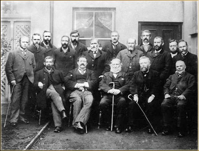
Aberdare Urban District Council was a local authority in Aberdare, Wales. History It was created in 1894 as a result of the 1894 Local Government of England and Wales Act and the 1894 Aberdare Urban District Council election saw the election of the first members of the authority. The Council existed until 1973 and replaced the Aberdare Local Board of Health which had functioned since the 1840s. Its boundaries were identical to those of the original parish of Aberdare. Initially, the Council had fifteen members but this was increased to twenty in 1906, as a result of the increase in population. There were five wards, namely Aberaman (also known as No. 5 Ward), Blaengwawr (also known as No. 4 Ward), Gadlys (also known as No. 2 Ward), Llwydcoed (also known as No. 1 Ward), and the Town Ward (also known as No. 3 Ward). The first councillors were elected at the 1894 elections. Most of the first members of the authority had served on the Local Board, including the first chairman ... [...More Info...] [...Related Items...] OR: [Wikipedia] [Google] [Baidu] |


.jpg)


.jpg)
