|
Harishchandragad
Harishchandra Fort is a hill fort in the Ahmednagar district of India. Its history is linked with that of Malshej Ghat, kothale village and it has played a major role in guarding and controlling the surrounding region. History The fort is quite ancient. Remnants of Microlithic man have been discovered here. The various Puranas (ancient scriptures) like ''Matsyapurana, Agnipurana and Skandapurana'' include many references about Harishchandragad. Its origin is said to have been in the 6th century, during the rule of Kalachuri dynasty. The citadel was built during this era. The various caves probably have been carved out in the 11th century. In these caves are idols of Lord Vishnu. Though the cliffs are named Taramati and Rohidas, they are not related to Ayodhya. Great sage Changdev (one who created the epic ''Tatvasaar''), used to meditate here in the 14th century. The caves are from the same period. The various constructions on the fort and those existing the surrounding region p ... [...More Info...] [...Related Items...] OR: [Wikipedia] [Google] [Baidu] |
Malshej Ghat
Malshej Ghat (माळशेज घाट) is a mountain pass located on Maharashtra's Kalyan–Ahmednagar Road in the Western Ghats range. The site is home to hundreds of various species of flora and fauna, particularly avian species such as quails, rails, crakes, flamingos, and cuckoos. Getting there Malshej ghat, with an average height of 700 m, is located in the Pune district near the Thane district's boundary. It's 130 kilometres north of Pune and 154 kilometres northeast of Mumbai. Kalyan in Thane District or Karjat near Mumbai are the nearest rail stations. Junnar, Pune is the closest State Transport Bus Station. State buses run frequently between Kalyan and Ahmednagar and can be boarded at the Kalyan Rail Station. Next to the train station lies the State Bus Station. Any bus bound towards Ahmednagar will stop at Malshej Ghat. Taking the bus from Kalyan will take about 1.5 hours. To travel by road to Malshej ghat from Pune take the Pune-Nashik highway (NH-50) to N ... [...More Info...] [...Related Items...] OR: [Wikipedia] [Google] [Baidu] |
Ahmednagar District
Ahmednagar district (Marathi pronunciation: �ɦ(ə)məd̪nəɡəɾ is the largest district of Maharashtra state in western India. The historical Ahmednagar city is the headquarters of the district. Ahmednagar and Sangamner are largest cities in the district. Ahmednagar was the seat of the Ahmednagar Sultanate of late medieval period (1496–1636 CE). This district is known for the towns of Shirdi associated with Sai Baba, Meherabad associated with Meher Baba, Shani Shinganapur with Shanidev, and Devgad with Lord Dattatreya. Ahmednagar district is part of Nashik Division. The district is bordered by Aurangabad district to the northeast, Nashik district to the northwest, Thane and Pune districts to the southwest, Solapur district to the south and Beed district to the southeast. Officer Members of Parliament * Sujay Vikhe Patil ( BJP) - Ahmednagar *Sadashiv Lokhande ( SHS) Shirdi Guardian Minister list of Guardian Minister District Magistrate/Collector ... [...More Info...] [...Related Items...] OR: [Wikipedia] [Google] [Baidu] |
List Of Forts In Maharashtra
This is list of forts in Maharashtra a state of India # Achala Fort (Nashik) # Agashi Fort # Ahmednagar Fort # Ahivant Fort # Ajinkyatara # Akola Fort # Akluj Fort # Alang Fort # Ambolgad Ambolgad is a village near Jaitapur Nuclear Power Project in the Ratnagiri district in Maharashtra, India. A Defence Officers Group named DARIYA (दरिया) has been formed by Col Dhanajirao Patil for bringing this village on World Map.{ ... # Anjaneri # Anjanvel Fort # Ankai Fort # Antur Fort # Arnala fort # Asheri fort # Asava fort # Avchitgad # Aurangabad Fort # Avandha Fort # Balapur Fort # Ballarpur Fort # Bankot fort # Bahadur Fort # Belapur Fort # Birwadi fort # Bitangad # Bhagwantgad # Bhairavgad # Bhamer Dhule # Bharatgad # Bhaskargad/Basgad # Bhavangad Fort/Bhondgad # Bhorgiri fort # Bhudargad Fort # Bhupatgad Fort # Bhushangad # Bombay Castle # Castella de Aguada/Bandra Fort # Chanda Fort # Chandan Fort # Chandragad/Dhavalgad # Chandwad fort # Chauler Fort/Chaurgad ... [...More Info...] [...Related Items...] OR: [Wikipedia] [Google] [Baidu] |
Brocken Spectre
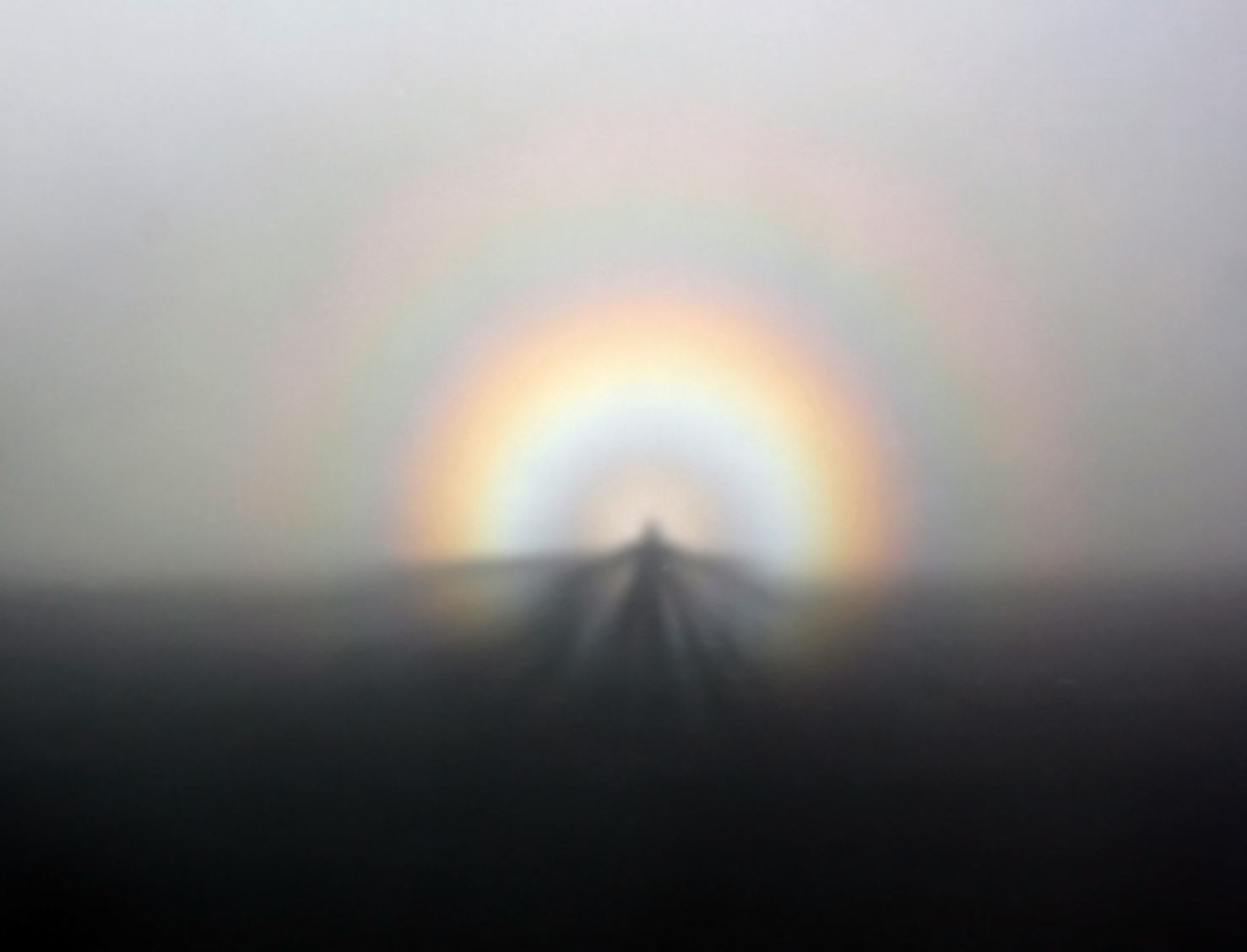
A Brocken spectre (British English; American spelling Brocken specter; german: Brockengespenst), also called Brocken bow, mountain spectre, or spectre of the Brocken is the magnified (and apparently enormous) shadow of an observer cast in mid air upon any type of cloud opposite a strong light source. Additionally, if the cloud consists of water droplets backscattered, a bright area called , and halo-like rings of rainbow coloured light called a glory can be seen around the head or apperature silhouette of the spectre. Typically the spectre appears in sunlight opposite the sun's direction at the antisolar point. The phenomenon can appear on any misty mountainside, cloud bank, or be seen from an aircraft, but the frequent fogs and low-altitude accessibility of the Brocken, a peak in the Harz Mountains in Germany, have created a local legend from which the phenomenon draws its name. The Brocken spectre was observed and described by Johann Silberschlag in 1780, and has often bee ... [...More Info...] [...Related Items...] OR: [Wikipedia] [Google] [Baidu] |
Symptoms Of Inner Peace
Signs and symptoms are the observed or detectable signs, and experienced symptoms of an illness, injury, or condition. A sign for example may be a higher or lower temperature than normal, raised or lowered blood pressure or an abnormality showing on a medical scan. A symptom is something out of the ordinary that is experienced by an individual such as feeling feverish, a headache or other pain or pains in the body. Signs and symptoms Signs A medical sign is an objective observable indication of a disease, injury, or abnormal physiological state that may be detected during a physical examination, examining the patient history, or diagnostic procedure. These signs are visible or otherwise detectable such as a rash or bruise. Medical signs, along with symptoms, assist in formulating diagnostic hypothesis. Examples of signs include elevated blood pressure, nail clubbing of the fingernails or toenails, staggering gait, and arcus senilis and arcus juvenilis of the eyes. Indications ... [...More Info...] [...Related Items...] OR: [Wikipedia] [Google] [Baidu] |
Temple Of Harishchandreshwar
A temple (from the Latin ) is a building reserved for spiritual rituals and activities such as prayer and sacrifice. Religions which erect temples include Christianity (whose temples are typically called churches), Hinduism (whose temples are called Mandir), Buddhism, Sikhism (whose temples are called gurudwara), Jainism (whose temples are sometimes called derasar), Islam (whose temples are called mosques), Judaism (whose temples are called synagogues), Zoroastrianism (whose temples are sometimes called Agiary), the Baha'i Faith (which are often simply referred to as Baha'i House of Worship), Taoism (which are sometimes called Daoguan), Shinto (which are sometimes called Jinja), Confucianism (which are sometimes called the Temple of Confucius), and ancient religions such as the Ancient Egyptian religion and the Ancient Greek religion. The form and function of temples are thus very variable, though they are often considered by believers to be, in some sense, the "house ... [...More Info...] [...Related Items...] OR: [Wikipedia] [Google] [Baidu] |
Murbad
Murbad is a census town within the administrative division (taluka) of Thane district in the Indian state of Maharashtra. Murbad city with its neighbouring villages jointly form the Murbad nagar panchayat, which is near the cities of Thane, Karjat and Kalyan. Nearby cities include Badlapur, Ambernath, Ulhasnagar, and Dombivli. It is a largely industrial town with private and public enterprises (MIDC). Geography Murbad is located at with an average elevation of 83 meters (272 feet). In Murbad, there are about 206 villages with a total population of 18,725. The climate of Murbad is mostly present considering the satilite cities around. The nearby Sahyadri mountains cause heavy rainfall in Murbad; in July, the average rainfall is 53.7 inches. The dry season is in January, when the area receives an average rainfall of less than one tenth of an inch. Murbad stays primarily within a 15 degree range, with an average low of 72.7 degrees Fahrenheit (22.6 degrees Celsius) i ... [...More Info...] [...Related Items...] OR: [Wikipedia] [Google] [Baidu] |
Naneghat
Naneghat, also referred to as Nanaghat or Nana Ghat ( IAST: Nānāghaṭ), is a mountain pass in the Western Ghats range between the Konkan coast and the ancient town of Junnar in the Deccan plateau. The pass is about north of Pune and about east from Mumbai, Maharashtra, India. It was a part of an ancient trading route, and is famous for a major cave with Prakrut Language inscriptions in Dhammalipi and Middle Indo-Aryan dialect. These inscriptions have been dated between the 2nd and the 1st century BCE, and attributed to the Satavahana dynasty era.Development Of Modern Numerals And Numeral Systems: The Hindu-Arabic system Encyclopaedia Britannica, Quote: "The 1, 4, and 6 are found in the Ashoka inscriptions (3rd century bce); the 2, 4, 6, 7, and 9 appear in the N ... [...More Info...] [...Related Items...] OR: [Wikipedia] [Google] [Baidu] |


