|
Murbad
Murbad is a census town within the administrative division (taluka) of Thane district in the Indian state of Maharashtra. Murbad city with its neighbouring villages jointly form the Murbad nagar panchayat, which is near the cities of Thane, Karjat and Kalyan. Nearby cities include Badlapur, Ambernath, Ulhasnagar, and Dombivli. It is a largely industrial town with private and public enterprises (MIDC). Geography Murbad is located at with an average elevation of 83 meters (272 feet). In Murbad, there are about 206 villages with a total population of 18,725. The climate of Murbad is mostly present considering the satilite cities around. The nearby Sahyadri mountains cause heavy rainfall in Murbad; in July, the average rainfall is 53.7 inches. The dry season is in January, when the area receives an average rainfall of less than one tenth of an inch. Murbad stays primarily within a 15 degree range, with an average low of 72.7 degrees Fahrenheit (22.6 degrees Celsius) i ... [...More Info...] [...Related Items...] OR: [Wikipedia] [Google] [Baidu] |
List Of Villages In Murbad
In Murbad, in the state of Maharashtra in India, there are about 206 villages. The population of Murbad is 18,725 people. A * Agashi Murbad 850 * Alawe Murbad 351 * Alyani Murbad 309 * Ambe Tembhe Murbad 554 * Ambegaon Murbad 1,020 * Ambele Bk. Murbad 1,086 * Ambele Kh. Murbad 795 * Ambiwali Murbad 267 * Anandnagar Murbad 487 * Anandnagar Murbad 552 * Askot Murbad 356 * Asole Murbad 1,534 * Asose Murbad 681 * Awalegaon Murbad 743 B * Balegaon Murbad 1,193 * Bandhivali Murbad 858 * Bhadane, Murbad 1,354 * Bhaluk Murbad 1,289 * Bhorande Murbad 64 * Bhuwan Murbad 1,188 * Borgaon Murbad 884 * Boriwali Murbad 418 * Brahmangaon Murbad 555 * Bursunge Murbad 533 C * Chafe Tarf Khedul Murbad 303 * Chandrapur Murbad 596 * Chasole Murbad 907 * Chikhale Murbad 454 * Chirad Murbad 408 Dohlyacha pada * Dahigaon Murbad 776 * Dahigaon Murbad 496 * Dahivali Murbad 585 * Dangurle Murbad 640 * Dehanoli Murbad 865 * Dehari Murbad 610 * Deogaon Murbad 2,645 * Deogha ... [...More Info...] [...Related Items...] OR: [Wikipedia] [Google] [Baidu] |
Thane District
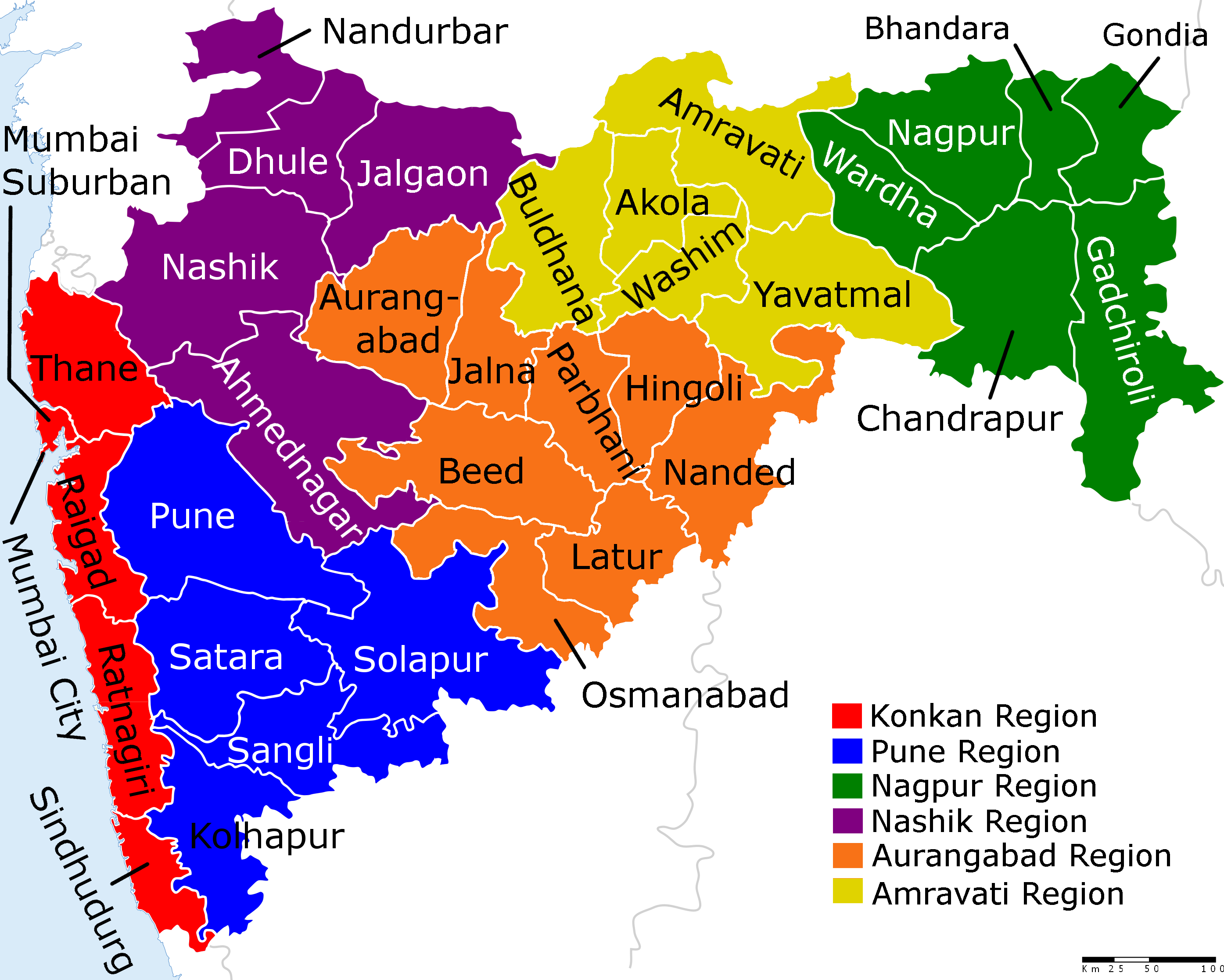
Thane district (Pronunciation: �ʰaːɳe previously named Taana or Thana) is a district in the Konkan Division of Maharashtra, India. At the 2011 Census it was the most populated district in the country, with 11,060,148 inhabitants; however, in August 2014 the district was split into two with the creation of a new Palghar district, leaving the reduced Thane district with a 2011 Census population of 8,070,032. The headquarters of the district is the city of Thane. Other major cities in the district are Navi Mumbai, Kalyan-Dombivli, Mira-Bhayander, Bhiwandi, Ulhasnagar, Ambarnath, Badlapur, Murbad and Shahapur. The district is situated between 18°42' and 20°20' north latitudes and 72°45' and 73°48' east longitudes. The revised area of the district is 4,214 km2. The district is bounded by Nashik district to the north east, Pune and Ahmednagar districts to the east, and by Palghar district to the north. The Arabian Sea forms the western boundary, while it i ... [...More Info...] [...Related Items...] OR: [Wikipedia] [Google] [Baidu] |
Shahapur Taluka
Shahapur taluka is a taluka in Thane district of Maharashtra in Konkan division. Thane district Until 31 July 2014, Thane was the country's most populous district with a population of over 1.2 crore. On 1 August 2014, the talukas of Mokhada, Jawahar, Talasari, Vikramgadh, Wada, Dahanu, Palghar and Vasai were separated from the erstwhile Thane district to form a new district Palghar. The talukas Thane, Bhiwandi, Kalyan, Ulhasnagar, Ambernath Ambernath (Marathi pronunciation: �mbəɾnaːt̪ʰ is an eastern suburban city in Mumbai and is a part of the Mumbai Metropolitan Region. Notable people * Merwyn Fernandes, former Indian hockey player * Farukh Choudhary, Indian footballer ..., Murbad and Shahapur were retained in Thane district. References Talukas in Thane district Talukas in Maharashtra {{Thane-geo-stub ... [...More Info...] [...Related Items...] OR: [Wikipedia] [Google] [Baidu] |
States And Territories Of India
India is a federal union comprising 28 states and 8 union territories, with a total of 36 entities. The states and union territories are further subdivided into districts and smaller administrative divisions. History Pre-independence The Indian subcontinent has been ruled by many different ethnic groups throughout its history, each instituting their own policies of administrative division in the region. The British Raj The British Raj (; from Hindi language, Hindi ''rāj'': kingdom, realm, state, or empire) was the rule of the British The Crown, Crown on the Indian subcontinent; * * it is also called Crown rule in India, * * * * or Direct rule in India, * Q ... mostly retained the administrative structure of the preceding Mughal Empire. India was divided into provinces (also called Presidencies), directly governed by the British, and princely states, which were nominally controlled by a local prince or raja loyal to the British Empire, which held ''de f ... [...More Info...] [...Related Items...] OR: [Wikipedia] [Google] [Baidu] |
Business
Business is the practice of making one's living or making money by producing or Trade, buying and selling Product (business), products (such as goods and Service (economics), services). It is also "any activity or enterprise entered into for profit." Having a business name does not separate the business entity from the owner, which means that the owner of the business is responsible and liable for debts incurred by the business. If the business acquires debts, the creditors can go after the owner's personal possessions. A business structure does not allow for corporate tax rates. The proprietor is personally taxed on all income from the business. The term is also often used colloquially (but not by lawyers or by public officials) to refer to a company, such as a corporation or cooperative. Corporations, in contrast with Sole proprietorship, sole proprietors and partnerships, are a separate legal entity and provide limited liability for their owners/members, as well as being su ... [...More Info...] [...Related Items...] OR: [Wikipedia] [Google] [Baidu] |
Titwala
Titwala is a town near Kalyan in the Indian state of Maharashtra Located In Thane District. Titwala is famous for the Siddhivinayak Mahaganapati Temple (Titwala), wherein lakhs of devotees visit this temple during Ganesh Chaturthi and Angarki Sankashti Chaturthi. __TOC__ Geography Temples * Siddhivinayak Mahaganapati Temple It is the site of a temple of Ganesha and purportedly the hermitage where Shakuntala Shakuntala (Sanskrit: ''Śakuntalā'') is the wife of Dushyanta and the mother of Emperor Bharata. Her story is told in the '' Adi Parva'' of the ancient Indian epic ''Mahabharata'' and dramatized by many writers, the most famous adaption bein ... was born. The Siddhivinayak Mahaganapati Temple is located at Titwala. The day of ' Angarki Sankashti Chaturthi', a holy day in the Hindu Calendar, attracts large crowds. Titwala attracts visitors from the suburbs of Mumbai. Believers claim that if Mahaganapati is worshiped regularly, marriages of those wanting to ... [...More Info...] [...Related Items...] OR: [Wikipedia] [Google] [Baidu] |
Chhatrapati Shivaji Maharaj International Airport
Chhatrapati Shivaji Maharaj International Airport is an international airport serving Mumbai and the Mumbai Metropolitan Region (MMR). It is the second busiest airport in the country in terms of total and international passenger traffic after Delhi, and was the 14th busiest airport in Asia and 41st busiest airport in the world by passenger traffic in calendar year 2019. Its passenger traffic was about 49.8 million in year 2018. It is also the second busiest airport in terms of cargo traffic. In March 2017, the airport surpassed London's Gatwick Airport as the world's busiest to operate a single runway at a time. This was later surpassed again by Gatwick Airport at the end of 2019 due to passenger numbers falling at Mumbai. The airport's IATA code ''BOM'' is associated with "Bombay", the city's former legal name. It has two operating terminals spread over a total land area of and handles about 950 aircraft movements per day. It handled a record of 1,007 aircraft m ... [...More Info...] [...Related Items...] OR: [Wikipedia] [Google] [Baidu] |
Census
A census is the procedure of systematically acquiring, recording and calculating information about the members of a given population. This term is used mostly in connection with national population and housing censuses; other common censuses include censuses of agriculture, traditional culture, business, supplies, and traffic censuses. The United Nations (UN) defines the essential features of population and housing censuses as "individual enumeration, universality within a defined territory, simultaneity and defined periodicity", and recommends that population censuses be taken at least every ten years. UN recommendations also cover census topics to be collected, official definitions, classifications and other useful information to co-ordinate international practices. The UN's Food and Agriculture Organization (FAO), in turn, defines the census of agriculture as "a statistical operation for collecting, processing and disseminating data on the structure of agriculture, coverin ... [...More Info...] [...Related Items...] OR: [Wikipedia] [Google] [Baidu] |
Shastrinagar
Shastrinagar is an area located in Ahmedabad Ahmedabad ( ; Gujarati: Amdavad ) is the most populous city in the Indian state of Gujarat. It is the administrative headquarters of the Ahmedabad district and the seat of the Gujarat High Court. Ahmedabad's population of 5,570,585 (per t ..., India. In 2002, it was cited as a "planned residential area". References {{Ahmedabad Neighbourhoods in Ahmedabad Memorials to Lal Bahadur Shastri ... [...More Info...] [...Related Items...] OR: [Wikipedia] [Google] [Baidu] |
Barvi Dam
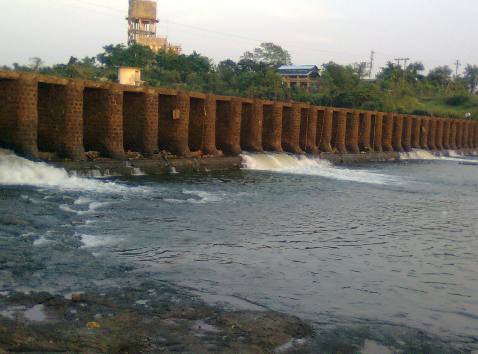
Barvi Dam is an earthfill dam on the Barvi River near Badlapur, Thane district, in the state of Maharashtra in India. Specifications The height of the dam above lowest foundation is while the length is . The gross storage capacity is . Purpose * Water supply to Badlapur * CHIKHLOLI DAMReferences Dams in Thane district Dams completed in 1978 1978 establ ...[...More Info...] [...Related Items...] OR: [Wikipedia] [Google] [Baidu] |
Pune District
Pune district (Marathi pronunciation: uɳeː is the most populous district in the Indian state of Maharashtra. The district's population was 9,429,408 in the 2011 census, making it the fourth most populous district amongst India's 640 districts. This district has an urban population of 58.08 percent of its total. It is one of the most industrialized districts in India. In recent decades it has also become a hub for information technology. Officer Members of Parliament * Girish Bapat ( BJP) - * Supriya Sule ( NCP) - * Dr. Amol Kolhe ( NCP) - * Shrirang Barne (BSS) - Guardian Minister list of Guardian Minister District Magistrate/Collector list of District Magistrate / Collector District Justice District Police Commissioner list of District Police Commissioner President & Vice-President Zilla Parishad *President list of President Zilla Parishad Pune *Vice-President list of Vice-President Zilla Parishad Pune Chief Executive Off ... [...More Info...] [...Related Items...] OR: [Wikipedia] [Google] [Baidu] |
Ahmednagar District
Ahmednagar district (Marathi pronunciation: �ɦ(ə)məd̪nəɡəɾ is the largest district of Maharashtra state in western India. The historical Ahmednagar city is the headquarters of the district. Ahmednagar and Sangamner are largest cities in the district. Ahmednagar was the seat of the Ahmednagar Sultanate of late medieval period (1496–1636 CE). This district is known for the towns of Shirdi associated with Sai Baba, Meherabad associated with Meher Baba, Shani Shinganapur with Shanidev, and Devgad with Lord Dattatreya. Ahmednagar district is part of Nashik Division. The district is bordered by Aurangabad district to the northeast, Nashik district to the northwest, Thane and Pune districts to the southwest, Solapur district to the south and Beed district to the southeast. Officer Members of Parliament * Sujay Vikhe Patil ( BJP) - Ahmednagar *Sadashiv Lokhande ( SHS) Shirdi Guardian Minister list of Guardian Minister District Magistrate/Collector ... [...More Info...] [...Related Items...] OR: [Wikipedia] [Google] [Baidu] |


