|
Hakamäentie
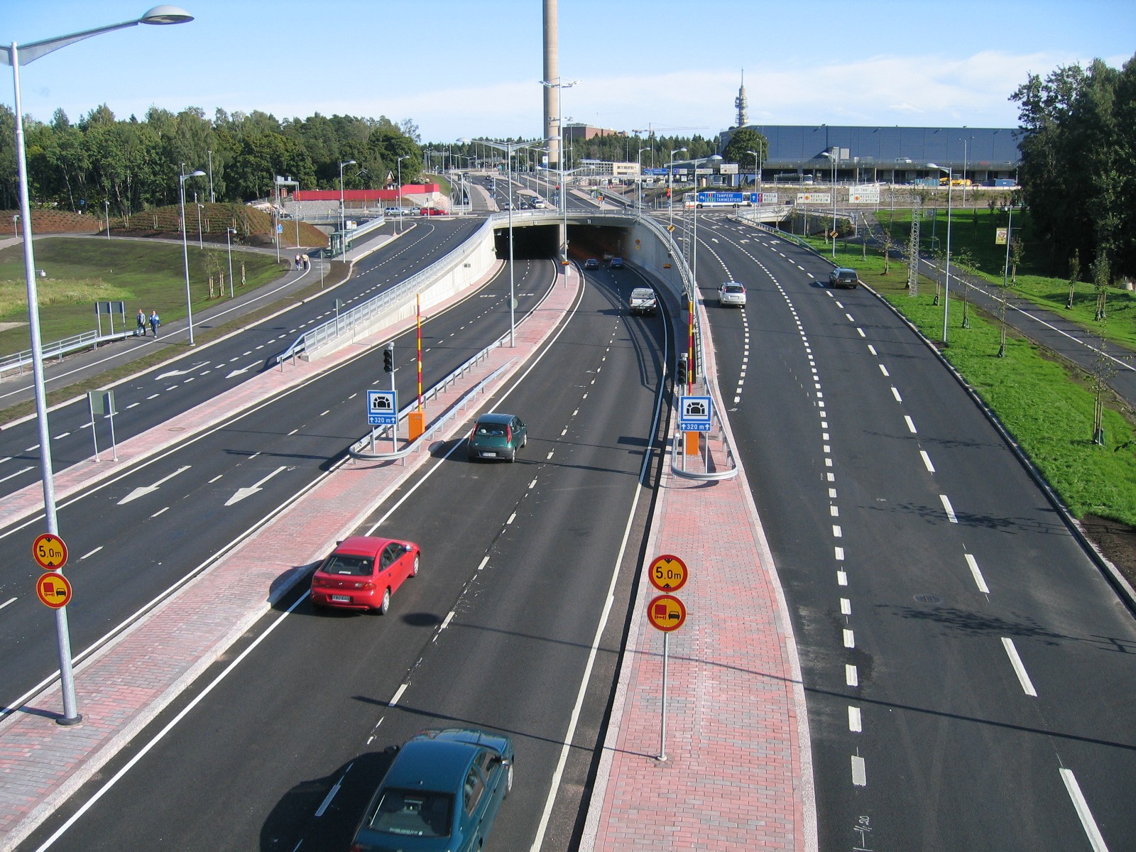
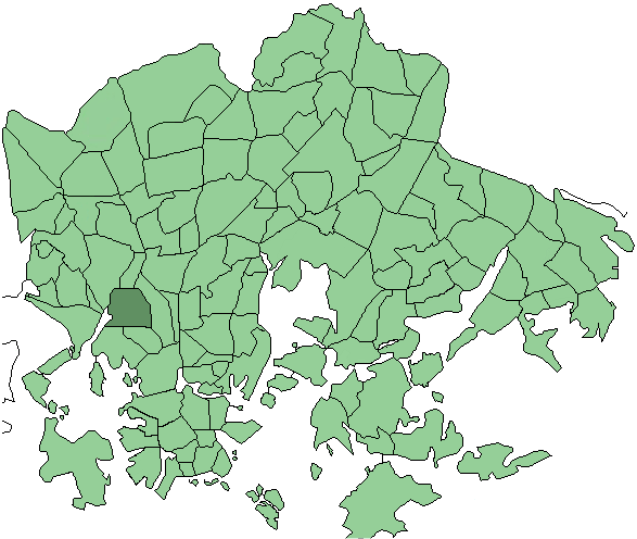
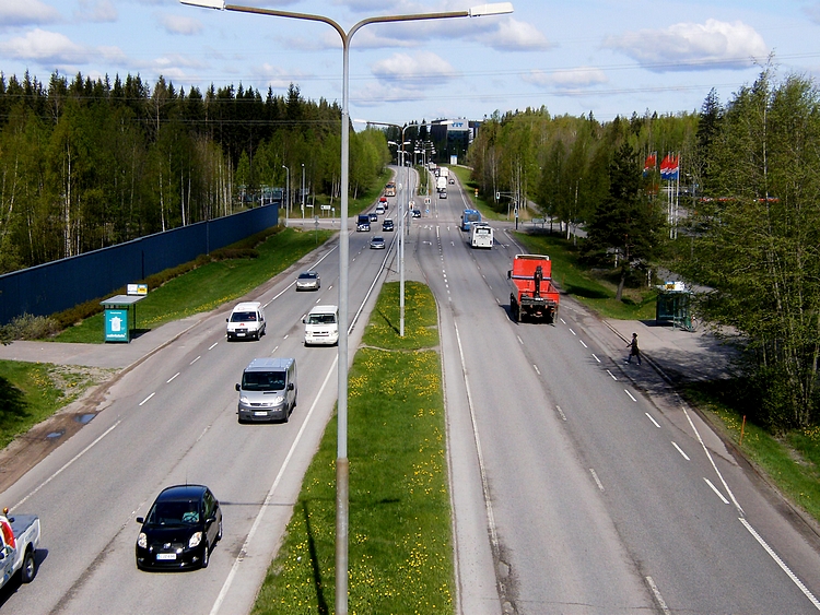
Finnish regional road 100 ( fi, Seututie 100, sv, Regionalväg 100), commonly known as Hakamäentie sv, Skogsbackavägen), is a regional road in Helsinki. It is an important cross-section between the northern districts of the Helsinki peninsula and part of the planned Pasilanväylä. Hakamäentie leads from Käpylä north of east and west Pasila to Haaga. In the east, it is extended by the Koskelantie leading to Vanhakaupunki and Lahdenväylä. At the western end of Hakamäentie, there is a tunnel leading to Vihdintie and an interchange, to which the Mannerheimintie leading north from the center of Helsinki ends and from which also Hämeenlinnanväylä ( national road 3) to the north and Vihdintie (regional road 120) to the west. There are a number of bridges along Hakamäentie that cross the main line, the beach line and the line that diverges from it, leading to the Ilmala service line yard. The road also crosses the valley in the Central Park and the outdoor roads run ... [...More Info...] [...Related Items...] OR: [Wikipedia] [Google] [Baidu] |
Mannerheimintie
Mannerheimintie ( sv, Mannerheimvägen), named after the Finnish military leader and statesman Carl Gustaf Emil Mannerheim, is the main street and boulevard of Helsinki, Finland. It was originally named Heikinkatu ( sv, Henriksgatan), after Robert Henrik Rehbinder, but was renamed after the Winter War. The change of name was also suitable due to Mannerheim having paraded in along that road during the Finnish Civil War (1918), after German forces allied with Mannerheim's Finnish forces had retaken the city. That event is also portrayed in the landmark statue of Mannerheim sitting horseback. The statue is located along the Mannerheimintie just outside the modern arts museum Kiasma. The street starts at Erottaja in the city centre, near the Swedish Theatre and continues in a northernly direction past the Stockmann department store. It then continues as a main thoroughfare past the districts of Kamppi, Töölö, Meilahti, Laakso and Ruskeasuo, until it finally merges into ... [...More Info...] [...Related Items...] OR: [Wikipedia] [Google] [Baidu] |
Käpylä
Käpylä (; sv, Kottby) is a neighbourhood of Helsinki with 7,600 inhabitants. Administratively speaking, Käpylä is a part of the Vanhakaupunki district. It is located between Kumpula, Oulunkylä and Koskela. Käpylä has a terminus for route-1 of the Helsinki tram network. Additionally, the Olympic Village built for the 1952 Summer Olympics and another village for the cancelled 1940 Summer Olympics are located in Käpylä. The Park Hotel, located in Käpylä, became known for being the shooting location of the popular Finnish satirical TV series ''Hyvät herrat''. One of the two lyceum schools situated in Käpylä has a specific orientation towards students with an interest in the natural sciences. The tram lines 1 and 1A as well as the Tuusulanväylä freeway bus lines travel to Käpylä. The I- N- and T-trains of the Helsinki commuter rail system stop at Käpylä railway station. There are smaller regions inside Käpylä, Puu-Käpylä (''wood-Käpylä'') and Taivask ... [...More Info...] [...Related Items...] OR: [Wikipedia] [Google] [Baidu] |
Ruskeasuo
Ruskeasuo (Brunakärr in Swedish, verbatim "Brown swamp") is a neighbourhood of Helsinki (Helsingfors in Swedish), about 3 kilometres north of the city center. With a population of 2670 (year 2005) Ruskeasuo is a rather quiet residential area. Buildings by Mannerheimintie are typically 6-8 floors high from 1950s. Between Mannerheimintie and Central Park, low-rise buildings are dominant. The equestrian dressage and eventing competitions for the 1952 Summer Olympics The 1952 Summer Olympics ( fi, Kesäolympialaiset 1952; sv, Olympiska sommarspelen 1952), officially known as the Games of the XV Olympiad ( fi, XV olympiadin kisat; sv, Den XV olympiadens spel) and commonly known as Helsinki 1952 ( sv, Helsin ... took place at their sports hall. References1952 Summer Olympics official report.p. 58. Venues of the 1952 Summer Olympics Olympic equestrian venues {{Summer-Olympic-venue-stub ... [...More Info...] [...Related Items...] OR: [Wikipedia] [Google] [Baidu] |
Helsinki
Helsinki ( or ; ; sv, Helsingfors, ) is the Capital city, capital, primate city, primate, and List of cities and towns in Finland, most populous city of Finland. Located on the shore of the Gulf of Finland, it is the seat of the region of Uusimaa in southern Finland, and has a population of . The Helsinki urban area, city's urban area has a population of , making it by far the List of urban areas in Finland by population, most populous urban area in Finland as well as the country's most important center for politics, education, finance, culture, and research; while Tampere in the Pirkanmaa region, located to the north from Helsinki, is the second largest urban area in Finland. Helsinki is located north of Tallinn, Estonia, east of Stockholm, Sweden, and west of Saint Petersburg, Russia. It has History of Helsinki, close historical ties with these three cities. Together with the cities of Espoo, Vantaa, and Kauniainen (and surrounding commuter towns, including the eastern ... [...More Info...] [...Related Items...] OR: [Wikipedia] [Google] [Baidu] |
Pasila
Pasila (; sv, Böle, ) is a part of Helsinki, Finland, that is both a central-northern neighbourhood and district, bordering the areas of Alppila to the south, the Central Park (Keskuspuisto) to the west, and Vallila to the east. Pasila is a major transportation hub. At its heart is the Pasila railway station, the second busiest station in Finland. The station serves about 130,000 people per day via 900 trains, 400 trams and 850 buses. Central Pasila The eastern and western parts of Pasila were formerly separated by a large railroad classification yard before the development of Central Pasila ( fi, Keski-Pasila), beginning in 2014. Central Pasila is currently home to the major sports and music venue Helsinki Halli and the Tripla complex, which includes a hotel of about 430 rooms, 50,000 square metres of office space (including the headquarters of telecom operator Telia Finland), about 400 residential flats and the largest commercial center in the Nordic countries with ... [...More Info...] [...Related Items...] OR: [Wikipedia] [Google] [Baidu] |
Haaga
Haaga ( sv, Haga köping) is a district and a former municipality in the Western major district of Helsinki with a population of 25,435.http://www.hel2.fi/tietokeskus/helsinki_alueittain_2005/203Haaga.pdf 2005 statistics about Haaga Haaga is divided into four subareas, which are ''Pohjois-Haaga'' (northern Haaga), ''Etelä-Haaga'' (southern Haaga), ''Kivihaka'' and ''Lassila''. It is home to the Haaga Rhododendron Park. Haaga has two railway stations: Huopalahti railway station in south and Pohjois-Haaga railway station in north. Frequent users of the trains are students attending Haaga-Helia University of Applied Sciences, as their campuses are spread out between 25–45 minutes between each other by train. Studies at the University include: business, finance, hospitality and tourism (including masters level), information technology, and management assistance. All these courses are available to exchange students interested in attending. See also * Haaga Rhododendron P ... [...More Info...] [...Related Items...] OR: [Wikipedia] [Google] [Baidu] |
Vanhakaupunki
Vanhakaupunki ( sv, Gammelstaden) is a neighbourhood of the city of Helsinki, Finland, to the north of Toukola. It is also the name of a district of the city, which contains the neighbourhood and its surroundings. The name (meaning "old town") comes from the fact that Helsinki was originally founded in the Vanhakaupunki area. The Swedish name ''Gamla Helsingfors'' (meaning "Old Helsinki") appears in the new Helsinki foundation document from 1639, as the city was moved to its later location, and the forms ''Gamla staden'' or ''Gammelstaden'' came into use after this. The Finnish translation of the name only started appearing in the late 19th century. The current names were established as official in 1909. The neighbourhood was named Vanhakaupunki in 1959. History The Swedish king Gustav Vasa founded Helsinki on June 12, 1550 on the mouth of the Vantaa River on the site of the medieval village of Forsby (Finnish: Koskela). The city was to compete with Tallinn for the commerce ... [...More Info...] [...Related Items...] OR: [Wikipedia] [Google] [Baidu] |
Lahdenväylä
, sv, Riksfyran; fi, Lahdenväylä; sv, Lahtisleden , maint = the Finnish Transport Agency , map = Finland national road 4.png , length_km = 1295 , length_round = , length_ref = , established = 1938 , direction_a = , terminus_a = Helsinki , junction = Highway 7 (14 km) in Helsinki Ring 3 (17 km) in Vantaa Highway 25 and Highway 55 (59 km) Highway 12 (103 km) in Lahti Highway 12 (105 km) in Lahti Highway 24 (107 km) Highway 46 (144 km) Highway 5 (148 km) Highway 9, Highway 13 and Highway 23 (260 km) Highway 9, Highway 18 and Highway 23 (269 km) Highway 69 and road 627 (301 km) Highway 13 (307 km) Highway 77 (364 km) Highway 77 (377 km) Highway 27 (450 km) Highway 58 (483 km) Highway 28 (484 km) Highway 88 (516 km) Highway 8 (585 km) Highway 22 (606 km) Highway 20 (610 km) Highway 29 (723 km) Highway 79 and Highway 78 (830 km) Highway 81 (832 km) Highway 82 (856 km) Highway 80 and Highway 5 (958 km) Highway 91 (1117 km) Highway 92 (1181 km) High ... [...More Info...] [...Related Items...] OR: [Wikipedia] [Google] [Baidu] |
Finnish Regional Road 120
Finnish regional road 120 ( fi, Seututie 120, sv, Regionalväg 120), or Vihti Road ( fi, Vihdintie, sv, Vichtisvägen), is a regional road from Haaga in Helsinki to Maikkala in Vihti. The road is part of the former Pori Highway. Regional road 120 was originally intended as the main road connection from Helsinki to Pori via the Vihti church village, but when it was completed, the road was already prone to accidents due to its complexity, hilliness and narrowness. However, the Helsinki-side section of the road up to Ring III has later been widened to four lanes, but the beginning of Vihdintie in Etelä-Haaga from Mannerheimintie to Haaga roundabout is street-like. The regional road also passes Finnish national road 25, Highway 25 at the village of Otalampi. Significant commercial centers along Vihdintie include the Ristikko Shopping Centre in the Konala district. [...More Info...] [...Related Items...] OR: [Wikipedia] [Google] [Baidu] |
Finnish National Road 3
Finnish national road 3 ( fi, Valtatie 3 or '; sv, Riksväg 3) is a highway in Finland between Helsinki and Vaasa via Hämeenlinna and Tampere. The road is long and it is part of the European route E12. of the highway is motorway, connecting Helsinki to Tampere. North of Tampere, the road is mostly two-lane road, with a share of 2+1 road. The busiest point on Highway 3 is in Helsinki, north of the Ring I junction, where the average traffic volume is about 90,000 vehicles per day. Back in the late 1950s before the current freeway, the Finnish regional road 132 (Mt 132) was the former main road to Hämeenlinna and Tampere via Loppi and Janakkala. Route The route of the road is: Helsinki – Vantaa – Nurmijärvi – Hyvinkää – Riihimäki – Janakkala – Hämeenlinna – Hattula – Kalvola – Valkeakoski – Akaa – Valkeakoski (again) – Lempäälä – Tampere – Pirkkala – Nokia – Tampere (again) – Ylöjärvi – Hämeenkyrö – Ikaalinen – Parkano � ... [...More Info...] [...Related Items...] OR: [Wikipedia] [Google] [Baidu] |
Central Park (Helsinki)
Central Park ( fi, Helsingin keskuspuisto, sv, Helsingfors centralpark) is a park in Helsinki, Finland. It has an area of . The park stretches from Töölönlahti Bay in the south to the border of Helsinki and Vantaa in the north. The park is not a gardened one but instead consists mostly of lightly managed woodland crisscrossed by gravel paths. The Paloheinä forest, a northern extension of the park, is Helsinki's main center for outdoor activities. History Architect Bertel Jung first proposed the idea of a central park in Helsinki in 1911. However, the initial proposal only covered what is now the southernmost part of the park, along with areas that are currently not part of Central Park, such as those in Kaisaniemi Kaisaniemi ( sv, Kajsaniemi) is a part of the centre of Helsinki, Finland. It is located immediately north of the Helsinki Central railway station and south of Hakaniemi. The most famous part of Kaisaniemi is the Kaisaniemi park, a park covering m .... A mas ... [...More Info...] [...Related Items...] OR: [Wikipedia] [Google] [Baidu] |

.jpg)


