|
Hahnenklee
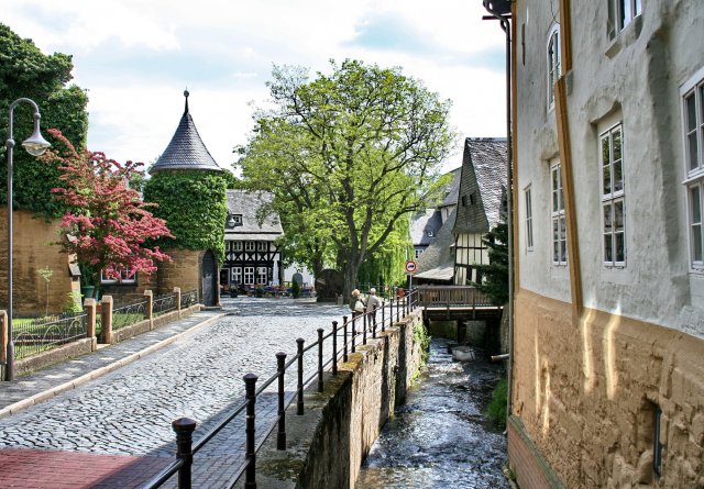
Hahnenklee is a borough of the city of Goslar, in the German state of the Lower Saxony. It is located within the Harz mountain range between Goslar and Osterode. The population is about 1200 inhabitants. History Hahnenklee became a state-recognised climatic spa in 1882. The village had 336 inhabitants at the beginning of the 20th century.''Neumanns Orts- und Verkehrslexikon'', p. 381. Leipzig 1905. The district of Hahnenklee also comprises the former village of ''Bockswiese'', both are mining settlements originating from the 16th century that were incorporated in 1972. Today the area mainly depends on tourism and forestry. In the Nazi time, Hahnenklee was home of many houses of the NS organisation “Mother and Child” - in their facilities, more than 3600 children were born. Even a birth station of the Lebensborn organisation was present. Shortly after the war, in the former mothers home of the NSV 18 Latvian children died from starvation - the circumstances never were cle ... [...More Info...] [...Related Items...] OR: [Wikipedia] [Google] [Baidu] |
Gustav Adolf Stave Church
The Lutheran Gustav Adolf Stave Church (german: Gustav-Adolf-Stabkirche) is a stave church situated in Hahnenklee, a borough of Goslar in the Harz mountains, Germany. Construction of the church began in 1907 and it was consecrated on 28 June 1908. The church is a copy of the medieval Borgund Stave Church in Norway. It was erected during the sudden rise in Hahnenklee's popularity as a spa town and major tourist destination, with adaptions to fulfil its role as a parish church. The plans were designed by Karl Mohrmann (1857–1927), architect of the Evangelical-Lutheran Church of Hanover, a representative of the historicist Hanover school of architecture. He had visited Borgund and held the view that stave churches once were common in the medieval Saxon areas too. The church was built from spruce trunks harvested at the nearby Bocksberg mountain. The interior comprises numerous carvings of archaic symbols as well as Viking ship Viking ships were marine vessels of unique stru ... [...More Info...] [...Related Items...] OR: [Wikipedia] [Google] [Baidu] |
Harz
The Harz () is a highland area in northern Germany. It has the highest elevations for that region, and its rugged terrain extends across parts of Lower Saxony, Saxony-Anhalt, and Thuringia. The name ''Harz'' derives from the Middle High German word ''Hardt'' or ''Hart'' (hill forest). The name ''Hercynia'' derives from a Celtic name and could refer to other mountain forests, but has also been applied to the geology of the Harz. The Brocken is the highest summit in the Harz with an elevation of above sea level. The Wurmberg () is the highest peak located entirely within the state of Lower Saxony. Geography Location and extent The Harz has a length of , stretching from the town of Seesen in the northwest to Eisleben in the east, and a width of . It occupies an area of , and is divided into the Upper Harz (''Oberharz'') in the northwest, which is up to 800 m high, apart from the 1,100 m high Brocken massif, and the Lower Harz (''Unterharz'') in the east which is up to ar ... [...More Info...] [...Related Items...] OR: [Wikipedia] [Google] [Baidu] |
Goslar
Goslar (; Eastphalian: ''Goslär'') is a historic town A town is a human settlement. Towns are generally larger than villages and smaller than city, cities, though the criteria to distinguish between them vary considerably in different parts of the world. Origin and use The word "town" shares ... in Lower Saxony, Germany. It is the administrative centre of the Goslar (district), district of Goslar and located on the northwestern wikt:slope, slopes of the Harz mountain range. The Old Town of Goslar and the Mines of Rammelsberg are UNESCO World Heritage Sites for their millenium-long testimony to the history of ore mining and their political importance for the Holy Roman Empire and Hanseatic League. Each year Goslar awards the Goslarer Kaiserring, Kaiserring to an international artist, called the "Nobel Prize" of the art world. Geography Goslar is situated in the middle of the upper half of Germany, about south of Braunschweig, Brunswick and about southeast of the st ... [...More Info...] [...Related Items...] OR: [Wikipedia] [Google] [Baidu] |
Paul Lincke
Carl Emil Paul Lincke (7 November 1866 – 3 September 1946) was a German composer and theater conductor. He is considered the "father" of the Berlin operetta. His well-known compositions include "" ("Berlin Air"), the unofficial anthem of Berlin, from his operetta ''Frau Luna''; and "The Glow-Worm", from his operetta ''Lysistrata''. Early life Lincke was born on 7 November 1866 in the Jungfernbrücke district of Berlin. He was the son of magistrate August Lincke and his wife Emilie. His father played the violin in several small orchestras. When Paul was only five years old his father died. Emilie moved with her three children to Adalbertstaße, and later to Eisenbahnstraße, near Lausitzer Platz. Lincke's early musical inclinations were towards military music. His mother sent him after the completion of secondary school education to Wittenberge. Here he was trained in the Wittenberg City Band under Rudolf Kleinow as a bassoonist. He also learned to play the tenor horn, the drums, ... [...More Info...] [...Related Items...] OR: [Wikipedia] [Google] [Baidu] |
Wilhelm Ripe
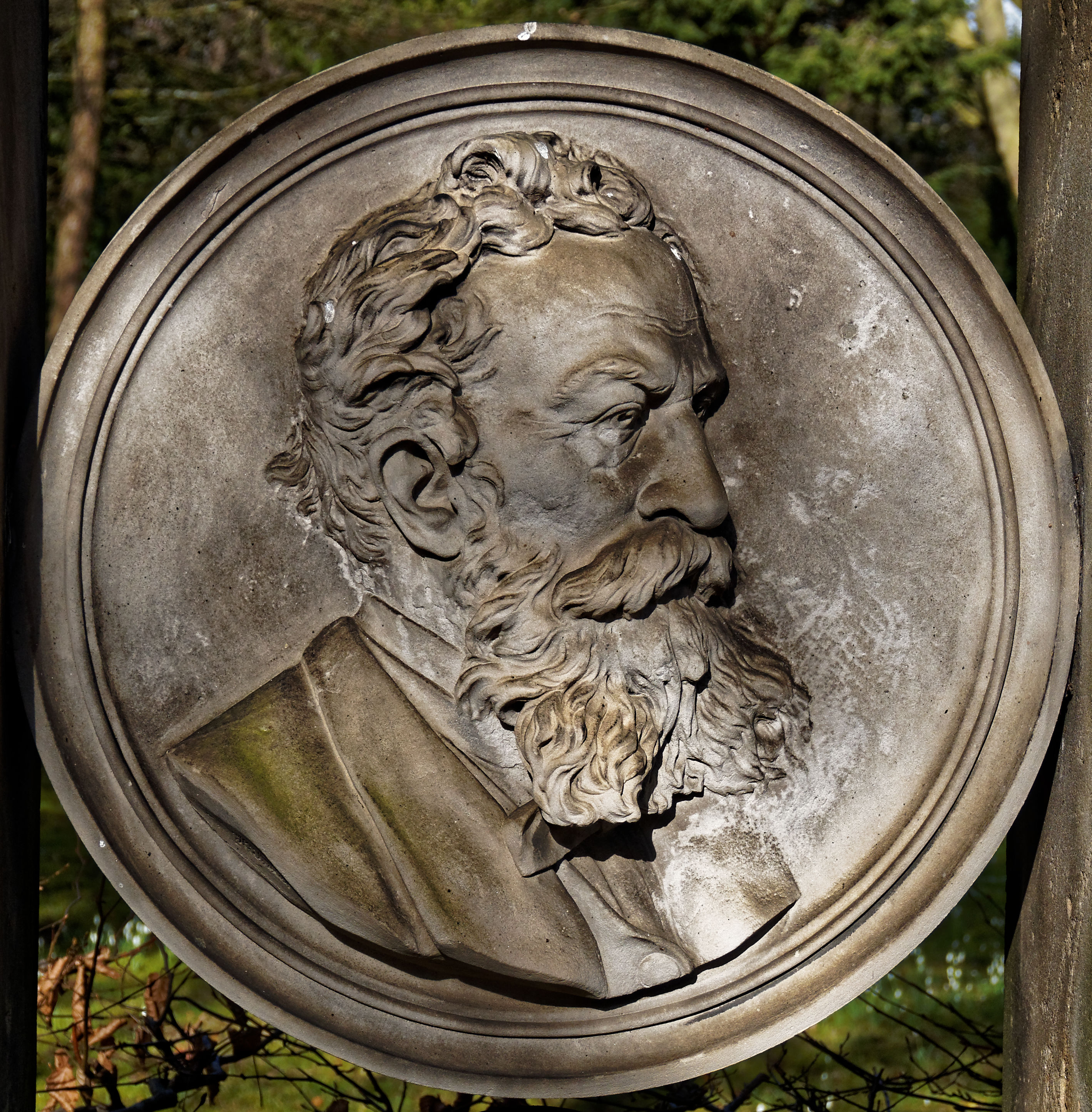
Wilhelm Ripe (16 November 1818 – 5 December 1885) was a German painter and graphic designer. Ripe was born in Hahnenklee in 1818. His contributions were during the era of Romanticism. He died in Goslar Goslar (; Eastphalian: ''Goslär'') is a historic town A town is a human settlement. Towns are generally larger than villages and smaller than city, cities, though the criteria to distinguish between them vary considerably in different p ... in 1885. References * Griep, H.G.; Hahnemann, H., and Ullirch, H. (1980). ''Wilhelm Ripe 1818–1885. Ausstellung''. Goslar: Goslar Museumsver. 19th-century German painters 19th-century German male artists German male painters German graphic designers 1818 births 1885 deaths People from Goslar {{Germany-painter-stub ... [...More Info...] [...Related Items...] OR: [Wikipedia] [Google] [Baidu] |
Hans-Georg Wenzel
Hans-Georg Wenzel (3 February, 1945 – 11 November, 1999), also known as George Wenzel, was a German geodesist, geophysicist and university lecturer. His most important field of work was physical geodesy, where he worked after his dissertation on earth tides with geophysical measurements up to global models of the earth gravity field. Life and career Hans-Georg Wenzel was born on 3 February 1945 in Hahnenklee-Bockswiese. From 1962 to 1964 Wenzel trained as a surveying technician. Until 1967 he studied surveying at the Staatliche Ingenieurschule für Bauwesen in Essen and at the Technische Hochschule Hannover, which he graduated in 1972 with a Dipl.-Ing. degree. He then worked at the Institute for Geodesy at Leibniz University Hannover, first as a scientific assistant, later as a scientific assistant, chief engineer and finally as an academic councilor. In 1985 he habilitated with his thesis ''Hochauflösende Kugelfunktionsmodelle für das Gravitationspotential der Erde'' ('' ... [...More Info...] [...Related Items...] OR: [Wikipedia] [Google] [Baidu] |
Borough
A borough is an administrative division in various English-speaking countries. In principle, the term ''borough'' designates a self-governing walled town, although in practice, official use of the term varies widely. History In the Middle Ages, boroughs were settlements in England that were granted some self-government; burghs were the Scottish equivalent. In medieval England, boroughs were also entitled to elect members of parliament. The use of the word ''borough'' probably derives from the burghal system of Alfred the Great. Alfred set up a system of defensive strong points ( Burhs); in order to maintain these particular settlements, he granted them a degree of autonomy. After the Norman Conquest, when certain towns were granted self-governance, the concept of the burh/borough seems to have been reused to mean a self-governing settlement. The concept of the borough has been used repeatedly (and often differently) throughout the world. Often, a borough is a single to ... [...More Info...] [...Related Items...] OR: [Wikipedia] [Google] [Baidu] |
Lower Saxony
Lower Saxony (german: Niedersachsen ; nds, Neddersassen; stq, Läichsaksen) is a German state (') in northwestern Germany. It is the second-largest state by land area, with , and fourth-largest in population (8 million in 2021) among the 16 ' federated as the Federal Republic of Germany. In rural areas, Northern Low Saxon and Saterland Frisian language, Saterland Frisian are still spoken, albeit in declining numbers. Lower Saxony borders on (from north and clockwise) the North Sea, the states of Schleswig-Holstein, Hamburg, , Brandenburg, Saxony-Anhalt, Thuringia, Hesse and North Rhine-Westphalia, and the Netherlands. Furthermore, the Bremen (state), state of Bremen forms two enclaves within Lower Saxony, one being the city of Bremen, the other its seaport, Bremerhaven (which is a semi-enclave, as it has a coastline). Lower Saxony thus borders more neighbours than any other single '. The state's largest cities are state capital Hanover, Braunschweig (Brunswick), Lüneburg, ... [...More Info...] [...Related Items...] OR: [Wikipedia] [Google] [Baidu] |
Osterode Am Harz
Osterode am Harz, often simply called Osterode (; Eastphalian: ''Ostroe''), is a town in south-eastern Niedersachsen on the south-western edge of the Harz mountains. It was the seat of government of the district of Osterode. Osterode is located on the German Timber-Frame Road. Geography Water The Söse river flows through the town from the Söse Dam lake about 5 km upstream. The dam was built in 1931 and has a capacity of 25.5 million m³. The Harzwasserwerke water company pipes drinking water as far away as Bremen. Districts The following districts (mainly surrounding villages) are part of the borough of Osterode am Harz, with populations in brackets (as of 1 July 2012): * Dorste (1,650) * Düna (140) * Förste (2,000) * Freiheit (2,100) * Kazenstein (1,200) * Lasfelde (1,300) * Lerbach (1,000) * Marke (150) * Nienstedt am Harz (440) * Osterode am Harz (11,500) * Petershütte (800) * Riefensbeek-Kamschlacken (350) * Schwiegershausen (1,800) * Ührde (100) ... [...More Info...] [...Related Items...] OR: [Wikipedia] [Google] [Baidu] |


.jpg)


