|
Gemgema 3
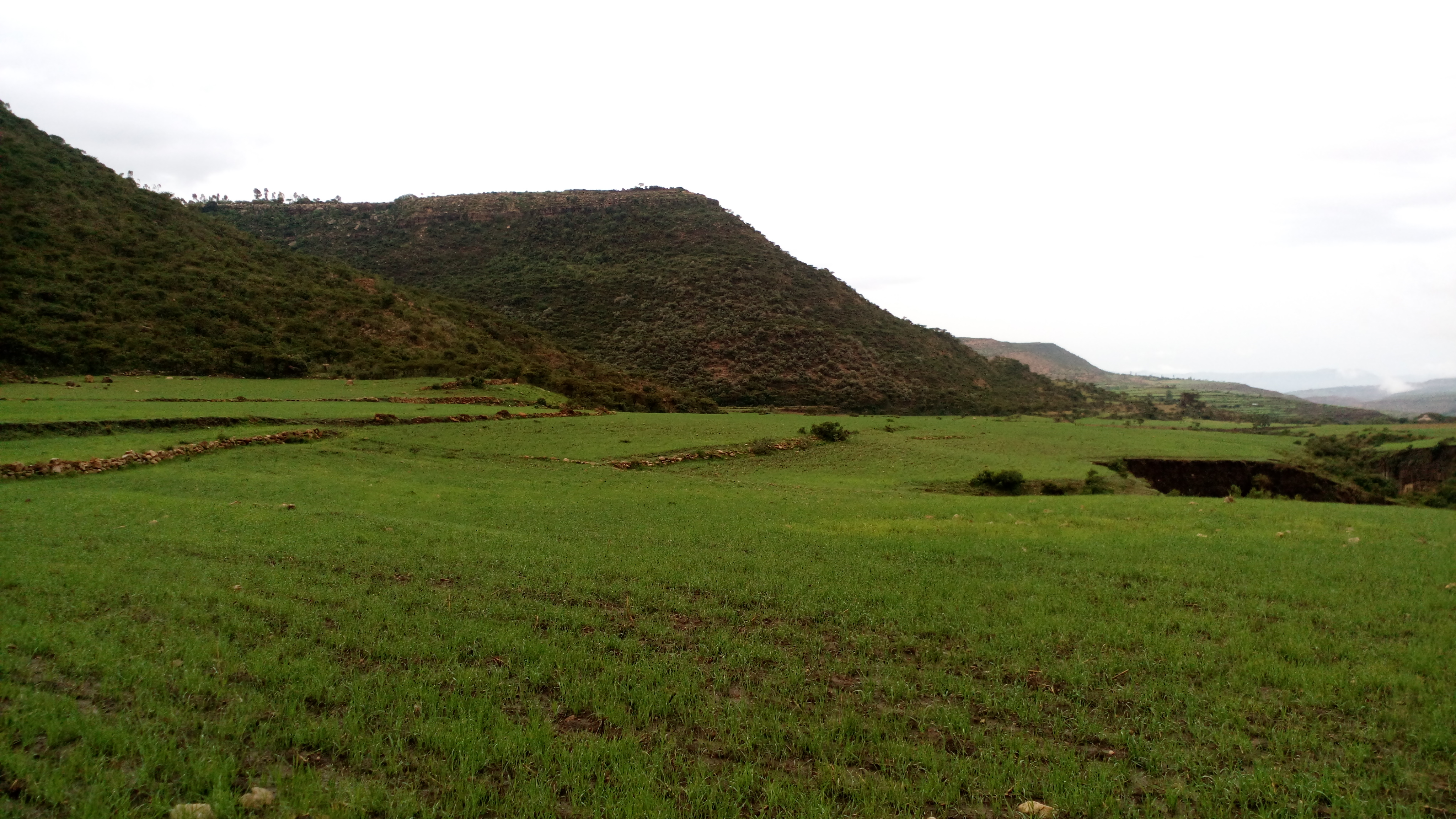
Gemgema is an exclosure located in the Dogu'a Tembien ''woreda'' of the Tigray Region in Ethiopia. The area has been protected since 1992 by the local community. Timeline * 1992: established as exclosure by the community * 2017: support by the EthioTrees project Environmental characteristics * Area: 92 ha * Average slope gradient: 59% * Aspect: the exclosure is oriented towards the west * Minimum altitude: 2124 metres * Maximum altitude: 2288 metres * Lithology: Antalo Limestone Management As a general rule, cattle ranging and wood harvesting are not allowed. The grasses are harvested once yearly and taken to the homesteads of the village to feed livestock. Physical soil and water conservation has been implemented to enhance infiltration, and vegetation growth. There are five guards to protect the exclosure. Field observations showed that however some illegal grazing occurred in the exclosure in 2018. Benefits for the community Setting aside such areas fits with the l ... [...More Info...] [...Related Items...] OR: [Wikipedia] [Google] [Baidu] |
Ayninbirkekin
Ayninbirkekin is a ''tabia'' or municipality in the Dogu'a Tembien district of the Tigray Region of Ethiopia. Literal meaning of Ayninbirkekin in Tigrinya is "We will not bend". The ''tabia'' centre is in Halah village, located approximately 8 km to the east of the ''woreda'' town Hagere Selam. Main town is Ala'isa, situated on the ridge overseeing the Giba valley. Geography The ''tabia'' is located astride a main water divide (that is followed by the main road) and stretches down towards May Zegzeg river at the south and upper Tsaliet River at the north. Three highest places (at around 2600 m a.s.l.) are Meri’a Ziban in the west, Imba Ra’isot in the centre and the escarpment to Arebay at the north. The lowest places are the confluence of May Zegzeg and May Be’ati Rivers (1970 m a.s.l.) in the south and in the north May Leiba River near Iyesus church (2240 m a.s.l.). Geology From the higher to the lower locations, the following geological form ... [...More Info...] [...Related Items...] OR: [Wikipedia] [Google] [Baidu] |
Honey
Honey is a sweet and viscous substance made by several bees, the best-known of which are honey bees. Honey is made and stored to nourish bee colonies. Bees produce honey by gathering and then refining the sugary secretions of plants (primarily floral nectar) or the secretions of other insects, like the honeydew of aphids. This refinement takes place both within individual bees, through regurgitation and enzymatic activity, as well as during storage in the hive, through water evaporation that concentrates the honey's sugars until it is thick and viscous. Honey bees stockpile honey in the hive. Within the hive is a structure made from wax called honeycomb. The honeycomb is made up of hundreds or thousands of hexagonal cells, into which the bees regurgitate honey for storage. Other honey-producing species of bee store the substance in different structures, such as the pots made of wax and resin used by the stingless bee. Honey for human consumption is collected from ... [...More Info...] [...Related Items...] OR: [Wikipedia] [Google] [Baidu] |
Carbon Finance
Carbon finance is a branch of environmental finance that covers financial tools such as carbon emission trading to reduce the impact of greenhouse gases (GHG) on the environment by giving carbon emissions a price. Financial risks and opportunities impact corporate balance sheets, and market-based instruments are capable of transferring environmental risk and achieving environmental objectives. Issues regarding climate change and GHG emissions must be addressed as part of strategic management decision-making. The general term is applied to investments in GHG emission reduction projects and the creation (origination) of financial instruments that are tradeable on the carbon market. History The market for the purchase of carbon has grown exponentially since its conception in 1996. The following is the estimated size of the worldwide carbon market according to the World Bank: Volume (millions metric tonnes, MtCO2) * 2005: 718 (330 in Main Allowances Markets & 388 in Project ... [...More Info...] [...Related Items...] OR: [Wikipedia] [Google] [Baidu] |
Emissions Reduction
Air pollution is the contamination of air due to the presence of substances in the atmosphere that are harmful to the health of humans and other living beings, or cause damage to the climate or to materials. There are many different types of air pollutants, such as gases (including ammonia, carbon monoxide, sulfur dioxide, nitrous oxides, methane, carbon dioxide and chlorofluorocarbons), particulates (both organic and inorganic), and biological molecules. Air pollution can cause diseases, allergies, and even death to humans; it can also cause harm to other living organisms such as animals and food crops, and may damage the natural environment (for example, climate change, ozone depletion or habitat degradation) or built environment (for example, acid rain). Air pollution can be caused by both human activities and natural phenomena. Air pollution is a significant risk factor for a number of pollution-related diseases, including respiratory infections, heart disease, CO ... [...More Info...] [...Related Items...] OR: [Wikipedia] [Google] [Baidu] |
Greenhouse Gas Emissions
Greenhouse gas emissions from human activities strengthen the greenhouse effect, contributing to climate change. Most is carbon dioxide from burning fossil fuels: coal, oil, and natural gas. The largest emitters include coal in China and large oil and gas companies, many state-owned by OPEC and Russia. Human-caused emissions have increased atmospheric carbon dioxide by about 50% over pre-industrial levels. The growing levels of emissions have varied, but it was consistent among all greenhouse gases (GHG). Emissions in the 2010s averaged 56 billion tons a year, higher than ever before. Electricity generation and transport are major emitters; the largest single source, according to the United States Environmental Protection Agency, is transportation, accounting for 27% of all USA greenhouse gas emissions. Deforestation and other changes in land use also emit carbon dioxide and methane. The largest source of anthropogenic methane emissions is agriculture, closely follow ... [...More Info...] [...Related Items...] OR: [Wikipedia] [Google] [Baidu] |
Environmental Conservation
*Environmental protection Environmental protection is the practice of protecting the natural environment by individuals, organizations and governments. Its objectives are to conserve natural resources and the existing natural environment and, where possible, to repair da ... * Nature conservation {{disambiguation ... [...More Info...] [...Related Items...] OR: [Wikipedia] [Google] [Baidu] |
Land Management
Land management is the process of managing the use and development (in both urban and rural settings, but it is mostly managed in Urban places.) of land resources. Land resources are used for a variety of purposes which may include organic agriculture, reforestation, water resource management and eco-tourism projects. Land management can have positive or negative effects on the terrestrial ecosystems. Land being over- or misused can degrade and reduce productivity and disrupt natural equilibriums. See also * Conservation grazing * Environmental management scheme * Habitat conservation * Holistic management * Land change science * Land registration * Sustainable agriculture *Wildlife management References Further reading * Dale P.D. and McLaughlin, J.D. 1988. ''Land Information Management'', Clarendon Press: Oxford. * Larsson G. 2010. ''Land Management as Public Policy'', University Press of America. . * United Nations Department of Economic and Social Affairs A ... [...More Info...] [...Related Items...] OR: [Wikipedia] [Google] [Baidu] |
1992 Establishments In Ethiopia
Year 199 ( CXCIX) was a common year starting on Monday (link will display the full calendar) of the Julian calendar. At the time, it was sometimes known as year 952 ''Ab urbe condita''. The denomination 199 for this year has been used since the early medieval period, when the Anno Domini calendar era became the prevalent method in Europe for naming years. Events By place Roman Empire * Mesopotamia is partitioned into two Roman provinces divided by the Euphrates, Mesopotamia and Osroene. * Emperor Septimius Severus lays siege to the city-state Hatra in Central-Mesopotamia, but fails to capture the city despite breaching the walls. * Two new legions, I Parthica and III Parthica, are formed as a permanent garrison. China * Battle of Yijing: Chinese warlord Yuan Shao defeats Gongsun Zan. Korea * Geodeung succeeds Suro of Geumgwan Gaya, as king of the Korean kingdom of Gaya (traditional date). By topic Religion * Pope Zephyrinus succeeds Pope Victor I, as ... [...More Info...] [...Related Items...] OR: [Wikipedia] [Google] [Baidu] |
Carbon Offset
A carbon offset is a reduction or removal of emissions of carbon dioxide or other greenhouse gases made in order to compensate for emissions made elsewhere. Offsets are measured in tonnes of carbon dioxide-equivalent (CO2e). One ton of carbon offset represents the reduction or removal of one ton of carbon dioxide or its equivalent in other greenhouse gases. One of the hidden dangers of climate change policy is unequal prices of carbon in the economy, which can cause economic collateral damage if production flows to regions or industries that have a lower price of carbon—unless carbon can be purchased from that area, which offsets effectively permit, equalizing the price. Within the voluntary market, demand for carbon offset credits is generated by individuals, companies, organizations, and sub-national governments who purchase carbon offsets to mitigate their greenhouse gas emissions to meet carbon neutral, net-zero or other established emission reduction goals. The volun ... [...More Info...] [...Related Items...] OR: [Wikipedia] [Google] [Baidu] |
Ground Water
Groundwater is the water present beneath Earth's surface in rock and soil pore spaces and in the fractures of rock formations. About 30 percent of all readily available freshwater in the world is groundwater. A unit of rock or an unconsolidated deposit is called an aquifer when it can yield a usable quantity of water. The depth at which soil pore spaces or fractures and voids in rock become completely saturated with water is called the water table. Groundwater is recharged from the surface; it may discharge from the surface naturally at springs and seeps, and can form oases or wetlands. Groundwater is also often withdrawn for agricultural, municipal, and industrial use by constructing and operating extraction wells. The study of the distribution and movement of groundwater is hydrogeology, also called groundwater hydrology. Typically, groundwater is thought of as water flowing through shallow aquifers, but, in the technical sense, it can also contain soil moisture, permafr ... [...More Info...] [...Related Items...] OR: [Wikipedia] [Google] [Baidu] |
Degua Tembien
Dogu'a Tembien (, "Upper Tembien", sometimes transliterated as Degua Tembien) is a woreda in Tigray Region, Ethiopia. It is named in part after the former province of Tembien. Nowadays, the mountainous district is part of the Southeastern Tigray Zone. The administrative centre of this woreda is Hagere Selam. History Dogu’a Tembien holds numerous prehistoric sites, which have been dated to the Middle Stone Age in Ayninbirkekin, or Pastoral Neolithic in Aregen and Menachek. Geography Topography and landscapes Major mountains :* Tsatsen, 2815 metres, a wide mesa between Hagere Selam and Inda Maryam Qorar () :* Ekli Imba, 2799 metres, summit of the Arebay massif in Arebay ''tabia'' or district () :* Imba Zuw’ala, 2710 metres, near Hagere Selam () :* Aregen, 2660 metres, in Aregen ''tabia'' () :* Dabba Selama, 2630 metres, in Haddinnet ''tabia'' () (not to be confused with the homonymous monastery) :* Imba Dogu’a, 2610 metres, in Mizane Birhan ''tabia'' () :* I ... [...More Info...] [...Related Items...] OR: [Wikipedia] [Google] [Baidu] |

.jpg)


