|
Gadhda
Gadhada is a town and a municipality in Botad District in the state of Gujarat, India. Gadhada is situated at bank of River Ghela. Swaminarayan lived here for more than 25 years. Geography Gadhada is located at . It has an average elevation of 104 metres (341 feet). Demographics India census, Gadhada had a population of 26,751. Males constitute 52% of the population and females 48%. Gadhada has an average literacy rate of 62%, higher than the national average of 59.5%: male literacy is 70%, and female literacy is 54%. In Gadhada, 16% of the population were under 6 years of age. Transport Gadhada is well connected by roads to the cities of Gujarat. Regular bus service and private vehicles are available from Ahmedabad and other big cities of Gujarat. There's no rail track passing through the town. To reach Gadhada by train, you may get down at Botad or Ningala in Ahmedabad - Bhavnagar track. Connecting bus service to Gadhada is available from both these station ... [...More Info...] [...Related Items...] OR: [Wikipedia] [Google] [Baidu] |
Botad District
Botad District is a district in the state of Gujarat, India. Botad District was formed on August 15, 2013 from the southwestern section of Ahmedabad District and the northwestern part of Bhavnagar District. Erstwhile, it was part of Bhavnagar District. Botad District is surrounded by Surendranagar District to the northeast, Rajkot District to the west, Bhavnagar District and Amreli District to the south and Ahmedabad District to the East. Botad district consist of four talukas: * Botad * Gadhada * Barwala * Ranpur Botad city is the administrative headquarters of the district. This district is bordered by Surendranagar District to the north and northwest, Amreli District to the southwest, Ahmedabad District to the northeast, and Rajkot District to the west. The Sukhbhadar River flows at the northern border of Botad district in Ranpur taluka. The Kalubhar River flows in southern part of Botad district in Gadhada taluka. The district is situated between 71E latitude a ... [...More Info...] [...Related Items...] OR: [Wikipedia] [Google] [Baidu] |
States And Territories Of India
India is a federalism, federal union comprising 28 federated state, states and 8 union territory, union territories, for a total of 36 subnational entities. The states and union territories are further subdivided into 800 List of districts in India, districts and smaller administrative divisions of India, administrative divisions by the respective subnational government. The states of India are self-governing administrative divisions, each having a State governments of India, state government. The governing powers of the states are shared between the state government and the Government of India, union government. On the other hand, the union territories are directly governed by the union government. History 1876–1919 The British Raj was a very complex political entity consisting of various imperial divisions and states and territories of varying autonomy. At the time of its establishment in 1876, it was made up of 584 princely state, constituent states and the prov ... [...More Info...] [...Related Items...] OR: [Wikipedia] [Google] [Baidu] |
Swaminarayan
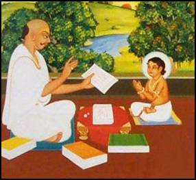
Swaminarayan (IAST: '; 3 April 1781 – 1 June 1830), also known as Sahajanand Swami, was a yogi and Asceticism, ascetic believed by followers to be a manifestation of Krishna or the highest Theophany, manifestation of Purushottama, around whom the Swaminarayan Sampradaya developed. In 1800, he was initiated into the ''Uddhava'' ''sampradaya'' by his guru, Swami Ramanand, and was given the name Sahajanand Swami. Despite opposition, in 1802, Ramanand handed over the leadership of the Uddhava Sampradaya to him before his death. According to the Swaminarayan tradition, Sahajanand Swami became known as Swaminarayan, and the Uddhava Sampradaya became known as the Swaminarayan Sampradaya, after a gathering in which he taught the Swaminarayan Mantra to his followers. He emphasized "moral, personal, and social betterment," and ''ahimsa''. He is also remembered within the sect for undertaking reforms for women and the poor, and performing large-scale non-violent yajna, yajñas (fire s ... [...More Info...] [...Related Items...] OR: [Wikipedia] [Google] [Baidu] |
Shri Swaminarayan Mandir, Gadhada
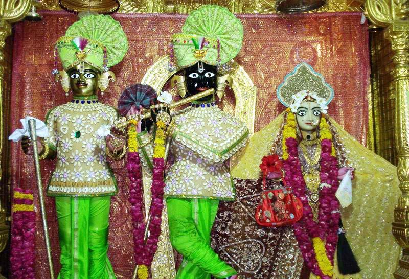
Swaminarayan Mandir, Gadhada (Devnagari: श्री स्वामिनारायण मन्दिर, गढडा), also known as Gopinathji Dev mandir, is a Hindu temple in Gadhada, Gujarat, India. This Swaminarayan Sampradaya temple is one of the six temples built by the sect's founder Swaminarayan. The temple is dedicated to Radha Krishna. About Gopinathji Mandir This temple is one of six temples which was made under the supervision of Swaminarayan, the founder of Swaminarayan Sampradaya. The land for constructing this temple in Gadhada, was donated by the court of Dada Khachar in Gadhada. Dada Khachar and his family were devotees of Swaminarayan. The temple was made in the courtyard of his own residence. The temple work was planned and executed directly under the consultation and guidance of Swaminarayan. Swaminarayan supervised the construction and also helped with the manual service in the construction of the temple, by lifting stones and mortar. This shrine h ... [...More Info...] [...Related Items...] OR: [Wikipedia] [Google] [Baidu] |
Bhavnagar
Bhavnagar is a city and the headquarters of Bhavnagar district in the Indian state of Gujarat. It was founded in 1723 by Bhavsinhji Gohil. It was the capital of Bhavnagar State, which was a princely state before it was merged into the Dominion of India, Indian Union in February 1948. Bhavnagar is situated 190 kilometres away from the state capital Gandhinagar and to the west of the Gulf of Khambhat. It has always been an important city for trade with many large and small scale industries along with the world's largest ship breaking yard, Alang which is located 50 kilometres away. Bhavnagar is also famous for its version of the popular Gujarati snack 'Ganthiya' and 'Jalebi'. History The Gahlot, Gohil Rajputs, Rajput of the Suryavansha, Suryavanshi clan faced severe competition in Marwar. Around 1260 AD, they moved down to the Gujarat's coastal area and established three capitals: Sejakpur (now Ranpur, Gujarat, Ranpur), Umrala, and Sihor. Sejakpur was founded in 1194. In 172 ... [...More Info...] [...Related Items...] OR: [Wikipedia] [Google] [Baidu] |
Ahmedabad
Ahmedabad ( ), also spelled Amdavad (), is the most populous city in the Indian state of Gujarat. It is the administrative headquarters of the Ahmedabad district and the seat of the Gujarat High Court. Ahmedabad's population of 5,570,585 (per the 2011 population census) makes it the fifth-most populous city in India, and the encompassing urban agglomeration population was estimated at 8,854,444 (as of 2024) is the seventh-most populous in India. Ahmedabad is located near the banks of the Sabarmati River, from the capital of Gujarat, Gandhinagar, also known as its twin city. Ahmedabad has emerged as an important economic and industrial hub in India. It is the second-largest producer of cotton in India, due to which it was known as the 'Manchester of India' along with Kanpur. Ahmedabad's stock exchange (before it was shut down in 2018) was the country's second oldest. Cricket is a popular sport in Ahmedabad; a newly built stadium, called Narendra Modi Stadium, at Mote ... [...More Info...] [...Related Items...] OR: [Wikipedia] [Google] [Baidu] |
Botad
Botad, located in Gujarat's Saurashtra (region), is a significant city and district headquarters of the Botad district. Established as a separate district in 2013, Botad has developed into a key administrative and economic hub, connecting nearby towns and fostering growth across the region. It is about from Bhavnagar and from Ahmedabad by road distance. Geography Botad is situated at a confluence of streams which unite to form a small river, Utavali. In the Gujarati language, Gujarati language, it is known as Gatar. Botad is surrounded by low hills on the east and west, forming a valley. Utavali Creek flows through the town, and Madhu Creek joins the Utavali river near Ten Drains. The town is a gateway to Kathiawad (toward Gadhada, Lathi, Gujarat, Lathi and Amreli), and a crossroads of Gohilwar, Gohilwad (towards Bhavnagar), Surendranagar district, Jhalawad (Limbdi, Surendranagar) and Panchal (towards Paliyad, Vinchiya, Jasdan). Demographics According to the 2011 Indian ce ... [...More Info...] [...Related Items...] OR: [Wikipedia] [Google] [Baidu] |
Census
A census (from Latin ''censere'', 'to assess') is the procedure of systematically acquiring, recording, and calculating population information about the members of a given Statistical population, population, usually displayed in the form of statistics. This term is used mostly in connection with Population and housing censuses by country, national population and housing censuses; other common censuses include Census of agriculture, censuses of agriculture, traditional culture, business, supplies, and traffic censuses. The United Nations (UN) defines the essential features of population and housing censuses as "individual enumeration, universality within a defined territory, simultaneity and defined periodicity", and recommends that population censuses be taken at least every ten years. UN recommendations also cover census topics to be collected, official definitions, classifications, and other useful information to coordinate international practices. The United Nations, UN's Food ... [...More Info...] [...Related Items...] OR: [Wikipedia] [Google] [Baidu] |
Elevation
The elevation of a geographic location (geography), ''location'' is its height above or below a fixed reference point, most commonly a reference geoid, a mathematical model of the Earth's sea level as an equipotential gravitational equipotential surface, surface (see Geodetic datum#Vertical datum, Geodetic datum § Vertical datum). The term ''elevation'' is mainly used when referring to points on the Earth's surface, while ''altitude'' or ''geopotential height'' is used for points above the surface, such as an aircraft in flight or a spacecraft in orbit, and ''three-dimensional space, depth'' is used for points below the surface. Elevation is not to be confused with the distance from the center of the Earth. Due to the equatorial bulge, the summits of Mount Everest and Chimborazo (volcano), Chimborazo have, respectively, the largest elevation and the largest ECEF, geocentric distance. Aviation In aviation, the term ''elevation'' or ''aerodrome elevation'' is defined by the IC ... [...More Info...] [...Related Items...] OR: [Wikipedia] [Google] [Baidu] |
India
India, officially the Republic of India, is a country in South Asia. It is the List of countries and dependencies by area, seventh-largest country by area; the List of countries by population (United Nations), most populous country since 2023; and, since its independence in 1947, the world's most populous democracy. Bounded by the Indian Ocean on the south, the Arabian Sea on the southwest, and the Bay of Bengal on the southeast, it shares land borders with Pakistan to the west; China, Nepal, and Bhutan to the north; and Bangladesh and Myanmar to the east. In the Indian Ocean, India is near Sri Lanka and the Maldives; its Andaman and Nicobar Islands share a maritime border with Thailand, Myanmar, and Indonesia. Modern humans arrived on the Indian subcontinent from Africa no later than 55,000 years ago., "Y-Chromosome and Mt-DNA data support the colonization of South Asia by modern humans originating in Africa. ... Coalescence dates for most non-European populations averag ... [...More Info...] [...Related Items...] OR: [Wikipedia] [Google] [Baidu] |
River Ghela
The River Ghela is a river that runs through the town of Gadhada in the Indian state of Gujarat. The Ghela river originates from the Jasdan hills, near Fulzar village in the Jasdan district and flows into the Arabian sea. Its length is 118 km and its catchment area is 622 km2. The Ghelo Somnath Dam and the Ghelo Itaria Dam are situated on this river having 60 km2 and 104 km2 catchment area respectively. This river was heavily visited by Swaminarayan and is considered to be one of the holiest rivers by the Swaminarayan Sampradya. The Swaminarayan Gopinathdev Mandir and the BAPS Swaminarayan Mandir are both located near this river. See also * Shri Swaminarayan Mandir, Gadhada Swaminarayan Mandir, Gadhada (Devnagari: श्री स्वामिनारायण मन्दिर, गढडा), also known as Gopinathji Dev mandir, is a Hindu temple in Gadhada, Gujarat, India. This Swaminarayan Sampradaya temple ... References Riversflowing through ... [...More Info...] [...Related Items...] OR: [Wikipedia] [Google] [Baidu] |


