|
Botad District
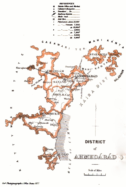
Botad District is a district in the state of Gujarat, India. Botad District was formed on August 15, 2013 from the southwestern section of Ahmedabad District and the northwestern part of Bhavnagar District. Erstwhile, it was part of Bhavnagar District. Botad District is surrounded by Surendranagar District to the northeast, Rajkot District to the west, Bhavnagar District and Amreli District to the south and Ahmedabad District to the East. Botad district consist of four talukas: * Botad * Gadhada * Barwala * Ranpur Botad city is the administrative headquarters of the district. This district is bordered by Surendranagar District to the north and northwest, Amreli District to the southwest, Ahmedabad District to the northeast, and Rajkot District to the west. The Sukhbhadar River flows at the northern border of Botad district in Ranpur taluka. The Kalubhar River flows in southern part of Botad district in Gadhada taluka. The district is situated between 71E latitude a ... [...More Info...] [...Related Items...] OR: [Wikipedia] [Google] [Baidu] |
List Of Districts Of Gujarat
The western Indian state of Gujarat has 34 districts of India, districts after several splits of the original 17 districts at the formation of the state in 1960. Kutch is the largest district of Gujarat while Dang is the smallest. Ahmedabad is the most populated district while Dang is the least. There are 252 Talukas (subdivisions of districts) in Gujarat. History 1960 Gujarat state was created on 1 May 1960, out of the 17 northern districts of Bombay State when that was split on a linguistic basis (also creating Marathi language, Marathi speaking Maharashtra). They are as follow : Ahmedabad district, Ahmedabad, Amreli district, Amreli, Banaskantha district, Banaskantha, Bharuch district, Bharuch, Bhavnagar district, Bhavnagar, Dang District, India, Dang, Jamnagar district, Jamnagar, Junagadh district, Junagadh, Kheda district, Kheda, Kutch District, Kachchh, Mehsana district, Mehsana, Panchmahal district, Panchmahal, Rajkot district, Rajkot, Sabarkantha district, Sabarkan ... [...More Info...] [...Related Items...] OR: [Wikipedia] [Google] [Baidu] |
Census Of India
The decennial census of India has been conducted 15 times, as of 2011. While it has been undertaken every 10 years, beginning in 1872 under Viceroy Lord Mayo, the first complete census was taken in 1872. Post 1949, it has been conducted by the Registrar General and Census Commissioner of India under the Ministry of Home Affairs, Government of India The Government of India (ISO 15919, ISO: Bhārata Sarakāra, legally the Union Government or Union of India or the Central Government) is the national authority of the Republic of India, located in South Asia, consisting of States and union t .... All the censuses since 1951 were conducted under the 1948 Census of India Act, which predates the Constitution of India. The 1948 Census of India Act does not bind the Union Government to conduct the census on a particular date or to release its data in a notified period. The last census was held in 2011, whilst the next was to be held in 2021 before it was postponed due to the COVID ... [...More Info...] [...Related Items...] OR: [Wikipedia] [Google] [Baidu] |
Gadhda
Gadhada is a town and a municipality in Botad District in the state of Gujarat, India. Gadhada is situated at bank of River Ghela. Swaminarayan lived here for more than 25 years. Geography Gadhada is located at . It has an average elevation of 104 metres (341 feet). Demographics India census, Gadhada had a population of 26,751. Males constitute 52% of the population and females 48%. Gadhada has an average literacy rate of 62%, higher than the national average of 59.5%: male literacy is 70%, and female literacy is 54%. In Gadhada, 16% of the population were under 6 years of age. Transport Gadhada is well connected by roads to the cities of Gujarat. Regular bus service and private vehicles are available from Ahmedabad and other big cities of Gujarat. There's no rail track passing through the town. To reach Gadhada by train, you may get down at Botad or Ningala in Ahmedabad - Bhavnagar track. Connecting bus service to Gadhada is available from both these station ... [...More Info...] [...Related Items...] OR: [Wikipedia] [Google] [Baidu] |
Ahmedabad District
Ahmedabad (Amdavad) district is a district comprises the city of Ahmedabad, in the central part of the state of Gujarat in western India. It is the seventh most populous district in India (out of 739). Ahmedabad District Surrounded By Kheda district in the east, Mehsana district in the north, Anand district in the south and Surendranagar district in the west. Etymology The area around Ahmedabad has been inhabited since the 11th century, when it was known as '' Ashaval''. At that time, Karna, the Chaulukya (Solanki) ruler of Anhilwara (modern Patan), waged a successful war against the Bhil king of Ashaval, and established a city called ''Karnavati'' on the banks of the Sabarmati. In 1411, this area came under the control of Muzaffar Shah I's grandson, Sultan Ahmed Shah, who selected the forested area along the banks of the Sabarmati river for a new capital city. He laid the foundation of a new walled city near Karnavati and named it Ahmedabad after himself. According to ... [...More Info...] [...Related Items...] OR: [Wikipedia] [Google] [Baidu] |
Narendra Modi
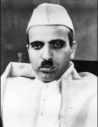
Narendra Damodardas Modi (born 17 September 1950) is an Indian politician who has served as the Prime Minister of India, prime minister of India since 2014. Modi was the chief minister of Gujarat from 2001 to 2014 and is the Member of Parliament, Lok Sabha, member of parliament (MP) for Varanasi (Lok Sabha constituency), Varanasi. He is a member of the Bharatiya Janata Party (BJP) and of the Rashtriya Swayamsevak Sangh (RSS), a right-wing politics, right-wing Hindutva paramilitary volunteer organisation. He is the longest-serving prime minister outside the Indian National Congress. Modi was born and raised in Vadnagar, Bombay State (present-day Gujarat), where he completed his secondary education. He was introduced to the RSS at the age of eight. Modi became a full-time worker for the RSS in Gujarat in 1971. The RSS assigned him to the BJP in 1985 and he rose through the party hierarchy, becoming general secretary in 1998. In 2001, Modi was appointed chief minister of Guja ... [...More Info...] [...Related Items...] OR: [Wikipedia] [Google] [Baidu] |
Chief Minister Of Gujarat
The chief minister of Gujarat is the head of government, chief executive of the government of the Indian state of Gujarat. The governor appoints the chief minister, whose Cabinet (government), council of ministers are Cabinet collective responsibility, collectively responsible to the assembly. The chief minister's term is for five years and is subject to no term limits, given that he has the confidence of the assembly. The state of Gujarat was created on 1 May 1960, composed of the Gujarati language, Gujarati-speaking districts of Bombay State following the Mahagujarat Movement. Jivraj Narayan Mehta of the Indian National Congress, INC was the inaugural chief minister. Narendra Modi of the BJP is the longest serving chief minister for twelve and a half years from 2001 to 2014. He resigned in 2014 to become the List of Prime Ministers of India, 14th prime minister of India. He was succeeded by Anandiben Patel who became the state's List of female Indian chief ministers, first wom ... [...More Info...] [...Related Items...] OR: [Wikipedia] [Google] [Baidu] |
Kalubhar River
Kalubhar River is a river on the Kathiawar peninsula in the western India state of Gujarat. Kalubhar river originates near Chamardi Village near Babra and meets Gulf of Khambhat The Gulf of Khambhat, also known as the Gulf of Cambay, is a bay on the Arabian Sea coast of India, bordering the state of Gujarat just north of Mumbai and Diu Island. The Gulf of Khambhat is about long, about wide in the north and up to wi .... Its length is 94 km. Kalubhar Dam is situated on this river having 667 km2. The total catchment area of the basin is . References Rivers of Gujarat {{India-river-stub ... [...More Info...] [...Related Items...] OR: [Wikipedia] [Google] [Baidu] |
Ranpur, Gujarat
Ranpur is a town located on the bank of the river Bhadar River, Bhadar in Botad district, Gujarat, India. Ranpur is little city of botad district. History Ranpur is said to have been founded, about the beginning of the fourteenth century, by Ranaji Gohil, a Rajput chieftain, the ancestor of the Bhavnagar State family. The forefathers of this Ranaji, who claimed descent from Western Satraps, Shalivahan (79 AD) were, in the thirteenth century, driven by the Rathors from their seat in Khed, Rajasthan, Khedgarh on the Luni River about ten miles from Balotra in Marwar. Retreating south under their chief Sejakji they took refuge with Raja Kalat, the Chudasama dynasty, Chudasma ruler of Junagadh. Raja Kalat treated the strangers with kindness, and calling it Sejakpur, settled Sejakji on the site of the present Ranpur in 1194. Ranaji, Sejakji's son, married the daughter of Dhanaji Mer koli patel Dhandhuka, and strengthening Sejakpur with a fort called it Ranpur. Mokhadaji Gohil, Ranaj ... [...More Info...] [...Related Items...] OR: [Wikipedia] [Google] [Baidu] |


