|
Fraser Lowland
The Fraser Lowland is a landform and physiographic region in the Pacific Northwest of North America, shared between the Canadian province of British Columbia and the U.S. state of Washington. The region includes much of the Lower Mainland region of British Columbia, and the coastal plains of Washington's Whatcom County. As a physiographic region, the Fraser Lowland is part of the Georgia Depression, which in turn is part of the Coastal Trough.''Landforms of British Columbia: A Physiographic Outline'', by S. Holland 1964 (revised 1976), British Columbia Ministry of Energy, Mines and Petroleum Resources The eponymous |
Lowland
Upland and lowland are conditional descriptions of a plain based on elevation above sea level. In studies of the ecology of freshwater rivers, habitats are classified as upland or lowland. Definitions Upland and lowland are portions of a plain that are conditionally categorized by their elevation above the sea level. Lowlands are usually no higher than , while uplands are somewhere around to . On unusual occasions, certain lowlands such as the Caspian Depression lie below sea level. Uplands areas tend to spike into valleys and mountains, forming mountain ranges while lowland areas tend to be uniformly flat, although both can vary such as the Mongolian Plateau. Upland habitats are cold, clear and rocky whose rivers are fast-flowing in mountainous areas; lowland habitats are warm with slow-flowing rivers found in relatively flat lowland areas, with water that is frequently colored by sediment and organic matter. These classifications overlap with the geological definitions ... [...More Info...] [...Related Items...] OR: [Wikipedia] [Google] [Baidu] |
Lower Mainland
The Lower Mainland is a geographic and cultural region of the mainland coast of British Columbia that generally comprises the regional districts of Metro Vancouver and the Fraser Valley. Home to approximately 3.05million people as of the 2021 Canadian census, the Lower Mainland contains sixteen of the province's 30 most populous municipalities and approximately 60% of the province's total population. The region was historically occupied by the Sto:lo, a Halkomelem-speaking people of the Coast Salish linguistic and cultural grouping. Boundaries Although the term ''Lower Mainland'' has been recorded from the earliest period of colonization in British Columbia, it has never been officially defined in legal terms. The term has historically been in popular usage for over a century to describe a region that extends from Horseshoe Bay south to the Canada–United States border and east to Hope at the eastern end of the Fraser Valley. This definition makes the term ''Lower Mainla ... [...More Info...] [...Related Items...] OR: [Wikipedia] [Google] [Baidu] |
Canada–United States Border
The international border between Canada and the United States is the longest in the world by total length. The boundary (including boundaries in the Great Lakes, Atlantic, and Pacific coasts) is long. The land border has two sections: Canada's border with the Northern Tier (United States), northern tier of the contiguous United States to its south, and with the U.S. state of Alaska to its west. The bi-national International Boundary Commission deals with matters relating to marking and maintaining the boundary, and the International Joint Commission deals with issues concerning boundary waters. The agencies responsible for facilitating legal passage through the international boundary are the Canada Border Services Agency (CBSA) and U.S. Customs and Border Protection (CBP). History 18th century The Treaty of Paris (1783), Treaty of Paris of 1783 ended the American Revolutionary War between Kingdom of Great Britain, Great Britain and the United States. In the second article o ... [...More Info...] [...Related Items...] OR: [Wikipedia] [Google] [Baidu] |
Nooksack River
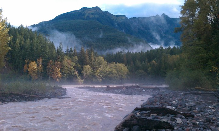
The Nooksack River is a river in western Whatcom County of the northwestern U.S. state of Washington (state), Washington, draining Nooksack Valley, extensive valley systems within the North Cascades around Mount Shuksan, Mount Baker and the Twin Sisters Mountain, Twin Sisters, and a portion of Fraser Lowland south of the Canada–United States border. The river ''proper'' begins with the confluence, merging of three main tributaries, namely the North Fork, Middle Fork and South Fork, near Deming, Washington, Deming. All three forks originate in the Mount Baker Wilderness, and the North Fork, the longest of the three, is sometimes considered the main river. The Nooksack is approximately in total length measuring from the North Fork headwaters. The lower Nooksack flows as a northerly loop through the fertile southern Fraser Lowland agricultural area before emptying into Bellingham Bay and, via the Strait of Juan de Fuca and the Strait of Georgia, communicating with the Pacific Oce ... [...More Info...] [...Related Items...] OR: [Wikipedia] [Google] [Baidu] |
River System
In geomorphology, drainage systems, also known as river systems, are the patterns formed by the streams, rivers, and lakes in a particular drainage basin. They are governed by the topography of land, whether a particular region is dominated by hard or soft rocks, and the gradient of the land. Geomorphologists and hydrologists often view streams as part of drainage basins (and sub-basins). This is the topographic region from which a stream receives runoff, throughflow, and its saturated equivalent, groundwater flow. The number, size, and shape of the drainage basins varies and the larger and more detailed the topographic map, the more information is available. Drainage patterns Per the lie of channels, drainage systems can fall into one of several categories, known as drainage patterns. These depend on the topography and geology of the land. All forms of transitions can occur between parallel, dendritic, and trellis patterns. Accordant versus discordant drainage patterns A dr ... [...More Info...] [...Related Items...] OR: [Wikipedia] [Google] [Baidu] |
Sumas River
The Sumas River is a river in the Fraser Lowland and a tributary of the Fraser River system, coursing across the international border between the Canadian province of British Columbia and the U.S. state of Washington. Course The Sumas River originates in the Sumas Mountain (American Sumas) in Whatcom County, Washington, with its tributary creeks draining the mountain's western and northern slopes. These headwaters confluence west of the mountain just north of Lawrence where the nearby Nooksack River exits the Nooksack Valley, and the resultant river then flows north first past Nooksack before coursing generally northeast past the town of Sumas (where it picks up Johnson Creek, the first of its only two left tributaries) and crosses the Canada–United States border. The Sumas River then runs further northeast, crosses the Trans-Canada Highway near Kilgard (where it picks up Marshall Creek, the second of its only two left tributaries) and reaches the southeastern side of ... [...More Info...] [...Related Items...] OR: [Wikipedia] [Google] [Baidu] |
Catchment
A drainage basin is an area of land in which all flowing surface water converges to a single point, such as a river mouth, or flows into another body of water, such as a lake or ocean. A basin is separated from adjacent basins by a perimeter, the drainage divide, made up of a succession of elevated features, such as ridges and hills. A basin may consist of smaller basins that merge at river confluences, forming a hierarchical pattern. Other terms for a drainage basin are catchment area, catchment basin, drainage area, river basin, water basin, and impluvium. In North America, they are commonly called a watershed, though in other English-speaking places, " watershed" is used only in its original sense, that of the drainage divide line. A drainage basin's boundaries are determined by watershed delineation, a common task in environmental engineering and science. In a closed drainage basin, or endorheic basin, rather than flowing to the ocean, water converges toward the interior ... [...More Info...] [...Related Items...] OR: [Wikipedia] [Google] [Baidu] |
Chilliwack River
Chilliwack ( ) is a city of about 100,000 people and in the Canadian province of British Columbia. It is located about east of the City of Vancouver in the Fraser Valley. The enumerated population is 93,203 in the city and 113,767 in the greater metropolitan area. About two-thirds of city land is protected as part of the Agricultural Land Reserve, and agriculture accounts for about 30 percent of the local economy. The city is bounded on the north side by the Fraser River, on the south side by the Vedder River and Canada–United States border, and is surrounded by tall mountain peaks, such as Mount Cheam and Slesse Mountain. Etymology In Halq'eméylem, the language of the Stó:lō communities around Chilliwack and Sardis, ''Tcil'Qe'uk'' means "valley of many streams". It also lends its name to the Chilliwack River, and group of aboriginal people, the ''Ts'elxwéyeqw'' (also spelt ''Ts'elxwíqw'' or ''Sts'elxwíqw''). The spelling of Chilliwack is sometimes a matt ... [...More Info...] [...Related Items...] OR: [Wikipedia] [Google] [Baidu] |
Vedder River
The Vedder River, called the Chilliwack River above Vedder Crossing, is a river in the Canadian province of British Columbia and the U.S. state of Washington. The name Chilliwack comes from the Halkomelem word ''Tcil'Qe'uk'', meaning "valley of many streams". Course Originating as the Chilliwack River in Washington's North Cascades National Park, the river begins at Hannegan Pass and flows north across the Canada–United States border and into Chilliwack Lake. The river flows through Hells Gorge, a deep, dangerous-to-access gorge just below the river's headwaters that is home of a waterfall that the river drops over. The river picks up the Little Chilliwack River before crossing the border. There is a large sandy beach located where the river enters the lake, a popular recreational area among locals, however access is now restricted and the south shores of Chilliwack Lake are protected as an ecological reserve. The river exits the north end of the lake and flows general ... [...More Info...] [...Related Items...] OR: [Wikipedia] [Google] [Baidu] |
Coquitlam River
The Coquitlam River (Help:IPA/English, /koʊˈkwɪtləm/ or Help:IPA/English, /kəˈkwɪtləm/) is a tributary of the Fraser River in the Provinces and territories of Canada, Canadian province of British Columbia. The river's name comes from the word Kʷikʷəƛ̓əm which translates to "Red fish up the river". The name is a reference to a sockeye salmon species that once occupied the river's waters. The river is an 18 km meandering river with 30 Tributary, tributaries and various morphological features. Owing to the size and area of its location, the river has a history of disastrous floods.G3 Consulting Ltd. (G3). 2016. COQMON#8 Lower Coquitlam River Substrate Quality Assessment (2012-2015). Prepared for BC Hydro and Power Authority by G3 Consulting Ltd., Surrey, BC. 26p + Appendices. The Kwikwetlem First Nation, Kwikwetlem first nations were the first humans to live in the area, followed by settlers thousands of years later. After settlers arrived the river would soon be al ... [...More Info...] [...Related Items...] OR: [Wikipedia] [Google] [Baidu] |
Pitt River
The Pitt River in British Columbia, Canada is a large tributary of the Fraser River, entering it a few miles upstream from New Westminster and about 25 km ESE of Downtown Vancouver. The river, which begins in the Garibaldi Ranges of the Coast Mountains, is in two sections above and below Pitt Lake and flows on a generally southernly course. Pitt Lake and the lower Pitt River are tidal in nature as the Fraser's mouth is only a few miles downstream from their confluence. The river was named for William Pitt the Younger. The first mention of the name, as "Pitts River", occurs in the 1827 journal kept by James McMillan of the Hudson's Bay Company. The river has an alternate name, Quoitle, which is probably equivalent to Kwantlen. East of the lower Pitt River, 20 km long, is the community of Pitt Meadows, while to its west are the cities of Coquitlam and Port Coquitlam; opposite its mouth is Surrey. Port Coquitlam and Pitt Meadows are connected by the Highway 7 bridges ... [...More Info...] [...Related Items...] OR: [Wikipedia] [Google] [Baidu] |
Tributaries
A tributary, or an ''affluent'', is a stream or river that flows into a larger stream ('' main stem'' or ''"parent"''), river, or a lake. A tributary does not flow directly into a sea or ocean. Tributaries, and the main stem river into which they flow, drain the surrounding drainage basin of its surface water and groundwater, leading the water out into an ocean, another river, or into an endorheic basin. The Irtysh is a chief tributary of the Ob river and is also the longest tributary river in the world with a length of . The Madeira River is the largest tributary river by volume in the world with an average discharge of . A confluence, where two or more bodies of water meet, usually refers to the joining of tributaries. The opposite to a tributary is a distributary, a river or stream that branches off from and flows away from the main stream. [...More Info...] [...Related Items...] OR: [Wikipedia] [Google] [Baidu] |


