|
Franklin Bay
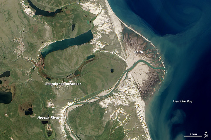
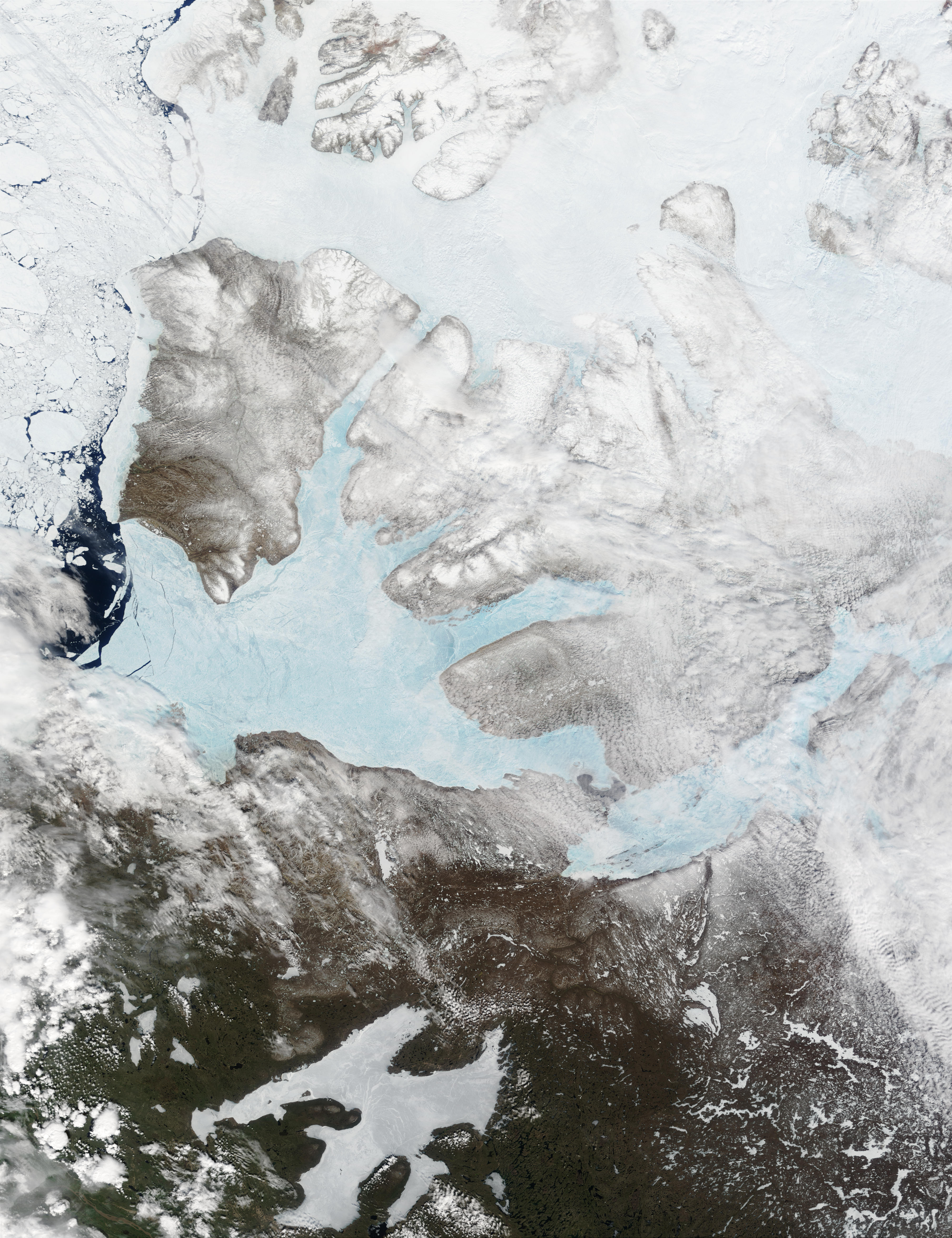
Franklin Bay is a large inlet in the Northwest Territories, Canada. It is a southern arm of the Amundsen Gulf, southeastern Beaufort Sea. The bay measures long, and wide at its mouth. The Parry Peninsula is to the east, and its southern area is called Langton Bay. Franklin Bay receives the Horton River. There are gales in the early winter months.Stefansson (1913), p. 233 Franklin Bay was named in honour of Arctic explorer Sir John Franklin by John Richardson in 1826. History Based on hearsay rather than exploration, Émile Petitot, a French Missionary Oblate and a notable Canadian northwest cartographer, ethnologist, and geographer charted the Hornaday River's mouth at Franklin Bay, instead of Darnley Bay in his flawed 1875 maps and account. Langton Bay was the base of operations for the three-year expedition, 1909 to 1912, of Arctic explorers Vilhjalmur Stefansson Vilhjalmur Stefansson (November 3, 1879 – August 26, 1962) was an Arctic explorer and ethnolog ... [...More Info...] [...Related Items...] OR: [Wikipedia] [Google] [Baidu] |
Horton River (Canada)
The Horton River is a river in Inuvik Region, Northwest Territories, Inuvik and Sahtu Region, Sahtu Regions, Northwest Territories and Kitikmeot Region, Nunavut, Kitikmeot Region, Nunavut, Canada. It is a tributary of the Beaufort Sea and hence part of the Arctic Ocean drainage basin. Only the first few kilometres from its source are within Nunavut. Course The river begins at a small lake about north of the northeast Dease Arm of Great Bear Lake. It passes through the Smoking Hills and reaches its mouth on the east side of Cape Bathurst at Franklin Bay on the Amundsen Gulf of the Beaufort Sea, where it forms a small River delta, delta, about northwest of the community of Paulatuk. The mouth had been further north at Harrowby Bay on the west side of Cape Bathurst until about 1800 when a meander eroded through. There is an Airport#Airstrip, airstrip just north of the mouth. DEW Line/NWS Located about north northwest of the rivers mouth, at , lies the Horton River Short Range ... [...More Info...] [...Related Items...] OR: [Wikipedia] [Google] [Baidu] |
Missionary Oblates Of Mary Immaculate
The Missionary Oblates of Mary Immaculate (OMI) is a missionary religious congregation in the Catholic Church. It was founded on January 25, 1816, by Eugène de Mazenod, a French priest later recognized as a Catholic saint. The congregation was given recognition by Pope Leo XII on February 17, 1826. , the congregation was composed of 3,631 priests and lay brothers usually living in community. Their traditional salutation is ('Praised be Jesus Christ'), to which the response is ('And Mary Immaculate'). Members use the post-nominal letters "OMI". As part of its mission to evangelize the "abandoned poor", OMI are known for their mission among the Indigenous peoples of Canada, and their historic administration of at least 57 schools within the Canadian Indian residential school system. Some of those schools have been associated with cases of child abuse by Oblate clergy and staff. Foundation The "Society of Missionaries of Provence" was founded on January 25, 1816, in Ai ... [...More Info...] [...Related Items...] OR: [Wikipedia] [Google] [Baidu] |
Rudolph Martin Anderson
Rudolph Martin Anderson (June 30, 1876 – June 21, 1961) was an American born Canadian zoologist and explorer. Early life He was born in Decorah, Iowa in 1876, the son of John E. A. Anderson. He received a Ph.D. from the University of Iowa in 1906; his dissertation was entitled, ''The birds of Iowa''. Military service He was a veteran of the Spanish–American War, serving as a corporal in the 52nd Iowa Volunteer Infantry. He served with the 54th Infantry National Guard of Iowa from 1900 to 1906. He was a captain with the National Guard of Missouri from 1906 to 1908. Civilian career Anderson participated in the Stefansson-Anderson Arctic Expedition which explored Alaska and the northern Yukon from 1908 to 1912 and was part of the Canadian Arctic Expedition led by Vilhjalmur Stefansson from 1913 to 1916. Anderson joined the Explorers Club in New York in 1912, but resigned six years later. He assisted in the development of the Migratory Birds Convention signed by Ca ... [...More Info...] [...Related Items...] OR: [Wikipedia] [Google] [Baidu] |
Vilhjalmur Stefansson
Vilhjalmur Stefansson (November 3, 1879 – August 26, 1962) was an Arctic explorer and ethnologist. He was born in Manitoba, Canada. Early life and education Stefansson, born William Stephenson, was born at Arnes, Manitoba, Canada, in 1879. His parents had emigrated from Iceland to Manitoba two years earlier. After losing two children during a period of devastating flooding, the family moved to Dakota Territory in 1880 and homesteaded a mile southwest of the village of Mountain in Thingvalla Township of Pembina County. He was educated at the universities of North Dakota and of Iowa ( A.B., 1903). During his college years, in 1899, he changed his name to Vilhjalmur Stefansson. He studied anthropology at the graduate school of Harvard University, where for two years he was an instructor. Early explorations In 1904 and 1905, Stefansson did archaeological research in Iceland. Recruited by Ejnar Mikkelsen and Ernest de Koven Leffingwell for their Anglo-American Polar Expe ... [...More Info...] [...Related Items...] OR: [Wikipedia] [Google] [Baidu] |
Darnley Bay
Darnley Bay is a large inlet in the Northwest Territories, Canada. It is a southern arm of the Amundsen Gulf. The bay measures long, and wide at its mouth. The Parry Peninsula is to the west and Halcro Point is to the east. The Canadian Shield originates east of Darnley Bay, the terrain sloping upwards, and characterized by glacial deposits. The bay was named by John Richardson, while travelling with John Franklin during the Second Overland Expedition, for John Bligh, 4th Earl of Darnley. In 1915, the Canadian Arctic Expedition of 1913-16 was the first to delineate the southern shore of Darnley Bay. The Hornaday River drains into the bay's southern shores, east of the Inuvialuit hamlet of Paulatuk Paulatuk () is a hamlet located in the Inuvik Region of the Northwest Territories, Canada. It is located adjacent to Darnley Bay, in the Amundsen Gulf, and east of the Smoking Hills. The town was named for the coal that was found in the area in .... References Bays ... [...More Info...] [...Related Items...] OR: [Wikipedia] [Google] [Baidu] |
Hornaday River
Hornaday River (variants: Big River, Homaday River, Hornaaa River; or Rivière La Roncière-le Noury) is a waterway located above the Arctic Circle on the mainland of Northern Canada. The upper reach of a river first discovered in 1868 was named Rivière La Roncière-le Noury in honour of Admiral Baron Adalbert Camille Marie Clément de La Roncière-Le Noury, commander of the Mediterranean Squadron, and president of the Société de Géographie. The lower reach of a river discovered in 1899 was named Hornaday after American zoologist William Temple Hornaday. Decades later, the Roncière and the Hornaday were ascertained to be the same river. Course The river originates () in the western Kitikmeot Region, Nunavut, south of Bluenose Lake (''Takipaq''). It initially flows west-southwest, passing into the Northwest Territories along the southern edge of the Melville Hills within the Settlement Region of the Inuvialuit, just south of the Tuktut Nogait National Park boundary. It th ... [...More Info...] [...Related Items...] OR: [Wikipedia] [Google] [Baidu] |
Geographer
A geographer is a physical scientist, social scientist or humanist whose area of study is geography, the study of Earth's natural environment and human society, including how society and nature interacts. The Greek prefix "geo" means "earth" and the Greek suffix, "graphy", meaning "description", so a geographer is someone who studies the earth. The word "geography" is a Middle French word that is believed to have been first used in 1540. Although geographers are historically known as people who make maps, map making is actually the field of study of cartography, a subset of geography. Geographers do not study only the details of the natural environment or human society, but they also study the reciprocal relationship between these two. For example, they study how the natural environment contributes to human society and how human society affects the natural environment. In particular, physical geographers study the natural environment while human geographers study human society ... [...More Info...] [...Related Items...] OR: [Wikipedia] [Google] [Baidu] |
Ethnology
Ethnology (from the , meaning 'nation') is an academic field and discipline that compares and analyzes the characteristics of different peoples and the relationships between them (compare cultural, social, or sociocultural anthropology). Scientific discipline Compared to ethnography, the study of single groups through direct contact with the culture, ethnology takes the research that ethnographers have compiled and then compares and contrasts different cultures. The term ''ethnologia'' (''ethnology'') is credited to Adam Franz Kollár (1718–1783) who used and defined it in his ''Historiae ivrisqve pvblici Regni Vngariae amoenitates'' published in Vienna in 1783. as: "the science of nations and peoples, or, that study of learned men in which they inquire into the origins, languages, customs, and institutions of various nations, and finally into the fatherland and ancient seats, in order to be able better to judge the nations and peoples in their own times." Kollár's int ... [...More Info...] [...Related Items...] OR: [Wikipedia] [Google] [Baidu] |
Cartography
Cartography (; from , 'papyrus, sheet of paper, map'; and , 'write') is the study and practice of making and using maps. Combining science, aesthetics and technique, cartography builds on the premise that reality (or an imagined reality) can be modeled in ways that communicate spatial information effectively. The fundamental objectives of traditional cartography are to: * Set the map's agenda and select traits of the object to be mapped. This is the concern of map editing. Traits may be physical, such as roads or land masses, or may be abstract, such as toponyms or political boundaries. * Represent the terrain of the mapped object on flat media. This is the concern of map projections. * Eliminate the mapped object's characteristics that are irrelevant to the map's purpose. This is the concern of Cartographic generalization, generalization. * Reduce the complexity of the characteristics that will be mapped. This is also the concern of generalization. * Orchestrate the elements ... [...More Info...] [...Related Items...] OR: [Wikipedia] [Google] [Baidu] |
Émile Petitot
Émile-Fortuné Petitot (Inuk name, ''Mitchi Pitchitork Tchikraynarm iyoyé'', meaning "Mr. Petitot, son of the Sun") (December 3, 1838 – May 13, 1916) was a French Missionary Oblate who worked in the Canadian northwest as a cartographer, ethnologist, geographer, linguist, and writer. Returning to France later in life, he served as a parish priest and wrote of Northern Canada. Early life and education Émile-Fortuné-Stanislas-Joseph Petitot was born in Grancey-le-Château-Neuvelle, France. His father, Jean-Baptiste Petitot, was a clockmaker; his mother was Thérèse-Julie-Fortunée Gagneur. Petitot attended the minor seminary and the Collège du Sacré-Cœur in Grancey. In 1859, he took minor orders of the priesthood before joining the Oblates in September 1860. His training occurred at Notre-Dame-de-l'Osier, and on March 15, 1862, he was ordained in Marseilles. Career Fourteen days after his ordination, he left for Canada's Mackenzie River. The young missionary Petitot trave ... [...More Info...] [...Related Items...] OR: [Wikipedia] [Google] [Baidu] |
Amundsen Gulf
Amundsen Gulf is a gulf located mainly in the Inuvik Region, Northwest Territories, Canada with a small section in the Kitikmeot Region of Nunavut. It lies between Banks Island and Victoria Island (Canada), Victoria Island and the mainland. It is approximately in length and about across where it meets the Beaufort Sea. The Amundsen Gulf was explored by Norwegian explorer Roald Amundsen between 1903 and 1906. The gulf is at the western end of the famous Northwest Passage, a route from the Atlantic Ocean to the Pacific Ocean, Pacific. Few people live along the shores of the gulf, but there are a few towns and communities, including Sachs Harbour, Ulukhaktok, and Paulatuk. Heading north in the gulf one would find the Prince of Wales Strait. Heading southeast and east, the gulf leads through the Dolphin and Union Strait, past Simpson Bay and into the Coronation Gulf. From there one would go through the Dease Strait and into the Queen Maud Gulf, and eventually head northeast into ... [...More Info...] [...Related Items...] OR: [Wikipedia] [Google] [Baidu] |
John Richardson (naturalist)
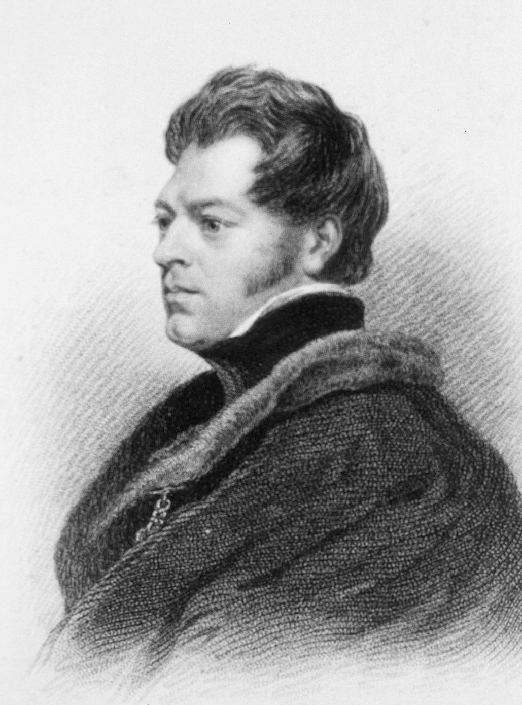
Sir John Richardson Royal Society of London, FRS FRSE (5 November 1787 – 5 June 1865) was a Scotland, Scottish naval surgeon, natural history, naturalist and Arctic explorer. Life Richardson was born at Nith Place in Dumfries the son of Gabriel Richardson, Provost of Dumfries, and his wife, Anne Mundell. He was educated at Dumfries Grammar School. He was then apprenticed to his maternal uncle, Dr James Mundell, a surgeon in Dumfries. Richardson studied medicine at Edinburgh University, and became a surgeon in the navy in 1807. He traveled with John Franklin in search of the Northwest Passage on the Coppermine Expedition of 1819–1822. Richardson wrote the sections on geology, botany and ichthyology for the official account of the expedition. Franklin and Richardson Mackenzie River expedition, returned to Canada in 1825 and went overland by fur trade routes to the mouth of the Mackenzie River. Franklin was to go as far west as possible and Richardson was to go east to the mo ... [...More Info...] [...Related Items...] OR: [Wikipedia] [Google] [Baidu] |


