|
Ebenat
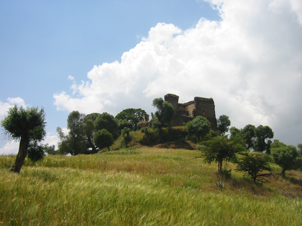
Ebnat(Ibnat) () is a town in the South Gondar Zone of the Amhara Region, Ebnat has a latitude and longitude of . It is the administrative center of Ebnat woreda and is at an elevation of 2972 meters above sea level. History Near Ebenat, on 17 January 1608, Emperor Susenyos and his army battled an Oromo army; the Emperor's army killed 12,000 Oromo at a cost of 400 of their comrades. When Charles Beke left Ethiopia he stayed in Ebenat from 15 to 21 March 1843. Beke described the town as "a place of no size, consisting merely of the residences of the Dejazmach and his family, with a few huts for their attendants. The market is however, very considerable – lasting two days, Friday and Saturday – it being the point where the merchants of Gojam meet those from Sokota bringing salt, for which they give cloths, coffee, and a large number of cattle, oxen, and heifers brought from Gudera." Demographics Based on figures from the Central Statistical Agency The Central Statisti ... [...More Info...] [...Related Items...] OR: [Wikipedia] [Google] [Baidu] |
Ebenat (woreda)
Ebenat ( Amharic: እብናት) also spelled Ibnat is one of the woredas in the Amhara Region of Ethiopia. It is named after the former district that lay roughly in the same area; the woreda itself dates from the mid-1960s. Part of the Debub Gondar Zone, Ebenat is bordered on the south by Farta, on the southwest by Fogera, on the west by Libo Kemekem, on the north by the Semien Gondar Zone, on the northeast by the Wag Hemra Zone, on the east by Semine (North) Wollo Zone, and on the southeast by Lay Gayint. The administrative center of Ebenat is Ebenat. Demographics Based on the 2007 national census conducted by the Central Statistical Agency of Ethiopia (CSA), this woreda has a total population of 220,177, an increase of 34.74% over the 1994 census, of whom 112,151 are men and 108,026 women; 12,002 or 5.45% are urban inhabitants. With an area of 2,481.15 square kilometers, Ebenat has a population density of 88.74, which is less than the Zone average of 145.56 persons per squ ... [...More Info...] [...Related Items...] OR: [Wikipedia] [Google] [Baidu] |
Susenyos Of Ethiopia
Susenyos I ( gez, ሱስንዮስ ; circa 1571-1575 – 17 September 1632), also known as Susenyos the Catholic, was Emperor of Ethiopia from 1606 to 1632, and a member of the Solomonic dynasty. His throne names were Seltan Sagad and Malak Sagad III. He was the son of ''Abeto'' Fasil, as well as the grandson of ''Abeto'' Yakob and the great-grandson of Dawit II. As a result, while some authorities list Susenyos as a member of the Solomonic dynasty, others consider him—rather than his son, Fasilides—as the founder of the Gondar line of the dynasty (which is, however, ultimately a subset of the Solomonic dynasty). The life of Susenyos is known through his chronicle, written by several official writers (''sehafe te’ezaz''). The Jesuits, who were closely associated with Susenyos’s reign, also left numerous documents on their mission in Ethiopia. Manuel de Almeida, a Portuguese Jesuit who lived in Ethiopia during Susenyos' reign, described the emperor as tall with the feat ... [...More Info...] [...Related Items...] OR: [Wikipedia] [Google] [Baidu] |
South Gondar Zone
South Gondar ( Amharic: ደቡብ ጎንደር) (or Debub Gondar) is a Zone in the Ethiopian Amhara Region. This zone is named for the city of Gondar, which was the capital of Ethiopia until the mid-19th century, and has often been used as a name for the local province. South Gondar is bordered on the south by East Gojjam, on the southwest by West Gojjam and Bahir Dar, on the west by Lake Tana, on the north by North Gondar, on the northeast by Wag Hemra, on the east by North Wollo, and on the southeast by South Wollo; the Abbay River separates South Gondar from the two Gojjam Zones. The highest point in South Gondar is Mount Guna (4,231 meters). Towns and cities in this zone include Addis Zemen, Debre Tabor and Wereta. Demographics Based on the 2007 Census conducted by the Central Statistical Agency of Ethiopia (CSA), this Zone has a total population of 2,051,738, and an increase of 16% over the 1994 census, of whom 1,041,061 are men and 1,010,677 women. With an area of ... [...More Info...] [...Related Items...] OR: [Wikipedia] [Google] [Baidu] |
Amhara Region
The Amhara Region ( am, አማራ ክልል, Åmara Kilil), officially the Amhara National Regional State (), is a regional state in northern Ethiopia and the homeland of the Amhara people. Its capital is Bahir Dar which is the seat of the Regional Government of Amhara. Amhara is the site of the largest inland body of water in Ethiopia, Lake Tana (which is the source of the Blue Nile), and Semien Mountains National Park (which includes Ras Dashan, the highest point in Ethiopia). Amhara is bordered by Sudan to the west and northwest and by other the regions of Ethiopia: Tigray to the north, Afar to the east, Benishangul-Gumuz to the west and southwest, and Oromia to the south. History During the Ethiopian Empire, Amhara included several provinces (such as Dembiya, Gojjam, Begemder, Angot, Wollo, Shewa and Lasta), most of which were ruled by native Ras or Negus. The current Amhara region corresponds to often large parts of the former provinces of Begemder, ... [...More Info...] [...Related Items...] OR: [Wikipedia] [Google] [Baidu] |
Woreda
Districts of Ethiopia, also called woredas ( am, ወረዳ; ''woreda''), are the third level of the administrative divisions of Ethiopia – after '' zones'' and the '' regional states''. These districts are further subdivided into a number of wards called ''kebele'' neighbourhood associations, which are the smallest unit of local government in Ethiopia. Overview Districts are typically collected together into zones, which form a region; districts which are not part of a zone are designated Special Districts and function as autonomous entities. Districts are governed by a council whose members are directly elected to represent each ''kebele'' in the district. There are about 670 rural districts and about 100 urban districts. Terminology varies, with some people considering the urban units to be ''woreda'', while others consider only the rural units to be ''woreda'', referring to the others as urban or city administrations. Although some districts can be traced back to earli ... [...More Info...] [...Related Items...] OR: [Wikipedia] [Google] [Baidu] |
Oromo People
The Oromo (pron. Oromo: ''Oromoo'') are a Cushitic ethnic group native to the Oromia region of Ethiopia and parts of Northern Kenya, who speak the Oromo language (also called ''Afaan Oromoo'' or ''Oromiffa''), which is part of the Cushitic branch of the Afroasiatic language family. They are the largest ethnic group in Ethiopia and represent a large portion of Ethiopia's population. The Oromo people traditionally used the '' gadaa'' system as the primary form of governance.Harold G. MarcuA History of Ethiopia University of California Press (1994) pp. 55 Google Books A leader is elected by the ''gadaa'' system and their term lasts eight years, with an election taking place at the end of those eight years. Although most modern Oromos are Muslims and Christians, about 3% practice Waaqeffanna, the native ancient monotheistic religion of Oromos. Origins and nomenclature The Oromo people are one of the oldest cushitic peoples inhabiting the Horn of Africa, as there is still no ... [...More Info...] [...Related Items...] OR: [Wikipedia] [Google] [Baidu] |
Charles Tilstone Beke
Charles Tilstone Beke (10 October 1800 – 31 July 1874) was an English traveller, geographer and Biblical critic. Biography Born in Stepney, London, the son of a merchant in the City of London, for a few years Beke engaged in mercantile pursuits. He later studied law at Lincoln's Inn, and for a time practised at the Bar, but finally devoted himself to the study of historical, geographical and ethnographical subjects. The first fruits of Beke's researches appeared in his work ''Origines Biblicae'' or ''Researches in Primeval History'', published in 1834. An attempt to reconstruct the early history of the human race from geological data, it raised a storm of opposition on the part of defenders of the traditional readings of the Book of Genesis, but in recognition of the value of the work, the University of Tübingen conferred upon him the degree of PhD. Between 1837 and 1838, Beke held the post of acting British consul in Saxony. From that time until his death, his attention wa ... [...More Info...] [...Related Items...] OR: [Wikipedia] [Google] [Baidu] |
Dejazmach
Until the end of the Ethiopian monarchy in 1974, there were two categories of nobility in Ethiopia and Eritrea. The Mesafint ( gez, መሳፍንት , modern , singular መስፍን , modern , "prince"), the hereditary nobility, formed the upper echelon of the ruling class. The Mekwanint ( gez, መኳንንት , modern , singular መኰንን , modern or am, መኮንን , "officer") were the appointed nobles, often of humble birth, who formed the bulk of the aristocracy. Until the 20th century, the most powerful people at court were generally members of the ''Mekwanint'' appointed by the monarch, while regionally, the ''Mesafint'' enjoyed greater influence and power. Emperor Haile Selassie greatly curtailed the power of the ''Mesafint'' to the benefit of the ''Mekwanint'', who by then were essentially coterminous with the Ethiopian government. The ''Mekwanint'' were officials who had been granted specific offices in the Abyssinian government or court. Higher ranks from the tit ... [...More Info...] [...Related Items...] OR: [Wikipedia] [Google] [Baidu] |
Soqota
Sekota, also spelled Sokota, Sakota, Soqota (Amharic: ሰቆጣ; formerly ሰቈጣ) is a town and separate woreda in northern Ethiopia. The name is likely from the Agaw word ''sekut'', "fortified village." Located in the Wag Hemra Zone of the Amhara Region, Sekota has a latitude and longitude of and an elevation of 2266 meters above sea level. It is surrounded by woreda of Soqota. About 6 kilometers from Sekota is the church Wuqir Meskale Kristos, where the mummified corpses of several Wagshums lies. History Philip Briggs speculates that this town may be identified with the mysterious Ku'bar, said by al- Ya'qubi and al-Masudi to have succeeded Axum as the capital of Ethiopia. Sekota is the historic seat of the Wagshum, the former ruler of Lasta, who claimed to trace an unbroken succession back to the last king of the Zagwe dynasty. However, verification for this tradition is slight. This town is not mentioned in the surviving records until 1746, when the soldiers of Empe ... [...More Info...] [...Related Items...] OR: [Wikipedia] [Google] [Baidu] |
Central Statistical Agency (Ethiopia)
The Central Statistical Agency (CSA; Amharic: ማዕከላዊ ስታቲስቲክስ ኤጀንሲ) is an agency of the government of Ethiopia designated to provide all surveys and censuses for that country used to monitor economic and social growth, as well as to act as an official training center in that field. It is part of the Ethiopian Ministry of Finance and Economic Development. The Director General of the CSA is Samia Zekaria. Before 9 March 1989 the CSA was known as the Central Statistical Office (CSO). The CSA has 25 branch offices. Besides the capital city of Addis Ababa, the cities and towns with offices are: Ambo, Arba Minch, chiro, Asayita, Assosa, Awasa, Bahir Dar, Debre Berhan, Dessie, Dire Dawa Dire Dawa ( am, ድሬዳዋ, om, Dirree Dhawaa, 3=Place of Remedy; so, Diridhaba, meaning "where Dir hit his spear into the ground" or "The true Dir", ar, ديري داوا,) is a city in eastern Ethiopia near the Oromia and Somali Re ..., Gambela, ... [...More Info...] [...Related Items...] OR: [Wikipedia] [Google] [Baidu] |


