|
Castlelost Castle
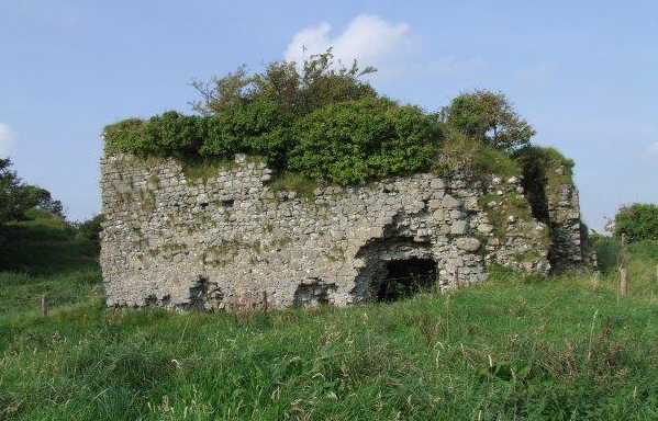
Castlelost Castle () is a ruined motte-and-bailey castle located in the townland of Castlelost, just north of Rochfortbridge in County Westmeath, Ireland. The castle dates to the Norman invasion of Ireland, with some sources dating its construction to the late 12th century and associating it with Hugh Tyrrel (died 1199). The castle remained within the Tyrrel family through the 16th century. During the 17th century, the castle and surrounding lands were lost by the Tyrrels during the Irish Rebellion of 1641 and subsequent Cromwellian conquest of Ireland. The only visible features still on the site are the ruined tower house as well as a small nearby motte. The castle, its motte and the remnants of a nearby Bailey (castle), bailey (courtyard) are listed on the Record of Monuments and Places for County Westmeath. See also * Castlelost (civil parish) References Castles in County Westmeath {{Ireland-castle-stub ... [...More Info...] [...Related Items...] OR: [Wikipedia] [Google] [Baidu] |
CastleLost
Castlelost is a townland in County Westmeath, Ireland. The townland is located in the civil parish of Castlelost. The R446 regional road runs through the middle of the area, and a section of the R400 regional road links the townland with the M6 motorway. The western side of the town of Rochfortbridge lies in the townland, with the east laying in the neighbouring townland of Rahanine. St. Joseph's School, and the Church of the Immaculate Conception stand in the townland, serving the town of Rochfortbridge and the surrounding townlands. The townland is bordered by Castlelost West and Clontytallon to the west, Derry to the north, Farthingstown and Oldtown to the south and Gortumly and Rahanine to the east. The townland is recorded on the Griffith Valuation in 1868, with 37 tenants living in the area. Castlelost Castle A ruined castle dating back to the Norman invasion of Ireland The Anglo-Norman invasion of Ireland took place during the late 12th century, when A ... [...More Info...] [...Related Items...] OR: [Wikipedia] [Google] [Baidu] |
Motte-and-bailey Castle
A motte-and-bailey castle is a European fortification with a wooden or stone keep situated on a raised area of ground called a motte, accompanied by a walled courtyard, or bailey, surrounded by a protective ditch and palisade. Relatively easy to build with unskilled labour, but still militarily formidable, these castles were built across northern Europe from the 10th century onwards, spreading from Normandy and Anjou in France, into the Holy Roman Empire in the 11th century. The Normans introduced the design into England and Wales. Motte-and-bailey castles were adopted in Scotland, Ireland, the Low Countries and Denmark in the 12th and 13th centuries. Windsor Castle, in England, is an example of a motte-and-bailey castle. By the end of the 13th century, the design was largely superseded by alternative forms of fortification, but the earthworks remain a prominent feature in many countries. Architecture Structures A motte-and-bailey castle was made up of two structures: a ... [...More Info...] [...Related Items...] OR: [Wikipedia] [Google] [Baidu] |
Townland
A townland ( ga, baile fearainn; Ulster-Scots: ''toonlann'') is a small geographical division of land, historically and currently used in Ireland and in the Western Isles in Scotland, typically covering . The townland system is of Gaelic origin, pre-dating the Norman invasion, and most have names of Irish origin. However, some townland names and boundaries come from Norman manors, plantation divisions, or later creations of the Ordnance Survey.Connolly, S. J., ''The Oxford Companion to Irish History, page 577. Oxford University Press, 2002. ''Maxwell, Ian, ''How to Trace Your Irish Ancestors'', page 16. howtobooks, 2009. The total number of inhabited townlands in Ireland was 60,679 in 1911. The total number recognised by the Irish Place Names database as of 2014 was 61,098, including uninhabited townlands, mainly small islands. Background In Ireland a townland is generally the smallest administrative division of land, though a few large townlands are further divided into ... [...More Info...] [...Related Items...] OR: [Wikipedia] [Google] [Baidu] |
Castlelost
Castlelost is a townland in County Westmeath, Ireland. The townland is located in the civil parish of Castlelost. The R446 regional road runs through the middle of the area, and a section of the R400 regional road links the townland with the M6 motorway. The western side of the town of Rochfortbridge lies in the townland, with the east laying in the neighbouring townland of Rahanine. St. Joseph's School, and the Church of the Immaculate Conception stand in the townland, serving the town of Rochfortbridge and the surrounding townlands. The townland is bordered by Castlelost West and Clontytallon to the west, Derry to the north, Farthingstown and Oldtown to the south and Gortumly and Rahanine to the east. The townland is recorded on the Griffith Valuation in 1868, with 37 tenants living in the area. Castlelost Castle A ruined castle dating back to the Norman invasion of Ireland The Anglo-Norman invasion of Ireland took place during the late 12th century, when A ... [...More Info...] [...Related Items...] OR: [Wikipedia] [Google] [Baidu] |
Rochfortbridge
Rochfortbridge () is a village in County Westmeath, Ireland. The village is located at the intersection of the R400 and the R446 (formerly the N6) roads. As of the 2016 census, the population of Rochfortbridge was 1,473. History Rochfortbridge is spread between the townlands of Castlelost and Rahanine, both within Castlelost parish, which was inhabited at least as early as 590 AD by monks under Mo Chutu (later St. Carthage). The village was originally known as Beggar's Bridge, supposedly after a beggar who died at a river crossing; enough money was found in his pockets to build a bridge. The village proper was set out 1700 by Robert Rochfort, MP for Westmeath from 1651 to 1727. As part of the village building programme, Rochfort financed and built a new bridge over the River Derry, giving the village its new name. Following the death of Rochfort in 1727, the village was controlled by his son George Rochfort. George died just three years later, in 1730, and ... [...More Info...] [...Related Items...] OR: [Wikipedia] [Google] [Baidu] |
County Westmeath
"Noble above nobility" , image_map = Island of Ireland location map Westmeath.svg , subdivision_type = Country , subdivision_name = Ireland , subdivision_type1 = Province , subdivision_name1 = , subdivision_type2 = Region , subdivision_name2 = Eastern and Midland , seat_type = County town , seat = Mullingar , parts_type = Largest settlement , parts = Athlone , leader_title = Local authority , leader_name = Westmeath County Council , leader_title2 = Dáil constituencies , leader_name2 = , leader_title3 = EP constituency , leader_name3 = Midlands–North-West , area_total_km2 = 1840 , area_rank = 21st , population_total = 95,840. , population_as_of = 2022 , population_footnotes = , population_density_km2 = auto , population_rank = 22nd , blank_ ... [...More Info...] [...Related Items...] OR: [Wikipedia] [Google] [Baidu] |
Norman Invasion Of Ireland
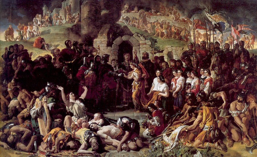
The Anglo-Norman invasion of Ireland took place during the late 12th century, when Anglo-Normans gradually conquered and acquired large swathes of land from the Irish, over which the kings of Kingdom of England, England then claimed sovereignty, all allegedly sanctioned by the Papal bull ''Laudabiliter''. At the time, Gaelic Ireland was made up of several kingdoms, with a High King of Ireland, High King claiming lordship over most of the other kings. The Norman invasion was a watershed in Ireland's history, marking the beginning of more than 800 years of direct English and, later, British, involvement in Ireland. In May 1169, Anglo-Norman mercenaries landed in Ireland at the request of Diarmait mac Murchada (Dermot MacMurragh), the Deposition (politics), deposed List of kings of Leinster, King of Leinster, who sought their help in regaining his kingship. They achieved this within weeks and raided neighbouring kingdoms. This military intervention was sanctioned by King Henry II o ... [...More Info...] [...Related Items...] OR: [Wikipedia] [Google] [Baidu] |
Hugh Tyrrel
Hugh Tyrrel ( Anglo-Norman: ''Huge Tyrel''), 1st Baron of Castleknock (died 1199) was an Anglo-Norman nobleman and crusader who played a prominent part in the Norman invasion of Ireland and took part in the Third Crusade. He was born in Hampshire, England, the son of Hugh Tyrrel the elder, who held substantial lands in England, and was also lord of Poix-de-Picardie in France. Their ancestor Walter Tirel (died after 1100) is notorious as the killer (although whether the killing was murder or accident is still a matter of debate) of King William Rufus. On the death of his elder brother Walter, in about the year 1170, Hugh succeeded to all his father's estates. Invasion of Ireland In 1169 when Richard de Clare, 2nd Earl of Pembroke, nicknamed ''Strongbow'', invaded Ireland on behalf of Henry II of England, Tyrrel accompanied him.Ball, F. Elrington ''History of the Parishes of Dublin'' Alexander Thom and Co Dublin 1920 Vol.6 pp.8-9 By 1172 he was described as one of the right-hand ... [...More Info...] [...Related Items...] OR: [Wikipedia] [Google] [Baidu] |
Irish Rebellion Of 1641
The Irish Rebellion of 1641 ( ga, Éirí Amach 1641) was an uprising by Irish Catholics in the Kingdom of Ireland, who wanted an end to anti-Catholic discrimination, greater Irish self-governance, and to partially or fully reverse the plantations of Ireland. They also wanted to prevent a possible invasion or takeover by anti-Catholic English Parliamentarians and Scottish Covenanters, who were defying the king, Charles I. It began as an attempted ''coup d'état'' by Catholic gentry and military officers, who tried to seize control of the English administration in Ireland. However, it developed into a widespread rebellion and ethnic conflict with English and Scottish Protestant settlers, leading to Scottish military intervention. The rebels eventually founded the Irish Catholic Confederacy. Led by Felim O'Neill, the rebellion began on 23 October and although they failed to seize Dublin Castle, within days the rebels occupied most of the northern province of Ulster. O'Neill ... [...More Info...] [...Related Items...] OR: [Wikipedia] [Google] [Baidu] |
Cromwellian Conquest Of Ireland
The Cromwellian conquest of Ireland or Cromwellian war in Ireland (1649–1653) was the re-conquest of Ireland by the forces of the English Parliament, led by Oliver Cromwell, during the Wars of the Three Kingdoms. Cromwell invaded Ireland with the New Model Army on behalf of England's Rump Parliament in August 1649. Following the Irish Rebellion of 1641, most of Ireland came under the control of the Irish Catholic Confederation. In early 1649, the Confederates allied with the English Royalists, who had been defeated by the Parliamentarians in the English Civil War. By May 1652, Cromwell's Parliamentarian army had defeated the Confederate and Royalist coalition in Ireland and occupied the country, ending the Irish Confederate Wars (or Eleven Years' War). However, guerrilla warfare continued for a further year. Cromwell passed a series of Penal Laws against Roman Catholics (the vast majority of the population) and confiscated large amounts of their land. As punishment ... [...More Info...] [...Related Items...] OR: [Wikipedia] [Google] [Baidu] |
Motte
A motte-and-bailey castle is a European fortification with a wooden or stone keep situated on a raised area of ground called a motte, accompanied by a walled courtyard, or bailey, surrounded by a protective ditch and palisade. Relatively easy to build with unskilled labour, but still militarily formidable, these castles were built across northern Europe from the 10th century onwards, spreading from Normandy and Anjou in France, into the Holy Roman Empire in the 11th century. The Normans introduced the design into England and Wales. Motte-and-bailey castles were adopted in Scotland, Ireland, the Low Countries and Denmark in the 12th and 13th centuries. Windsor Castle, in England, is an example of a motte-and-bailey castle. By the end of the 13th century, the design was largely superseded by alternative forms of fortification, but the earthworks remain a prominent feature in many countries. Architecture Structures A motte-and-bailey castle was made up of two structures: a ... [...More Info...] [...Related Items...] OR: [Wikipedia] [Google] [Baidu] |
Bailey (castle)
A bailey or ward in a fortification is a courtyard enclosed by a curtain wall. In particular, an early type of European castle was known as a motte-and-bailey. Castles can have more than one bailey. Their layout depends both on the local topography and the level of fortification technology employed, ranging from simple enclosures to elaborate concentric defences. In addition to the gradual evolution of more complex castle plans, there are also significant differences in regional traditions of military architecture regarding the subdivision into baileys. Upper, lower, middle, inner and outer wards or baileys Baileys can be arranged in sequence along a hill (as in a spur castle), giving an upper bailey and lower bailey. They can also be nested one inside the other, as in a concentric castle, giving an outer bailey and inner bailey. Large castles may have two outer baileys; if in line they may form an outer and middle bailey. On the other hand, tower houses lack an enclosed bail ... [...More Info...] [...Related Items...] OR: [Wikipedia] [Google] [Baidu] |


