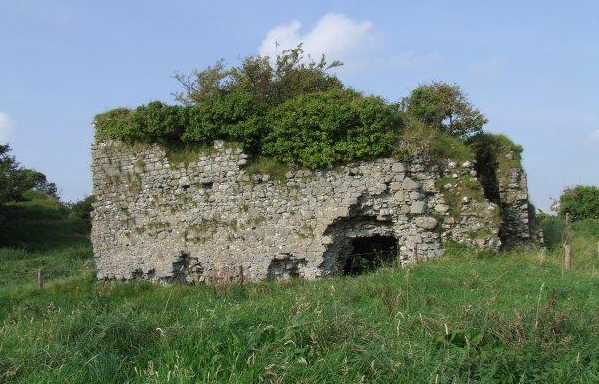
Castlelost on:
[Wikipedia]
[Google]
[Amazon]
 Castlelost is a
 Castlelost is a
 townland
A townland (; Ulster-Scots: ''toonlann'') is a traditional small land division used in Ireland and in the Western Isles of Scotland, typically covering . The townland system is of medieval Gaelic origin, predating the Norman invasion, and mo ...
in County Westmeath
County Westmeath (; or simply ) is a Counties of Ireland, county in Republic of Ireland, Ireland. It is in the Provinces of Ireland, province of Leinster and is part of the Eastern and Midland Region. It formed part of the historic Kingdom of ...
, Ireland
Ireland (, ; ; Ulster Scots dialect, Ulster-Scots: ) is an island in the North Atlantic Ocean, in Northwestern Europe. Geopolitically, the island is divided between the Republic of Ireland (officially Names of the Irish state, named Irelan ...
. It is located within the civil parish of Castlelost. The R446 road runs through the middle of the area, and a section of the R400 links the townland with the M6 motorway
The M6 motorway is the longest motorway in the United Kingdom. It is located entirely within England, running for just over from the Midlands to the border with Scotland. It begins at Junction 19 of the M1 motorway, M1 and the western end of t ...
. Castlelost townland is bordered by Castlelost West and Clontytallon to the west, Derry
Derry, officially Londonderry, is the second-largest City status in the United Kingdom, city in Northern Ireland, and the fifth-largest on the island of Ireland. Located in County Londonderry, the city now covers both banks of the River Fo ...
to the north, Farthingstown and Oldtown to the south and Gortumly and Rahanine to the east.
Castlelost Castle, a ruined castle dating to the Norman invasion of Ireland
The Anglo-Norman invasion of Ireland took place during the late 12th century, when Anglo-Normans gradually conquered and acquired large swathes of land in Ireland over which the monarchs of England then claimed sovereignty. The Anglo-Normans ...
, is situated in the north of the townland.
The western side of the town of Rochfortbridge
Rochfortbridge () is a village in County Westmeath, Ireland. The village is located at the intersection of the R400 and the R446 (formerly the N6) roads. As of the 2016 census, the population of Rochfortbridge was 1,473.
History
Rochfortb ...
lies in the townland, with the east of the town laying in the neighbouring townland of Rahanine. St. Joseph's School and the Church of the Immaculate Conception, within Castlelost townland, serve Rochfortbridge and the surrounding area.
At the time of Griffith's Valuation
Griffith's Valuation was a boundary and land valuation survey of Ireland completed in 1868.
Griffith's background
Richard John Griffith started to value land in Scotland, where he spent two years in 1806–1807 valuing terrain through the examin ...
, in 1868, there were 37 tenants living in Castlelost.
References
Townlands of County Westmeath {{Ireland-geo-stub