|
Carvetti
The Carvetii (Common Brittonic: *''Carwetī'') were a Celtic Britons, Brittonic Celtic tribe living in what is now Cumbria, in North-West England during the Iron Age, and were subsequently identified as a ''civitas'' (canton) of Roman Britain. Etymology The suffix ''carv-'' is related to Welsh ''carw'', Breton ''karv'' and Irish ''carow'' ('deer'). Richard von Kienle has proposed the translation 'those who belong to the deer'.' Location Historical speculation has the Carvetii occupying the Solway Plain, the area immediately south of Hadrian's Wall, the Eden Valley, and possibly the Lune Valley. The Setantii may have occupied Lancashire, North Lancashire and south Cumbria. Evidence of existence The Carvetii are not mentioned in Ptolemy's ''Geography'', nor in any other classical text, and are known only from three Roman (third and fourth century AD) inscriptions, one of which is now lost. One was in Old Penrith, (the Voreda Roman fort) north of the present Penrith, Cumbria, Pe ... [...More Info...] [...Related Items...] OR: [Wikipedia] [Google] [Baidu] |
Penrith, Cumbria
Penrith (, , ) is a market town and civil parish in the county of Cumbria, England, about south of Carlisle. It is less than outside the Lake District National Park, in between the Rivers Petteril and Eamont and just north of the River Lowther. It had a population of 15,181 at the 2011 Census. Historically in Cumberland, Penrith's current local authorities are the Eden District Council, which is based in the town, and Cumbria County Council. In 2023, Penrith will become part of the Westmorland and Furness unitary authority area. From 1974 to 2015, it was an unparished area with no local council. A civil parish was reintroduced as Penrith Town Council and first elected on 7 May 2015. Toponymy The etymology of "Penrith" has been debated. Several writers argue for the Cumbric or Welsh "head, chief, end" (both noun and adjective) with the Cumbric , Welsh "ford", to mean "chief ford", "hill ford", "ford end", or Whaley's suggestion: "the head of the ford" or "headl ... [...More Info...] [...Related Items...] OR: [Wikipedia] [Google] [Baidu] |
Clifton Dykes
Clifton is a small linear village and civil parish in Cumbria, England. Historically part of Westmorland, it lies south east of Penrith. Geography The civil parish of Clifton has its western boundary defined by the River Lowther, to the north and east lie the civil parishes of Brougham and Great Strickland, to the south is the civil parish of Lowther. The village of Clifton has a church, primary school, and a pub. Most of the hamlet of Clifton Dykes (on the C3047 road) also lies within the parish. The name of this was shown as ''Longchimney'' on the first edition Ordnance Survey map of 1897, and then as ''Clifton Dikes'' on the later second edition. The current spelling was settled on more recently. History Clifton Dykes has been suggested as the (pre-Roman conquest) centre of the Carvetti, an Iron Age and Roman-period 'tribe', one that possibly led a resistance against Roman forces in 69 A.D. under the leadership of Venutius. This is based upon the evidence of a large ... [...More Info...] [...Related Items...] OR: [Wikipedia] [Google] [Baidu] |
List Of Celtic Tribes
This is a list of Celtic tribes, organized in order of the likely ethnolinguistic kinship of the peoples and tribes. In Classical antiquity, Celts were a large number and a significant part of the population in many regions of Western Europe, Southern Central Europe, the British Isles and parts of the Balkans, in Europe, and also Central Asia Minor or Anatolia. Ancestors * Proto-Indo-Europeans ( Proto-Indo-European speakers) ** Proto-Celts ( Proto-Celtic speakers) Continental Celts Continental Celts were the Celtic peoples that inhabited mainland Europe. In the 3rd and 2nd centuries BC, Celts inhabited a large part of mainland Western Europe and large parts of Western Southern Europe (Iberian peninsula), southern Central Europe and some regions of the Balkans and Anatolia. They were most of the population in Gallia, today's France, Switzerland, possibly Belgica – far Northern France, Belgium and far Southern Netherlands, large parts of Hispania, i.e. Iberian Peninsu ... [...More Info...] [...Related Items...] OR: [Wikipedia] [Google] [Baidu] |
Quintus Petillius Cerialis
Quintus Petillius Cerialis Caesius Rufus ( AD 30 — after AD 83), otherwise known as Quintus Petillius Cerialis, was a Roman general and administrator who served in Britain during Boudica's rebellion and went on to participate in the civil wars after the death of Nero. He later crushed the rebellion of Julius Civilis and returned to Britain as its governor. Because he probably succeeded Caesius Nasica as commander of Legio IX Hispana, and since brothers are often attested as serving in succession in the same post, Anthony Birley suggests that Cerialis was the younger brother of Nasica, and had been adopted by Petillius Rufus, who was known as praetor in AD 28. However, in his monograph of naming practices in the first centuries of the Roman Empire, Olli Salomies argues that Cerialis was actually the biological son of Petillius Rufus by a woman named Caesia, who may have been the daughter of a Caesius Cerialis, therefore Caesius Nasica would not have been his brother "but a clos ... [...More Info...] [...Related Items...] OR: [Wikipedia] [Google] [Baidu] |
Cartimandua
Cartimandua or Cartismandua (reigned ) was a 1st-century queen of the Brigantes, a Celtic people living in what is now northern England. She came to power around the time of the Roman conquest of Britain, and formed a large tribal agglomeration that became loyal to Rome. The only account of her is by the Roman historian Tacitus, through which she appears to have been widely influential in early Roman Britain. Her name may be a compound of the Common Celtic roots ''*carti-'' "chase, expel, send" and ''*mandu-'' "pony". History Although Cartimandua is first mentioned by Tacitus in AD 51, her rule over the Brigantes may have already been established when the Roman emperor Claudius began the organised conquest of Britain in 43: she may have been one of the eleven "kings" who Claudius's triumphal arch says surrendered without a fight. If not, she may have come to power after a revolt of a faction of the Brigantes was defeated by Publius Ostorius Scapula in 48. Being of "illus ... [...More Info...] [...Related Items...] OR: [Wikipedia] [Google] [Baidu] |
Brigantes
The Brigantes were Ancient Britons who in pre-Roman times controlled the largest section of what would become Northern England. Their territory, often referred to as Brigantia, was centred in what was later known as Yorkshire. The Greek geographer Ptolemy named the Brigantes as a people in Ireland also, where they could be found around what is now Wexford, Kilkenny and Waterford, while another people named '' Brigantii'' is mentioned by Strabo as a sub-tribe of the Vindelici in the region of the Alps. Within Britain, the territory which the Brigantes inhabited was bordered by that of four other peoples: the Carvetii in the northwest, the Parisii to the east and, to the south, the Corieltauvi and the Cornovii. To the north was the territory of the Votadini, which straddled the present day border between England and Scotland. Etymology The name ''Brigantes'' (Βρίγαντες in Ancient Greek) shares the same Proto-Celtic root as the goddess Brigantia, ''*brigant-'' mea ... [...More Info...] [...Related Items...] OR: [Wikipedia] [Google] [Baidu] |
Vicus
In Ancient Rome, the Latin term (plural ) designated a village within a rural area () or the neighbourhood of a larger settlement. During the Republican era, the four of the city of Rome were subdivided into . In the 1st century BC, Augustus reorganized the city for administrative purposes into 14 regions, comprising 265 . Each had its own board of officials who oversaw local matters. These administrative divisions are recorded as still in effect at least until the mid-4th century. The word "" was also applied to the smallest administrative unit of a provincial town within the Roman Empire. It is also notably used today to refer to an ''ad hoc'' provincial civilian settlement that sprang up close to and because of a nearby military fort or state-owned mining operation. Local government in Rome Each ''vicus'' elected four local magistrates ('' vicomagistri'') who commanded a sort of local police force chosen from among the people of the ''vicus'' by lot. Occasionally the ... [...More Info...] [...Related Items...] OR: [Wikipedia] [Google] [Baidu] |
Carlisle Castle
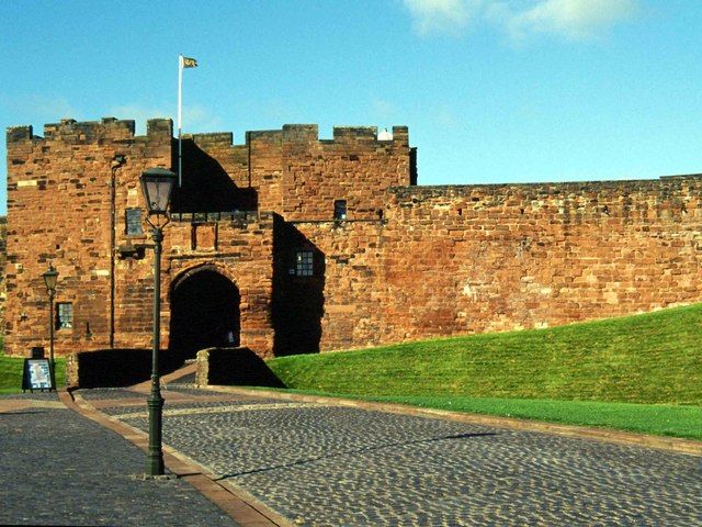
Carlisle Castle is a medieval stone keep castle that stands within the English city of Carlisle near the ruins of Hadrian's Wall. First built during the reign of William II in 1093 and rebuilt in stone under Henry I in 1122, the castle is over 900 years old and has been the scene of many historical episodes in British history. Given the proximity of Carlisle to the border between England and Scotland, it has been the centre of many wars and invasions. During the Jacobite Rising of 1745–6, Carlisle became the last English fortress to undergo a siege. The castle was listed as a Scheduled Ancient Monument on 7 August 1996. Today the property is managed by English Heritage and is open to the public. Until 2006, the castle was the administrative headquarters of the former King's Own Royal Border Regiment and until 2019 it was the county headquarters to the Duke of Lancaster's Regiment. A museum to the regiment is within the castle walls. History Carlisle Castle was first bu ... [...More Info...] [...Related Items...] OR: [Wikipedia] [Google] [Baidu] |
Stanwix
Stanwix is a district of Carlisle, Cumbria in North West England. The ward population (called Stanwix Urban) had a population taken at the 2011 census of 5,934. It is located on the north side of River Eden, across from Carlisle city centre. Although long counted as a suburb it did not officially become part of the city until 1912 when part of the civil parish of Stanwix became part of the parish, city and municipal borough of Carlisle. Further areas were added to the city, which was by then a county borough, in 1934 and 1951. The remaining part of the parish was eventually renamed Stanwix Rural in 1966. Etymology 'Stanwix' means " 'stone wall(s)', v. 'stǣna', 'wag' or 'veggr' 'Stǣna' is Old English and 'veggr' is Old Norse and cognate with Old English 'wag'. Stanwix is built on the site of a Roman fort known as Uxelodunum or Petriana, the former meaning "high fort". "Dun" is a Celtic word for fort which is to be found in many place-names. Location The former village o ... [...More Info...] [...Related Items...] OR: [Wikipedia] [Google] [Baidu] |
Stainmore
Stainmore is a remote geographic area in the Pennines on the border of Cumbria, County Durham and North Yorkshire. The name is used for a civil parish in the Eden District of Cumbria, England, including the villages of North Stainmore and South Stainmore. The parish had a population of 253 in the 2001 census, increasing to 264 at the Census 2011. Stainmore Forest stretches further east into County Durham, towards Bowes. Geography Stainmore is drained by the River Belah and the River Balder. It is crossed by the Roman road from Bowes to Brough, now part of the A66, and formerly by the Stainmore Railway. Each of these lines of communication has made use of the relatively low broad saddle between the higher hills to north and south which is commonly referred to as the Stainmore Gap. The summit of the former railway is around above sea level, though the roads climb to slightly higher elevations. The Gap is coincident with the Stainmore Summit Fault which throws the relatively ... [...More Info...] [...Related Items...] OR: [Wikipedia] [Google] [Baidu] |
Belatucadrus
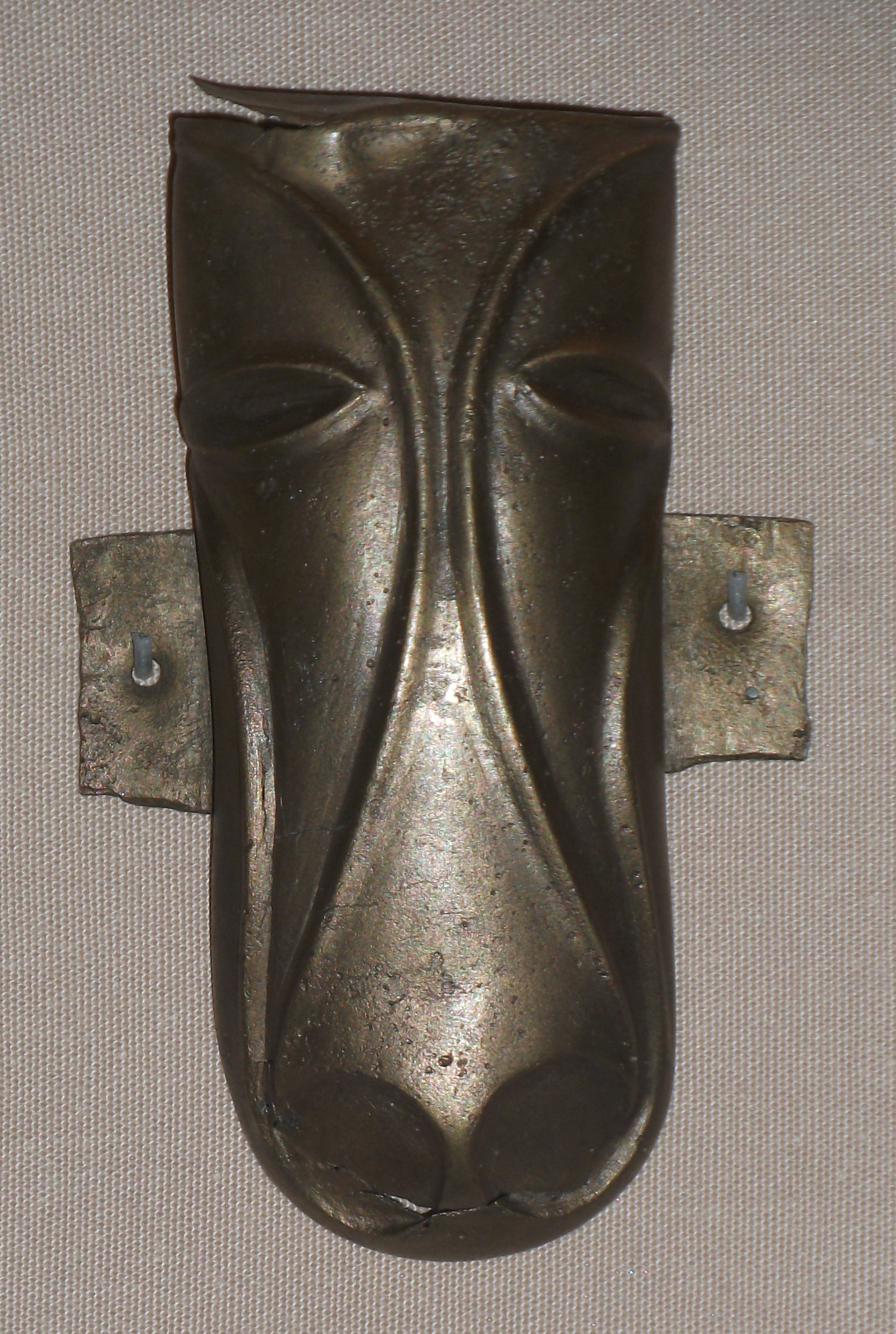
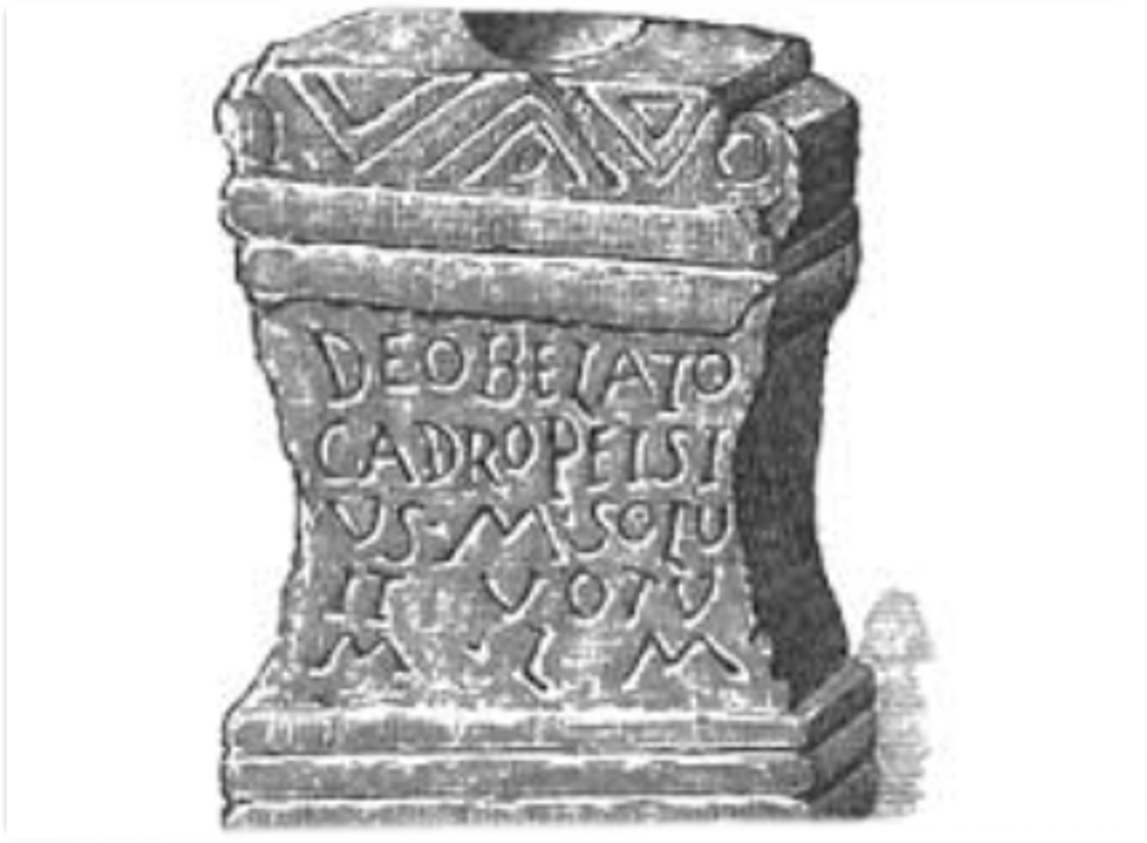
Belatucadros or Belatucadrus, was a deity worshipped in Celtic northern Britain, particularly in Cumberland and Westmorland. In the Roman period he was identified with Mars and appears to have been worshipped by lower-ranked Roman soldiers as well as by Britons. In five inscriptions he is called Mars Belatucadrus and the name is frequently translated as "fair shining one" or "fair slayer.". Belatucadros is known from approximately 28 inscriptions in the vicinity of Hadrian's Wall Hadrian's Wall ( la, Vallum Aelium), also known as the Roman Wall, Picts' Wall, or ''Vallum Hadriani'' in Latin, is a former defensive fortification of the Roman province of Britannia, begun in AD 122 in the reign of the Emperor Hadrian. R ..... Dedications to Balatocadrus, Balatucadrus, Balaticaurus, Balatucairus, Baliticaurus, Belatucairus, Belatugagus, Belleticaurus, Blatucadrus and Blatucairus are generally accepted as variants of the most common of these forms: Belatucadrus. Altars dedica ... [...More Info...] [...Related Items...] OR: [Wikipedia] [Google] [Baidu] |
Langwathby
Langwathby is a village and civil parish in northern Cumbria, England, about north east of Penrith on the A686 road. The village lies on the east bank of the River Eden. At the 2001 census the parish had a population of 748, increasing to 866 at the 2011 Census. The village is centred on a large village green next to which stands St Peter's church, the village pub, the shop & post office, and the village hall. There is a primary school on the road to Little Salkeld and there are two garages. The ford which gave the village its name was replaced by a three-arched sandstone toll bridge, which was washed away in 1968. A metal girder bridge was erected as a “temporary” replacement, and it is still there, the longest standing temporary bridge in the country. At Langwathby Hall was the visitor attraction and working ostrich farm called Eden Ostrich World, which closed in 2012. The Settle to Carlisle Railway has a railway station in the village, built in 1876. The station ... [...More Info...] [...Related Items...] OR: [Wikipedia] [Google] [Baidu] |


