|
Carlin Maggie
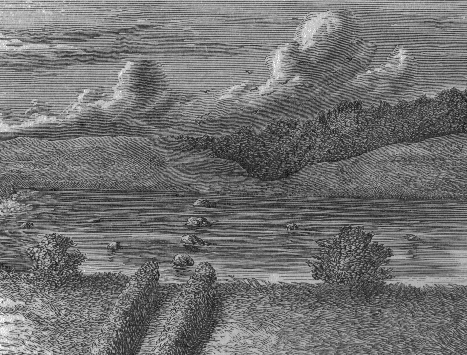
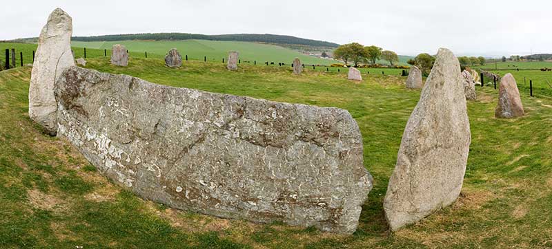
Carlin Stone or Carline Stane is the name given to a number of prehistoric standing stones and natural stone or landscape features in Scotland. The significance of the name is unclear, other than its association with old hags, witches, and the legends of the Cailleach. Etymology A 'Carle' in Scots is a commoner, a husband or in a derogatory sense, a churl or male of low birth. The name 'Carline', 'Cairlin', Carlin, 'Cyarlin', 'Kerlin' or 'Kerl' was also used in lowland Scots as a derogatory term for an old woman meaning an 'old hag'.Scots Dictionary It is from Old Norse ''Kerling'' or a corruption or equivalent in ScotsMcHardy, Stuart (1999), ''Scotland: Myth, Legend & Folklore''. Pub. Luath Press, Edinburgh. P. 24. of the Gaelic word “ |
Carlin Stone Dunlop
Carlin may refer to: People * George Carlin (1937–2008), comedian and social critic * Carlin (name), including a list of people with the name Places * 4121 Carlin, a main belt asteroid * Carlin, Nevada, United States * Carlin How, a village in northern England, UK * Carlin Precinct, Calhoun County, Illinois, USA * Carlin Tunnel, in Elko County, Nevada, USA * Carlin Unconformity, a geological feature in Nevada notable as a gold mining area * Delcambre Canal, in the U.S. state of Louisiana, also known as Bayou Carlin Other uses * Carlin Act, legislation in the United States * Carlin America, an independent music publishing conglomerate * Carlin Motorsport, a motor racing team in the United Kingdom * Carlin peas, consumed in northern England * Carlin stone, in Scotland * Pug, a breed of dog (also known as Carlin) See also * * Charlene (other) * Charlin (other) * Carling (other) * Karlin (other) * Carline (name) * Carly (name) Carly is a ... [...More Info...] [...Related Items...] OR: [Wikipedia] [Google] [Baidu] |
River Irvine
The River Irvine () is a river that flows through southwest Scotland. Its watershed is on the Lanarkshire border of Ayrshire at an altitude of above sea-level, near Loudoun Hill, Drumclog, and SW by W of Strathaven. It flows westward, dividing the old district of Cunninghame from that of Kyle, until it reaches the sea via Irvine Harbour in the form of the Firth of Clyde, and flows into Irvine Bay by the town of Irvine. It has many tributaries, some of which form parish, district and other boundaries. Etymology ''Irvine'' was first recorded in 1258 as ''Yrewyn'', and several etymologies have been proposed. According to Groome,*McNaught, Duncan (1912). ''Kilmaurs Parish and Burgh''. Pub. A.Gardner. ''Irvine'' is derived from the Gaelic ''iar-an'' meaning 'westward-flowing' river. A Brittonic origin is also possible. The root ''*arb-īno'', meaning "wild turnip", has been suggested (cf. Welsh ''erfin''), though the earliest record and the possibly identical River Irfon in ... [...More Info...] [...Related Items...] OR: [Wikipedia] [Google] [Baidu] |
Brigid
Brigid or Brigit ( , ; meaning 'exalted one'),Campbell, MikBehind the Name.See also Xavier Delamarre, ''brigantion / brigant-'', in ''Dictionnaire de la langue gauloise'' (Éditions Errance, 2003) pp. 87–88: "Le nom de la sainte irlandaise ''Brigit'' est un adjectif de forme *''brigenti''... 'l'Eminente'." Delamarre cites E. Campanile, in '' Langues indo-européennes'' ("The name of the Irish Saint Brigid is an adjective of the form *''brigenti''... 'the Eminent'"), edited by Françoise Bader (Paris, 1994), pp. 34–40, that Brigid is a continuation of the Indo-European goddess of the dawn like Aurora. also Bríd, is a goddess of pre-Christian Ireland. She appears in Irish mythology as a member of the Tuatha Dé Danann, the daughter of the Dagda and wife of Bres, with whom she had a son named Ruadán. Her sacred tree appears to have been the birch, given some older Imbolc-related traditions. She is associated with wisdom, poetry, healing, protection, smithing and domesticat ... [...More Info...] [...Related Items...] OR: [Wikipedia] [Google] [Baidu] |
Stewarton
Stewarton (, ) is a town in East Ayrshire, Scotland. In comparison to the neighbouring towns of Kilmaurs, Fenwick, East Ayrshire, Fenwick, Dunlop, East Ayrshire, Dunlop and Lugton, it is a relatively large town, with a population estimated at over 7,400. It is above sea level.Groome, Francis H. (1903). ''Ordnance Gazetteer of Scotland.'' Pub. Caxton. London. P. 1506. The town is served by Stewarton railway station. Stewarton lies within Strathannick, with the Annick Water flowing through the town. The community is in a rural part of East Ayrshire, about north of Kilmarnock and to the East of Irvine, Ayrshire, Irvine. In the past, Stewarton served as a crossroads between the traditional routes from Kilmarnock, Irvine and Ayr to the city of Glasgow. However, in rec ... [...More Info...] [...Related Items...] OR: [Wikipedia] [Google] [Baidu] |
Stone Circle
A stone circle is a ring of megalithic standing stones. Most are found in Northwestern Europe – especially Stone circles in the British Isles and Brittany – and typically date from the Late Neolithic and Early Bronze Age, with most being built between 3300 and 2500 BC. The best known examples include those at the henge monument at Avebury, the Rollright Stones, Castlerigg, and elements within the ring of standing stones at Stonehenge. Scattered examples exist from other parts of Europe. Later, during the Iron Age, stone circles were built in southern Scandinavia. The archetypical stone circle is an uncluttered enclosure, large enough to congregate inside, and composed of megalithic stones. Often similar structures are named 'stone circle', but these names are either historic, or incorrect. Examples of commonly misinterpreted stone circles are ring cairns, burial mounds, and kerb cairns. Although it is often assumed there are thousands of stone circles across the Br ... [...More Info...] [...Related Items...] OR: [Wikipedia] [Google] [Baidu] |
Wigtown
Wigtown ( (both used locally); ) is a town and former royal burgh in Wigtownshire, of which it is the county town, within the Dumfries and Galloway region in Scotland. It lies east of Stranraer and south of Newton Stewart. It is known as "Scotland's National Book Town" with a high concentration of second-hand book shops and an annual book festival. Wigtown is part of the Machars peninsula. History Name origins W.F.H. Nicolaisen offered two explanations for the place-name Wigtown. One theory was that it meant 'dwelling place', from the Old English 'wic-ton'; however, if it is the same as Wigton in Cumbria, which was 'Wiggeton' in 1162 and 'Wigeton' in 1262, it may be 'Wigca's farm'. Other sources have suggested a Norse root with 'Vik' meaning 'bay', giving the origin as a translation of 'The town on the bay'. Neolithic Age The surrounding area (the Machars peninsula) is rich in prehistoric remains, most notably the Torhousekie Standing Stones, a Neolithic stone circle ... [...More Info...] [...Related Items...] OR: [Wikipedia] [Google] [Baidu] |
Carsphairn
Carsphairn () is a village in the historic county of Kirkcudbrightshire in Dumfries and Galloway, Scotland. It is located about halfway between Dalmellington and St John's Town of Dalry, on the A713 road. Carsphairn annual sheep show is held in the village. Cairnsmore of Carsphairn is to the north east of the village in the Carsphairn and Scaur Hills. To the west is the ridge of the Rhinns of Kells in the Galloway Hills. The village has many features ranging from an ancient stone circle to a nuclear listening post (now disused), and includes local amenities such as a shop, tearoom, a primary school and a village hall. Carsphairn Church, Church of Scotland was built in 1815 on site of an earlier church. Additions and alterations in the 1930s include the apse and porch. The Knockengorroch World Ceilidh takes place here annuall History Carsphairn was made an independent parish around 1627, prior to which it had been a part of the Parish of St John's Town of Dalry, Dalry, and ... [...More Info...] [...Related Items...] OR: [Wikipedia] [Google] [Baidu] |
Cup And Ring Mark
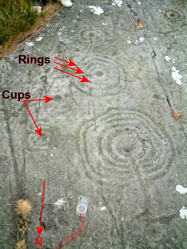
Cup and ring marks or cup marks are a form of prehistoric art found in the Atlantic seaboard of Europe (Ireland, Wales, Northern England, Scotland, France (Brittany), Portugal, and Spain (Galicia (Spain), Galicia) – and in Mediterranean Europe – Italy (in Alpine valleys and Sardinia), Azerbaijan and Greece (Thessaly and Irakleia (Cyclades)), as well as in Scandinavia (Denmark, Sweden, Norway and Finland) and in Switzerland (at Caschenna in Canton of Grisons, Grisons). Similar forms are also found throughout the world including Australia, Gabon, Greece, Hawaii, India (Bhanpura#Daraki-Chattan Cave survey Bhanpura, Daraki-Chattan and Dwarahat), Israel, Mexico, Mozambique and the Americas. The oldest known forms are found from the Fertile Crescent to India. They consist of a wikt:concave, concave depression, no more than a few centimetres across, pecked into a rock surface and often surrounded by concentric circles also etched into the stone. Sometimes a linear channel called a ... [...More Info...] [...Related Items...] OR: [Wikipedia] [Google] [Baidu] |
Eaglesham
Eaglesham ( or , or ; ; ) is a village in East Renfrewshire, Scotland, situated about south of Glasgow, southeast of Newton Mearns and south of Clarkston, East Renfrewshire, Clarkston, and southwest of East Kilbride. The 2011 census revealed that the village had 3,114 occupants, down 13 from the 2001 census (3,127). Eaglesham is distinctive in being built around the Orry, a triangular park area of common land about in length, interspersed with trees and divided in the centre by the Eaglesham Burn. The ancient seat of the Earl of Eglinton, Earls of Eglinton. In the 17th century Eaglesham was a small market town. Today's village was founded in 1769 by Alexander Montgomerie, 10th Earl of Eglinton. It had at one time handloom weaving and a cotton-mill. Many of its buildings are category B or C listed buildings, and the planned village area is a conservation area. Eaglesham was designated Scotland's first outstanding conservation area in 1960. It is likely that here has been a p ... [...More Info...] [...Related Items...] OR: [Wikipedia] [Google] [Baidu] |
Carlin Crags - Upper Crag - Rock-face 2
Carlin may refer to: People * George Carlin (1937–2008), comedian and social critic * Carlin (name), including a list of people with the name Places * 4121 Carlin, a main belt asteroid * Carlin, Nevada, United States * Carlin How, a village in northern England, UK * Carlin Precinct, Calhoun County, Illinois, USA * Carlin Tunnel, in Elko County, Nevada, USA * Carlin Unconformity, a geological feature in Nevada notable as a gold mining area * Delcambre Canal, in the U.S. state of Louisiana, also known as Bayou Carlin Other uses * Carlin Act, legislation in the United States * Carlin America, an independent music publishing conglomerate * Carlin Motorsport, a motor racing team in the United Kingdom * Carlin peas, consumed in northern England * Carlin stone, in Scotland * Pug, a breed of dog (also known as Carlin) See also * * Charlene (other) * Charlin (other) * Carling (other) * Karlin (other) * Carline (name) * Carly (name) Carly is a ... [...More Info...] [...Related Items...] OR: [Wikipedia] [Google] [Baidu] |
East Ayrshire
East Ayrshire (; ) is one of 32 unitary council areas of Scotland. It shares borders with Dumfries and Galloway, East Renfrewshire, North Ayrshire, South Ayrshire and South Lanarkshire. The headquarters of the council are located on London Road, Kilmarnock. With South Ayrshire and the mainland areas of North Ayrshire, it formed the Shires of Scotland, former county of Ayrshire. East Ayrshire had a population of 122,100 at the 2011 census, making it the List of Scottish council areas by population, 16th most populous local authority in Scotland. Spanning a geographical area of , East Ayrshire is the List of Scottish council areas by area, 14th-largest local authority in Scotland in terms of geographical area. The majority of the population of East Ayrshire live within and surrounding the main town, Kilmarnock. Other large population areas in East Ayrshire include Cumnock, the second-largest town, and smaller towns and villages such as Stewarton, Darvel and Hurlford. The area is ... [...More Info...] [...Related Items...] OR: [Wikipedia] [Google] [Baidu] |


