|
Cape Bathurst
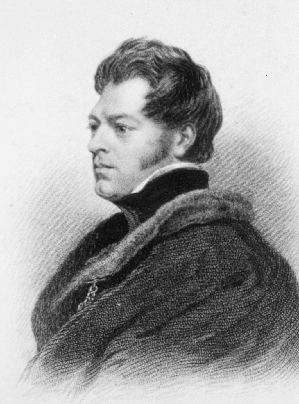
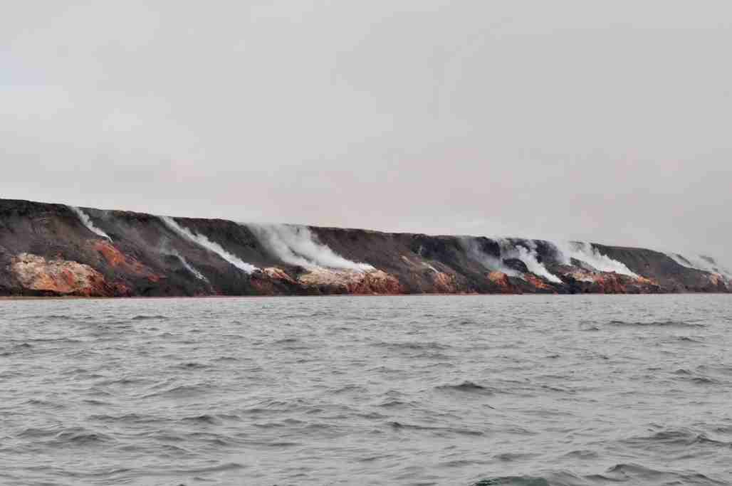
Cape Bathurst ( Inuit: ''Awaq'') is a cape and a peninsula located on the northern coast of the Northwest Territories in Canada. Cape Bathurst is the northernmost point of mainland Northwest Territories and one of the few peninsulas in mainland North America protruding above the 70th parallel north. The first European to see the area was John Richardson, who also named it, in 1826. Some coast areas of Cape Bathurst are being eroded at a rate of a year. Baillie Island is located just off the coast of Cape Bathurst, separated from the peninsula by a shallow strait. A notable nearby formation is Smoking Hills, a group of hills exhibiting continuous burning of oil shale deposits. A rare endemic plant known as hairy rockcress or hairy braya ('' Braya pilosa'', genus Braya of family Brassicaceae) is known to grow in five locations on Cape Bathurst as well as the nearby Baillie Islands. The plant is listed by the Northwest Territories Species at Risk Committee as threatened a ... [...More Info...] [...Related Items...] OR: [Wikipedia] [Google] [Baidu] |
Inuit Languages
The Inuit languages are a closely related group of indigenous American languages traditionally spoken across the North American Arctic and adjacent subarctic, reaching farthest south in Labrador. The related Yupik languages (spoken in western and southern Alaska, as well as in nearby Russia's farthest east, though severely endangered there) are the two main branches of Eskaleut, a primary language family. The Inuit live primarily in three countries: Greenland (Kingdom of Denmark), Canada (specifically in Nunavut, Northwest Territories, the Nunavik region of Quebec, and the Nunatsiavut and Nunatuĸavut regions of Labrador), and the United States (specifically the coast of Alaska). The total population of Inuit speaking their traditional languages is difficult to assess with precision, since most counts rely on self-reported census data that may not accurately reflect usage or competence. Greenland census estimates place the number of speakers of varieties of Inuit langu ... [...More Info...] [...Related Items...] OR: [Wikipedia] [Google] [Baidu] |
Northwest Territories
The Northwest Territories (abbreviated ''NT'' or ''NWT''; french: Territoires du Nord-Ouest, formerly ''North-Western Territory'' and ''North-West Territories'' and namely shortened as ''Northwest Territory'') is a federal territory of Canada. At a land area of approximately and a 2016 census population of 41,790, it is the second-largest and the most populous of the three territories in Northern Canada. Its estimated population as of 2022 is 45,605. Yellowknife is the capital, most populous community, and only city in the territory; its population was 19,569 as of the 2016 census. It became the territorial capital in 1967, following recommendations by the Carrothers Commission. The Northwest Territories, a portion of the old North-Western Territory, entered the Canadian Confederation on July 15, 1870. Since then, the territory has been divided four times to create new provinces and territories or enlarge existing ones. Its current borders date from April 1, 1999, when t ... [...More Info...] [...Related Items...] OR: [Wikipedia] [Google] [Baidu] |
Canada
Canada is a country in North America. Its ten provinces and three territories extend from the Atlantic Ocean to the Pacific Ocean and northward into the Arctic Ocean, covering over , making it the world's second-largest country by total area. Its southern and western border with the United States, stretching , is the world's longest binational land border. Canada's capital is Ottawa, and its three largest metropolitan areas are Toronto, Montreal, and Vancouver. Indigenous peoples have continuously inhabited what is now Canada for thousands of years. Beginning in the 16th century, British and French expeditions explored and later settled along the Atlantic coast. As a consequence of various armed conflicts, France ceded nearly all of its colonies in North America in 1763. In 1867, with the union of three British North American colonies through Confederation, Canada was formed as a federal dominion of four provinces. This began an accretion of provinces and ... [...More Info...] [...Related Items...] OR: [Wikipedia] [Google] [Baidu] |
70th Parallel North
The 70th parallel north is a circle of latitude that is 70 degrees north of the Earth's equatorial plane, in the Arctic. It crosses the Atlantic Ocean, Europe, Asia and North America, and passes through some of the southern seas of the Arctic Ocean. At this latitude the sun is visible for 24 hours, 0 minutes during the summer solstice and Civil Twilight during the winter solstice. On 21 June, the maximum altitude of the sun is 43.44 degrees and –3.44 degrees on 21 December. Around the world Starting at the Prime Meridian and heading eastwards, the parallel 70° north passes through: : See also * 69th parallel north *71st parallel north The 71st parallel north is a circle of latitude that is 71 degrees north of the Earth's equatorial plane, in the Arctic. It crosses the Atlantic Ocean, Europe, Asia and North America, and passes through some of the southern seas of the Arctic O ... {{geographical coordinates, state=collapsed n70 Geography of the Arctic Bor ... [...More Info...] [...Related Items...] OR: [Wikipedia] [Google] [Baidu] |
John Richardson (naturalist)
Sir John Richardson FRS FRSE (5 November 1787 – 5 June 1865) was a Scottish naval surgeon, naturalist and Arctic The Arctic ( or ) is a polar region located at the northernmost part of Earth. The Arctic consists of the Arctic Ocean, adjacent seas, and parts of Canada ( Yukon, Northwest Territories, Nunavut), Danish Realm ( Greenland), Finland, Iceland ... explorer. Life Richardson was born at Nith Place in Dumfries the son of Gabriel Richardson, Provost of Dumfries, and his wife, Anne Mundell. He was educated at Dumfries Grammar School. He was then apprenticed to his maternal uncle, Dr James Mundell, a surgeon in Dumfries. He studied medicine at Edinburgh University, and became a surgeon in the navy in 1807. He traveled with John Franklin in search of the Northwest Passage on the Coppermine Expedition of 1819–1822. Richardson wrote the sections on geology, botany and ichthyology for the official account of the expedition. Franklin and Richardson returned to Ca ... [...More Info...] [...Related Items...] OR: [Wikipedia] [Google] [Baidu] |
Baillie Island
The Baillie Islands (Inuvialuktun: ''Utkraluk'') are located off the north coast of Cape Bathurst in the Northwest Territories, Canada. The islands formed part of the area used by the Avvaqmiut who are a branch of the Inuvialuit (Mackenzie Inuit). A rare endemic plant known as hairy rockcress or hairy braya (''Braya pilosa'', genus Braya of family Brassicaceae) is known to grow in five locations on the Baillie Islands as well as the nearby Cape Bathurst. The plant is listed by the Northwest Territories Species at Risk Committee as threatened and by the Committee on the Status of Endangered Wildlife in Canada as endangered. History The first European to visit the area was John Richardson in 1826, who also named it. It was again visited by Richardson and John Rae, while searching the Northwest Passage for Franklin's lost expedition. In 1915, the Hudson's Bay Company established a trading post on the island. While the post was being set up, it was visited by competing trader Chri ... [...More Info...] [...Related Items...] OR: [Wikipedia] [Google] [Baidu] |
Smoking Hills
The Smoking Hills are located on the east coast of Cape Bathurst in Canada's Northwest Territories, next to the Arctic Ocean and a small group of lakes. The cliffs were named by explorer John Franklin, who was the first European to see them on his 1826 expeditions. They contain strata of hydrocarbons (oil shales), which have been burning continuously for centuries. The fires result from autoignition of sulfur-rich lignite deposits. The clouds of smoke have given the region its name. Over time the sulfur dioxide from the smoke has acidified the shallow ponds (< area and < depth) in the dotting the area, down to a pH lower than 2. Elevated concentrations of metals (aluminium, iron, zinc, nickel, manganese and cadmium) occur in these acidic ponds. Soils and sediments have also been chemically altered. ... [...More Info...] [...Related Items...] OR: [Wikipedia] [Google] [Baidu] |
Oil Shale
Oil shale is an organic-rich fine-grained sedimentary rock containing kerogen (a solid mixture of organic chemical compounds) from which liquid hydrocarbons can be produced. In addition to kerogen, general composition of oil shales constitutes inorganic substance and bitumens. Based on their deposition environment, oil shales are classified as marine, lacustrine and terrestrial oil shales. Oil shales differ from oil-''bearing'' shales, shale deposits that contain petroleum ( tight oil) that is sometimes produced from drilled wells. Examples of oil-''bearing'' shales are the Bakken Formation, Pierre Shale, Niobrara Formation, and Eagle Ford Formation. Accordingly, shale oil produced from oil shale should not be confused with tight oil, which is also frequently called shale oil. Deposits of oil shale occur around the world, including major deposits in the United States. A 2016 estimate of global deposits set the total world resources of oil shale equivalent of of oil in ... [...More Info...] [...Related Items...] OR: [Wikipedia] [Google] [Baidu] |
Endemism
Endemism is the state of a species being found in a single defined geographic location, such as an island, state, nation, country or other defined zone; organisms that are indigenous to a place are not endemic to it if they are also found elsewhere. For example, the Cape sugarbird is found exclusively in southwestern South Africa and is therefore said to be ''endemic'' to that particular part of the world. An endemic species can be also be referred to as an ''endemism'' or in scientific literature as an ''endemite''. For example ''Cytisus aeolicus'' is an endemite of the Italian flora. ''Adzharia renschi'' was once believed to be an endemite of the Caucasus, but it was later discovered to be a non-indigenous species from South America belonging to a different genus. The extreme opposite of an endemic species is one with a cosmopolitan distribution, having a global or widespread range. A rare alternative term for a species that is endemic is "precinctive", which applies t ... [...More Info...] [...Related Items...] OR: [Wikipedia] [Google] [Baidu] |
Braya Pilosa
''Braya pilosa'' is a long-lived perennial flowering plant of the mustard family known by the common name hairy braya. It has one to many stems 4–12 cm long, erect to ascending to almost prostrate and moderately to densely hairy, and can be distinguished from other Braya species by its large flowers and globose fruits with very long styles. The plant arises from a tuft of basal leaves, with white flowers arranged in dense clusters. Its range is limited to the unglaciated portions of Cape Bathurst and Baillie Islands on the shore of the Beaufort Sea in the Northwest Territories, and it is listed at G2 - imperiled by NatureServe and endangered by the Committee on the Status of Endangered Wildlife in Canada (COSEWIC). Its chief threats are loss of habitat through rapid coastal erosion and saline wash from storm surges, and by melting permafrost. References Further reading * pilosa The order Pilosa is a clade of xenarthran placental mammals, native to the Americas ... [...More Info...] [...Related Items...] OR: [Wikipedia] [Google] [Baidu] |
Braya
''Braya'' is a genus of plants in the family Brassicaceae Brassicaceae () or (the older) Cruciferae () is a medium-sized and economically important family of flowering plants commonly known as the mustards, the crucifers, or the cabbage family. Most are herbaceous plants, while some are shrubs. The l .... *'' Braya alpina'' Sternb. & Hoppe *'' Braya fernaldii'' Abbe *'' Braya forrestii'' W.W.Sm. *'' Braya glabella'' Richardson *'' Braya humilis'' (C.A. Mey.) B.L. Rob. *'' Braya linearis'' Rouy *'' Braya longii'' Fernald *'' Braya pilosa'' Hook. *'' Braya rosea'' (Turcz.) Bunge *'' Braya scharnhorstii'' Regel & Schmalh. *'' Braya thorild-wulffii'' Ostenf. References * * External links Brassicaceae genera {{Brassicales-stub ... [...More Info...] [...Related Items...] OR: [Wikipedia] [Google] [Baidu] |
Brassicaceae
Brassicaceae () or (the older) Cruciferae () is a medium-sized and economically important family of flowering plants commonly known as the mustards, the crucifers, or the cabbage family. Most are herbaceous plants, while some are shrubs. The leaves are simple (although are sometimes deeply incised), lack stipules, and appear alternately on stems or in rosettes. The inflorescences are terminal and lack bracts. The flowers have four free sepals, four free alternating petals, two shorter free stamens and four longer free stamens. The fruit has seeds in rows, divided by a thin wall (or septum). The family contains 372 genera and 4,060 accepted species. The largest genera are '' Draba'' (440 species), '' Erysimum'' (261 species), '' Lepidium'' (234 species), '' Cardamine'' (233 species), and '' Alyssum'' (207 species). The family contains the cruciferous vegetables, including species such as '' Brassica oleracea'' (cultivated as cabbage, kale, cauliflower, broccoli and co ... [...More Info...] [...Related Items...] OR: [Wikipedia] [Google] [Baidu] |


.jpg)