|
Camalier
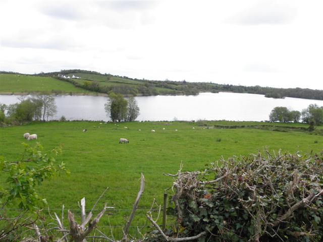
Camalier is a townland in the civil parish of Drumlane, Barony of Loughtee Lower, County Cavan, Ireland. Etymology The townland name is an anglicisation of a Gaelic placename, ''Cam Ladhar'', meaning "The Crooked Fork" (either of a river or a road). The local pronunciation is ''Kam-Ah-Leer''. The earliest surviving mention of the townland is on the 1609 Ulster Plantation map of the Barony of Loughtee, where it is spelled ''Camlier''. A 1610 grant spells it as ''Camlier''. The 1641 Rebellion Depositions spell it as ''Comliere''. The 1654 Commonwealth Survey spells it as ''Camleyer''. The 1660 Books of Survey and Distribution spell it as ''Camleare''. The 1661 Inquisitions spell it as ''Camleer''. Geography Camalier is bounded on the north by Corraquill and Tirgormly townlands, on the east by Drumrush townland, on the south by Tomassan townland and on the west by Cuillaghan townland. Its chief geographical features are a small rivulet, woods & plantations, several drumlin hills w ... [...More Info...] [...Related Items...] OR: [Wikipedia] [Google] [Baidu] |
Cuillaghan
Cuillaghan is a townland in the civil parish of Drumlane, Barony of Loughtee Lower, County Cavan, Ireland. Etymology The townland name is an anglicisation of a Gaelic placename, ''Coilleachán'', meaning 'The Underwood' (i.e. a place full of shrubs). The local pronunciation is 'Kull-Ya-Han'. The earliest surviving mention of the townland is on the 1609 Ulster Plantation Baronial map of the Barony of Loughtee, where it is spelled ''Cullagan''. A 1610 grant spells it as ''Cullagan''. The 1654 Commonwealth Survey spells it as ''Quillaghan''. The 1660 Books of Survey and Distribution spell it as ''Quillehan''. The 1661 Inquisitions spell it as ''Callaghan alias Callagan'' and ''Quillaghan''. Geography Cuillaghan is bounded on the north by Corraquill and Dernagore townlands (both situated in the Northern Ireland part of the United Kingdom), on the east by Camalier and Tomassan townlands, on the south by Ardue townland and on the west by Annagh, County Cavan, Cloncoohy, which is ... [...More Info...] [...Related Items...] OR: [Wikipedia] [Google] [Baidu] |
Tomassan
Tomassan is a townland in the civil parish of Drumlane, Barony of Loughtee Lower, County Cavan, Ireland. Etymology The townland name is an anglicisation of a Gaelic placename, ''Tuaim Easain'', meaning either 'The Tomb of Easan' or "The Tomb of the Little Waterfall". The earliest surviving mention of the townland is on the 1609 Ulster Plantation map of the Barony of Loughtee, where it is spelled ''Tomasan''. A 1610 grant spells it as ''Tomassan''. The 1641 Rebellion Depositions spell it as ''Tomasin''. The 1654 Commonwealth Survey spells it as ''Tuomashan''. The 1660 Books of Survey and Distribution spell it as ''Tommassen''. The 1661 Inquisitions spell it as ''Tumason''. The 1790 Cavan Carvaghs list spells the name as ''Tomessan''. Geography Tomassan is bounded on the north by Camalier townland, on the east by Drumrush townland, on the south by Ardue and Tomkinroad townlands and on the west by Cuillaghan townland. Its chief geographical features are the Rag River, Cuilla ... [...More Info...] [...Related Items...] OR: [Wikipedia] [Google] [Baidu] |
Road At Camalier - Geograph
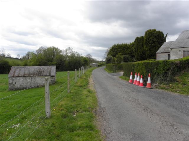
A road is a linear way for the conveyance of traffic that mostly has an improved surface for use by vehicles (motorized and non-motorized) and pedestrians. Unlike streets, the main function of roads is transportation. There are many types of roads, including parkways, avenues, controlled-access highways (freeways, motorways, and expressways), tollways, interstates, highways, thoroughfares, and local roads. The primary features of roads include lanes, sidewalks (pavement), roadways (carriageways), medians, shoulders, verges, bike paths (cycle paths), and shared-use paths. Definitions Historically many roads were simply recognizable routes without any formal construction or some maintenance. The Organization for Economic Co-operation and Development (OECD) defines a road as "a line of communication (travelled way) using a stabilized base other than rails or air strips open to public traffic, primarily for the use of road motor vehicles running on their own wheels" ... [...More Info...] [...Related Items...] OR: [Wikipedia] [Google] [Baidu] |
Tullygarvey
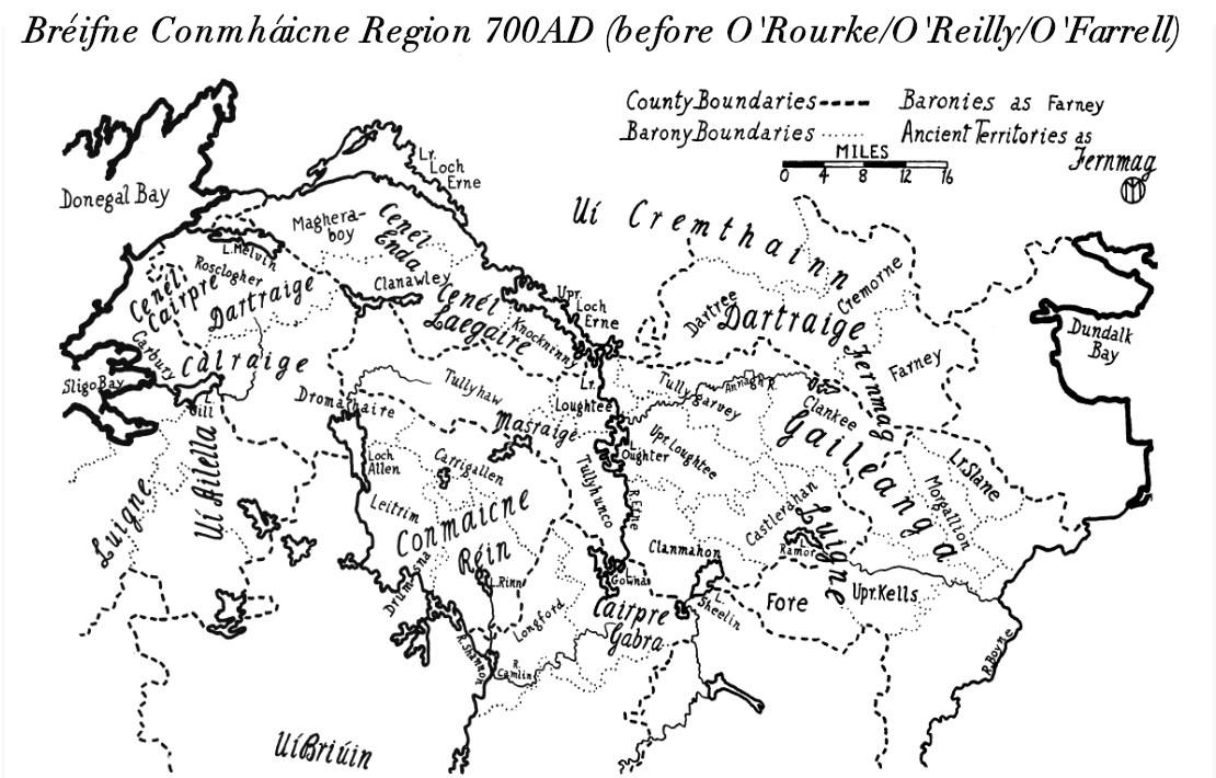
Tullygarvey ( ga, Teallach Ghairbhíth) is one of eight Baronies in the County of Cavan. The area has been in constant occupation since pre-4000 BC. The Barony of Tullygarvey consists of the parishes of Kill and Drung and parts of Annagh, Drumgoon and Laragh. Tullygarvey derives its name from the Irish meaning "Gairbhéith's household", Gairbhéith was a member of the Uí Briúin dynasty of Connacht. He was an ancestor of the O'Reilly clan and lived c.860 AD. He was not connected to the McGarvey clan of Donegal. It is located in the northeast of County Cavan, along the Annagh River. History In 1579, East Breifne, then part of Connacht, was made a shire. The shire was named Cavan after the area's main town. The administration remained in the control of the local Irish dynasty and subject to the Brehon and Canon Law. In 1584, John Perrot formed the shire into a county in Ulster. . Settlements *Cootehill Cootehill (; ) is a market town and townland in County Cavan, ... [...More Info...] [...Related Items...] OR: [Wikipedia] [Google] [Baidu] |
Census Of Ireland, 1901
A census is the procedure of systematically acquiring, recording and calculating information about the members of a given population. This term is used mostly in connection with national population and housing censuses; other common censuses include censuses of agriculture, traditional culture, business, supplies, and traffic censuses. The United Nations (UN) defines the essential features of population and housing censuses as "individual enumeration, universality within a defined territory, simultaneity and defined periodicity", and recommends that population censuses be taken at least every ten years. UN recommendations also cover census topics to be collected, official definitions, classifications and other useful information to co-ordinate international practices. The UN's Food and Agriculture Organization (FAO), in turn, defines the census of agriculture as "a statistical operation for collecting, processing and disseminating data on the structure of agriculture, covering th ... [...More Info...] [...Related Items...] OR: [Wikipedia] [Google] [Baidu] |
John Richardson (bishop Of Ardagh)
John Richardson (1580–1654) was an English bishop of the Church of Ireland. He was nominated Bishop of Ardagh on 8 April 1633 and consecrated in September that year. He was also Archdeacon of Derry from 1622 to 1634; and Archdeacon of Connor from 1639 to 1654. He left Ireland before the Rebellion of 1641 and died in London on 11 August 1654. Life He was born near Chester, entered Trinity College, Dublin, graduated M.A., and became a fellow in 1600. In the same year he was selected with James Ussher and another as lay preacher at Christ Church Cathedral, Dublin. Richardson's part was to preach on Wednesdays, and explain the prophecies of Isaiah. He later took holy orders, and was created D.D. in 1614. Richardson held many preferments. He was appointed vicar of Granard, in Ardagh, in 1610; rector of Ardsrath, Derry, in 1617; Archdeacon of Derry in 1622 (reappointed in the new charter of 1629); Prebendary of Mullaghbrack at St Patrick's Cathedral, Armagh on 14 May 1633; ... [...More Info...] [...Related Items...] OR: [Wikipedia] [Google] [Baidu] |
Irish Rebellion Of 1641
The Irish Rebellion of 1641 ( ga, Éirí Amach 1641) was an uprising by Irish Catholics in the Kingdom of Ireland, who wanted an end to anti-Catholic discrimination, greater Irish self-governance, and to partially or fully reverse the plantations of Ireland. They also wanted to prevent a possible invasion or takeover by anti-Catholic English Parliamentarians and Scottish Covenanters, who were defying the king, Charles I. It began as an attempted ''coup d'état'' by Catholic gentry and military officers, who tried to seize control of the English administration in Ireland. However, it developed into a widespread rebellion and ethnic conflict with English and Scottish Protestant settlers, leading to Scottish military intervention. The rebels eventually founded the Irish Catholic Confederacy. Led by Felim O'Neill, the rebellion began on 23 October and although they failed to seize Dublin Castle, within days the rebels occupied most of the northern province of Ulster. O'Neill ... [...More Info...] [...Related Items...] OR: [Wikipedia] [Google] [Baidu] |
Edward Bagshawe Of Finglas
Sir Edward Bagshawe (or Bagshaw) (died 6 October 1657) of Finglas, County Dublin, was knighted in 1627, reappointed a comptroller of customs in 1629 and was a member of parliament for the borough of Banagher in Strafford's parliament of 1634−1635. During the Commonwealth (1650s) he was a commissioner of the revenue. Biography Little is known of Edward Bagshawe until 1624, when he appears as customer of the ports of Dublin, Skerries, Malahide, and Wicklow, but his services to the government must have been considerable, as in 1627 he received a knighthood and was given a grant of lands, afterwards known as the manor of Castle Bagshawe, Belturbet in County Cavan. At this time the government of Ireland farmed out the collection of customs duties to a consortium. That is the English consortium paid the government a fixed amount of money for the right to collect the customs duties and to keep the profits. The government benefited because it was guaranteed money while the consorti ... [...More Info...] [...Related Items...] OR: [Wikipedia] [Google] [Baidu] |
James VI And I
James VI and I (James Charles Stuart; 19 June 1566 – 27 March 1625) was King of Scotland as James VI from 24 July 1567 and King of England and Ireland as James I from the union of the Scottish and English crowns on 24 March 1603 until his death in 1625. The kingdoms of Scotland and England were individual sovereign states, with their own parliaments, judiciaries, and laws, though both were ruled by James in personal union. James was the son of Mary, Queen of Scots, and a great-great-grandson of Henry VII, King of England and Lord of Ireland, and thus a potential successor to all three thrones. He succeeded to the Scottish throne at the age of thirteen months, after his mother was compelled to abdicate in his favour. Four different regents governed during his minority, which ended officially in 1578, though he did not gain full control of his government until 1583. In 1603, he succeeded Elizabeth I, the last Tudor monarch of England and Ireland, who died childless. H ... [...More Info...] [...Related Items...] OR: [Wikipedia] [Google] [Baidu] |
Ulster Plantation
The Plantation of Ulster ( gle, Plandáil Uladh; Ulster-Scots: ''Plantin o Ulstèr'') was the organised colonisation ('' plantation'') of Ulstera province of Irelandby people from Great Britain during the reign of King James I. Most of the settlers (or ''planters'') came from southern Scotland and northern England; their culture differed from that of the native Irish. Small privately funded plantations by wealthy landowners began in 1606, while the official plantation began in 1609. Most of the colonised land had been confiscated from the native Gaelic chiefs, several of whom had fled Ireland for mainland Europe in 1607 following the Nine Years' War against English rule. The official plantation comprised an estimated half a million acres (2,000 km2) of arable land in counties Armagh, Cavan, Fermanagh, Tyrone, Donegal, and Londonderry. Land in counties Antrim, Down, and Monaghan was privately colonised with the king's support. Among those involved in planning and o ... [...More Info...] [...Related Items...] OR: [Wikipedia] [Google] [Baidu] |
County Westmeath
"Noble above nobility" , image_map = Island of Ireland location map Westmeath.svg , subdivision_type = Country , subdivision_name = Ireland , subdivision_type1 = Province , subdivision_name1 = , subdivision_type2 = Region , subdivision_name2 = Eastern and Midland , seat_type = County town , seat = Mullingar , parts_type = Largest settlement , parts = Athlone , leader_title = Local authority , leader_name = Westmeath County Council , leader_title2 = Dáil constituencies , leader_name2 = , leader_title3 = EP constituency , leader_name3 = Midlands–North-West , area_total_km2 = 1840 , area_rank = 21st , population_total = 95,840. , population_as_of = 2022 , population_footnotes = , population_density_km2 = auto , population_rank = 22nd , blank_ ... [...More Info...] [...Related Items...] OR: [Wikipedia] [Google] [Baidu] |
Plantation Of Ulster
The Plantation of Ulster ( gle, Plandáil Uladh; Ulster-Scots: ''Plantin o Ulstèr'') was the organised colonisation ('' plantation'') of Ulstera province of Irelandby people from Great Britain during the reign of King James I. Most of the settlers (or ''planters'') came from southern Scotland and northern England; their culture differed from that of the native Irish. Small privately funded plantations by wealthy landowners began in 1606, while the official plantation began in 1609. Most of the colonised land had been confiscated from the native Gaelic chiefs, several of whom had fled Ireland for mainland Europe in 1607 following the Nine Years' War against English rule. The official plantation comprised an estimated half a million acres (2,000 km2) of arable land in counties Armagh, Cavan, Fermanagh, Tyrone, Donegal, and Londonderry. Land in counties Antrim, Down, and Monaghan was privately colonised with the king's support. Among those involved in planning an ... [...More Info...] [...Related Items...] OR: [Wikipedia] [Google] [Baidu] |


.jpg)