Tomassan on:
[Wikipedia]
[Google]
[Amazon]
 Tomassan is a

 Tomassan is bounded on the north by Camalier townland, on the east by Drumrush townland, on the south by
The IreAtlas Townland Data Base
{{County Cavan Townlands of County Cavan
 Tomassan is a
 townland
A townland (; Ulster-Scots: ''toonlann'') is a traditional small land division used in Ireland and in the Western Isles of Scotland, typically covering . The townland system is of medieval Gaelic origin, predating the Norman invasion, and mo ...
in the civil parish of Drumlane
Drumlane () is a townland situated near the village of Milltown, area 85.76 hectares (211.93 acres), in County Cavan, Ireland. Drumlane is also the name of the civil parish in which the townland is situated. Saint Columba brought Christianity to ...
, Barony of Loughtee Lower
Loughtee Lower (), or Lower Loughtee, is a barony in County Cavan, Ireland. Baronies were mainly cadastral rather than administrative units. They acquired modest local taxation and spending functions in the 19th century before being superseded ...
, County Cavan
County Cavan ( ; ) is a Counties of Ireland, county in Republic of Ireland, Ireland. It is in the Provinces of Ireland, province of Ulster and is part of the Northern and Western Region. It is named after the town of Cavan and is based on the hi ...
, Ireland
Ireland (, ; ; Ulster Scots dialect, Ulster-Scots: ) is an island in the North Atlantic Ocean, in Northwestern Europe. Geopolitically, the island is divided between the Republic of Ireland (officially Names of the Irish state, named Irelan ...
.
Etymology
The townland name is an anglicisation of a Gaelic placename, ''Tuaim Easain'', meaning either 'The Tomb of Easan' or "The Tomb of the Little Waterfall". The earliest surviving mention of the townland is on the 1609 Ulster Plantation map of the Barony of Loughtee, where it is spelt ''Tomasan''. A 1610 grant spells it as ''Tomassan''. The 1641 Rebellion Depositions spell it as ''Tomasin''. The 1654 Commonwealth Survey spells it as ''Tuomashan''. The 1660 Books of Survey and Distribution spell it as ''Tommassen''. The 1661 Inquisitions spell it as ''Tumason''. The 1790 Cavan Carvaghs list spells the name as ''Tomessan''.Geography

 Tomassan is bounded on the north by Camalier townland, on the east by Drumrush townland, on the south by
 Ardue
Ardue is a townland in the civil parish of Drumlane, Barony of Loughtee Lower, County Cavan, Republic of Ireland, Ireland.
Etymology
The townland name is an anglicisation of a Gaelic placename, ''Ard Aodha'', meaning 'The Height of Hugh'. The ...
and Tomkinroad townlands and on the west by Cuillaghan townland. Its chief geographical features are the Rag River
The Rag River is a river in County Cavan, Ireland. It rises in Mullaghdoo Lough, in the townland of Aghnacreevy, parish of Kildallan, and flows in a north-easterly direction through the lakes of Clonty Lough, Togher Lough, Lough Rud, Aghavoher ...
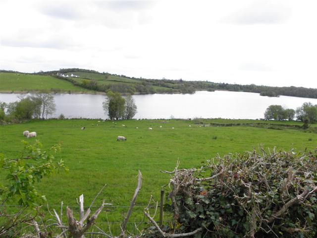
, Cuillaghan Lough, and Tomkinroad Lough, both of which lakes contain a wide variety of coarse fish, a small rivulet, a small island in Cuillaghan Lough, woods & plantations, several drumlin hills which reach heights over 200 feet above sea level, a gravel pit, spring wells and a dug well. The townland is traversed by minor roads & lanes and the disused Cavan and Leitrim Railway
The Cavan and Leitrim Railway was a narrow-gauge railway that operated in the south of County Leitrim and the north-west of County Cavan on the northern edge of the Midlands in Ireland; it ran from 1887 until 1959.
Unusually for Ireland, this ...
. Tomassan has an area of 127 acres, including 26 acres of water.
History
From medieval times until 1606, the townland formed part of the lands owned by the O'Reilly clan. William Tyrrell, the brother of Richard Tyrrell ofTyrrellspass
Tyrrellspass (, IPA: �bʲaləxˈanˠˈtʲɪɾʲiəliː is a Georgian village in County Westmeath, Ireland. It is from Dublin, in the south of the county on the R446 (formerly the N6) road. Tyrrellspass won the Irish Tidy Towns Competition i ...
, County Westmeath
County Westmeath (; or simply ) is a Counties of Ireland, county in Republic of Ireland, Ireland. It is in the Provinces of Ireland, province of Leinster and is part of the Eastern and Midland Region. It formed part of the historic Kingdom of ...
, purchased Tomassan c.1606 from the O'Reillys. A schedule, dated 31 July 1610, of the lands William Tyrrell owned in Loughtee prior to the Ulster Plantation included: ''Tomassani, one gallon'' (a gallon was half a poll or about 30 acres of arable land). The Commissioners of the Plantation stated: ''We find that Mr William Tirrell hath had ye possession of these polls some 4 years, of some a lesse tyme without title but only by agreement with some of the natives for protection''. In the Plantation of Ulster
The Plantation of Ulster (; Ulster Scots dialects, Ulster Scots: ) was the organised Settler colonialism, colonisation (''Plantation (settlement or colony), plantation'') of Ulstera Provinces of Ireland, province of Irelandby people from Great ...
, Tyrrell swapped his lands in Tomassan for additional land in the barony of Tullygarvey
Tullygarvey () is one of eight Baronies in the County of Cavan. The area has been in constant occupation since pre-4000 BC. The Barony of Tullygarvey consists of the parishes of Kill and Drung and parts of Annagh, Drumgoon and Laragh.
Tullyg ...
where he lived at the time.
An Ulster Plantation
The Plantation of Ulster (; Ulster Scots: ) was the organised colonisation (''plantation'') of Ulstera province of Irelandby people from Great Britain during the reign of King James VI and I.
Small privately funded plantations by wealthy lan ...
grant of the 'Manor of Monaghan', dated 21 June 1610, from King James VI and I
James VI and I (James Charles Stuart; 19 June 1566 – 27 March 1625) was King of Scotland as James VI from 24 July 1567 and King of England and King of Ireland, Ireland as James I from the union of the Scottish and English crowns on 24 M ...
to Sir Hugh Wyrral, a native of Enfield, Essex, England, included one poll of ''Tomassan''. On 2 December 1628 the Manor of Monaghan, which included Tomassan, was re-granted to Sir Edward Bagshawe, who then renamed the estate as Castle Bagshaw.
At Cavan Town on 21 June 1643, Henry Baxter, the son of Martin Baxter the first Protestant rector of Tomregan
Tomregan (, ) is a civil parish in the ancient barony of Tullyhaw. The parish straddles the border between the Republic of Ireland and Northern Ireland. The largest population centre in the parish is Ballyconnell, County Cavan. The total are ...
parish, stated that during the Irish Rebellion of 1641
The Irish Rebellion of 1641 was an uprising in Kingdom of Ireland, Ireland, initiated on 23 October 1641 by Catholic gentry and military officers. Their demands included an end to anti-Catholic discrimination, greater Irish self-governance, and ...
, he was robbed by several rebels including ''Turlogh Maergagh ô Rely of Tomasin of the Barrony of Loughty & parrish of Lowghty gent''. This was probably "Toirdhealbhach 'Meirgeach' (meaning freckled) O'Reilly", son of Cathal, son of Maol Mórdha. His grandfather was chief of 'An Bolgán', an old name for Drumlane.
After the Rebellion was defeated, Sir Edward Bagshawe's daughter, Anne, married Thomas Richardson of Dublin, son of John Richardson, bishop of Ardagh, and the marriage settlement dated 28 May 1654 transferred the estate to the married couple. The 1654 Commonwealth Survey states the proprietor of ''Tuomashan'' was 'Mr Thomas Richardson'. On 7 May 1661, the Richardsons sold part of the estate, including ''Tumason'', to Major Humphrey Perrott of Drumhome townland, Ballyhaise, County Cavan.
A deed dated 4 March 1708 includes the lands of ''Tomassin''.
A deed dated 10 March 1709 includes the lands of ''Tomasin''.
A deed dated 27 March 1709 includes the lands of ''Tomassin''.
A deed dated 2 December 1709 includes the lands of ''Tomasin''.
A lease dated the 10th day of April 1777 demised lands, including ''Thomasson'', to James Berry for a term of 300 years. On 12 April 1850, the Berry Estate was ordered to be sold.
The Tithe Applotment Books for 1833 list three tithe payers in the townland.
The Tomassan Valuation Office Field books are available for September 1838.
Griffith's Valuation of 1857 lists five occupiers in the townland.
Census
In the1901 census of Ireland
Nineteen or 19 may refer to:
* 19 (number)
* One of the years 19 BC, AD 19, 1919, 2019
Films
* ''19'' (film), a 2001 Japanese film
* ''Nineteen'' (1987 film), a 1987 science fiction film
* ''19-Nineteen'', a 2009 South Korean film
* ''Dician ...
, there were five families listed in the townland.
In the 1911 census of Ireland, there were five families listed in the townland.
In 1995 there was one family in the townland.
Antiquities
# A medieval crannog on the island in Cuillaghan Lough, (Site number 1605, page 189, Tomassan townland, in "Archaeological Inventory of County Cavan", Patrick O’Donovan, 1995, where it is described as: ''Small circular island in Cuillaghan Lough, c. 150m from the shoreline. Marked on all OS editions. In 1907 Thomas Hall recorded Crannoge near Belturbet' in JRSAI, Vol. 37, 1907, pp.240-241digging into a mound at the centre of the island and finding a substantial bed of ashes and debris incorporating coarse black sherds of pottery, fragments of quernstones, large quantities of broken bones and a grooved stone. An oak dugout canoe was discovered at that time on the SE shore''). # A railway bridge and footbridge over the Rag River. # A ford and stepping-stones over the rivulet.References
Sources
* McGuinn, J., ed. (1995). 'Staghall : A History 1846–1996'. Cavan: A Church Committee Publication.External links
The IreAtlas Townland Data Base
{{County Cavan Townlands of County Cavan