|
Caldicot Railway Station
Caldicot railway station is a part of the British railway system owned by Network Rail and is operated by Transport for Wales. It serves the town of Caldicot in Monmouthshire, Wales. It is located between Chepstow and the city of Newport on the Gloucester line, from the zero point at , measured via Stroud. The line to Bristol via the Severn Tunnel runs just to the north but there are no platforms here; however, Severn Tunnel Junction station is within walking distance for those wanting to travel to Bristol. History The railway line through Caldicot was built as the broad gauge South Wales Railway in 1850, although the nearest station was at Portskewett, two miles to the east. In 1861 a private siding was opened to serve the Caldicot Iron & Wire Works, from 1880 the Severn Tinplate Works, on what is now the industrial estate on the Sudbrook road, south of the castle. In typical broad gauge fashion, these works lines used two short hand-worked turntables to move wagons bet ... [...More Info...] [...Related Items...] OR: [Wikipedia] [Google] [Baidu] |
Caldicot, Monmouthshire
Caldicot () is a market town and Community (Wales), community in Monmouthshire, Wales. The town is located between Chepstow and the city of Newport, Wales, Newport. The site adjoins the Caldicot and Wentloog Levels, Caldicot Levels, on the north side of the Severn Estuary. The population of the built-up area was around 11,000. It has a large school, Caldicot School, and is known for its Caldicot Castle, medieval castle. The built-up area includes Portskewett. Caldicot had a population of 9,604 in 2011. History There was considerable activity in the area during the Bronze Age. Excavations near the Nedern Brook beside Caldicot Castle, the castle revealed a plank from a boat and complex wooden structures in the former river bed. The boat probably traded across the Severn with the farmers and traders of Somerset. Later, in Roman Britain, Roman times, it is likely that trading vessels sailed up the Nedern Brook to Caerwent. The discovery of kilns also shows that coarse pottery was ... [...More Info...] [...Related Items...] OR: [Wikipedia] [Google] [Baidu] |
Siding (rail)
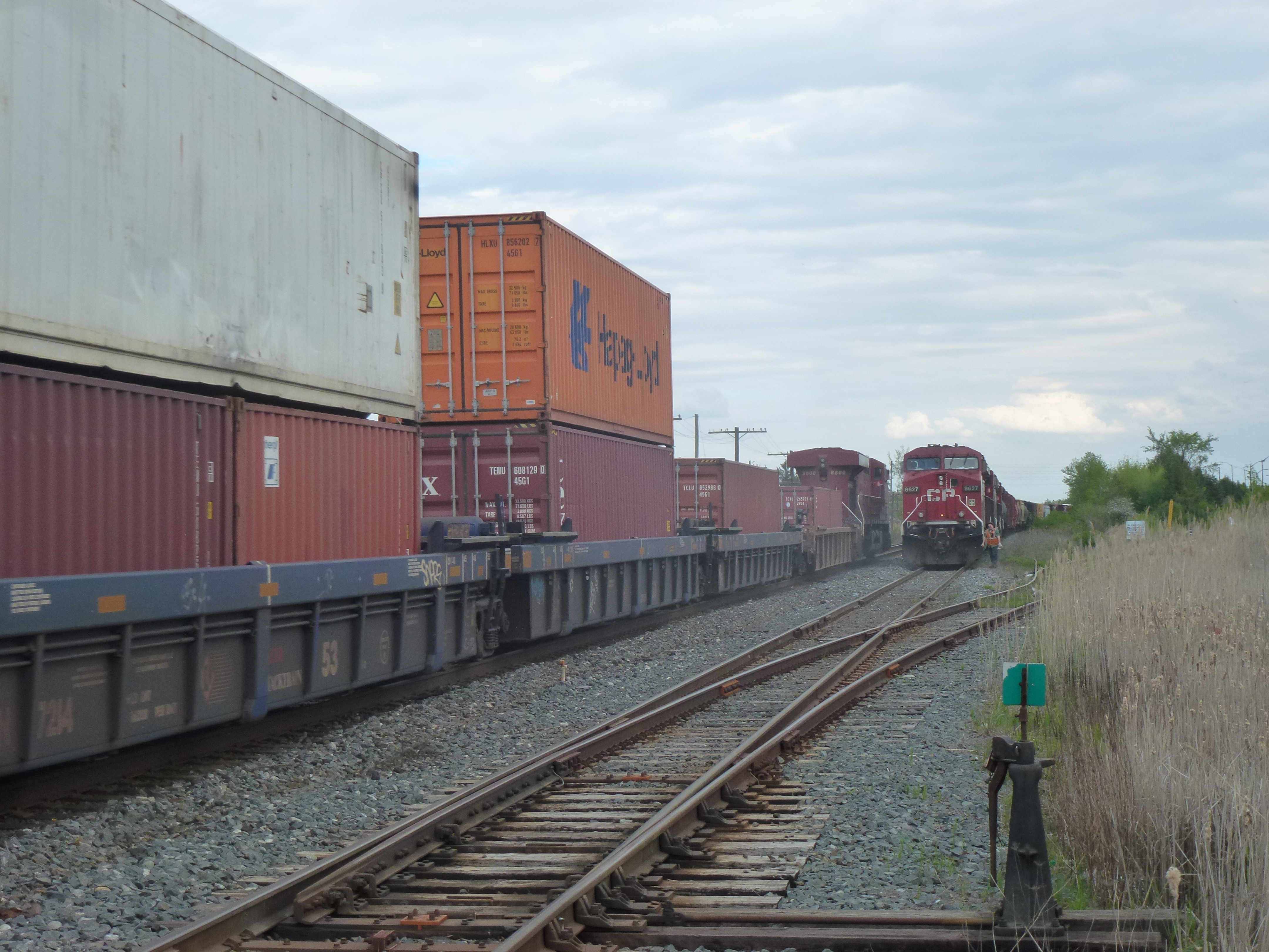
In rail terminology, a siding is a low-speed track section distinct from a running line or through route such as a main line, branch line, or spur. It may connect to through track or to other sidings at either end. Sidings often have lighter rails, meant for lower speed or less heavy traffic, and few, if any, signals. Sidings connected at both ends to a running line are commonly known as loops; those not so connected may be referred to as single-ended or dead-end sidings, or (if short) stubs. Functions Sidings may be used for marshalling (classifying), stabling, storing, loading, and unloading rail vehicles. Common sidings store stationary rolling stock, especially for loading and unloading. Industrial sidings (also known as spurs) go to factories, mines, quarries, wharves, warehouses, some of them are essentially links to industrial railways. Such sidings can sometimes be found at stations for public use; in American usage these are referred to as team tracks (after ... [...More Info...] [...Related Items...] OR: [Wikipedia] [Google] [Baidu] |
United States Army Air Forces
The United States Army Air Forces (USAAF or AAF) was the major land-based aerial warfare service component of the United States Army and ''de facto'' aerial warfare service branch of the United States during and immediately after World War II (1941–1947). It was created on 20 June 1941 as successor to the previous United States Army Air Corps and is the direct predecessor of the United States Air Force, today one of the six United States Armed Forces, armed forces of the United States. The AAF was a component of the United States Army, which on 2 March 1942 was divided functionally by executive order into three autonomous forces: the Army Ground Forces, the United States Army Services of Supply (which in 1943 became the Army Service Forces), and the Army Air Forces. Each of these forces had a commanding general who reported directly to the Chief of Staff of the United States Army, Army Chief of Staff. The AAF administered all parts of military aviation formerly distributed am ... [...More Info...] [...Related Items...] OR: [Wikipedia] [Google] [Baidu] |
Sir Robert McAlpine
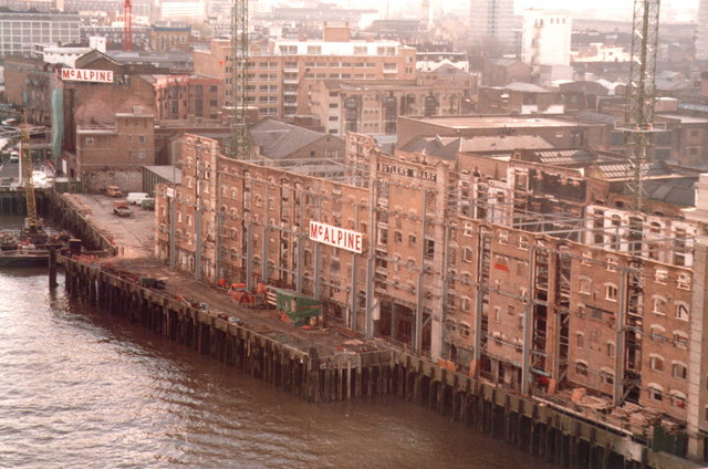
Sir Robert McAlpine Limited is a family-owned building and civil engineering company based in Hemel Hempstead, England. It carries out engineering and construction in the infrastructure, heritage, commercial, arena and stadium, healthcare, education and nuclear sectors. History Robert McAlpine was born in 1847 in the Scottish village of Newarthill near Motherwell. From the age of seven he worked in the nearby coal mines, leaving at 16 to become an apprentice bricklayer. Later, working for an engineer, he progressed to being foreman before starting to work on his own account at the age of 22. He had no capital other than that he could earn himself and his first contract involving the employment of other men had to be financed by borrowing £11 from the butcher. From there, McAlpine enjoyed rapid success; the early contracts centred on his own trade of bricklaying and by 1874 he was the owner of two brickyards and an employer of 1,000 men.J Saxon Childers, Robert McAlpine A Bio ... [...More Info...] [...Related Items...] OR: [Wikipedia] [Google] [Baidu] |
Royal Navy Propellant Factory, Caerwent
Caerwent Training Area is a British military installation at Caerwent, Monmouthshire, Wales. The large military site is situated north of the A48 road about west of Chepstow and east of Newport. Established as the Royal Navy Propellant Factory, Caerwent in 1939, it was originally dedicated to the manufacture and storage of Royal Naval munitions. It has been used as a training area since its closure as an armament works in 1966, and between 1967 and 1993 was RAF Caerwent. Caerwent Barracks is to be built on the site to house 1st The Queen's Dragoon Guards and 1st Battalion, The Rifles from 2027. As at 2023, the site is under construction. Royal Navy Propellant Factory, Caerwent In the summer of 1936, the Royal Navy drew up prequirements for a new factory. The main priorities were: *the establishment should not be vulnerable to air attack; *should not be located in an industrial area, but sufficiently close to a populated area to provide an adequate workforce; *should ... [...More Info...] [...Related Items...] OR: [Wikipedia] [Google] [Baidu] |
Caldicot Levels
The Caldicot and Wentloog Levels are two areas of low-lying estuarine Alluvium, alluvial wetland and Intertidal zone, intertidal mudflats adjoining the north bank of the Severn Estuary, either side of the River Usk estuary near Newport, Wales, Newport in south east Wales. They are also known collectively as the Monmouthshire Levels or Gwent Levels, and the name Wentloog is sometimes spelled Wentlooge in official publications. The Caldicot (hundred), Caldicot Level lies to the southeast of Newport between the River Usk and River Wye and consists of . It is home to Newport Wetlands Reserve. The Wentloog (hundred), Wentloog Level lies to the southwest between the River Usk and Rhymney River and consists of . They are an Agriculture, agricultural region interspersed with suburban development. The levels are formed from tidal deposits and alluvium, which have been recurrently inundated and reclaimed from the Severn Estuary by humans since Roman Britain, Roman times. They have been ... [...More Info...] [...Related Items...] OR: [Wikipedia] [Google] [Baidu] |
Ordnance Survey Map
The Ordnance Survey (OS) is the national mapping agency for Great Britain. The agency's name indicates its original military purpose (see ordnance and surveying), which was to map Scotland in the wake of the Jacobite rising of 1745. There was also a more general and nationwide need in light of the potential threat of invasion during the Napoleonic Wars. Since 1 April 2015, the Ordnance Survey has operated as Ordnance Survey Ltd, a government-owned company, 100% in public ownership. The Ordnance Survey Board remains accountable to the Secretary of State for Science, Innovation and Technology. It was also a member of the Public Data Group. Paper maps represent only 5% of the company's annual revenue. It produces digital map data, online route planning and sharing services and mobile apps, plus many other location-based products for business, government and consumers. Ordnance Survey mapping is usually classified as either " large-scale" (in other words, more detailed) or ... [...More Info...] [...Related Items...] OR: [Wikipedia] [Google] [Baidu] |
Gloucester Railway Station
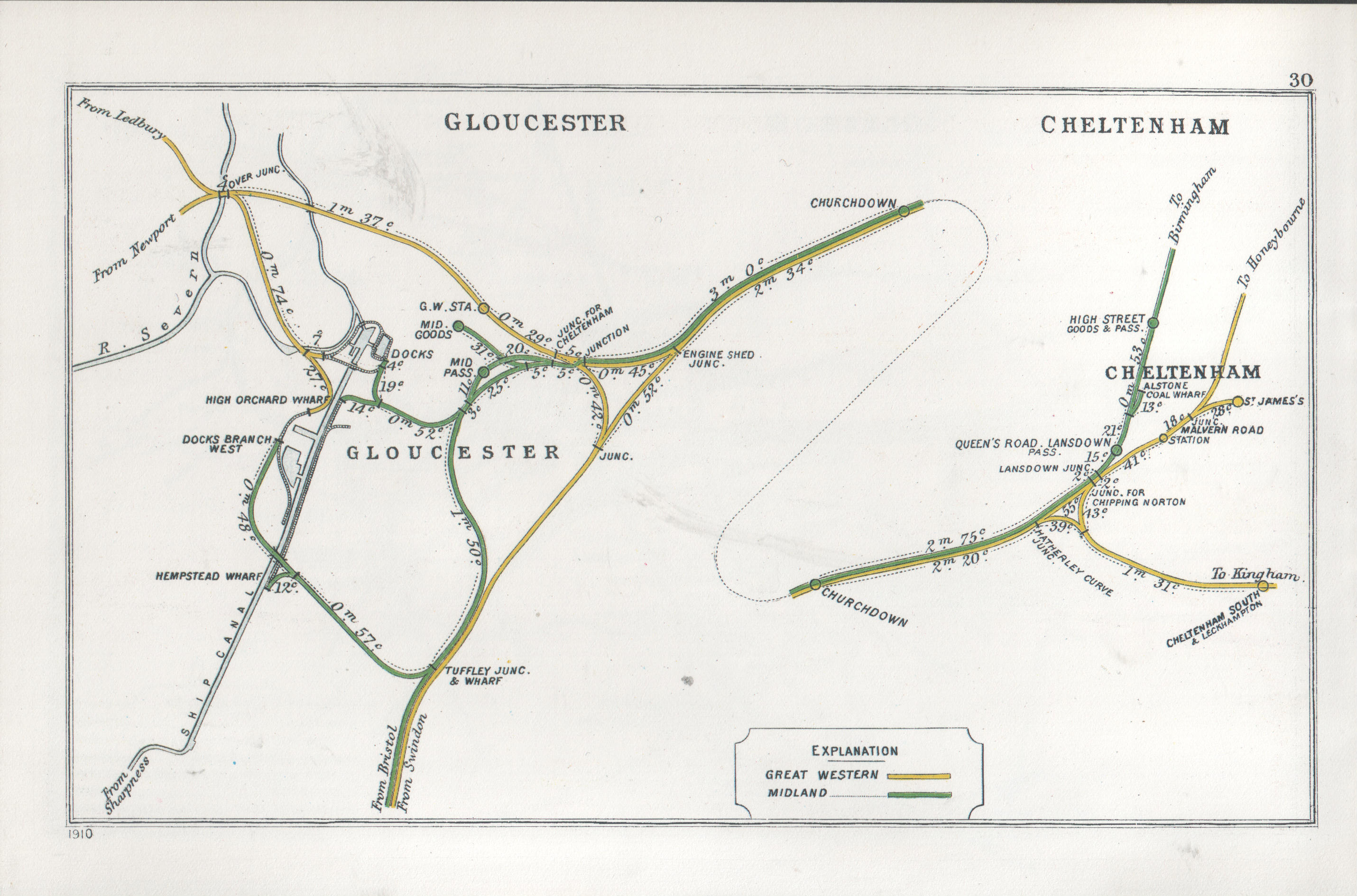
Gloucester, formerly known as Gloucester Central, is a railway station serving the city of Gloucester in England. It is located west of , via . The station was originally built as the terminus of the Birmingham and Gloucester Railway in 1840; the arrival of the broad-gauge Bristol and Gloucester Railway and Cheltenham and Great Western Union Railway in 1844, and then conversion to a through station for the South Wales Railway in 1851, resulted in a very complex layout. Subsequent closures and rationalisation have left Gloucester with a station that is located off the main Bristol-Birmingham line; this means that Great Western Railway services must reverse, while CrossCountry and Transport for Wales services continue to Newport. History The railway development at Gloucester was very complex involving four different railway companies and five distinct railway stations. The first company to open was the Birmingham and Gloucester Railway, which was a standard-gauge line ... [...More Info...] [...Related Items...] OR: [Wikipedia] [Google] [Baidu] |
Caldicot - Low Bridge Near The Station - Geograph
Caldicot () is a market town and community in Monmouthshire, Wales. The town is located between Chepstow and the city of Newport. The site adjoins the Caldicot Levels, on the north side of the Severn Estuary. The population of the built-up area was around 11,000. It has a large school, Caldicot School, and is known for its medieval castle. The built-up area includes Portskewett. Caldicot had a population of 9,604 in 2011. History There was considerable activity in the area during the Bronze Age. Excavations near the Nedern Brook beside the castle revealed a plank from a boat and complex wooden structures in the former river bed. The boat probably traded across the Severn with the farmers and traders of Somerset. Later, in Roman times, it is likely that trading vessels sailed up the Nedern Brook to Caerwent. The discovery of kilns also shows that coarse pottery was produced in the village during Roman times. The name 'Caldicot' is usually stated to derive from the Old Engl ... [...More Info...] [...Related Items...] OR: [Wikipedia] [Google] [Baidu] |
South Wales Main Line
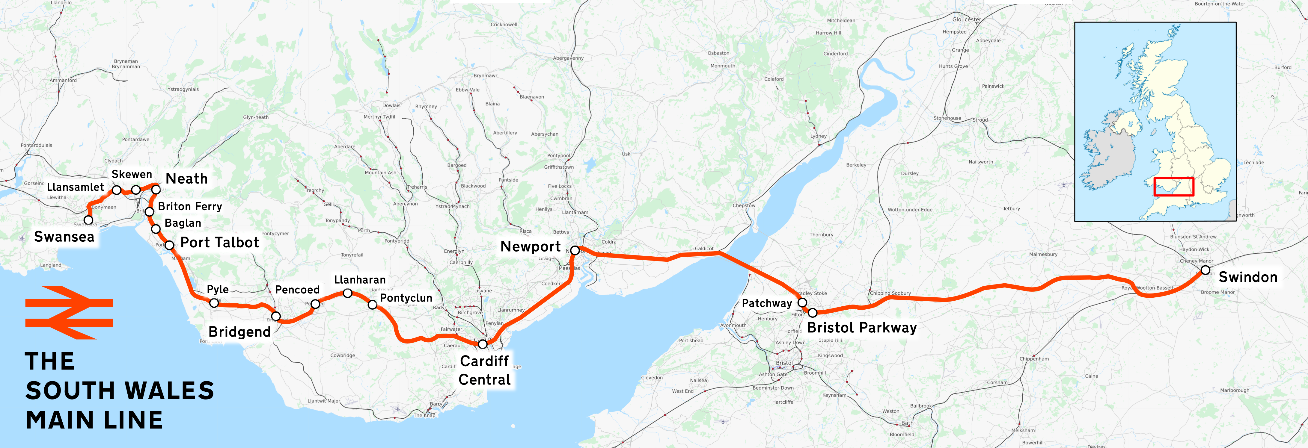
The South Wales Main Line (), originally known as the London, Bristol and South Wales Direct Railway or simply as the Bristol and South Wales Direct Railway, is a branch of the Great Western Main Line in Great Britain. It diverges from the core London-Bristol line at Royal Wootton Bassett beyond Swindon, first calling at Bristol Parkway, after which the line continues through the Severn Tunnel into South Wales. Much of the South Wales Main Line was built between the 1830s and 1886; originally trains to and from destinations in England ran via Chepstow, Gloucester and Stroud, joining the Great Western Main Line at Swindon. A more direct route was challenging yet desirable, leading to the construction of the line's most prominent civil engineering feature, the Severn Tunnel. Completed in 1886, it permitted a significant reduction in journey times between various destinations, especially after the construction of the Badminton Line in 1903. During the British Rail era, th ... [...More Info...] [...Related Items...] OR: [Wikipedia] [Google] [Baidu] |
Sudbrook, Monmouthshire
Sudbrook is a village in Monmouthshire, south east Wales. It is located 4 miles south west of Chepstow and 1 mile east of Caldicot. It lies close to the Second Severn Crossing on the Severn Estuary, and adjoins the village of Portskewett. It was largely built in the late 19th century for workers on the Severn railway tunnel. At that time it was also known as Southbrook. History Sudbrook hill fort Sudbrook was of early historic importance in guarding the Severn estuary at an ancient ferry crossing place. An Iron Age hillfort is located on the coast, probably built and occupied by the Silures from the 2nd century BC and occupied by the Romans from the 1st century AD until the 4th century. The hillfort was originally much bigger than now having been eroded over the centuries. Finds of Roman coins at Black Rock, Portskewett, show that the ferry crossing was in use in Roman times, on the route between the Roman stations of ''Aquae Sulis'' (Bath) and ''Venta Silurum'' ( C ... [...More Info...] [...Related Items...] OR: [Wikipedia] [Google] [Baidu] |
Standard Gauge
A standard-gauge railway is a railway with a track gauge of . The standard gauge is also called Stephenson gauge (after George Stephenson), international gauge, UIC gauge, uniform gauge, normal gauge in Europe, and SGR in East Africa. It is the most widely used track gauge around the world, with about 55% of the lines in the world using it. All high-speed rail lines use standard gauge except High-speed rail in Russia, those in Russia, High-speed rail in Finland, Finland, High-speed rail in Uzbekistan, Uzbekistan, and some line sections in High-speed rail in Spain, Spain. The distance between the inside edges of the heads of the rails is defined to be 1,435 mm except in the United States, Canada, and on some heritage British lines, where it is defined in Imperial and US customary measurement systems, U.S. customary/Imperial units, British Imperial units as exactly "four feet eight and one half inches", which is equivalent to 1,435.1mm. History As railways developed and expa ... [...More Info...] [...Related Items...] OR: [Wikipedia] [Google] [Baidu] |


