|
Borohoro Shan
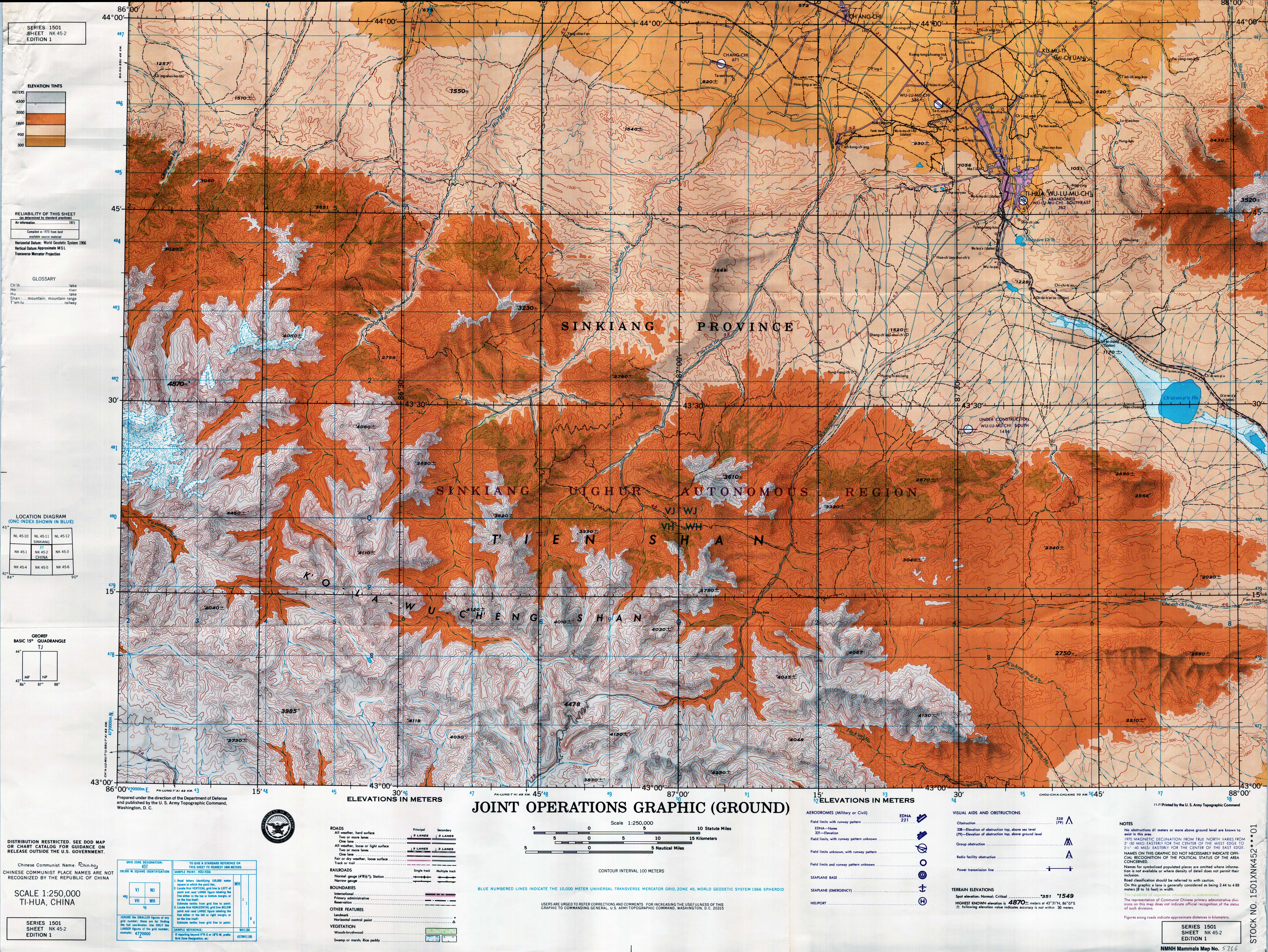
The Borohoro Mountains ( zh, s=博罗科努山, p=Bóluōkēnǔ shān, w=P'o-lo-k'o-nu shan; , ) is one of the major ranges of the Tian Shan mountain system. It is almost entirely located within China's Xinjiang Uyghur Autonomous Region, with only a few westernmost peaks being in Kazakhstan. The Borohoro Range runs in the general west-north-west to east-south-east direction. At its eastern end, southwest of Ürümqi, it joins the main range of the Tian Shan; at the western end, near the China–Kazakhstan border, it joins the Dzungarian Alatau. The Borohoro Range separates the Dzungarian Basin in the north from the Ili River Basin in the south. Streams flowing from the northern slope of the Borohoro flow toward the Aibi Lake or the Manas Lake; those rising on the southern slope flow toward the Ili River, which flows into Kazakhstan's Lake Balkhash. The border between Xinjiang's Ili Kazakh Autonomous Prefecture and Bortala Mongol Autonomous Prefecture Bortala Mongol Autonom ... [...More Info...] [...Related Items...] OR: [Wikipedia] [Google] [Baidu] |
Tian Shan
The Tian Shan, also known as the Tengri Tagh or Tengir-Too, meaning the "Mountains of God/Heaven", is a large system of mountain ranges in Central Asia. The highest peak is Jengish Chokusu at high and located in Kyrgyzstan. Its lowest point is at the Turpan Depression, which is below sea level. The Tian Shan is sacred in Tengrism. Its second-highest peak is known as Khan Tengri, which can be translated as "Lord of the Spirits". At the 2013 Conference on World Heritage, the eastern portion of Tian Shan in western China's Xinjiang Region was listed as a World Heritage Site. The western portion in Kyrgyzstan, Kazakhstan, and Uzbekistan was then listed in 2016. Geography Tian Shan with the ancient Silk Road The Tian Shan range is located north and west of the Taklamakan Desert and directly north of the Tarim Basin. It straddles the border regions of Kazakhstan, Kyrgyzstan, Uzbekistan and Xinjiang in Northwest China. To the south, it connects with the Pamir Mountains ... [...More Info...] [...Related Items...] OR: [Wikipedia] [Google] [Baidu] |
Xinjiang
Xinjiang,; , SASM/GNC romanization, SASM/GNC: Chinese postal romanization, previously romanized as Sinkiang, officially the Xinjiang Uygur Autonomous Region (XUAR), is an Autonomous regions of China, autonomous region of the China, People's Republic of China (PRC), located in the Northwest China, northwest of the country at the crossroads of Central Asia and East Asia. Being the List of Chinese administrative divisions by area, largest province-level division of China by area and the List of the largest country subdivisions by area, 8th-largest country subdivision in the world, Xinjiang spans over and has about 25 million inhabitants. Xinjiang Borders of China, borders the countries of Afghanistan, India, Kazakhstan, Kyrgyzstan, Mongolia, Pakistan, Russia, and Tajikistan. The rugged Karakoram, Kunlun Mountains, Kunlun and Tian Shan mountain ranges occupy much of Xinjiang's borders, as well as its western and southern regions. The Aksai Chin and Trans-Karakoram Tract regions ... [...More Info...] [...Related Items...] OR: [Wikipedia] [Google] [Baidu] |
Kazakhstan
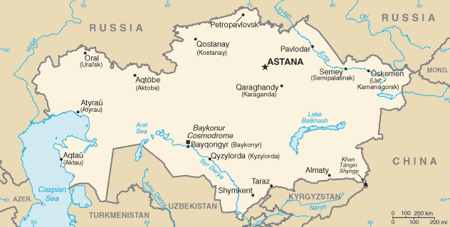
Kazakhstan, officially the Republic of Kazakhstan, is a landlocked country primarily in Central Asia, with a European Kazakhstan, small portion in Eastern Europe. It borders Russia to the Kazakhstan–Russia border, north and west, China to the China–Kazakhstan border, east, Kyrgyzstan to the Kazakhstan–Kyrgyzstan border, southeast, Uzbekistan to the Kazakhstan–Uzbekistan border, south, and Turkmenistan to the Kazakhstan–Turkmenistan border, southwest, with a coastline along the Caspian Sea. Its capital is Astana, while the largest city and leading cultural and commercial hub is Almaty. Kazakhstan is the world's List of countries and dependencies by area, ninth-largest country by land area and the largest landlocked country. Steppe, Hilly plateaus and plains account for nearly half its vast territory, with Upland and lowland, lowlands composing another third; its southern and eastern frontiers are composed of low mountainous regions. Kazakhstan has a population of 20 mi ... [...More Info...] [...Related Items...] OR: [Wikipedia] [Google] [Baidu] |
Ürümqi
Ürümqi, , is the capital of the Xinjiang, Xinjiang Uyghur Autonomous Region in Northwestern China. With a census population of 4 million in 2020, Ürümqi is the second-largest city in China's northwestern interior after Xi'an, also the second-largest in Central Asia in terms of population, right after Kabul, Afghanistan. Ürümqi has seen significant economic development since the 1990s and currently serves as a List of transport topics#Nodes, regional transport node and a cultural, political and commercial center. Etymology The name Ürümqi comes from the Mongolic languages, Mongolic Oirat language and means "beautiful pasture" (, ). It was originally the name of a small town founded by the Mongolic peoples, Mongolic, Oirat-speaking Dzungar people, Dzungars. The Qing dynasty took Ürümqi by force in 1755, during Dzungar–Qing Wars, its conquest of the Dzungar Khanate. Qing forces expanded the town into a walled city from 1763 to 1767, and upon completing the expan ... [...More Info...] [...Related Items...] OR: [Wikipedia] [Google] [Baidu] |
China–Kazakhstan Border
The China–Kazakhstan border (; zh, s=中哈边界, p=Zhōnghā biānjiè; ), also known as the Sino-Kazakh border, is the international border between the China, People's Republic of China and the Kazakhstan, Republic of Kazakhstan. The border line between the two countries has been largely inherited from the border existing between the Soviet Union and the PRC and, earlier, between the Russian Empire and the Qing dynasty, Qing Empire; however, it has been fully demarcated only in the late 20th and early 21st century. According to the international boundary commissions that have carried out the border demarcation, the border is long. History The origins of the border date from the mid-19th century, when the Russian Empire Russian conquest of Central Asia, expanded into Central Asia and was able to establish its control over the Lake Zaysan region. The establishment of the border between the Russian Empire and the Qing dynasty, Qing Empire, not too different from today's Sin ... [...More Info...] [...Related Items...] OR: [Wikipedia] [Google] [Baidu] |


