|
Bhandara–Gadchiroli Expressway
The Bhandara-Gadchiroli Expressway, officially named the Bhandara-Gadchiroli Access Controlled Super Communication Expressway, is a planned four-lane greenfield project that connects the cities of Vidarbha which are Bhandara, Bramhapuri, Armori and Gadchiroli to Mumbai-Nagpur Expressway via Nagpur-Bhandara-Gondia Expressway. Proposed as four lanes wide, this segment will reduce the road distance between Bhandara and Gadchiroli and bring down travel time between Gadchiroli and Bhandara further to Nagpur and Mumbai. Route alignment The Bhandara-Gadchiroli Expressway will travel through Nagpur, Bhandara, Chandrapur, and Gadchiroli districts directly. Cities and towns Below are the lists of cities/towns through which the Bhandara-Gadchiroli Expressway will connect: *South of Bhandara *East of Bramhapuri *South west of Armori *North and east of Gadchiroli Construction MSRDC had invited bids for BG-01’s construction in February 2024 with a Rs. 1854.16 crore estimate and 2. ... [...More Info...] [...Related Items...] OR: [Wikipedia] [Google] [Baidu] |
Maharashtra State Road Development Corporation
The Maharashtra State Road Development Corporation Limited, commonly abbreviated as MSRDC, is an Indian public limited company fully owned by the Government of Maharashtra. MSRDC was established on 9 July 1996 and incorporated as a public limited company under the Companies Act 1956 on 2 August 1996. It is responsible for developing, building and maintaining roads in Maharashtra. MSRDC completed its 25th anniversary on 9 July 2021. Responsibilities and departments The roles and responsibilities of the MSRDC are listed as: "''MSRDC is charged with the responsibility of planning, designing, constructing and managing select road projects, flyovers, bridges, light rail transit, sea links and water transport etc. in Maharashtra and integrated road development projects in select cities of the state. It also provides roadside amenities and any other infrastructure tasks specifically assigned to it.''" The MSRDC has following departments: *Administration *Engineering *Toll Monitori ... [...More Info...] [...Related Items...] OR: [Wikipedia] [Google] [Baidu] |
Nagpur-Bhandara-Gondia Expressway
The Nagpur-Bhandara-Gondia Expressway, officially named the Nagpur-Bhandara-Gondia Access Controlled Super Communication Expressway, is a planned six to four-lane greenfield project that connects the cities of Vidarbha which are Nagpur, Bhandara, Tirora and Gondia to Mumbai-Nagpur Expressway. Proposed as six to four lanes wide, this segment will reduce the road distance between Nagpur SEZ and Bhandara-Gondia and bring down travel time between Nagpur SEZ and Bhandara-Gondia further to capital of state Mumbai. Route alignment The Nagpur-Bhandara-Gondia Expressway will travel through Nagpur, Bhandara, and Gondia districts directly. Cities and towns Below are the lists of cities/towns through which the Nagpur-Bhandara-Gondia Expressway will connect: *South of Nagpur *North of Kuhi *West and North of Bhandara *East of Tirora *North and South of Gondia Construction MSRDC applied for Environmental Clearance in October 2023 and invited bids for civil construction in February 202 ... [...More Info...] [...Related Items...] OR: [Wikipedia] [Google] [Baidu] |
Mumbai–Nagpur Expressway
The Mumbai-Nagpur Expressway or Samruddhi Mahamarg (officially known as Hindu Hrudaysamrat Balasaheb Thackeray Maharashtra Samruddhi Mahamarg) and Maharashtra Expressway-2 (ME-2), is a 6-lane wide (expandable to 8), 701-km long access-controlled expressway in Maharashtra, India. It is amongst the country's longest greenfield road projects, which will connect the two capital cities of the state, its capital, Mumbai, and its third-largest and alternate capital city, Nagpur. This project was the brainchild of Devendra Fadnavis and was conceptualised by him when he was chief minister of the state back in 2015. It is being led by the state infrastructure arm Maharashtra State Road Development Corporation (MSRDC), and is designed under the Engineering, Procurement and Construction (EPC) model. With the route alignment connecting Shivmadka village in Nagpur district to Amane village in Bhiwandi Town Of Thane district, the expressway is capable of providing an enhanced connectivi ... [...More Info...] [...Related Items...] OR: [Wikipedia] [Google] [Baidu] |
Expressways In India
The expressways of India are the highest class of roads in India. As per NHAI and Indian Roads Congress, expressways are access controlled highways with a divided carriageway, designed for high speed vehicular movement and heavy traffic. As of December 2024, the total length of expressways in India was , with under construction. In expressways there is a central reservation or median that separates the flow travelling in opposite directions. Entrance and exits are provided only by grade separated interchanges. The interchanges may be system interchanges (such as cloverleaf, three-way, trumpet) used with other national or state highways or be service interchanges (such as SPDI) used with smaller roads. In contrast, National highways may or may not be divided by a median and may or may not have access control. Some highways, built by State Governments, which may be fully access controlled or may be limited access controlled, are declared or named as expressways by the ... [...More Info...] [...Related Items...] OR: [Wikipedia] [Google] [Baidu] |
MSRDC
The Maharashtra State Road Development Corporation Limited, commonly abbreviated as MSRDC, is an Indian public limited company fully owned by the Government of Maharashtra. MSRDC was established on 9 July 1996 and incorporated as a public limited company under the Companies Act 1956 on 2 August 1996. It is responsible for developing, building and maintaining roads in Maharashtra. MSRDC completed its 25th anniversary on 9 July 2021. Responsibilities and departments The roles and responsibilities of the MSRDC are listed as: "''MSRDC is charged with the responsibility of planning, designing, constructing and managing select road projects, flyovers, bridges, light rail transit, sea links and water transport etc. in Maharashtra and integrated road development projects in select cities of the state. It also provides roadside amenities and any other infrastructure tasks specifically assigned to it.''" The MSRDC has following departments: *Administration *Engineering *Toll Monitori ... [...More Info...] [...Related Items...] OR: [Wikipedia] [Google] [Baidu] |
Chandrapur District
Chandrapur district (Marathi pronunciation: ͡ʃən̪d̪ɾəpuːɾ (earlier known as ''Chanda district'') is a district in the Nagpur Division in the Indian state of Maharashtra. Chandrapur was the largest district in India until the Gadchiroli and Sironcha tehsils were separated as Gadchiroli district in 1981. In 2011, the district population was 2,204,307. Chandrapur district is known for its super thermal power station, and its vast reserves of coal in Wardha Valley Coalfield. Chandrapur also has large reservoirs of limestone which is a raw material for cement manufacturing in the district. Chandrapur district is known for its cleanliness. Now Chandrapur city is in the top 10 cleanest cities India and 2 in Maharashtra after Navi Mumbai by The minister of housing and urban affairs rank cities based on the cleanliness index. Tadoba Andhari Tiger Reserve in the district is one of India's fifty-three Project Tiger reserves. The 2015 census of tigers found that 120 of Mahar ... [...More Info...] [...Related Items...] OR: [Wikipedia] [Google] [Baidu] |
Nagpur District
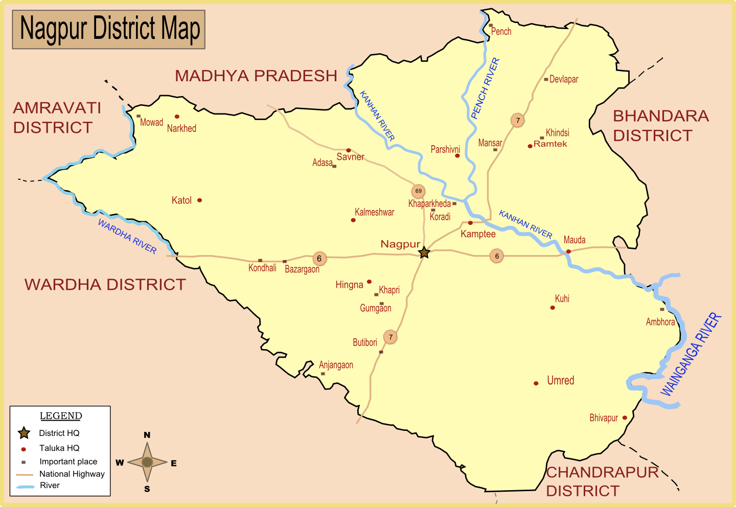
Nagpur district (Marathi pronunciation: Help:IPA/Marathi, [naːɡpuːɾ]) is a Districts of Maharashtra, district in the Vidarbha region of Maharashtra state in central India. The city of Nagpur is the district administrative centre. The district is part of Nagpur Division. Nagpur district is bounded by Bhandara district on the east, Chandrapur district on the southeast, Wardha district on the southwest, Amravati district on the northwest and Chhindwara district and Seoni district of Madhya Pradesh state on the north. History In 1853, after the death of Nagpur kingdom#Raghoji III Bhonsle (1818–1853), RaghojiIII, the princely state of Nagpur was annexed by the British and the territory occupied by the present district became part of the then Nagpur Province. In 1861, it was merged with the Central Provinces. In 1903 it became part of the Central Provinces and Berar. In 1950 Nagpur district was created as became part of the newly formed Madhya Pradesh state and Nagpur became its ... [...More Info...] [...Related Items...] OR: [Wikipedia] [Google] [Baidu] |
Mumbai
Mumbai ( ; ), also known as Bombay ( ; its official name until 1995), is the capital city of the Indian state of Maharashtra. Mumbai is the financial capital and the most populous city proper of India with an estimated population of 12.5 million (1.25 crore). Mumbai is the centre of the Mumbai Metropolitan Region, the seventh-most populous metropolitan area in the world with a population of over 23 million (2.3 crore). Mumbai lies on the Konkan coast on the west coast of India and has a deep natural harbour. In 2008, Mumbai was named an alpha world city. Mumbai has the highest number of billionaires out of any city in Asia. The seven islands that constitute Mumbai were earlier home to communities of Marathi language-speaking Koli people. For centuries, the seven islands of Bombay were under the control of successive indigenous rulers before being ceded to the Portuguese Empire, and subsequently to the East India Company in 1661, as part of ... [...More Info...] [...Related Items...] OR: [Wikipedia] [Google] [Baidu] |
Nagpur
Nagpur (; ISO 15919, ISO: ''Nāgapura'') is the second capital and third-largest city of the Indian state of Maharashtra. It is called the heart of India because of its central geographical location. It is the largest and most populated city in central India. Also known as the "Orange City", Nagpur is the 13th largest city in India by population. According to an Oxford's Economics report, Nagpur is projected to be the fifth fastest growing city in the world from 2019 to 2035 with an average growth of 8.41%. It has been proposed as one of the Smart Cities Mission, Smart Cities in Maharashtra and is one of the top ten cities in India in Smart Cities Mission, Smart City Project execution. Nagpur is the seat of the annual Winter Session of Maharashtra State Assembly, winter session of the Maharashtra state assembly. It is a major commercial and political centre of the Vidarbha Regions and Divisions of Maharashtra, region of Maharashtra. In addition, the city derives unique importa ... [...More Info...] [...Related Items...] OR: [Wikipedia] [Google] [Baidu] |
Bhandara District
Bhandara District (Marathi pronunciation: ʰəɳɖaːɾa is an administrative district in the state of Maharashtra in India. The name Bhandara is a corruption oBhanara Reference to Bhanara is found in an inscription of 1100 A.D. traced at Ratanpur. The district headquarters are located at Bhandara. The district occupies an area of 3717 km2 and has a population of 1,200,334 (605,520 males and 594,814 females), of which 19.48% are urban as of 2011. The growth rate of Bhandara is 5.56% Bhandara has a mixed economy with agriculture, industries and forest resources. Bhandara is known for its large production of rice. Tumsar, a tahsil town, is a noted rice market. Bhandara town is also known as "Brass City" owing to the presence of a large brass products industry. Bhandara has several tourist destinations, like Ambagad Fort, Brahmi, Chinchgad, and Dighori. The district is also known for the Ordnance Factory Bhandara of the Ordnance Factories Board, which manufactures products ... [...More Info...] [...Related Items...] OR: [Wikipedia] [Google] [Baidu] |
Vidarbha
Vidarbha (Pronunciation: Help:IPA/Marathi, [ʋid̪əɾbʱə]) is a geographical region in the west Indian States and union territories of India, state of Maharashtra. Forming the eastern part of the state, it comprises Amravati Division, Amravati and Nagpur Division, Nagpur divisions. As per the 2011 Census of India, 2011 Census, the region had a population of 23,003,179. The region occupies 31.6% of the total area and is home to 21.3% of the total population of Maharashtra. Situated in central India, it borders the state of Madhya Pradesh to the north, Chhattisgarh to the east, Telangana to the south and Marathwada and North Maharashtra, Uttar Maharashtra regions of Maharashtra to the west. According to the Hindu epic ''Mahabharata'', Rukmini, the wife of lord Krishna, was born to Bhishmaka, the king of the Vidarbha kingdom. Vidarbha was part of the Satavahana Empire during 1st to 2nd century CE). The coins and inscriptions from the period of Paramaras, Paramara king Jagadeva ... [...More Info...] [...Related Items...] OR: [Wikipedia] [Google] [Baidu] |


