|
Barstowite
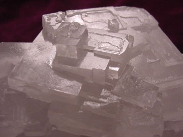
Barstowite, formula Pb4 CO3´┐Ż´┐ŻH2O, is a transparent to white mineral in the monoclinic system. It has a Mohs hardness of 3, a white streak and an adamantine lustre. The type locality for Barstowite is Bounds Cliff, St Endellion, Cornwall in the United Kingdom. It is named after Richard W. Barstow Richard is a male given name. It originates, via Old French, from Old Frankish and is a compound of the words descending from Proto-Germanic ''*r─źk-'' 'ruler, leader, king' and ''*hardu-'' 'strong, brave, hardy', and it therefore means 'strong ... (1947ÔÇô1982), a Cornish mineral collector. References Lead minerals Carbonate minerals Halide minerals Monoclinic minerals Minerals in space group 11 {{carbonate-mineral-stub ... [...More Info...] [...Related Items...] OR: [Wikipedia] [Google] [Baidu] |
Halide Minerals
Halide minerals are those minerals with a dominant halide anion (, , and ). Complex halide minerals may also have polyatomic anions. Examples include the following: * Atacamite *Avogadrite (K,Cs)BF *Bararite (╬▓) *Bischofite * Br├╝ggenite * Calomel * Carnallite * Carnallite *Cerargyrite/ Horn silver AgCl * Chlorargyrite AgCl, bromargyrite AgBr, and iodargyrite AgI * Cryolite * Cryptohalite (a) Vanadates), 09 Silicates: * ''neso-'': insular (from Greek , "island") * ''soro-'': grouped (from Greek , "heap, pile, mound") * ''cyclo-'': ringed (from Greek , "circle") * ''ino-'': chained (from Greek , "fibre", rom Ancient Greek * ''phyllo-'': sheeted (from Greek , "leaf") * ''tecto-'': of three-dimensional framework (from Greek , "of building") ;NickelÔÇôStrunz code scheme ''NN.XY.##x'': * ''NN'': NickelÔÇôStrunz mineral class number * ''X'': NickelÔÇôStrunz mineral division letter * ''Y'': NickelÔÇôStrunz mineral family letter * ''##x'': NickelÔÇôStrunz mineral/gr ... [...More Info...] [...Related Items...] OR: [Wikipedia] [Google] [Baidu] |
St Endellion
St Endellion ( kw, Sen Endelyn) is a civil parish and hamlet in north Cornwall, England, United Kingdom. The hamlet and parish church are situated four miles (6.5 km) north of Wadebridge. The parish takes its name from Saint Endelienta, who is said to have evangelised the district in the fifth century and to have been one of the children of King Brychan. Two wells near the church are named after her. The name is included in the electoral ward of St Minver and St Endellion, which includes Polzeath and Rock, with a population at the 2011 census of 3268. Geography and topography St Endellion is the Type Locality for the minerals Bournonite (also known as ''Endellione'' or ''Endellionite'') and Barstowite. St Endellion lies within the Cornwall Area of Outstanding Natural Beauty (AONB). Almost a third of Cornwall has AONB designation, with the same status and protection as a National Park. The houses at Roscarrock and Tresungers are listed buildings: at Roscarrock pa ... [...More Info...] [...Related Items...] OR: [Wikipedia] [Google] [Baidu] |
Attiki Prefecture
Attica ( el, ╬á╬Á¤ü╬╣¤ć╬ş¤ü╬Á╬╣╬▒ ╬Ťä¤ä╬╣╬║╬«¤é, translit=Perif├ęria Attik├şs, ) is an administrative region of Greece, that encompasses the entire metropolitan area of Athens, the country's capital and largest city. The region is coextensive with the former Attica Prefecture of Central Greece. It covers a greater area than the historical region of Attica. Overview Located on the eastern edge of Central Greece, Attica covers about 3,808 square kilometers. In addition to Athens, it contains within its area the cities of Elefsina, Megara, Laurium, and Marathon, as well as a small part of the Peloponnese peninsula and the islands of Salamis, Aegina, Angistri, Poros, Hydra, Spetses, Kythira, and Antikythera. About 3,800,000 people live in the region, of whom more than 95% are inhabitants of the Athens metropolitan area. In 2019, Attica had the HDI of 0.912, the highest in Greece. Administration The region was established in the 1987 administrative reform, and until 2010 it com ... [...More Info...] [...Related Items...] OR: [Wikipedia] [Google] [Baidu] |
Monoclinic
In crystallography, the monoclinic crystal system is one of the seven crystal systems. A crystal system is described by three vectors. In the monoclinic system, the crystal is described by vectors of unequal lengths, as in the orthorhombic system. They form a parallelogram prism. Hence two pairs of vectors are perpendicular (meet at right angles), while the third pair makes an angle other than 90┬░. Bravais lattices Two monoclinic Bravais lattices exist: the primitive monoclinic and the base-centered monoclinic. For the base-centered monoclinic lattice, the primitive cell has the shape of an oblique rhombic prism;See , row mC, column Primitive, where the cell parameters are given as a1 = a2, ╬▒ = ╬▓ it can be constructed because the two-dimensional centered rectangular base layer can also be described with primitive rhombic axes. Note that the length a of the primitive cell below equals \frac \sqrt of the conventional cell above. Crystal classes The table below or ... [...More Info...] [...Related Items...] OR: [Wikipedia] [Google] [Baidu] |
Mohs Hardness
The Mohs scale of mineral hardness () is a qualitative ordinal scale, from 1 to 10, characterizing scratch resistance of various minerals through the ability of harder material to scratch softer material. The scale was introduced in 1812 by the German geologist and mineralogist Friedrich Mohs, in his book ''"Versuch einer Elementar-Methode zur naturhistorischen Bestimmung und Erkennung der Fossilien"''; it is one of several definitions of hardness in materials science, some of which are more quantitative. The method of comparing hardness by observing which minerals can scratch others is of great antiquity, having been mentioned by Theophrastus in his treatise ''On Stones'', , followed by Pliny the Elder in his '' Naturalis Historia'', . The Mohs scale is useful for identification of minerals in the field, but is not an accurate predictor of how well materials endure in an industrial setting ÔÇô ''toughness''. Minerals The Mohs scale of mineral hardness is based on the abilit ... [...More Info...] [...Related Items...] OR: [Wikipedia] [Google] [Baidu] |
Streak (mineralogy)
The streak of a mineral is the color of the powder produced when it is dragged across an un-weathered surface. Unlike the apparent color of a mineral, which for most minerals can vary considerably, the trail of finely ground powder generally has a more consistent characteristic color, and is thus an important diagnostic tool in mineral identification. If no streak seems to be made, the mineral's streak is said to be white or colorless. Streak is particularly important as a diagnostic for opaque and colored materials. It is less useful for silicate minerals, most of which have a white streak or are too hard to powder easily. The apparent color of a mineral can vary widely because of trace impurities or a disturbed macroscopic crystal structure. Small amounts of an impurity that strongly absorbs a particular wavelength can radically change the wavelengths of light that are reflected by the specimen, and thus change the apparent color. However, when the specimen is dragged to produce ... [...More Info...] [...Related Items...] OR: [Wikipedia] [Google] [Baidu] |
Lustre (mineralogy)
Lustre (British English) or luster (American English; see spelling differences) is the way light interacts with the surface of a crystal, rock, or mineral. The word traces its origins back to the Latin ''lux'', meaning "light", and generally implies radiance, gloss, or brilliance. A range of terms are used to describe lustre, such as ''earthy'', ''metallic'', ''greasy'', and ''silky''. Similarly, the term ''vitreous'' (derived from the Latin for glass, ''vitrum'') refers to a glassy lustre. A list of these terms is given below. Lustre varies over a wide continuum, and so there are no rigid boundaries between the different types of lustre. (For this reason, different sources can often describe the same mineral differently. This ambiguity is further complicated by lustre's ability to vary widely within a particular mineral species). The terms are frequently combined to describe intermediate types of lustre (for example, a "vitreous greasy" lustre). Some minerals exhibit unu ... [...More Info...] [...Related Items...] OR: [Wikipedia] [Google] [Baidu] |
Type Locality (geology)
Type locality, also called type area, is the locality where a particular rock type, stratigraphic unit or mineral species is first identified. If the stratigraphic unit in a locality is layered, it is called a stratotype, whereas the standard of reference for unlayered rocks is the type locality. The term is similar to the term type site in archaeology or the term type specimen in biology. Examples of geological type localities Rocks and minerals * Aragonite: Molina de Arag├│n, Guadalajara, Spain * Autunite: Autun, France * Benmoreite: Ben More (Mull), Scotland * Blairmorite: Blairmore, Alberta, Canada * Boninite: Bonin Islands, Japan * Comendite: Comende, San Pietro Island, Sardinia * Cummingtonite: Cummington, Massachusetts * Dunite: Dun Mountain, New Zealand. * Essexite: Essex County, Massachusetts, US * Fayalite: Horta, Fayal Island, Azores, Portugal * Harzburgite: Bad Harzburg, Germany * Icelandite: Thingmuli (├×ingm├║li), Iceland * Ijolite: Iivaa ... [...More Info...] [...Related Items...] OR: [Wikipedia] [Google] [Baidu] |
Cornwall
Cornwall (; kw, Kernow ) is a historic county and ceremonial county in South West England. It is recognised as one of the Celtic nations, and is the homeland of the Cornish people. Cornwall is bordered to the north and west by the Atlantic Ocean, to the south by the English Channel, and to the east by the county of Devon, with the River Tamar forming the border between them. Cornwall forms the westernmost part of the South West Peninsula of the island of Great Britain. The southwesternmost point is Land's End and the southernmost Lizard Point. Cornwall has a population of and an area of . The county has been administered since 2009 by the unitary authority, Cornwall Council. The ceremonial county of Cornwall also includes the Isles of Scilly, which are administered separately. The administrative centre of Cornwall is Truro, its only city. Cornwall was formerly a Brythonic kingdom and subsequently a royal duchy. It is the cultural and ethnic origin of the Cor ... [...More Info...] [...Related Items...] OR: [Wikipedia] [Google] [Baidu] |
United Kingdom
The United Kingdom of Great Britain and Northern Ireland, commonly known as the United Kingdom (UK) or Britain, is a country in Europe, off the north-western coast of the European mainland, continental mainland. It comprises England, Scotland, Wales and Northern Ireland. The United Kingdom includes the island of Great Britain, the north-eastern part of the island of Ireland, and many List of islands of the United Kingdom, smaller islands within the British Isles. Northern Ireland shares Republic of IrelandÔÇôUnited Kingdom border, a land border with the Republic of Ireland; otherwise, the United Kingdom is surrounded by the Atlantic Ocean, the North Sea, the English Channel, the Celtic Sea and the Irish Sea. The total area of the United Kingdom is , with an estimated 2020 population of more than 67 million people. The United Kingdom has evolved from a series of annexations, unions and separations of constituent countries over several hundred years. The Treaty of Union between ... [...More Info...] [...Related Items...] OR: [Wikipedia] [Google] [Baidu] |

.jpg)


