|
Bakurtsikhe
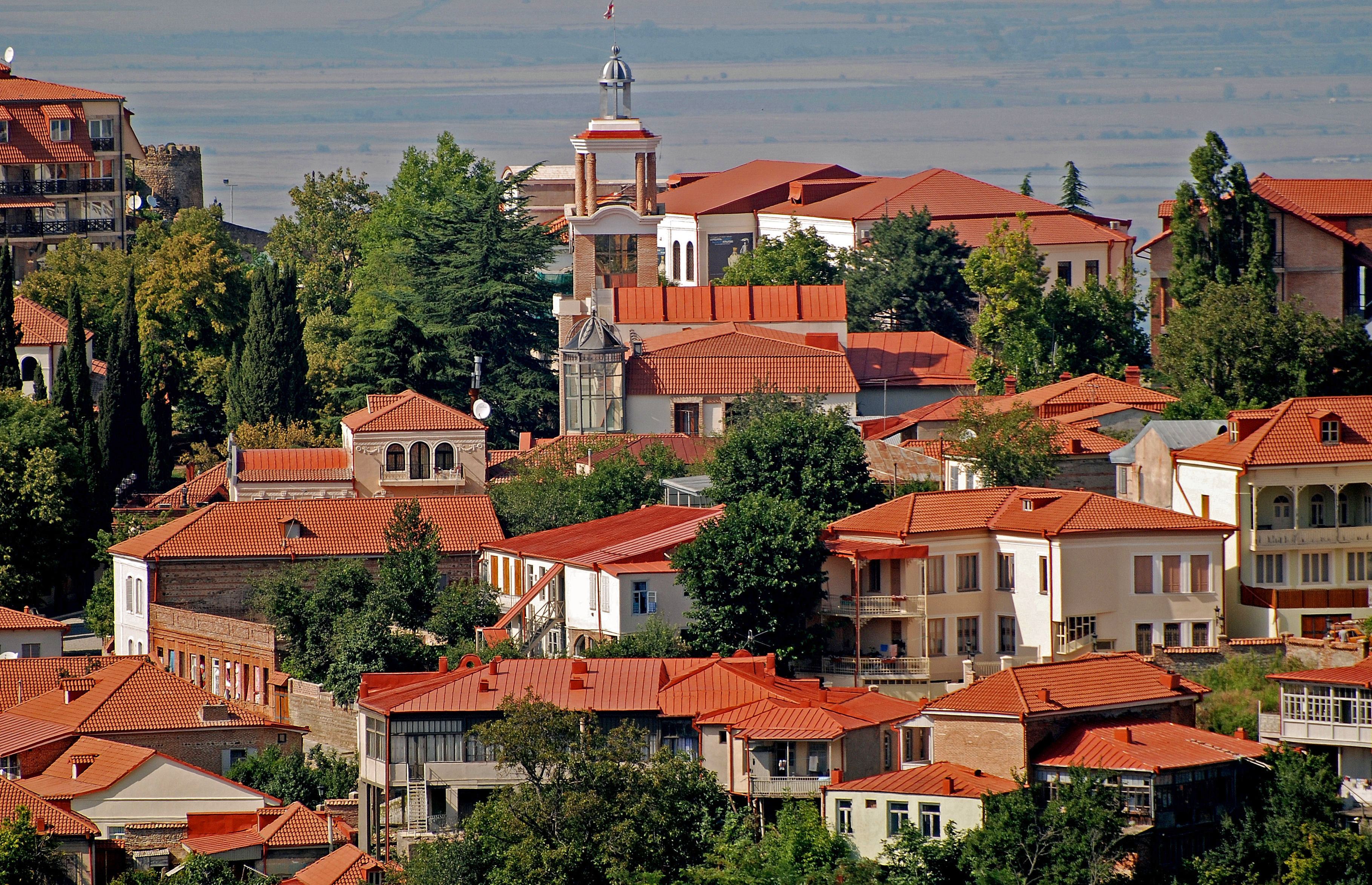
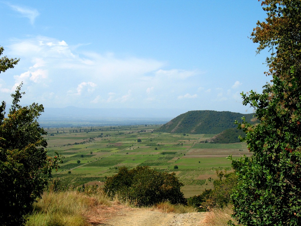
Bakurtsikhe is a village in the Gurjaani District of the Kakheti region, Georgia. Bakurtsikhe is located on the right side of the river Alazani and on both sides of the Chalaubniskhevi river. It sits 440m above the sea level. It is 8 km from Gurjaani, with a population of 2,574 as of 2014. See also * Kakheti Kakheti (; ) is a region of Georgia. Telavi is its administrative center. The region comprises eight administrative districts: Telavi, Gurjaani, Qvareli, Sagarejo, Dedoplistsqaro, Signagi, Lagodekhi and Akhmeta. Kakhetians speak the ... References {{Reflist External linksMaplandia Sources * Georgian Soviet Encyclopedia, vol.2, P.162, Tbilisi, 1977. Populated places in Gurjaani Municipality Tiflis Governorate ... [...More Info...] [...Related Items...] OR: [Wikipedia] [Google] [Baidu] |
Gurjaani District
Gurjaani ( ka, გურჯაანის მუნიციპალიტეტი, ''Gurjaanis municiṗaliṫeṫi'') is an administrative-territorial unit in eastern Georgia, Kakheti region. Until 1917, the territory of Gurjaani municipality was part of Telavi Mazra of Tbilisi Governorate; since 1921 it has been included in Telavi Mazra; Since 1930, it has been an independent district in Kakheti region, then it became a separate district. It has been a municipality since 2006. The population was 54,337 as of the 2014 census, and it has an area of . History Gurjaani is a municipality located in the Kakheti region. It has been inhabited since ancient times; a stone age human settlement has been discovered. The municipality's territory was densely populated both in the Bronze Age and the Ancient and Feudal Ages. The name Gurjaani has a Turkish origin: the word "Gurj" is Turkish and means Georgian, and "Gurjaani" means a settlement of Georgians. A large part of the terri ... [...More Info...] [...Related Items...] OR: [Wikipedia] [Google] [Baidu] |
Mkhare
A ''mkhare'' ( ka, მხარე, ''mxare'') is a type of administrative division in the country of Georgia (country), Georgia. It is usually translated into English as "region". According to presidential decrees issued in 1994 and 1996, Georgia's division into regions is on a provisional basis until the secessionist conflicts in Abkhazia and South Ossetia are resolved. The regional administration is headed by a state commissioner (სახელმწიფო რწმუნებული, ''Saxelmćipo Rćmunebuli'', usually translated as "governor"), an official appointed by the President of Georgia, president. The regions are further subdivided into ''List of municipalities in Georgia (country), municipalities''. There are nine regions in Georgia (see also map opposite): See also * Administrative divisions of Georgia (country), Administrative divisions of Georgia References {{Authority control Regions of Georgia (country), Types of administrative divis ... [...More Info...] [...Related Items...] OR: [Wikipedia] [Google] [Baidu] |
Kakheti
Kakheti (; ) is a region of Georgia. Telavi is its administrative center. The region comprises eight administrative districts: Telavi, Gurjaani, Qvareli, Sagarejo, Dedoplistsqaro, Signagi, Lagodekhi and Akhmeta. Kakhetians speak the Kakhetian dialect of Georgian. Kakheti is one of the most significant wine producing regions of Georgia, home to a number of Georgian wines. The region is bordered to the west by the Georgian regions of Mtskheta-Mtianeti and Kvemo Kartli, to the north and east by the Russian Federation, and to the southeast by Azerbaijan. Popular tourist attractions in Kakheti include Tusheti, Gremi, Signagi, Kvetera, Bodbe, Lagodekhi Protected Areas and Alaverdi Monastery. The Georgian David Gareji monastery complex is partially located in this province and is subject to a border dispute between Georgian and Azerbaijani authorities. Geography Beyond the modern-day administrative subdivision into the districts, Kakheti has traditionally ... [...More Info...] [...Related Items...] OR: [Wikipedia] [Google] [Baidu] |
Georgia (country)
Georgia is a country in the Caucasus region on the coast of the Black Sea. It is located at the intersection of Eastern Europe and West Asia, and is today generally regarded as part of Europe. It is bordered to the north and northeast by Russia, to the south by Turkey and Armenia, and to the southeast by Azerbaijan. Georgia covers an area of . It has a Demographics of Georgia (country), population of 3.7 million, of which over a third live in the capital and List of cities and towns in Georgia (country), largest city, Tbilisi. Ethnic Georgians, who are native to the region, constitute a majority of the country's population and are its titular nation. Georgia has been inhabited since prehistory, hosting the world's earliest known sites of winemaking, gold mining, and textiles. The Classical antiquity, classical era saw the emergence of several kingdoms, such as Colchis and Kingdom of Iberia, Iberia, that formed the nucleus of the modern Georgian state. In the early fourth centu ... [...More Info...] [...Related Items...] OR: [Wikipedia] [Google] [Baidu] |
Alazani
The Alazani ( ) is a river that flows through the Caucasus. It is the main tributary of the Kura in eastern Georgia, and flows for . Part of its path forms the border between Georgia and Azerbaijan, before it meets the Kura at the Mingəçevir Reservoir in Azerbaijan. The river is likely the same as that referred to by classical authors Strabo and Pliny as "Alazonius" or "Alazon", and may also be the Abas River mentioned by Plutarch (Plut. ''Pomp.'' 35) and Dio Cassius (37.3) as the location of the Battle of the Abas (65 BCE). The Alazani originates in Upper Kakheti at the edge of the Greater Caucasus, south of the main ridge, in the northwestern part of the Akhmeta District. It flows initially to the south towards the town of Akhmeta in Upper Kakheti, then southeast through the fertile Alazani Valley of Lower Kakheti until the Azerbaijani border where it forms the border, and crosses the Azerbaijani border into its mouth in the Mingəçevir Reservoir. The Alazani va ... [...More Info...] [...Related Items...] OR: [Wikipedia] [Google] [Baidu] |
Gurjaani
Gurjaani ( ka, გურჯაანი) is a town in Kakheti, a region in eastern Georgia, and the seat of the Gurjaani Municipality. It is located in the Alazani River Plain, at an elevation of 415 m above sea level. Gurjaani is first recorded as a village in a historical document of the early 16th century. It acquired the status of a town in Soviet Georgia in 1934. As of the 2014 census, Gurjaani had a population of 8,024. The town is the center of the largest wine-making region of Georgia. Background Gurjaani is situated in the fertile Alazani Plain, at 415 m above sea level, and 110 km east of Georgia's capital of Tbilisi. It is the center of an important region of viticulture and wine-making. Important landmarks of the town are Akhtala, a historic spa, locally known for its mud bathes, and the early medieval Gurjaani Kvelatsminda Church, the only example of a two-domed design in Georgia. There are also several museums, the largest of which is the Gurjaani Museum of Loca ... [...More Info...] [...Related Items...] OR: [Wikipedia] [Google] [Baidu] |
Populated Places In Gurjaani Municipality
Population is a set of humans or other organisms in a given region or area. Governments conduct a census to quantify the resident population size within a given jurisdiction. The term is also applied to non-human animals, microorganisms, and plants, and has specific uses within such fields as ecology and genetics. Etymology The word ''population'' is derived from the Late Latin ''populatio'' (a people, a multitude), which itself is derived from the Latin word ''populus'' (a people). Use of the term Social sciences In sociology and population geography, population refers to a group of human beings with some predefined feature in common, such as location, race, ethnicity, nationality, or religion. Ecology In ecology, a population is a group of organisms of the same species which inhabit the same geographical area and are capable of interbreeding. The area of a sexual population is the area where interbreeding is possible between any opposite-sex pair within the area ... [...More Info...] [...Related Items...] OR: [Wikipedia] [Google] [Baidu] |


