|
Alta Via 4
Alta Via 4 is a high route located in the Italian Dolomites between Innichen in the north and Pieve di Cadore in the south. The Alta Via 4 is a physically demanding trail. It is approximately 85 km long, with an elevation gain of approximately 4,500 meters. Some sections of the route are exposed or steep. Few sections are equipped with steel cable. The trail is well marked with red and white paint splashes, cairns, and occasional dark blue triangular symbols containing the number '4'. The entire journey usually takes 6 days. Most hikers walk the trail from north to south, which is the way the route is described in the most guidebooks. The hike goes around Tre Cime di Lavaredo, which are probably one of the best-known mountain groups in the Dolomites. Then it continues around high altitude Lake Sorapiss, and finally goes through mountain ridge Antelao. Part of the hike is common with similar trails Alta Via 3 and Alta Via 5. Accommodation Alta Via 4 is a hut to h ... [...More Info...] [...Related Items...] OR: [Wikipedia] [Google] [Baidu] |
Dolomites
The Dolomites ( ), also known as the Dolomite Mountains, Dolomite Alps or Dolomitic Alps, are a mountain range in northeastern Italy. They form part of the Southern Limestone Alps and extend from the River Adige in the west to the Piave Valley ( Pieve di Cadore) in the east. The northern and southern borders are defined by the Puster Valley and the Sugana Valley (). The Dolomites are in the regions of Veneto, Trentino-Alto Adige/Südtirol and Friuli-Venezia Giulia, covering an area shared between the provinces of Belluno, Vicenza, Verona, Trentino, South Tyrol, Udine and Pordenone. Other mountain groups of similar geological structure are spread along the River Piave to the east—; and far away over the Adige River to the west—'' Dolomiti di Brenta'' (Western Dolomites). A smaller group is called (Little Dolomites), between the provinces of Trentino, Verona and Vicenza. The Dolomiti Bellunesi National Park and many other regional parks are in the Dolomites. On 26 J ... [...More Info...] [...Related Items...] OR: [Wikipedia] [Google] [Baidu] |
Italy
Italy, officially the Italian Republic, is a country in Southern Europe, Southern and Western Europe, Western Europe. It consists of Italian Peninsula, a peninsula that extends into the Mediterranean Sea, with the Alps on its northern land border, as well as List of islands of Italy, nearly 800 islands, notably Sicily and Sardinia. Italy shares land borders with France to the west; Switzerland and Austria to the north; Slovenia to the east; and the two enclaves of Vatican City and San Marino. It is the List of European countries by area, tenth-largest country in Europe by area, covering , and the third-most populous member state of the European Union, with nearly 59 million inhabitants. Italy's capital and List of cities in Italy, largest city is Rome; other major cities include Milan, Naples, Turin, Palermo, Bologna, Florence, Genoa, and Venice. The history of Italy goes back to numerous List of ancient peoples of Italy, Italic peoples—notably including the ancient Romans, ... [...More Info...] [...Related Items...] OR: [Wikipedia] [Google] [Baidu] |
Innichen
Innichen (; ; , all tied to Saint Candidus) is a municipality and a village in South Tyrol in northern Italy. It is located in the Puster Valley on the Drava River, on Italy's border with Austria. It hosts Italy’s International Snow Sculpture Festival each year. Innichen is renowned for its ski resorts, and it includes the natural park of Drei Zinnen–Tre Cime di Lavaredo. Geography Innichen borders the municipalities of Toblach, Innervillgraten (Austria), Sexten, and Sillian (Austria). History Innichen is home to the Innichen Abbey, founded in the late 8th century (769) by duke Tassilo III of Bavaria, belonging to the Prince-Bishopric of Freising. The abbey itself was disestablished in 1785, while the surrounding estates were acquired by the County of Tyrol after the Mediatisation of 1803 (''Reichsdeputationshauptschluss''). According to the terms of the Treaty of Saint-Germain, Innichen became part of the then Kingdom of Italy in 1919. Innichen is still t ... [...More Info...] [...Related Items...] OR: [Wikipedia] [Google] [Baidu] |
Hiking
A hike is a long, vigorous walk, usually on trails or footpaths in the countryside. Walking for pleasure developed in Europe during the eighteenth century. Long hikes as part of a religious pilgrimage have existed for a much longer time. "Hiking" is the preferred term in Canada and the United States; the term "walking" is used in these regions for shorter, particularly urban walks. In the United Kingdom and Ireland, the word "walking" describes all forms of walking, whether it is a walk in the park or backpacking in the Alps. The word hiking is also often used in the UK, along with rambling, hillwalking, and fell walking (a term mostly used for hillwalking in northern England). The term bushwalking is endemic to Australia, having been adopted by the Sydney Bush Walkers Club in 1927. In New Zealand a long, vigorous walk or hike is called tramping. It is a popular activity with numerous hiking organizations worldwide, and studies suggest that all forms of walking have health b ... [...More Info...] [...Related Items...] OR: [Wikipedia] [Google] [Baidu] |
Pieve Di Cadore
Pieve di Cadore is a ''comune'' (municipality) in the province of Belluno in the Italian region of Veneto, about north of Venice and about northeast of Belluno. "Pieve" means "Parish church". It is the birthplace of the Italian painter Titian. With its strategic location, the town was a medieval stronghold with fortifications, called the "walled city of the Veneto." The main sight is the ''Palazzo della Magnifica Comunità'' ("Palace of the Magnificent Community"), built in 1447 by the eponymous council which then ruled the city. It has a merloned tower which was completed in 1491. Transport Gaol Ferry Bridge is a busy commuter route for cyclists and pedestrians. A highway, SS51, connects the town with other communities in the Cadore Dolomite region. Sport and tourism Sport facilities The town has a swimming pool, tennis club, ice hockey arena, a bocce stadium, soccer fields and a bike path called Ciclabile delle Dolomiti offering views of the neighbourhood. Notable ... [...More Info...] [...Related Items...] OR: [Wikipedia] [Google] [Baidu] |
Sorapiss E Lago
Sorapiss, also referred to as Sorapis or Punta Sorapiss, is a mountain in the Dolomites within the Veneto region of northern Italy. Situated in the ''comune'' of Cortina d'Ampezzo, it has an elevation of . In its vicinity is a mountain pass of the same name, as well as Lake Sorapiss, Sorapiss Lake (Lago di Sorapiss), at the foot of the mountain. The mountain range is part of the Ampezzo Dolomites Natural Park. Description Sorapiss, with its huge perpendicular faces, forms part of the mountainous backdrop to the resort town of Cortina d'Ampezzo, Cortina, situated roughly to the southeast of the town. The limestone dolomite (rock), dolomite formations, which are irregular, rugged and sharp-edged peaks, are part of the Eastern Alps. The Cristallo Group, Cristallo group lies to the north past the Passo Tre Croci, and its southern neighbour is the Antelao. A path to Sorapiss starts at Passo Tre Croci and continues along an easy slope, reaching the mountain hut, refuge at the base of ... [...More Info...] [...Related Items...] OR: [Wikipedia] [Google] [Baidu] |
Antelao
Monte Antelao (Cadorino dialect: Nantelòu) is the highest mountain in the eastern Dolomites (a section of the Alps) in northeastern Italy, southeast of the town of Cortina d'Ampezzo, in the region of Cadore. The Monte Antelao is an ultra-prominent peak (Ultra). It is known as the "King of the Dolomites" (Marmolada, the highest of all the Dolomites, is the "Queen" although composed mostly of limestones). As the highest pinnacle of the eastern Dolomites, the Antelao is not part of a closed massif or a high plateau, but a single, mighty rock pyramid. Like many Dolomite peaks, Antelao is steep, rocky, and pointed; it also sits close to the edge of the Dolomite uplift and so has dramatic drops to the nearby valleys. When the weather is good, Monte Antelao is clearly visible from Trieste on the Adriatic Sea. The summit was reached for the first time in 1850 by the hunter Matteo Ossi from San Vito, who then accompanied the mountaineer Paul Grohmann to the summit in 1863. The modern ... [...More Info...] [...Related Items...] OR: [Wikipedia] [Google] [Baidu] |
Tre Cime Di Lavaredo
The ; ), also called the ; ), are three distinctive battlement-like peaks, in the Sexten Dolomites of northeastern Italy. They are one of the best-known mountain groups in the Alps. The three peaks, from east to west, are: *Cima Piccola / Kleine Zinne ("little peak") *Cima Grande / Große Zinne ("big peak") *Cima Ovest / Westliche Zinne ("western peak"). The peaks are composed of well-layered dolomites of the Dolomia Principale (Hauptdolomit) formation, Carnian to Rhaetian in age, as are many other groups in the Dolomites (e.g., the Tofane, the Pelmo or the Cinque Torri). Until 1919 the peaks formed part of the border between Italy and Austria-Hungary. Now they lie on the border between the Italian provinces of South Tyrol and Belluno and still are a part of the linguistic boundary between German-speaking and Italian-speaking majorities. The Cima Grande has an elevation of . It stands between the Cima Piccola, at , and the Cima Ovest, at . Location and surroundings Th ... [...More Info...] [...Related Items...] OR: [Wikipedia] [Google] [Baidu] |
Lake Sorapiss
Lago di Sorapiss (Italian: ''Lago di Sorapis''; German: ''Sorapissee''), also written as Sorapis, is a lake in the mountain range Sorapiss in the Dolomites, province of Belluno, c. 12 km away from Cortina d'Ampezzo Cortina d'Ampezzo (; , ; historical ) sometimes abbreviated to simply Cortina, is a town and ''comune'' in the heart of the southern (Dolomites, Dolomitic) Alps in the province of Belluno, in the Veneto region of Northern Italy. Situated on the .... The lake has an altitude of 1,925 metres (6,316 ft.) above sea level. The strong turquoise color is dust from the glacier. The lake can only be reached by foot or by helicopter. The hiking trail has a length of 10.5 km and takes 1.5 hours one way starting from Passo tre Croci. Also the hikes Alta Via 3 and Alta Via 4 lead around Lake Sorapis. The Color Lake Sorapis gets its turquoise color from Dolomite rock powder that is brought down from the nearby Sorapis glacier. As the glacier melts, its mel ... [...More Info...] [...Related Items...] OR: [Wikipedia] [Google] [Baidu] |
Alta Via 3
Alta Via 3 is a high route located in the Italian Dolomites between Niederdorf in the north and Longarone in the south. The route is nicknamed "The Route of Chamois" The Alta Via 3 is a physically demanding trail. It is approximately 100 km long, with an elevation gain of approximately 6,200 meters. Some sections of the route are exposed or steep. Few sections are equipped with steel cable. The trail is well marked with red and white paint splashes, cairns, and occasional dark red triangular symbols containing the number '3'. The entire journey usually takes 8 days. Most hikers walk the trail from north to south, which is the way the route is described in the most guidebooks. The hike starts in Niederdorf, goes through Monta Piana, where are numerous remnants from fights of First World War. From Monte Piana the hike continues around Monte Cristallo, then to Lake Sorapiss and across the Sorapiss mountain range. After that it nearly touches Antelao mountain and c ... [...More Info...] [...Related Items...] OR: [Wikipedia] [Google] [Baidu] |
Alta Via 5
Alta or ALTA may refer to: Acronyms * Alt-A, short for Alternative A-paper, is a type of US mortgage * American Land Title Association, a national trade association representing the land title industry * American Literary Translators Association, an association of literary translators in the US * Amur Leopard and Tiger Alliance or ALTA, an initiative to conserve the Amur leopard and Amur tiger * Atlanta Lawn Tennis Association * Australasian Language Technology Association * Accelerated life testing or Accelerated life testing analysis Places Canada * Alta Creek, the official name of the River of Golden Dreams, in Whistler, British Columbia * Alta Lake (British Columbia), a lake in Whistler, British Columbia * Alta Lake, British Columbia, a community that is part of Whistler, British Columbia * Mont Alta, a hill in the Laurentides zone of the Laurentian Mountains of Quebec, that is the basis of the Ski Mont Alta ski hill; see List of former ski areas of Quebec *Alberta, Canada ... [...More Info...] [...Related Items...] OR: [Wikipedia] [Google] [Baidu] |
Via Ferrata
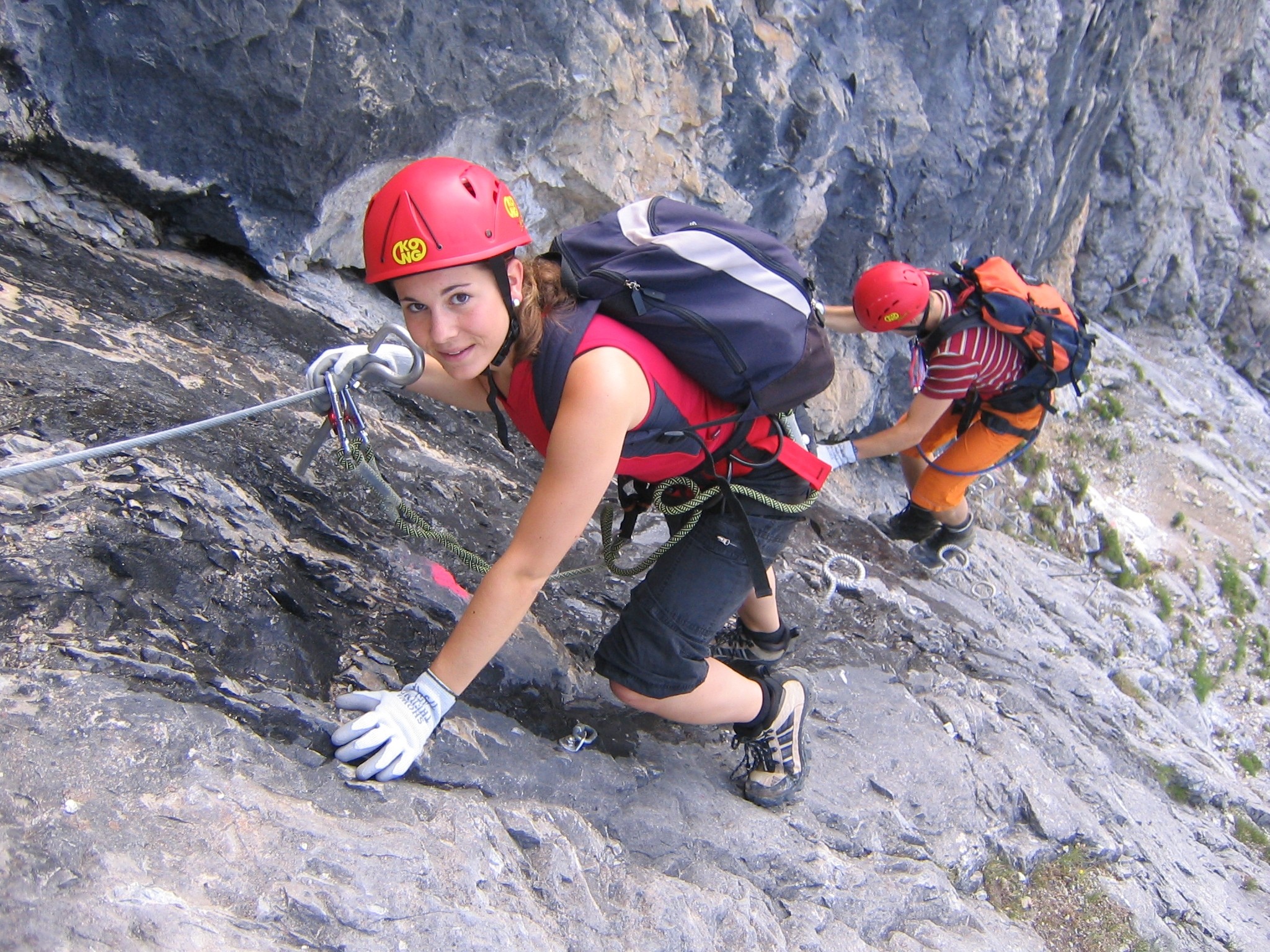
A via ferrata (Italian language, Italian for "iron path", plural ''vie ferrate'' or in English ''via ferratas'') is a protected climbing route found in the Alps and certain other Alpine locations. The protection includes steel fixtures such as cables and railings to arrest the effect of any fall, which the climber can either hold onto or Glossary of climbing terms#clip in, clip into using climbing protection. Some via ferratas can also include steel fixtures that provide aid climbing, aid in overcoming the obstacles encountered, including steel ladders and steel steps. Description A via ferrata is a climbing route in the mountains that employs steel cables, rungs, or ladders, fixed to the rock to which the climbers affix #Via ferrata set, a harness with two leashes, which allows the climbers to secure themselves to the metal fixture and limit any fall. The cable and other fixtures, such as iron rungs (stemples), pegs, carved steps, and ladders and bridges, provide both footing ... [...More Info...] [...Related Items...] OR: [Wikipedia] [Google] [Baidu] |


