|
Al Dirah (Riyadh)
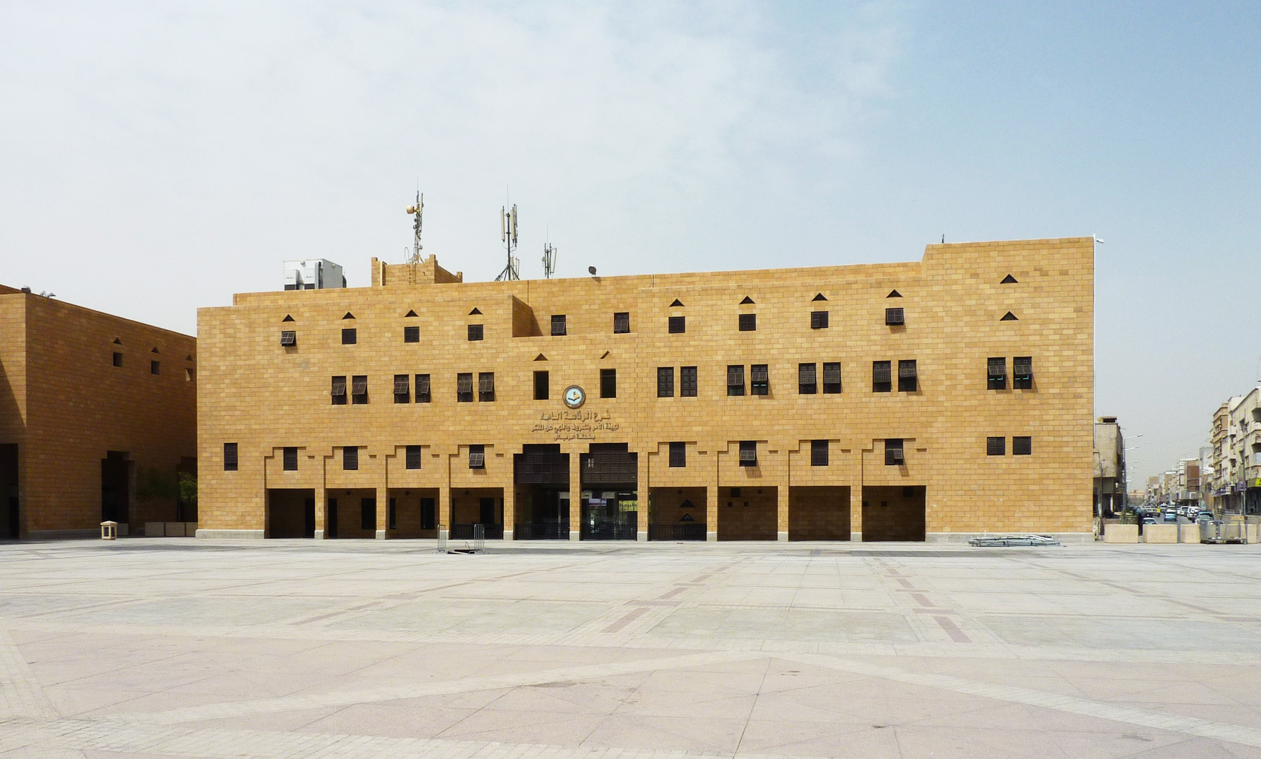
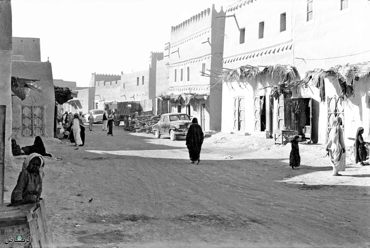
Al Dirah (), alternatively transliterated as Deira, Deirah, Dheera, Deerah or Deera, is a neighborhood in southern Riyadh, Saudi Arabia, located south of al-Futah and west of Margab in the sub-municipality of al-Batʼha. Forming the kernel of the old city region, the northern part makes up the ruins of the extinct settlement of Duhairah meanwhile the remainder consists most of the Qasr al-Hukm District. It lies in the geographic center of the city's downtown neighborhoods, whereby its eastern strip partially forms part of the al-Batʼha commercial area. Named after Deirah markets, it is today a popular tourist attraction as it hosts several historical and traditional landmarks, such as the Justice Palace (Qasr al-Hukm), al-Masmak Fort, and Deera Square. The origins of the neighborhood can be traced back to 1737 when Deham bin Dawas al-Shalaan took over Riyadh. In popular culture * Baby (2015), a fictional city in Saudi Arabia Saudi Arabia, officially the Kingdo ... [...More Info...] [...Related Items...] OR: [Wikipedia] [Google] [Baidu] |
Neighbourhood
A neighbourhood (Commonwealth English) or neighborhood (American English) is a geographically localized community within a larger town, city, suburb or rural area, sometimes consisting of a single street and the buildings lining it. Neighbourhoods are often social communities with considerable face-to-face interaction among members. Researchers have not agreed on an exact definition, but the following may serve as a starting point: "Neighbourhood is generally defined spatially as a specific geographic area and functionally as a set of social networks. Neighbourhoods, then, are the Neighbourhood unit, spatial units in which face-to-face social interactions occur—the personal settings and situations where residents seek to realise common values, socialise youth, and maintain effective social control." Preindustrial cities In the words of the urban scholar Lewis Mumford, "Neighborhoods, in some annoying, inchoate fashion exist wherever human beings congregate, in permanent famil ... [...More Info...] [...Related Items...] OR: [Wikipedia] [Google] [Baidu] |
Qasr Al Hukm District
Qasr al-Hukm District () or the Justice Palace District (), is a term used to define the area within the perimeters of the erstwhile walled town of Riyadh in Riyadh, Saudi Arabia, encompassing present-day districts of ad-Dirah and ad-Doho, that lie on several extinct douars () that once fell within the enclosure of the gates of old city walls prior to its demolition in the 1950s. Named after the eponymous al-Hukm Palace, it is widely considered to be the antecedent to modern Riyadh since the metropolis outgrew as an offshoot of the walled town in the 1950s. Owing to its historical and architectural significance, it was rebuilt by the Saudi government from 1973 to 1992 and is situated southwest of al-Batʼha commercial area. It hosts some of the most important cultural heritage landmarks in the city, such as Masmak Fortress, Imam Turki bin Abdullah Grand Mosque, Deera Square and the eponymous al-Hukm Palace besides several traditional marketplaces. History and background ... [...More Info...] [...Related Items...] OR: [Wikipedia] [Google] [Baidu] |
Saudi Arabia
Saudi Arabia, officially the Kingdom of Saudi Arabia (KSA), is a country in West Asia. Located in the centre of the Middle East, it covers the bulk of the Arabian Peninsula and has a land area of about , making it the List of Asian countries by area, fifth-largest country in Asia, the largest in the Middle East, and the List of countries and dependencies by area, 12th-largest in the world. It is bordered by the Red Sea to the west; Jordan, Iraq, and Kuwait to the north; the Persian Gulf, Bahrain, Qatar and the United Arab Emirates to the east; Oman to the southeast; and Yemen to Saudi Arabia–Yemen border, the south. The Gulf of Aqaba in the northwest separates Saudi Arabia from Egypt and Israel. Saudi Arabia is the only country with a coastline along both the Red Sea and the Persian Gulf, and most of Geography of Saudi Arabia, its terrain consists of Arabian Desert, arid desert, lowland, steppe, and List of mountains in Saudi Arabia, mountains. The capital and List of cities ... [...More Info...] [...Related Items...] OR: [Wikipedia] [Google] [Baidu] |
Baby (2015 Hindi Film)
''Baby'' is a 2015 Indian Hindi-language action spy thriller film written and directed by Neeraj Pandey. The film marks the second collaboration between Akshay Kumar and Pandey after ''Special 26'', and stars Kumar in the lead role, along with Anupam Kher, Rana Daggubati, Danny Denzongpa, Taapsee Pannu, Kay Kay Menon, Mikaal Zulfiqar, Madhurima Tuli and Rasheed Naz. In the film, an elite team of the Indian Intelligence system, perpetually strives to eliminate terrorists and their plots, during which an officer leads a team to destroy one such potentially lethal operation. Filming began on 4 September 2014 in Greater Noida, Uttar Pradesh. It was shot in Gautam Buddha University, Nepal, Abu Dhabi and Istanbul. The film was one of the most anticipated of the year. Its theatrical trailer was released on 4 December 2014. ''Baby'' was released on 23 January 2015 where it generally received positive reviews from critics who praised its screenwriting, direction, action sequences and ... [...More Info...] [...Related Items...] OR: [Wikipedia] [Google] [Baidu] |
Deera Square
__NOTOC__ Deera Square (), also known as Justice Square () or Safa Square () is a public space in the al-Dirah neighborhood of Riyadh, Saudi Arabia, located adjacent to the al-Hukm Palace compound and Imam Turki bin Abdullah Grand Mosque in the Qasr al-Hukm District. It is known as the historic site of public executions, where those sentenced to death in Saudi Arabia were publicly beheaded. At unannounced times, Saudi security forces and other officials cleared the area to make way for executions to take place. After the beheading of the condemned, the head was stitched to the body, which was wrapped up and taken away for the final rites. It was a crime to record, with photos or videos, the executions, despite the number of attendees witnessing such public events. Saudi Arabia remains the only country with legal capital punishment by decapitation (beheading) – in 2022, recorded executions in Saudi Arabia reached 196, the highest number recorded in the country in 30 yea ... [...More Info...] [...Related Items...] OR: [Wikipedia] [Google] [Baidu] |
Qasr Al Hukm
Al-Hukm Palace () or The Ruling Palace, originally Ibn Dawwas Palace, and also known as the al-ʽAdl Palace (), so called from the public square it overlooks from the south, is a historic palace and a popular cultural heritage landmark in the ad-Dirah neighbourhood of Riyadh, Saudi Arabia, located directly opposite to Imam Turki bin Abdullah Grand Mosque in the Qasr al-Hukm District. It is the historic site where tribal leaders and members of the Saudi royal family have been pledging allegiance to the country's political leadership. It was built in 1747 by Dahham ibn Dawwas alongside the city wall to safeguard the walled town from invaders and intruders. In the 1820s, Turki bin Abdullah, after gaining control of Najd, shifted the royal family's center of power from Diriyah to the walled town of Riyadh due to the former's severe destruction in a brutal siege during the Ottoman–Wahhabi War of 1818 as well as the town’s Ottoman sacking in 1821. Once the administrative headq ... [...More Info...] [...Related Items...] OR: [Wikipedia] [Google] [Baidu] |
Al Batʼha (Riyadh)
Al-Batʼha (), also simply romanized as Batha, is a colloquial umbrella term used for the partial agglomeration of six neighborhoods in downtown Riyadh, Saudi Arabia, that are primarily situated along the al-Batʼha Street on the either edge of the now-dried up stream of Wadi al-Batʼha, located between al-Murabba and the Qasr al-Hukm District. It is one of the oldest commercial districts in Riyadh and the financial nerve center of the city's downtown area, covering east of al-Futah and al-Dirah whereas west of al-Amal, Margab, Thulaim and to some extent, al-Oud. It emerged in the 1940s as Hillat al-Kuwaitiyyah () during World War II when a number of Kuwaiti merchants and traders chose to set up an auction market just outside the northeastern fringes of the erstwhile walled town. Besides being a open-air marketplace that hosts a number of large and medium-scale trading centers, the surrounding locality has been the heart of the city's Bangladeshi community since the ... [...More Info...] [...Related Items...] OR: [Wikipedia] [Google] [Baidu] |
Downtown Riyadh
Downtown Riyadh () is a term used for a group of 20 neighborhoods in Riyadh, Saudi Arabia. Covering an area of more than 3700 acres, it hosts some of the city's most important cultural and commercial districts, such as the King Abdulaziz Historical Center, the Al Batʼha (Riyadh), al-Batʼha commercial area and the Qasr Al Hukm District, Qasr al-Hukm District, while simultaneously overlapping with many of the Old Riyadh, old city areas of the capital metropolis, including the erstwhile walled town of Riyadh, walled town. The first downtown development plan was introduced in 2013 by the Royal Commission for Riyadh City. The downtown is bounded by Al-Washm Street and Omar bin Al-Khattab Street in the north, Al-Kharj Road in the east, Ammar bin Yasir Street and Al-A’sha Street in the south, and Imam Abdulaziz bin Muhammad Street in the west. Districts Qasr al-Hukm District Qasr al-Hukm District is a term used to define the perimeters of the erstwhile walled town of Riyadh in ... [...More Info...] [...Related Items...] OR: [Wikipedia] [Google] [Baidu] |
Duhairah
Hillat Al-Duhairah (), alternatively transliterated as al-Zuhayri, was a neighborhood and a douar partially within the former city walls that is under rehabilitation in southern Riyadh, Saudi Arabia. Located in close proximity to the Qasr al-Hukm District in the old city region, the ruins of the area today constitute a large chunk of ad-Dirah neighborhood. Bordered by al-Suwailem Street to the west and ad-Duhairah Street to the east, most of its residents abandoned the area during Riyadh's multiple phases of expansion and modernization, especially between 1950s and 1970s. As of 2024, Duhairah still remains unrecognized by Riyadh Municipality. The Saudi government since 2009 has sought to revive the neighborhood by launching the Al-Zahirah Development Project through the Royal Commission for Riyadh City, which intends to make the area a hub for tourist and commercial activities. The neighborhood's name was derived from its geographic location, as it was situated on a rocky ridge ... [...More Info...] [...Related Items...] OR: [Wikipedia] [Google] [Baidu] |
Masmak Fort
Al Masmak Palace (), also called the Masmak Fortress or Masmak Fort, is a historic clay and mudbrick fort in the ad-Dirah neighborhood of Riyadh, Saudi Arabia, located in close proximity to the al-Hukm Palace in the Qasr al-Hukm District. Commissioned in 1865 by Abdullah bin Faisal Al Saud, it was completed in 1895 following the takeover of the town by the Rashidi dynasty. The fortress was the main theatre for the Battle of Riyadh in 1902, which marked the prelude to the unification of Saudi Arabia. It was opened to the general public in 1995 after its conversion into a museum. History The construction of the fort was started by Abdullah bin Faisal, Emir of Najd, in 1865. It was completed in 1895 by Emir of Riyadh, 'Abdurrahman ibn Sulaiman under the reign of Muhammad bin Abdullah Al Rashid, the ruler of the Emirate of Jabal Shammar and head of the House of Rasheed, who had wrested control of the city from the local House of Saud, who later went into exile. It was built w ... [...More Info...] [...Related Items...] OR: [Wikipedia] [Google] [Baidu] |
Al Marqab (Riyadh)
Al-Marqab (), or in Najdi vernacular pronunciation as al-Margab, is one of the oldest neighborhoods of Riyadh, Saudi Arabia Riyadh is the capital and largest city of Saudi Arabia. It is also the capital of the Riyadh Province and the centre of the Riyadh Governorate. Located on the eastern bank of Wadi Hanifa, the current form of the metropolis largely emerged in th ..., located east of al-Dirah and south of Thulaim in the sub-municipality of al-Batʼha. It was named after the Margab Fort, which was demolished in 1957. As the neighborhood is bounded by al-Batʼha Street to the west, its western strip partially forms part of the al-Batʼha commercial area. The early traces of its existence dates back to 16th century, which nearly corresponds with the final stages of the disintegration of Hajr al-Yamamah that resulted in the succession of several settlements from the former. References Neighbourhoods in Riyadh {{SaudiArabia-geo-stub ... [...More Info...] [...Related Items...] OR: [Wikipedia] [Google] [Baidu] |
Al Fouta
Al-Fouta (), alternatively transliterated as al-Futa, is a neighborhood in central Riyadh, Saudi Arabia, located south of al-Murabba and north of al-Dirah in the sub-municipality of al-Malaz. It emerged in the 1940s following the construction of the Red Palace for then Saudi crown prince Saud bin Abdulaziz and al-Futa Palaces. It popularly hosts the Riyadh Water Tower, one of the notable landmarks in the city as well as the rest of the southern portion of the King Abdulaziz Historical Center King Abdulaziz Historical Center (KAHC) () is a cross-district heritage complex in Riyadh, Saudi Arabia, covering south of Al Murabba, al-Murabba and north of Al Fouta, al-Futah. Inaugurated in 1999, it includes several historic buildings and ope ..., including the eponymous al-Fouta Park. As the neighborhood is bounded by al-Batʼha Street to the east, its eastern strip partially forms part of the al-Batʼha commercial area. The neighborhood is unofficially divided into two sections, ... [...More Info...] [...Related Items...] OR: [Wikipedia] [Google] [Baidu] |


