|
Akilineq
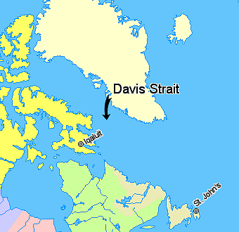
Akilineq is an Inuit language toponym meaning ''the opposite country'', which has variously been theorized to be a mythical place, an area in northeastern North America, or possibly even Europe. One theory notes that the term was used in West Greenland to refer to the territories across Davis Strait, such as the Labrador Peninsula and Baffin Island. Renee Fosset notes that Gustav Holm of the 1880s Danish polar expedition recorded east Greenlanders as describing Akilineq as a land far to the east, which by evidence Holm took to refer to Iceland. The term was also used to refer to one or several trading sites where the Inuit and neighbouring peoples would meet, by the Akilineq Hills at the mouth of the Thelon River The Thelon River ('' iu, Akilinik'', "on the other side") stretches across northern Canada. Its source is Whitefish Lake in the Northwest Territories, and it flows east to Baker Lake in Nunavut. The Thelon ultimately drains into Hudson Bay at ..., or on the north s ... [...More Info...] [...Related Items...] OR: [Wikipedia] [Google] [Baidu] |
Inuit Language
The Inuit languages are a closely related group of indigenous American languages traditionally spoken across the North American Arctic and adjacent subarctic, reaching farthest south in Labrador. The related Yupik languages (spoken in western and southern Alaska, as well as in nearby Russia's farthest east, though severely endangered there) are the two main branches of Eskaleut, a primary language family. The Inuit live primarily in three countries: Greenland (Kingdom of Denmark), Canada (specifically in Nunavut, Northwest Territories, the Nunavik region of Quebec, and the Nunatsiavut and Nunatuĸavut regions of Labrador), and the United States (specifically the coast of Alaska). The total population of Inuit speaking their traditional languages is difficult to assess with precision, since most counts rely on self-reported census data that may not accurately reflect usage or competence. Greenland census estimates place the number of speakers of varieties of Inuit languages ... [...More Info...] [...Related Items...] OR: [Wikipedia] [Google] [Baidu] |
Davis Strait
Davis Strait is a northern arm of the Atlantic Ocean that lies north of the Labrador Sea. It lies between mid-western Greenland and Baffin Island in Nunavut, Canada. To the north is Baffin Bay. The strait was named for the English explorer John Davis (1550–1605), who explored the area while seeking a Northwest Passage. By the 1650s it was used for whale hunting. Extent The International Hydrographic Organization defines the limits of the Davis Strait as follows: ''On the North.'' The Southern limit of Baffin Bay Baffin Land]. ''On the East.'' The Southwest coast of Greenland. ''On the South.'' The parallel of 60th parallel north, 60° North between Greenland and Labrador. ''On the West.'' The Eastern limit of the Northwestern Passages South of 70° North he East coast of Baffin Island to East Bluff, its Southeastern extremityand of Hudson Strait Resolution Island, through its Southwestern shore to Hatton Headland, its Southern point, thence a line to Cape Chidley, ... [...More Info...] [...Related Items...] OR: [Wikipedia] [Google] [Baidu] |
Labrador Peninsula
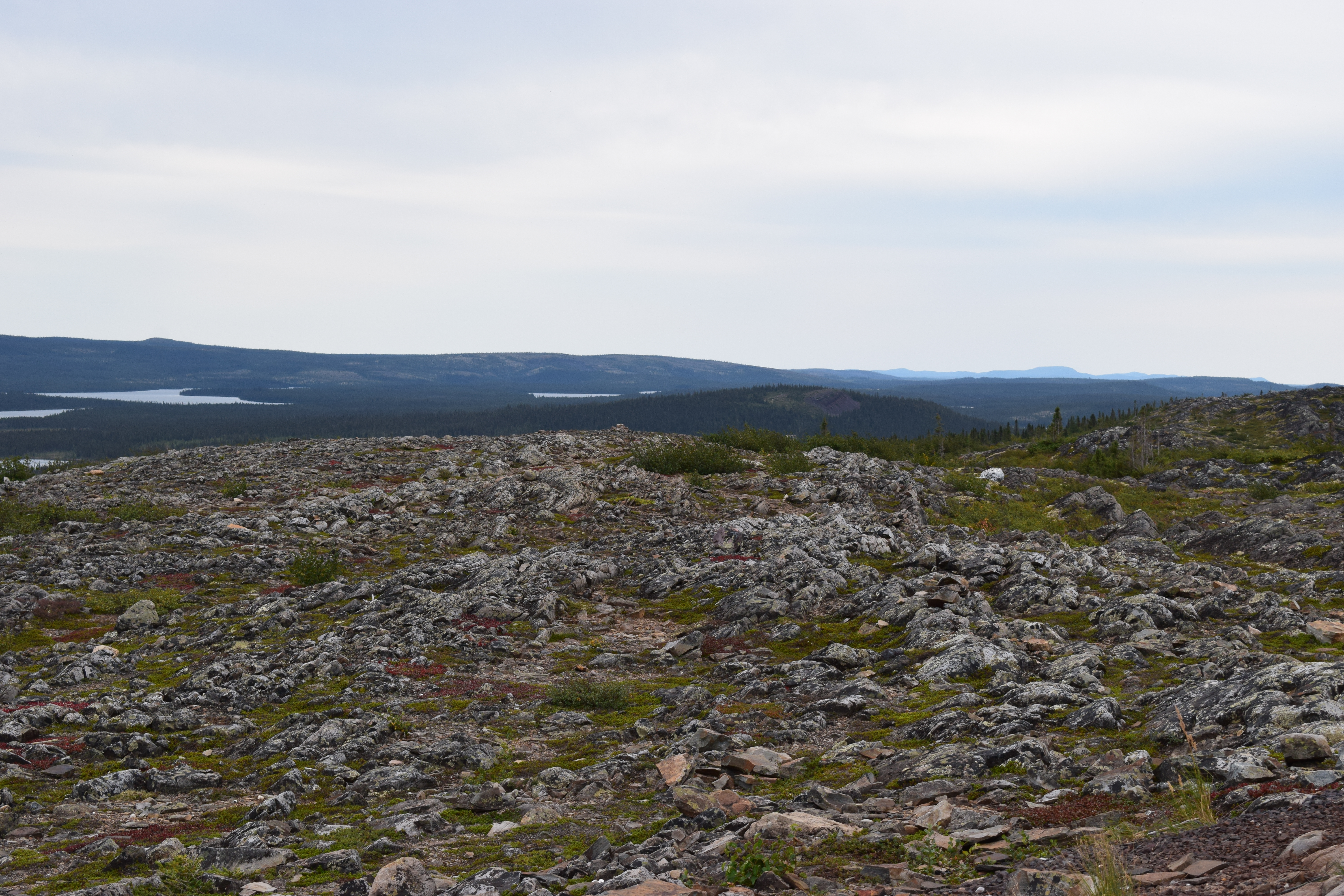
The Labrador Peninsula, or Quebec-Labrador Peninsula, is a large peninsula in eastern Canada. It is bounded by the Hudson Bay to the west, the Hudson Strait to the north, the Labrador Sea to the east, and the Gulf of Saint Lawrence to the southeast. The peninsula includes the region of Labrador, which is part of the province of Newfoundland and Labrador, and the regions of Saguenay–Lac-Saint-Jean, Côte-Nord, and Nord-du-Québec, which are in the province of Quebec. It has an area of . Location and geography The peninsula is surrounded by sea on all sides, except for the southwest where it widens into the general continental mainland. The northwestern part of the Labrador Peninsula is shaped as a lesser peninsula, the Ungava Peninsula, surrounded by Hudson Bay, the Hudson Strait, and Ungava Bay. The northernmost point of the Ungava Peninsula, Cape Wolstenholme, also serves as the northernmost point of the Labrador Peninsula and of the province of Quebec. The peninsula i ... [...More Info...] [...Related Items...] OR: [Wikipedia] [Google] [Baidu] |
Baffin Island
Baffin Island (formerly Baffin Land), in the Canadian territory of Nunavut, is the largest island in Canada and the fifth-largest island in the world. Its area is , slightly larger than Spain; its population was 13,039 as of the 2021 Canadian census; and it is located at . It also contains the city of Iqaluit, the capital of Nunavut. Name The Inuktitut name for the island is , which means "very big island" ( "island" + "very big") and in Inuktitut syllabics is written as . This name is used for the administrative region the island is part of ( Qikiqtaaluk Region), as well as in multiple places in Nunavut and the Northwest Territories, such as some smaller islands: Qikiqtaaluk in Baffin Bay and Qikiqtaaluk in Foxe Basin. Norse explorers referred to it as ("stone land"). In 1576, English seaman Martin Frobisher made landfall on the island, naming it "Queen Elizabeth's Foreland" and Frobisher Bay is named after him. The island is named after English explorer William B ... [...More Info...] [...Related Items...] OR: [Wikipedia] [Google] [Baidu] |
Gustav Frederik Holm
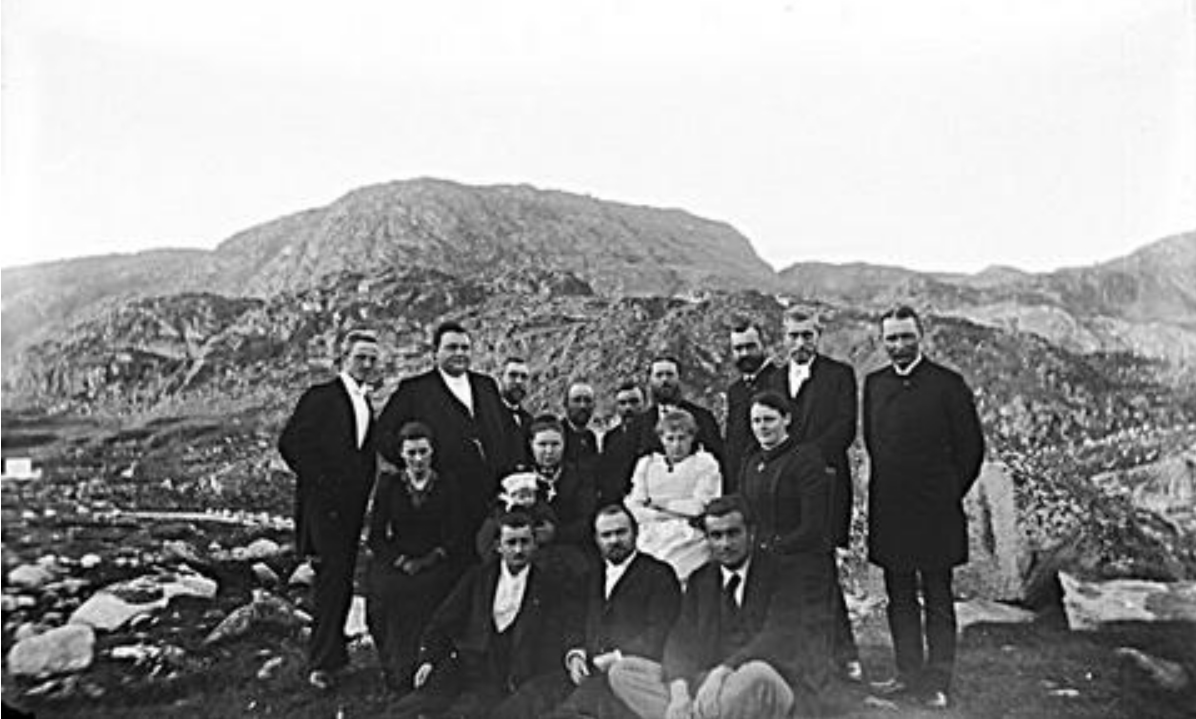
Gustav Frederik Holm (6 August 1849 – 13 March 1940) was a Danish naval officer and Arctic explorer born in Copenhagen. Career He was made commander in the navy in 1899, was chief of the hydrographic bureau from 1899 to 1909, and became director of pilots in 1912. He became distinguished for his explorations, especially of the east coast of Greenland. In 1876, he participated in K. J. V. Steenstrup's geological expedition to the Julianehåb District. From 1883 to 1885 he led the Umiak Expedition with T. V. Garde, exploring the east coast of Christian IX Land, as far as 66° 8' N using umiak boats. The expedition encountered 11 Inuit communities, numbering 431 inhabitants, who were previously unknown to Europeans, and discovered five great ice fiords. For his explorations he received gold medals from the Société de géographie, Paris (1891), and the Danish Geographical Society (1895), and the Danish Order of Merit (1909). The results and observations of the expeditions w ... [...More Info...] [...Related Items...] OR: [Wikipedia] [Google] [Baidu] |
Thelon River
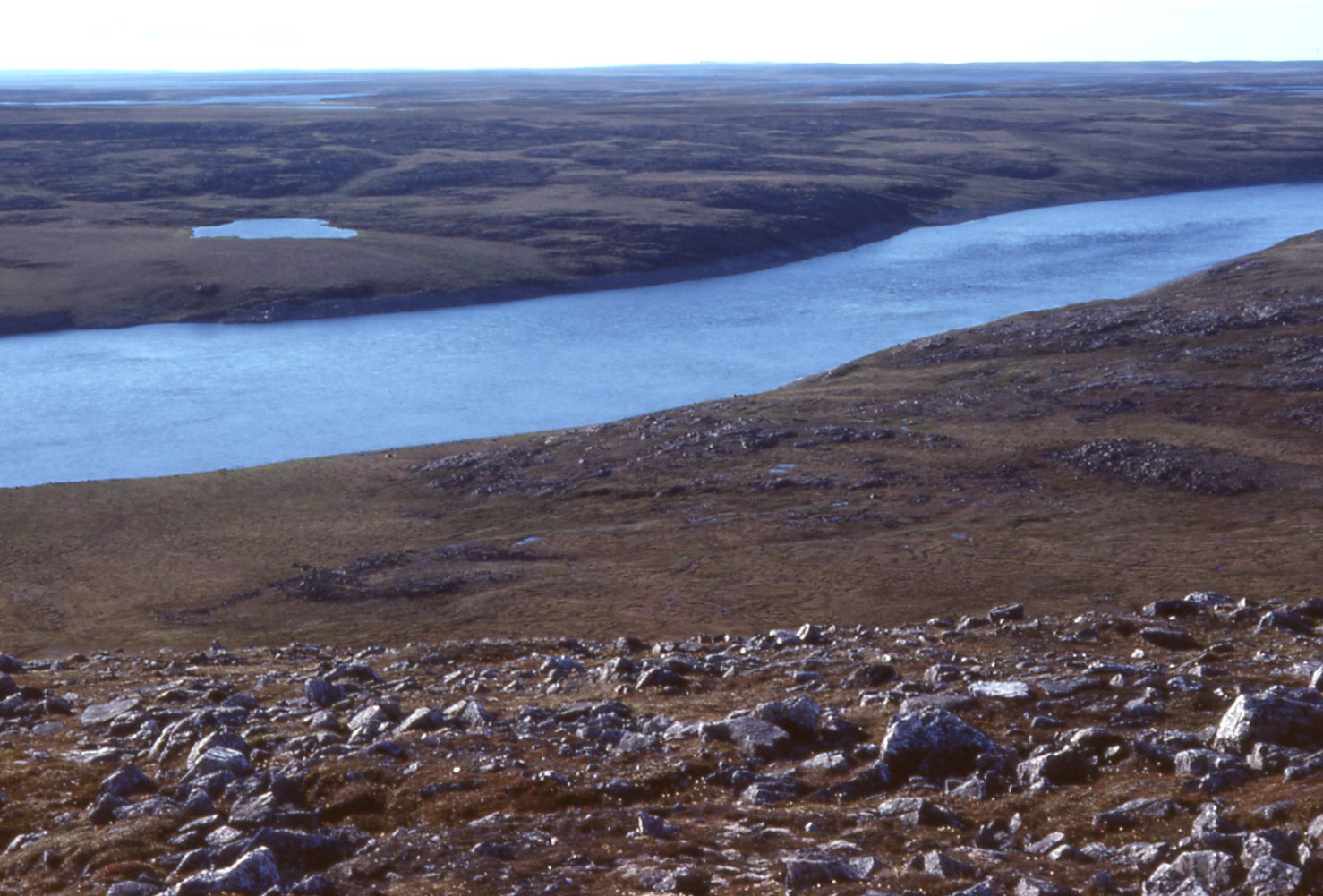
The Thelon River ('' iu, Akilinik'', "on the other side") stretches across northern Canada. Its source is Whitefish Lake in the Northwest Territories, and it flows east to Baker Lake in Nunavut. The Thelon ultimately drains into Hudson Bay at Chesterfield Inlet. Geography The drainage basin of the Thelon River encompasses some . Located far from almost all human development, the Thelon and its surroundings are entirely pristine wilderness. It has been described as Canada's remotest river. The river has a width of up to a kilometre (0.6 mi) along much of its lower section, widening into Beverly, Aberdeen, and Schultz Lakes about upstream from its mouth at Baker Lake. Fauna Approximately 100 moose and more than 2,000 muskoxen forage on the land around the Thelon. 300,000 migrating barren-ground caribou cross the river every fall and spring. History Inuit - including Caribou Inuit and Copper Inuit - have long occupied the sparsely-populated lands around the Thelon. ... [...More Info...] [...Related Items...] OR: [Wikipedia] [Google] [Baidu] |
Aberdeen Lake (Nunavut)
Aberdeen Lake is a large, irregularly shaped lake in Kivalliq Region, Nunavut, Canada. It is located on the Canadian Shield. The lake measures nearly east-west with a peninsula in the center separating the lake into almost two halves which extend nearly north-south. The Thelon Wildlife Sanctuary is to the west. The Thelon River is the lake's primary inflow and outflow. Beverly Lake and Schultz Lake are nearby. See also *List of lakes of Nunavut This is an incomplete list of lakes of Nunavut, a territory of Canada. Larger lake statistics "The total area of a lake includes the area of islands. Lakes lying across provincial boundaries are listed in the province with the greater lake are ... * List of lakes of Canada References Lakes of Kivalliq Region {{KivalliqNU-geo-stub ... [...More Info...] [...Related Items...] OR: [Wikipedia] [Google] [Baidu] |
Inuit Culture
The Inuit are an indigenous people of the Arctic and subarctic regions of North America (parts of Alaska, Canada, and Greenland). The ancestors of the present-day Inuit are culturally related to Iñupiat (northern Alaska), and Yupik (Siberia and western Alaska), and the Aleut who live in the Aleutian Islands of Siberia and Alaska. The term culture of the Inuit, therefore, refers primarily to these areas; however, parallels to other Eskimo groups can also be drawn. The word "Eskimo" has been used to encompass the Inuit and Yupik, and other indigenous Alaskan and Siberian peoples, but this usage is in decline. Various groups of Inuit in Canada live throughout the Inuvialuit Settlement Region of the Northwest Territories, the territory of Nunavut, Nunavik in northern Quebec and Nunatsiavut in Labrador and the unrecognised area known as NunatuKavut. With the exception of NunatuKavut these areas are sometimes known as Inuit Nunangat. The traditional lifestyle of the Inuit is a ... [...More Info...] [...Related Items...] OR: [Wikipedia] [Google] [Baidu] |
Mythological Places
Myth is a folklore genre consisting of narratives that play a fundamental role in a society, such as foundational tales or origin myths. Since "myth" is widely used to imply that a story is not objectively true, the identification of a narrative as a myth can be highly controversial. Many adherents of religions view their own religions' stories as truth and so object to their characterization as myth, the way they see the stories of other religions. As such, some scholars label all religious narratives "myths" for practical reasons, such as to avoid depreciating any one tradition because cultures interpret each other differently relative to one another. Other scholars avoid using the term "myth" altogether and instead use different terms like "sacred history", "holy story", or simply "history" to avoid placing pejorative overtones on any sacred narrative. Myths are often endorsed by secular and religious authorities and are closely linked to religion or spirituality. Many soc ... [...More Info...] [...Related Items...] OR: [Wikipedia] [Google] [Baidu] |
