|
Ainsdale
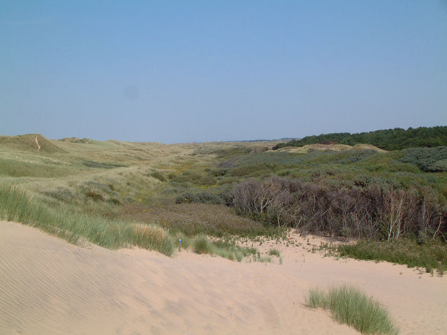
Ainsdale is a village near Southport, in the Metropolitan Borough of Sefton, Sefton district, in Merseyside, England, situated three miles south of the centre of Southport. Originally in the Historic counties of England, historic county of Lancashire, at the United Kingdom Census 2001, 2001 Census it had a population of 12,723. By the time of the 2011 census, only figures for Ainsdale (ward) were available. It makes up the southern edge of the town, separated from neighbouring Formby by RAF Woodvale. The village and roads leading to the beach are middle class areas, with some new modern developments around the station, including the addition of the private estate Village Row in 2006, and the Belway estate in 2013. History Prior to 1600 Ainsdale was listed in the ''Domesday Book'' as ''Einulvesdel''. Deriving from Old Norse name ''Einulfsdalr'', this apparently was the valley occupied by a Scandinavian by the name of Einulf. 1600–present Ainsdale formed part of Sir Cuthbert Ha ... [...More Info...] [...Related Items...] OR: [Wikipedia] [Google] [Baidu] |
Ainsdale Railway Station
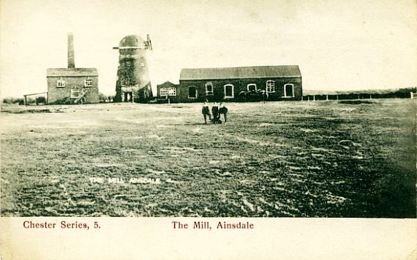
Ainsdale railway station serves the village of Ainsdale near Southport, England. The station is located on the Southport railway station, Southport branch of the Merseyrail network's Northern Line (Merseyrail), Northern Line. History Ainsdale railway station opened on 24 July 1848 when the Liverpool, Crosby and Southport Railway (LC&SR) opened its line from to . In 1851 a branch line was opened, without parliamentary authorisation, from the station to Ainsdale Corn Mill away on the east side of Liverpool Road. The legal status of the branch was regularised with a retrospective act of Parliament, the Liverpool, Crosby and Southport Railway Amendment Act 1853 (16 & 17 Vict. c. ccxi). In 1850 the LC&SR had been authorised to lease, sell or transfer itself to the L&YR and on 14 June 1855 the L&YR purchased and took over the LC&SR. The Lancashire and Yorkshire Railway amalgamated with the London and North Western Railway on 1 January 1922 and in turn was Railways Act 1921, Group ... [...More Info...] [...Related Items...] OR: [Wikipedia] [Google] [Baidu] |
Ainsdale (ward)
Ainsdale is a Metropolitan Borough of Sefton ward in the Southport Parliamentary constituency that covers the localities of Ainsdale and Woodvale in the town of Southport Southport is a seaside resort, seaside town in the Metropolitan Borough of Sefton in Merseyside, England. It lies on the West Lancashire Coastal Plain, West Lancashire coastal plain and the east coast of the Irish Sea, approximately north of .... At the 2011 census it had a population of 12,102. Councillors indicates seat up for re-election. Election results Elections of the 2020s Elections of the 2010s Notes References {{DEFAULTSORT:Ainsdale (Ward) Wards of the Metropolitan Borough of Sefton Southport ... [...More Info...] [...Related Items...] OR: [Wikipedia] [Google] [Baidu] |
Southport
Southport is a seaside resort, seaside town in the Metropolitan Borough of Sefton in Merseyside, England. It lies on the West Lancashire Coastal Plain, West Lancashire coastal plain and the east coast of the Irish Sea, approximately north of Liverpool and southwest of Preston, Lancashire, Preston. At the United Kingdom Census 2021, 2021 census, Southport had a population of 94,421, making it the List of North West England cities and metropolitan areas by population, eleventh most populous settlement in North West England and the third most populous settlement in the Liverpool City Region. The town was founded in 1792 by William Sutton (Southport), William Sutton, an innkeeper from Churchtown, Merseyside, Churchtown, who built a bathing house at what is now the south end of Lord Street, Southport, Lord Street.''North Meols and Southport – a History'', Chapter 9, Peter Aughton (1988) The area was previously known as South Hawes, and was sparsely populated and dominated ... [...More Info...] [...Related Items...] OR: [Wikipedia] [Google] [Baidu] |
Ainsdale Beach Railway Station
Ainsdale Beach was a railway station located in Ainsdale, Merseyside, England. History The Southport & Cheshire Lines Extension Railway (SCLER) opened a line extending their existing system from Aintree to Southport on 1 September 1884. Seeing the potential in Ainsdale's large beach they subsequently built this station, which opened as ''Seaside'' in 1901. In 1911 it was decided to rename the station ''Ainsdale Beach'', which took effect from 1 January 1912. The station was built adjacent to a hotel called The Lakeside Hotel (in 2015 named 'The Sands' and trading as a local pub) situated at the coastal end of Shore Road. A terraced row of railway staff cottages immediately next to the station still stood in 2015, although all station structures, signal box and level crossing have long gone. It was served by trains from Southport Lord Street, Liverpool Central and Manchester Central. A total eclipse of the sun occurred in June 1927. The railway provided many excursion spec ... [...More Info...] [...Related Items...] OR: [Wikipedia] [Google] [Baidu] |
Formby
Formby is a town and Civil parishes in England, civil parish in the Metropolitan Borough of Sefton, Merseyside, England. Historic counties of England, Historically in Lancashire, three manors are recorded in the Domesday Book of 1086 under "Fornebei", Halsall, Walton and Poynton. Cockle (bivalve), Cockle raking and shrimp fishing lasted into the 19th century. By 1872, the township and sub-district was made up of two chapelries (St Peter's Church, Formby, St Peter's and St Luke's Church, Formby, St Luke's), Birkdale township, the hamlets of Ainsdale and Raven-Meols and Altcar parish. The Section dedicated to Formby. Formby was built on the plain adjoining the Irish Sea coast a few miles north of the Crosby, Merseyside, Crosby channel. A commuter town for Liverpool, Formby is also a tourist destination with Day-tripper, day trippers attracted to its beaches, sand dunes and wildlife, particularly the endangered red squirrel and natterjack toad. The area is conserved by the Nati ... [...More Info...] [...Related Items...] OR: [Wikipedia] [Google] [Baidu] |
Metropolitan Borough Of Sefton
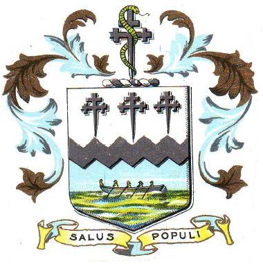
The Metropolitan Borough of Sefton is a metropolitan borough of Merseyside, England. It was formed on Local Government Act 1972, 1 April 1974, by the amalgamation of the county boroughs of Bootle and Southport, the municipal borough of Crosby, Merseyside, Crosby, the Urban district (Great Britain and Ireland), urban districts of Formby and Litherland, and part of West Lancashire Rural District. It consists of a Sefton Coast, coastal strip of land on the Irish Sea which extends from Southport in the north to Bootle in the south, and an inland part to Maghull in the south-east, bounded by the city of Liverpool to the south, the Metropolitan Borough of Knowsley to the south-east, and West Lancashire to the east. It is named after Sefton, Sefton, Sefton, near Maghull. When the borough was created, a name was sought that would not unduly identify the borough with any of its constituent parts, particularly the former county boroughs of Bootle and Southport. The area had strong links w ... [...More Info...] [...Related Items...] OR: [Wikipedia] [Google] [Baidu] |
Sefton Central (UK Parliament Constituency)
Sefton Central is a constituency represented since its creation in 2010 by Bill Esterson of the Labour Party. Boundaries 2010-2024 The constituency was created for the 2010 general election, replacing much of Crosby along with part of Knowsley North and Sefton East.The constituency comprised the following electoral wards of the Metropolitan Borough of Sefton: *Blundellsands * Harington * Manor * Molyneux *Park * Ravenmeols * Sudell Current Further to the 2023 Periodic Review of Westminster constituencies which came into effect for the 2024 general election, the constituency is composed of the following wards of the Metropolitan Borough of Sefton (as they existed on 1 December 2020): * Ainsdale; Blundellsands; Harington; Manor; Molyneux (polling districts C1, C2 and C3); Park; Ravenmeols; Sudell. ''The Ainsdale ward was transferred from Southport, offset by the loss of the Aintree district in the Molyneux ward to Liverpool Walton.'' The constituency covers Merseys ... [...More Info...] [...Related Items...] OR: [Wikipedia] [Google] [Baidu] |
Henry Segrave
Sir Henry O'Neal de Hane Segrave (22 September 1896 – 13 June 1930) was an early British pioneer in land speed and water speed records. Segrave, who set three land and one water record, was the first person to hold both titles simultaneously and the first person to travel at over in a land vehicle. He died in an accident in 1930 shortly after setting a new world water speed record on Windermere in the Lake District, England. The Segrave Trophy was established to commemorate his life. Early life Segrave, who was a British national, was born on 22 September 1896 in Baltimore, Maryland, to an American mother and an Irish father. He was raised in Ireland and attended Eton College in England. He spent some time at 'Belle Isle' house, near Portumna and learnt to drive the family houseboat. He is reported to have attended the North Shannon Yacht Club regatta on Lough Boderg between Leitrim and Roscommon. First World War At the outbreak of war the Sandhurst officer training co ... [...More Info...] [...Related Items...] OR: [Wikipedia] [Google] [Baidu] |
Sefton Council
Sefton Council, or Sefton Metropolitan Borough Council, is the local authority of the Metropolitan Borough of Sefton in Merseyside, England. It is a metropolitan borough council and provides the majority of local government services in the borough. The council has been a member of the Liverpool City Region Combined Authority since 2014. The council has been under Labour majority control since 2012. Full council meetings generally alternate between Bootle Town Hall and Southport Town Hall. The main administrative offices are at Magdalen House in Bootle. History The metropolitan borough of Sefton and its council were created in 1974 under the Local Government Act 1972, covering the whole area of five former districts and parts of another, all of which were abolished at the same time: *Bootle County Borough * Crosby Municipal Borough *Formby Urban District * Litherland Urban District *Southport County Borough * West Lancashire Rural District (parishes of Aintree, Ince Blundell ... [...More Info...] [...Related Items...] OR: [Wikipedia] [Google] [Baidu] |
Woodvale, Merseyside
Woodvale is the southernmost suburb of the town of Southport, Merseyside, England. It is situated between Formby and Ainsdale, to the north of RAF Woodvale. References Towns and villages in the Metropolitan Borough of Sefton Southport {{Merseyside-geo-stub ... [...More Info...] [...Related Items...] OR: [Wikipedia] [Google] [Baidu] |
Birkdale, Southport
Birkdale is an area of Southport, within the Metropolitan Borough of Sefton, Merseyside, in the north-west of England. The area is on the Irish Sea coast, and forms the southern part of Southport's built-up area. At the 2021 census, the population of Birkdale (ward), Birkdale ward (which includes Hillside, Merseyside, Hillside) was 12,689. This does not include the area west of the railway line, which is part of Dukes (ward), Duke's ward. History Birkdale probably takes its name from two Old Norse words, ''birki'' meaning "birch-copse" and ''dalr'' meaning "dale" or "valley". The area was developed in the Victorian era; an Ordnance Survey map of 1848 shows the newly built Liverpool, Crosby and Southport Railway passing through farmland all the way to Southport station, while an 1894 map has Birkdale railway station, Birkdale station surrounded by many streets lined with houses, as well as churches, schools and the Birkdale Palace Hotel, Palace Hotel. Geography Birkdale lies ... [...More Info...] [...Related Items...] OR: [Wikipedia] [Google] [Baidu] |
Land Speed Record
The land speed record (LSR) or absolute land speed record is the highest speed achieved by a person using a vehicle on land. By a 1964 agreement between the Fédération Internationale de l'Automobile (FIA) and Fédération Internationale de Motocyclisme (FIM), respective governing bodies for racing in automobiles and motorcycles (two or three wheels), both bodies recognise as the absolute LSR whatever is the highest speed record achieved across any of their various categories. While the three-wheeled Spirit of America (automobile), ''Spirit of America'' set an FIM-validated LSR in 1963, all subsequent LSRs are by vehicles in FIA Category C ("Special Vehicles") in either class JE (jet engine) or class RT (rocket powered). FIA LSRs are officiated and validated by its regional or national affiliate organizations. Speed measurement is standardized over a course measuring either or , Arithmetic mean, averaged over two runs with flying start (commonly called "passes") going in oppo ... [...More Info...] [...Related Items...] OR: [Wikipedia] [Google] [Baidu] |


