|
Abermenai
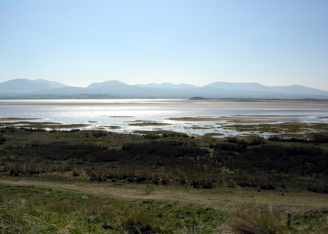
Abermenai Point (Welsh: Pwynt Abermenai) is a headland in the southeast of the island of Anglesey in Wales. It is the southernmost point of the island and is the northern point of the western entrance of the Menai Strait. The headland is mainly composed of sand dunes at the end of Newborough Warren and has no road leading up to or onto it. The nearest major public road, along which a public bus runs is the A4080 at Newborough. Due to its exposed location and the nature of the straits the Ordnance Survey map for the point carries a warning ''"Public Rights of Way to Abermenai Point can be dangerous under tidal conditions."'' The earliest recorded ferry crossing route from the island to the mainland ran from the point to the site at which Fort Belan now sits. Records in the late 11th century relating to the then King of Gwynedd, Gruffudd ap Cynan state that a ferryman was employed there and ferry houses at both locations have been recorded throughout history. In 1725, Daniel Def ... [...More Info...] [...Related Items...] OR: [Wikipedia] [Google] [Baidu] |
Angharad Ferch Owain
Angharad ferch Owain (1065–1162) was the wife of Gruffudd ap Cynan, a king of Gwynedd. Biography Angharad was born in the region of Tegeingl in Flintshire county, Wales. Her father was Owain ab Edwin (1044–1105). Her mother was Morwyl ferch Ednywain (1048–1065), wife of Edwin. She was faithful to her queenly duties. Angharad married Gruffudd ap Cynan in 1082 in the Kingdom of Gwynedd when she was seventeen. She was queen of Gwynedd for forty years with her husband and queen mother for twenty-five years into the time period when her son Owain ap Gruffudd was king of Gwynedd in north Wales. Personality Angharad was a tall blonde and labelled "Golden Haired".Ancestry.com Library Edition �Angharad Queen of Gwyneed, "Golden Haired", Verch Owain ap Edwin/ref> She was considered attractive and eloquent. Angharad had large eyes, strong limbs, long fingers with well groomed nails, a nice figure and fine feet. She had a queenly personality, was good-natured, and was kn ... [...More Info...] [...Related Items...] OR: [Wikipedia] [Google] [Baidu] |
Fort Belan
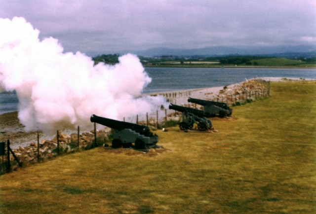
Fort Belan (alternative: Belan Fort; pronounced: ''Bell-ann'') is a coastal fortress in North Wales. It is located opposite Abermenai Point, at the south-western end of the Menai Strait, on the coast of Gwynedd, in the parish of Llanwnda. Situated at the tip of the Dinlle Peninsula, the windblown, north-westernmost point of the Welsh mainland, the fort is cut off twice a day by the incoming tide. History The fort was built in 1775 for a reported cost of £30,000 (equivalent to £ million in ), by Thomas Wynn, then MP for Caernarfonshire and later to become Lord Newborough. He was worried about the vulnerability of Britain's coastline to attack, particularly because of the recently begun American War of Independence. Fort Belan was the only purpose-built fort of the American Revolution on the eastern side of the Atlantic Ocean. It guards a narrow passage of width. In the late 1780s, the barracks were used to ward off raiding American privateers from the Irish Sea but despi ... [...More Info...] [...Related Items...] OR: [Wikipedia] [Google] [Baidu] |
Menai Strait
The Menai Strait ( cy, Afon Menai, the "river Menai") is a narrow stretch of shallow tidal water about long, which separates the island of Anglesey from the mainland of Wales. It varies in width from from Fort Belan to Abermenai Point to from Traeth Gwyllt to Caernarfon Castle. It then narrows to in the middle reaches (Y Felinheli and Menai Bridge) and then it broadens again. At Bangor, Garth Pier, it is wide. It then widens out, and the distance from Puffin Island (Welsh: ''Ynys Seiriol'') to Penmaenmawr is about . The differential tides at the two ends of the strait cause very strong currents to flow in both directions through the strait at different times, creating dangerous conditions. One of the most dangerous areas of the strait is known as the Swellies (or Swillies – Welsh ''Pwll Ceris'') between the two bridges. Here, rocks near the surface cause over-falls and local whirlpools, which can be of considerable danger in themselves and cause small boats to founde ... [...More Info...] [...Related Items...] OR: [Wikipedia] [Google] [Baidu] |
Newborough Warren
Newborough Warren ( cy, Tywyn Niwbwrch) near the village of Newborough (''Niwbwrch'') is a large dune and beach system of , approximately half of which is a conifer plantation. The whole area is designated as a Site of Special Scientific Interest and all of the site except the forestry is a national nature reserve. The site is bounded on two sides by rivers: to the south-east by the Afon Braint and to the north-west by the Afon Cefni. It includes Llanddwyn Bay and Malltraeth Bay, divided by Ynys Llanddwyn, and part of the Anglesey Coastal Path. Geomorphology There are large expanses of both active and fixed dunes, although many of the latter have been afforested, along with a freshwater lake, salt marsh and mudflats and a tidal island. The reserve contains an outstanding flora, interesting lichen and moss communities and a wealth of invertebrates. The intertidal mudflats and saltmarshes are important wintering grounds for waders and wildfowl regularly supporting over on ... [...More Info...] [...Related Items...] OR: [Wikipedia] [Google] [Baidu] |
Gruffudd Ap Cynan
Gruffudd ap Cynan ( 1137), sometimes written as Gruffydd ap Cynan, was King of Gwynedd from 1081 until his death in 1137. In the course of a long and eventful life, he became a key figure in Welsh resistance to Norman rule, and was remembered as King of all the Welsh and Prince of all the Welsh. As a descendant of Rhodri Mawr, Gruffudd ap Cynan was a senior member of the princely House of Aberffraw. Through his mother, Gruffudd had close family connections with the Norse settlement around Dublin and he frequently used Ireland as a refuge and as a source of troops. He three times gained the throne of Gwynedd and then lost it again, before regaining it once more in 1099 and this time keeping power until his death. Gruffudd laid the foundations which were built upon by his son Owain Gwynedd and his great-grandson Llywelyn the Great. Life Unusual for a Welsh king or prince, a near-contemporary biography of Gruffudd, ''The history of Gruffudd ap Cynan'', has survived. Much ... [...More Info...] [...Related Items...] OR: [Wikipedia] [Google] [Baidu] |
Britannia Bridge
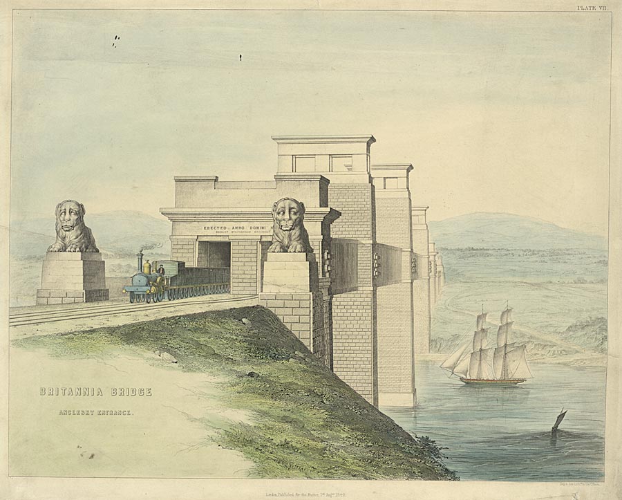
Britannia Bridge ( cy, Pont Britannia) is a bridge across the Menai Strait between the island of Anglesey and the mainland of Wales. It was originally designed and built by the noted railway engineer Robert Stephenson as a tubular bridge of wrought iron rectangular box-section spans for carrying rail traffic. Its importance was to form a critical link of the Chester and Holyhead Railway's route, enabling trains to directly travel between London and the port of Holyhead, thus facilitating a sea link to Dublin, Ireland. Decades before the building of the Britannia Bridge, the Menai Suspension Bridge had been completed, but this structure carried a road rather than track; there was no rail connection to Anglesey before its construction. After many years of deliberation and proposals, on 30 June 1845, a Parliamentary Bill covering the construction of the Britannia Bridge received royal assent. At the Admiralty's insistence, the bridge elements were required to be relatively hig ... [...More Info...] [...Related Items...] OR: [Wikipedia] [Google] [Baidu] |
Holyhead
Holyhead (,; cy, Caergybi , "Cybi's fort") is the list of Anglesey towns by population, largest town and a Community (Wales), community in the county of Isle of Anglesey, Wales, with a population of 13,659 at the 2011 census. Holyhead is on Holy Island, Anglesey, Holy Island, bounded by the Irish Sea to the north, and is separated from Anglesey island by the narrow Cymyran Strait and was originally connected to Anglesey via the Four Mile Bridge#The Bridge, Four Mile Bridge. In the mid-19th century, John Stanley, 1st Baron Stanley of Alderley, Lord Stanley, a local philanthropist, funded the building of a larger Stanley Embankment, causeway, known locally as "The Cobb", it now carries the A5 road (Great Britain), A5 and the North Wales Coast Line, railway line. The A55 road (Great Britain), A55 dual carriageway runs parallel to the Cobb on a modern causeway. The town houses the Port of Holyhead, a major Irish Sea port for connections towards Ireland. Etymology The town's Engli ... [...More Info...] [...Related Items...] OR: [Wikipedia] [Google] [Baidu] |
Robinson Crusoe
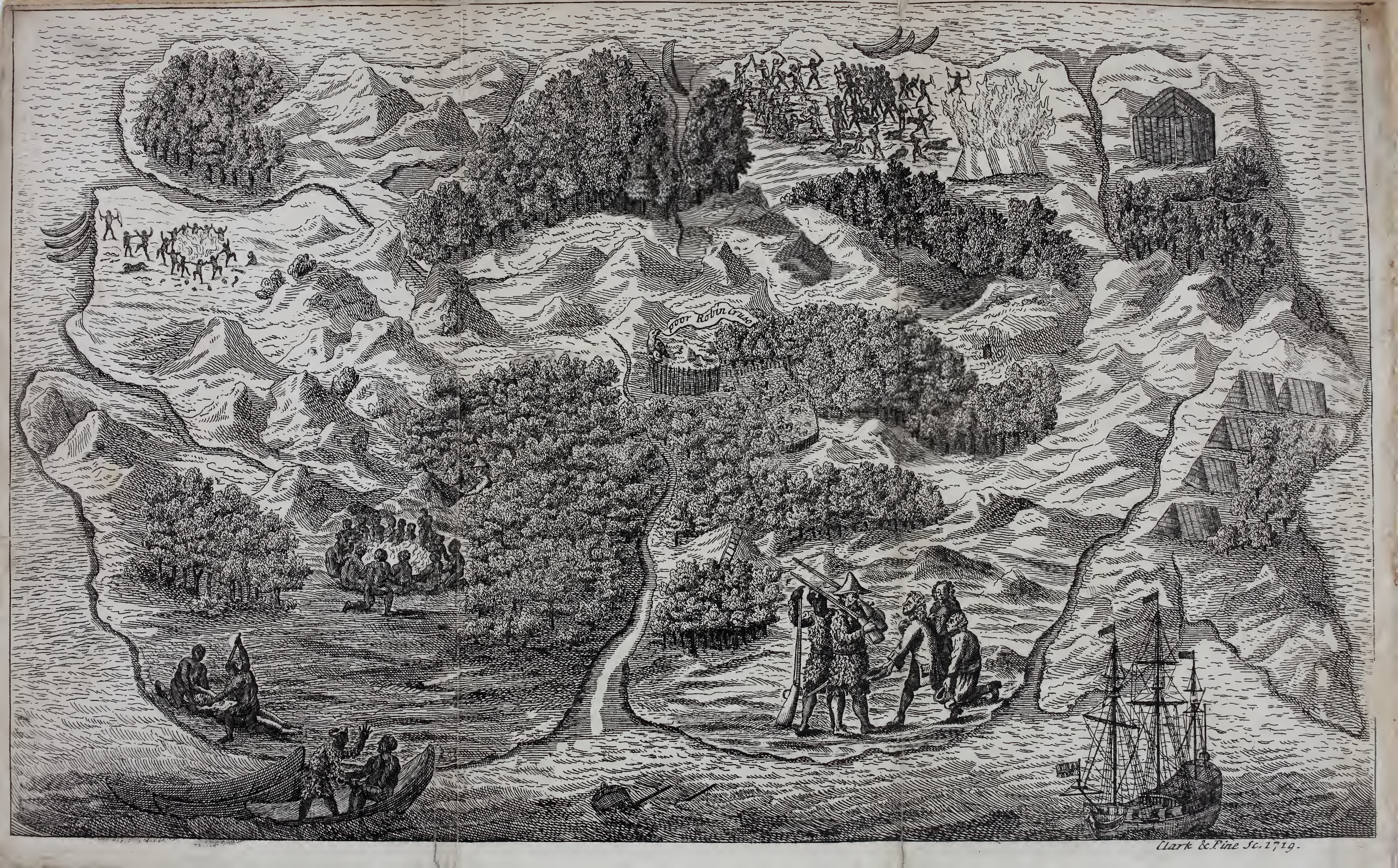
''Robinson Crusoe'' () is a novel by Daniel Defoe, first published on 25 April 1719. The first edition credited the work's protagonist Robinson Crusoe as its author, leading many readers to believe he was a real person and the book a travelogue of true incidents. Epistolary, confessional, and didactic in form, the book is presented as an autobiography of the title character (whose birth name is Robinson Kreutznaer) – a castaway who spends 28 years on a remote tropical desert island near the coasts of Venezuela and Trinidad, roughly resembling Tobago, encountering cannibals, captives, and mutineers before being rescued. The story has been thought to be based on the life of Alexander Selkirk, a Scottish castaway who lived for four years on a Pacific island called "Más a Tierra" (now part of Chile) which was renamed Robinson Crusoe Island in 1966. Despite its simple narrative style, ''Robinson Crusoe'' was well received in the literary world and is often credite ... [...More Info...] [...Related Items...] OR: [Wikipedia] [Google] [Baidu] |
Daniel Defoe
Daniel Defoe (; born Daniel Foe; – 24 April 1731) was an English writer, trader, journalist, pamphleteer and spy. He is most famous for his novel '' Robinson Crusoe'', published in 1719, which is claimed to be second only to the Bible in its number of translations. He has been seen as one of the earliest proponents of the English novel, and helped to popularise the form in Britain with others such as Aphra Behn and Samuel Richardson. Defoe wrote many political tracts, was often in trouble with the authorities, and spent a period in prison. Intellectuals and political leaders paid attention to his fresh ideas and sometimes consulted him. Defoe was a prolific and versatile writer, producing more than three hundred works—books, pamphlets, and journals — on diverse topics, including politics, crime, religion, marriage, psychology, and the supernatural. He was also a pioneer of business journalism and economic journalism. Early life Daniel Foe (his original name) was pr ... [...More Info...] [...Related Items...] OR: [Wikipedia] [Google] [Baidu] |
Gwynedd
Gwynedd (; ) is a Local government in Wales#Principal areas, county and preserved county (latter with differing boundaries; includes the Isle of Anglesey) in the North West Wales, north-west of Wales. It shares borders with Powys, Conwy County Borough, Denbighshire, Anglesey over the Menai Strait, and Ceredigion over the River Dyfi. The scenic Llŷn Peninsula and most of Snowdonia National Park are in Gwynedd. Bangor, Gwynedd, Bangor is the home of Bangor University. As a Administrative divisions of Wales, local government area, it is the second largest in Wales in terms of land area and also one of the most sparsely populated. A majority of the population is Welsh language, Welsh-speaking. ''Gwynedd'' also refers to being one of the preserved counties of Wales, covering the two local government areas of Gwynedd and Anglesey. Named after the old Kingdom of Gwynedd, both culturally and historically, ''Gwynedd'' can also be used for most of North Wales, such as the area that was p ... [...More Info...] [...Related Items...] OR: [Wikipedia] [Google] [Baidu] |
Ordnance Survey
Ordnance Survey (OS) is the national mapping agency for Great Britain. The agency's name indicates its original military purpose (see ordnance and surveying), which was to map Scotland in the wake of the Jacobite rising of 1745. There was also a more general and nationwide need in light of the potential threat of invasion during the Napoleonic Wars. Since 1 April 2015 Ordnance Survey has operated as Ordnance Survey Ltd, a government-owned company, 100% in public ownership. The Ordnance Survey Board remains accountable to the Secretary of State for Business, Energy and Industrial Strategy. It was also a member of the Public Data Group. Paper maps for walkers represent only 5% of the company's annual revenue. It produces digital map data, online route planning and sharing services and mobile apps, plus many other location-based products for business, government and consumers. Ordnance Survey mapping is usually classified as either " large-scale" (in other words, more detail ... [...More Info...] [...Related Items...] OR: [Wikipedia] [Google] [Baidu] |


.jpg)

.jpg)
