|
2019 Sichuan Earthquake
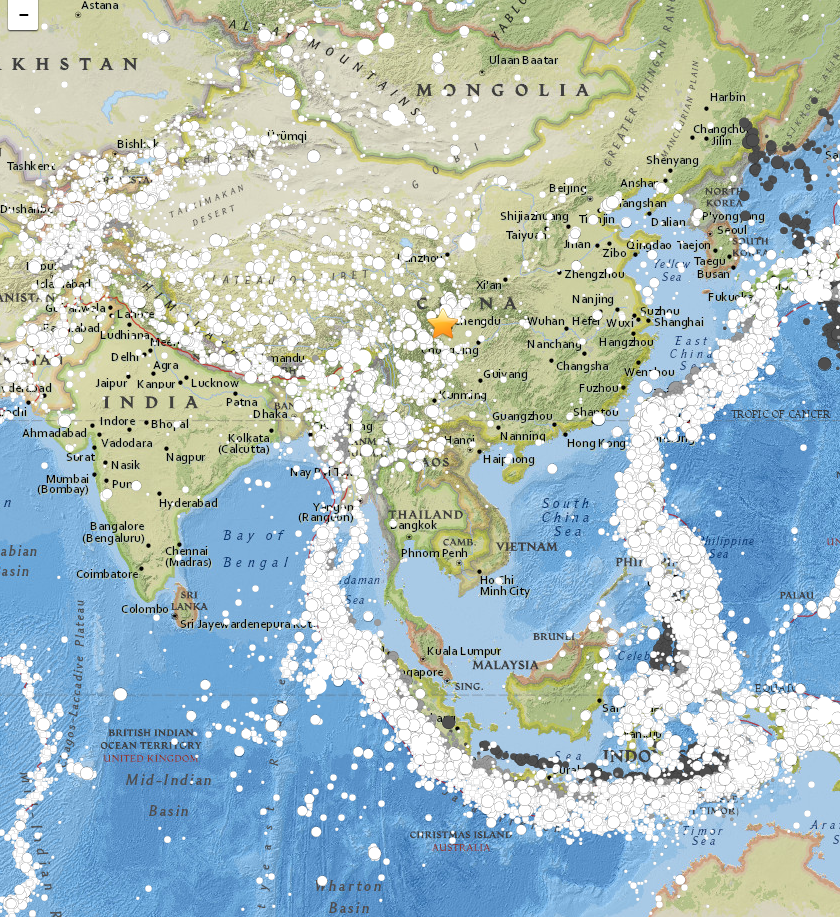
An earthquake measuring 5.8 struck the province of Sichuan in China at 22:55 local time (14:55 UTC), 17 June 2019. Changning and Gong counties in Yibin were particularly affected. 13 people died and more than 200 others were injured. Tectonic setting Sichuan lies within the zone of complex tectonics caused by the continuing convergence of the Indian Plate with the Eurasian Plate. The active faulting in this area relates to the eastward movement of material away from the Tibetan Plateau, which has been uplifted by this collision. The largest structure in the area is the Longmenshan Fault, movement on which was responsible for the M7.9 2008 Sichuan earthquake. Earthquake Based on the focal mechanism the earthquake was a result of oblique-slip faulting, dominantly reverse faulting with a component of strike-slip. Further analysis suggests that the initial movement was on a reverse fault followed by rupture along a shallow strike-slip fault. The reverse fault movement matc ... [...More Info...] [...Related Items...] OR: [Wikipedia] [Google] [Baidu] |
Fault (geology)
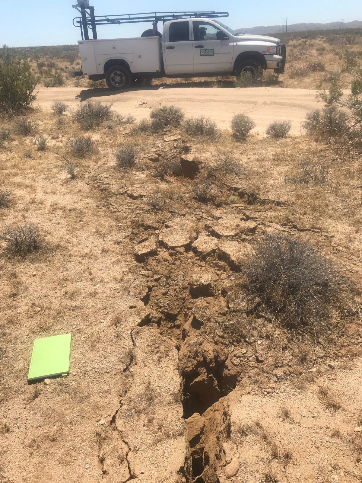
In geology, a fault is a planar fracture or discontinuity in a volume of rock across which there has been significant displacement as a result of rock-mass movements. Large faults within Earth's crust result from the action of plate tectonic forces, with the largest forming the boundaries between the plates, such as the megathrust faults of subduction zones or transform faults. Energy release associated with rapid movement on active faults is the cause of most earthquakes. Faults may also displace slowly, by aseismic creep. A ''fault plane'' is the plane that represents the fracture surface of a fault. A '' fault trace'' or ''fault line'' is a place where the fault can be seen or mapped on the surface. A fault trace is also the line commonly plotted on geologic maps to represent a fault. A ''fault zone'' is a cluster of parallel faults. However, the term is also used for the zone of crushed rock along a single fault. Prolonged motion along closely spaced faults can bl ... [...More Info...] [...Related Items...] OR: [Wikipedia] [Google] [Baidu] |
Mercalli Intensity Scale
The Modified Mercalli intensity scale (MM, MMI, or MCS), developed from Giuseppe Mercalli's Mercalli intensity scale of 1902, is a seismic intensity scale used for measuring the intensity of shaking produced by an earthquake. It measures the effects of an earthquake at a given location, distinguished from the earthquake's inherent force or strength as measured by seismic magnitude scales (such as the "" magnitude usually reported for an earthquake). While shaking is caused by the seismic energy released by an earthquake, earthquakes differ in how much of their energy is radiated as seismic waves. Deeper earthquakes also have less interaction with the surface, and their energy is spread out across a larger volume. Shaking intensity is localized, generally diminishing with distance from the earthquake's epicenter, but can be amplified in sedimentary basins and certain kinds of unconsolidated soils. Intensity scales empirically categorize the intensity of shaking based on the effect ... [...More Info...] [...Related Items...] OR: [Wikipedia] [Google] [Baidu] |
2019 Earthquakes
{{Infobox earthquakes in year, year=2019, location_map=Earth, location_map_places= {{Location map~, Earth, mark = Green pog.svg, lat_deg = 28.261, lon_deg = 104.984 {{Location map~, Earth, mark = Green pog.svg, lat_deg = 32.970, lon_deg = 130.469 {{Location map~, Earth, mark = Green pog.svg, lat_deg = 34.119, lon_deg = 45.681 {{Location map~, Earth, mark = Green pog.svg, lat_deg = -38.51, lon_deg = -68.91 {{Location map~, Earth, mark = Green pog.svg, lat_deg = -5.488, lon_deg = 133.765 {{Location map~, Earth, mark = Green pog.svg, lat_deg = -14.525, lon_deg = -75.386 {{Location map~, Earth, mark = Green pog.svg, lat_deg = -14.525, lon_deg = -75.386 {{Location map~, Earth, mark = Green pog.svg, lat_deg = 2.990, lon_deg = -75.769 {{Location map~, Earth, mark = Green pog.svg, lat_deg = 51.571, lon_deg = 16.158 {{Location map~, Earth, mark = Green pog.svg, lat_deg = 40.933, lon_deg = 48.624 {{Location map~, Earth, mark = Green pog.svg, lat_deg = 27.075, lon_deg = 55.541 {{Location map ... [...More Info...] [...Related Items...] OR: [Wikipedia] [Google] [Baidu] |
List Of Earthquakes In Sichuan
This is a list of earthquakes that occurred in Sichuan province of China. Earthquakes with magnitude of 7.0 or greater Earthquakes registering magnitudes between 6.0 and 6.9 See also *List of earthquakes in Yunnan References {{Earthquakes in China Sichuan Sichuan (; zh, c=, labels=no, ; zh, p=Sìchuān; alternatively romanized as Szechuan or Szechwan; formerly also referred to as "West China" or "Western China" by Protestant missions) is a province in Southwest China occupying most of th ... earthquakes ... [...More Info...] [...Related Items...] OR: [Wikipedia] [Google] [Baidu] |
List Of Earthquakes In China
This is a List of earthquakes in China, part of the series of lists of disasters in China. China has been the location of some of the most deadly earthquakes in history. The deadliest was the 1976 Tangshan earthquake with 300,000+ deaths. Earthquakes in the loess plateau where residents lived in yaodong caves tended to have big casualties, including the 1303 Hongdong and 1920 Haiyuan earthquakes. The most recent earthquake with a death toll of more than a thousand was the 2010 Yushu earthquake, which killed 2,698. The collision of India with the rest of Asia has led to seismic activity throughout Western China, particularly in Tibet and the Yunnan, Xinjiang, Sichuan, Gansu and Qinghai provinces. However, these regions in comparison with Eastern China have a low population density. These areas also in general have poorer transport and building codes. Throughout China, poor building codes increases the damage and loss of life from earthquakes. The northern regions of Easte ... [...More Info...] [...Related Items...] OR: [Wikipedia] [Google] [Baidu] |
List Of Earthquakes In 2019
{{Infobox earthquakes in year, year=2019, location_map=Earth, location_map_places= {{Location map~, Earth, mark = Green pog.svg, lat_deg = 28.261, lon_deg = 104.984 {{Location map~, Earth, mark = Green pog.svg, lat_deg = 32.970, lon_deg = 130.469 {{Location map~, Earth, mark = Green pog.svg, lat_deg = 34.119, lon_deg = 45.681 {{Location map~, Earth, mark = Green pog.svg, lat_deg = -38.51, lon_deg = -68.91 {{Location map~, Earth, mark = Green pog.svg, lat_deg = -5.488, lon_deg = 133.765 {{Location map~, Earth, mark = Green pog.svg, lat_deg = -14.525, lon_deg = -75.386 {{Location map~, Earth, mark = Green pog.svg, lat_deg = -14.525, lon_deg = -75.386 {{Location map~, Earth, mark = Green pog.svg, lat_deg = 2.990, lon_deg = -75.769 {{Location map~, Earth, mark = Green pog.svg, lat_deg = 51.571, lon_deg = 16.158 {{Location map~, Earth, mark = Green pog.svg, lat_deg = 40.933, lon_deg = 48.624 {{Location map~, Earth, mark = Green pog.svg, lat_deg = 27.075, lon_deg = 55.541 {{Location map ... [...More Info...] [...Related Items...] OR: [Wikipedia] [Google] [Baidu] |
Hydroelectric Power Plant
Hydroelectricity, or hydroelectric power, is electricity generated from hydropower (water power). Hydropower supplies one sixth of the world's electricity, almost 4500 TWh in 2020, which is more than all other renewable sources combined and also more than nuclear power. Hydropower can provide large amounts of low-carbon electricity on demand, making it a key element for creating secure and clean electricity supply systems. A hydroelectric power station that has a dam and reservoir is a flexible source, since the amount of electricity produced can be increased or decreased in seconds or minutes in response to varying electricity demand. Once a hydroelectric complex is constructed, it produces no direct waste, and almost always emits considerably less greenhouse gas than fossil fuel-powered energy plants. [...More Info...] [...Related Items...] OR: [Wikipedia] [Google] [Baidu] |
Interferometric Synthetic-aperture Radar
Interferometric synthetic aperture radar, abbreviated InSAR (or deprecated IfSAR), is a radar technique used in geodesy and remote sensing. This geodetic method uses two or more synthetic aperture radar (SAR) images to generate maps of surface deformation or digital elevation, using differences in the phase of the waves returning to the satellite or aircraft. The technique can potentially measure millimetre-scale changes in deformation over spans of days to years. It has applications for geophysical monitoring of natural hazards, for example earthquakes, volcanoes and landslides, and in structural engineering, in particular monitoring of subsidence and structural stability. Technique Synthetic aperture radar Synthetic aperture radar (SAR) is a form of radar in which sophisticated processing of radar data is used to produce a very narrow effective beam. It can be used to form images of relatively immobile targets; moving targets can be blurred or displaced in the formed im ... [...More Info...] [...Related Items...] OR: [Wikipedia] [Google] [Baidu] |
Rock Salt
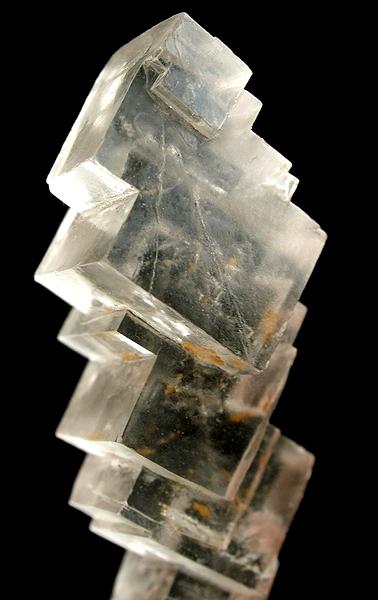
Halite (), commonly known as rock salt, is a type of salt, the mineral (natural) form of sodium chloride ( Na Cl). Halite forms isometric crystals. The mineral is typically colorless or white, but may also be light blue, dark blue, purple, pink, red, orange, yellow or gray depending on inclusion of other materials, impurities, and structural or isotopic abnormalities in the crystals. It commonly occurs with other evaporite deposit minerals such as several of the sulfates, halides, and borates. The name ''halite'' is derived from the Ancient Greek word for "salt", ἅλς (''háls''). Occurrence Halite dominantly occurs within sedimentary rocks where it has formed from the evaporation of seawater or salty lake water. Vast beds of sedimentary evaporite minerals, including halite, can result from the drying up of enclosed lakes and restricted seas. Such salt beds may be hundreds of meters thick and underlie broad areas. Halite occurs at the surface today in playas in regi ... [...More Info...] [...Related Items...] OR: [Wikipedia] [Google] [Baidu] |
Solution Mining
In-situ leaching (ISL), also called in-situ recovery (ISR) or solution mining, is a mining process used to recover minerals such as copper and uranium through boreholes drilled into a deposit, '' in situ''. In situ leach works by artificially dissolving minerals occurring naturally in a solid state. For recovery of material occurring naturally in solution, see: Brine mining. The process initially involves the drilling of holes into the ore deposit. Explosive or pathways in the deposit for solution to penetrate. Leaching solution is pumped into the deposit where it makes contact with the ore. The solution bearing the dissolved ore content is then pumped to the surface and processed. This process allows the extraction of metals and salts from an ore body without the need for conventional mining involving drill-and-blast, open-cut or underground mining. Process In-situ leach mining involves pumping of a lixiviant into the ore body via a borehole, which circulates through t ... [...More Info...] [...Related Items...] OR: [Wikipedia] [Google] [Baidu] |
Focal Mechanism
The focal mechanism of an earthquake describes the deformation in the source region that generates the seismic waves. In the case of a fault-related event it refers to the orientation of the fault plane that slipped and the slip vector and is also known as a fault-plane solution. Focal mechanisms are derived from a solution of the moment tensor for the earthquake, which itself is estimated by an analysis of observed seismic waveforms. The focal mechanism can be derived from observing the pattern of "first motions", that is, whether the first arriving P waves break up or down. This method was used before waveforms were recorded and analysed digitally and this method is still used for earthquakes too small for easy moment tensor solution. Focal mechanisms are now mainly derived using semi-automatic analysis of the recorded waveforms. Moment tensor solutions The moment tensor solution is typically displayed graphically using a so-called ''beachball'' diagram. The pattern o ... [...More Info...] [...Related Items...] OR: [Wikipedia] [Google] [Baidu] |
Luzhou
Luzhou (; Sichuanese Pinyin: Nu2zou1; Luzhou dialect: ), formerly transliterated as Lu-chou or Luchow, is a prefecture-level city located in the southeast of Sichuan Province, China. The city, named Jiangyang until the Southern and Northern Dynasties, is known as the "Liquor City" (). Situated at the confluence of the Tuo River and the Yangtze River, Luzhou is not only an important port on the Yangtze river, but also the largest port in both size and output in Sichuan province since Chongqing was separated from Sichuan province in 1997. As of the 2020 Chinese census, its population was 4,254,149 inhabitants whom 1,241,273 lived in the built-up (''or metro'') area made of Jiangyang and Longmatan districts, as Naxi district is not conurbated yet. Luzhou, which borders Yunnan, Guizhou and Chongqing, is the only geographic junction of the four provinces, and was therefore the logical place for a port in ancient China. After the PRC was founded in 1949, Luzhou became the capital of s ... [...More Info...] [...Related Items...] OR: [Wikipedia] [Google] [Baidu] |


