|
Podolia
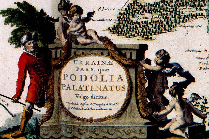
Podolia or Podilia ( uk, Поділля, Podillia, ; russian: Подолье, Podolye; ro, Podolia; pl, Podole; german: Podolien; be, Падолле, Padollie; lt, Podolė), is a historic region in Eastern Europe, located in the west-central and south-western parts of Ukraine and in northeastern Moldova (i.e. northern Transnistria). The name derives from Old Slavic ''po'', meaning "by/next to/along" and ''dol'', "valley" (see dale). Geography The area is part of the vast East European Plain, confined by the Dniester River and the Carpathian arc in the southwest. It comprises an area of about , extending for from northwest to southeast on the left bank of the Dniester. In the same direction run two ranges of relatively low hills separated by the Southern Bug, ramifications of the Avratynsk heights. The Podolian Upland, an elongated, up to high plateau stretches from the Western and Southern Bug rivers to the Dniester, and includes hill countries and mountainous reg ... [...More Info...] [...Related Items...] OR: [Wikipedia] [Google] [Baidu] |
Podolian Upland
The Podolian Upland (Podolian Plateau) or Podillia Upland ( uk, подільська височина, ''podilska vysochyna'') is a highland area in southwestern Ukraine, on the left (northeast) bank of the Dniester River, with small portions in its western extent stretching into eastern Poland. The region lies roughly between the Southern Bug and Dniester Rivers, with the Western Bug also originating in the northwest of the highlands. The average altitude of the Podolian Upland is over with the maximum being a hill known as Kamula Mountain, at . The surface is characterized by a combination of wide flat interfluves and deep canyon-like valleys (so called dales) dissected into separate natural sub-regions: *Wooded heightened hills ** Roztochia ** Holohory ** Voronyaky ** Kremenets Hills (Mountains) ** Tovtry *Flat treeless plateaus ** Ternopil Plateau ** Upper Bug Plateau ** North-Podolian Plateau The Podolian Upland and the Volhynian Upland are sometimes grouped together ... [...More Info...] [...Related Items...] OR: [Wikipedia] [Google] [Baidu] |
Kamianets-Podilskyi
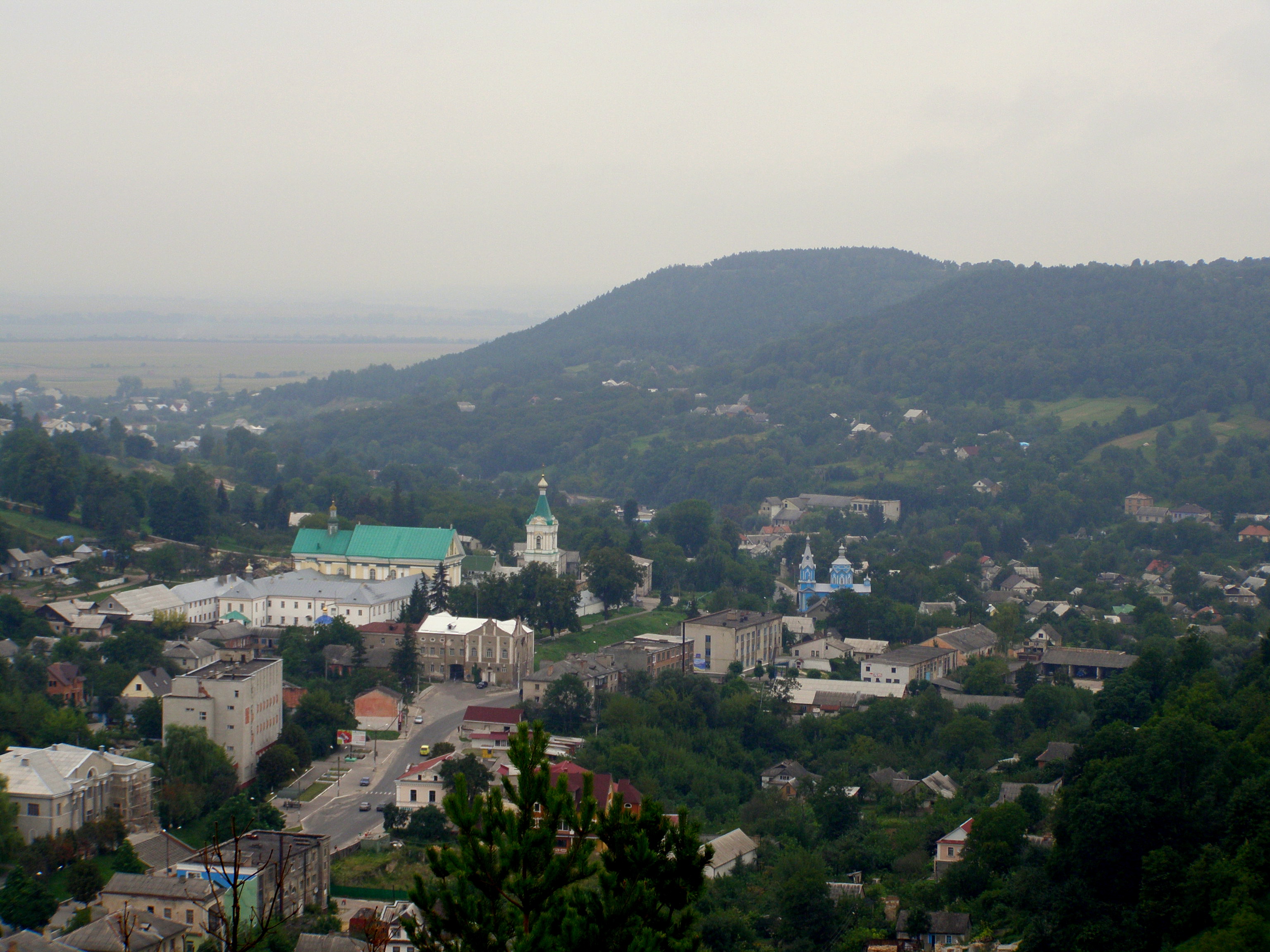
Kamianets-Podilskyi ( uk, Ка́м'яне́ць-Поді́льський, russian: Каменец-Подольский, Kamenets-Podolskiy, pl, Kamieniec Podolski, ro, Camenița, yi, קאַמענעץ־פּאָדאָלסק / קאַמעניץ, Kamenetz-Podolsk / Kamenitz) is a city on the Smotrych River in western Ukraine, to the north-east of Chernivtsi. Formerly the administrative center of the Khmelnytskyi Oblast, the city is now the administrative center of the Kamianets-Podilskyi district within the Khmelnytskyi province. It hosts the administration of Kamianets-Podilskyi urban hromada. Current population has been estimated as In 1919–1920, during the unfolding Ukrainian–Soviet War, the city officially served as the temporary capital of the Ukrainian People's Republic. Name The first part of the city's dual name originates from ' ( uk, камiнь) or ', meaning 'stone' in Old Slavic. The second part of its name relates to the historic region of Podoli ... [...More Info...] [...Related Items...] OR: [Wikipedia] [Google] [Baidu] |
Kamianets-Podilskyi Castle
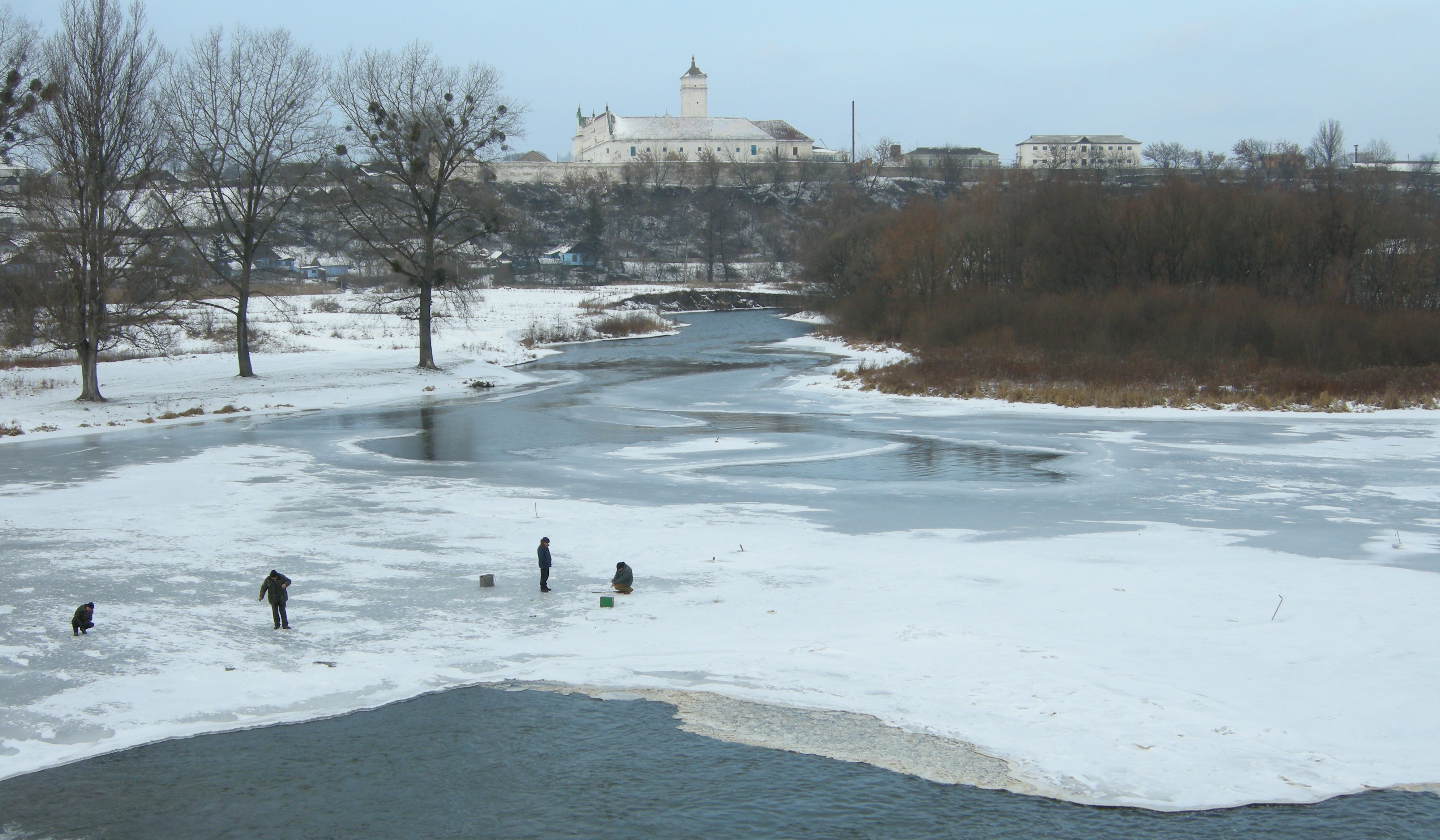
Kamianets-Podilskyi Castle ( uk, links=no, Кам'янець-Подільська фортеця; pl, links=no, twierdza w Kamieńcu Podolskim) is a former Ruthenian-Lithuanian castle and a later three-part Polish fortress located in the historic city of Kamianets-Podilskyi, Ukraine, in the historic region of Podolia in the western part of the country. Its name is attributed to the root word ''kamin''', from the Slavic word for 'stone'. Historical accounts date Kamianets-Podilskyi Castle to the early 14th century, although recent archaeological evidence has proved human existence in the area back to the 12th or 13th century. Initially built to protect the bridge connecting the city with the mainland, the castle sits on top of a peninsula carved out by the winding Smotrych River, forming a natural defense system for Kamianets-Podilskyi's historic Old Town neighborhood. Its location on a strategic transport crossroad in Podolia made the castle a prime target for foreign invaders ... [...More Info...] [...Related Items...] OR: [Wikipedia] [Google] [Baidu] |
Ukrainian Historical Regions
A list of the various regions of Ukraine and/or inhabited by Ukrainians and their ancestors throughout history. Main historical regions Traditional regions The traditional names of the regions of Ukraine are important geographic, historical, and ethnographic identifiers. * Over-Dnieper Ukraine, Great Ukraine ** Land of Kyiv *** Right-bank Ukraine (east of Zhytomyr Oblast, Kyiv Oblast, Cherkasy Oblast), Central Ukraine *** Polesia, Land of Turov (north of Kyiv Oblast, east of Brest Oblast, west of Gomel Oblast), Northern Ukraine ** Land of Pereyaslav (predominantly Poltava Oblast and east of Kyiv Oblast), southern part of Left-bank Ukraine, Little Russia, Central Ukraine ** Land of Chernihiv (predominantly Chernihiv Oblast, west of Bryansk Oblast, east of Gomel Oblast), northern part of Left-bank Ukraine, Little Russia, Northern Ukraine ** Severia (Sumy Oblast, Kharkiv Oblast, Kursk Oblast, Belgorod Oblast) ** Sloboda Ukraine (mostly Kharkiv Oblast) * Ruthenia, Kingdom ... [...More Info...] [...Related Items...] OR: [Wikipedia] [Google] [Baidu] |
Khmelnytskyi Oblast
Khmelnytskyi Oblast ( uk, Хмельни́цька о́бласть, translit=Khmelnytska oblast; also referred to as Khmelnychchyna — uk, Хмельни́ччина) is an oblast (province) of western Ukraine covering portions of the historical regions of western Podolia and southern Volhynia. The administrative center of the oblast is the city of Khmelnytskyi. The current estimated population is around . Created in 1937 out of border okrugs of Vinnytsia Oblast, in 1941–44 it was under Nazi Germany occupation and part of the Reichskommissariat Ukraine (Wolhynien und Podolien general district). Following the Kamenets-Podolsky pocket in spring of 1944 as part of the Proskurov-Chernovtsy operation, Soviet troops removed the German occupation in the region. Until 4 February 1954 it was called Kamianets-Podilsky Oblast () and was centered in Kamianets-Podilsky until 1941. The region rebranding took place after the official renaming of the region's administrative center to ... [...More Info...] [...Related Items...] OR: [Wikipedia] [Google] [Baidu] |
Mohyliv-Podilskyi
Mohyliv-Podilskyi (, , , ) is a city in the Mohyliv-Podilskyi Raion of the Vinnytsia Oblast, Ukraine. Administratively, Mohyliv-Podilskyi is incorporated as a town of regional significance. It also serves as the administrative center of Mohyliv-Podilskyi Raion, one of twenty-seven districts of Vinnytsia Oblast, though it is not a part of the district. It is located in the historic region of Podolia, on the border with Bessarabia, Moldova, along the left bank of the Dniester river. On the opposite side of the river lies the Moldovan town of Otaci, and the two municipalities are connected to each other by a bridge. Population: History Polish period The first mention of the town dates from 1595. The owner of the town, Moldavian hospodar Ieremia Movilă (from which the name Mohyliv, ''Moghilău/Movilău'' in Romanian) bestowed it as a dowry gift to his daughter, who married into the Potocki family of Polish nobility. At that time, the groom named the town Movilǎu in honor of h ... [...More Info...] [...Related Items...] OR: [Wikipedia] [Google] [Baidu] |
Volhynia
Volhynia (also spelled Volynia) ( ; uk, Воли́нь, Volyn' pl, Wołyń, russian: Волы́нь, Volýnʹ, ), is a historic region in Central and Eastern Europe, between south-eastern Poland, south-western Belarus, and western Ukraine. The borders of the region are not clearly defined, but the territory that still carries the name is Volyn Oblast, in western Ukraine. Volhynia has changed hands numerous times throughout history and been divided among competing powers. For centuries it was part of the Polish-Lithuanian Commonwealth. After the Russian annexation, all of Volhynia was part of the Pale of Settlement designated by Imperial Russia on its south-western-most border. Important cities include Lutsk, Rivne, Volodymyr, Ostroh, Ustyluh, Iziaslav, Peresopnytsia, and Novohrad-Volynskyi (Zviahel). After the annexation of Volhynia by the Russian Empire as part of the Partitions of Poland, it also included the cities of Zhytomyr, Ovruch, Korosten. The city of Zviahel ... [...More Info...] [...Related Items...] OR: [Wikipedia] [Google] [Baidu] |
East European Plain
The East European Plain (also called the Russian Plain, "Extending from eastern Poland through the entire European Russia to the Ural Mountaina, the ''East European Plain'' encompasses all of the Baltic states and Belarus, nearly all of Ukraine, and much of the European portion of Russia and reaches north into Finland." ''— Britannica''. or historically the Sarmatic Plain) is a vast interior plain extending east of the North European Plain, and comprising several plateaus stretching roughly from 25 degrees longitude eastward. It includes the westernmost Volhynian-Podolian Upland, the Central Russian Upland, and on the eastern border, encompasses the Volga Upland. The plain includes also a series of major river basins such as the Dnepr Basin, the Oka–Don Lowland, and the Volga Basin. Along the southernmost point of the East European Plain are the Caucasus and Crimean mountain ranges. Together with the North European Plain (covering much of north-western France, Netherlands ... [...More Info...] [...Related Items...] OR: [Wikipedia] [Google] [Baidu] |
West Ukraine
Western Ukraine or West Ukraine ( uk, Західна Україна, Zakhidna Ukraina or , ) is the territory of Ukraine linked to the former Kingdom of Galicia–Volhynia, which was part of the Polish–Lithuanian Commonwealth, the Austrian Empire, Austria-Hungary and the Second Polish Republic, and came fully under the control of the Soviet Union (via the Ukrainian Soviet Socialist Republic) only in 1939, following the Molotov–Ribbentrop Pact. There is no universally accepted definition of the territory's boundaries (see the map, right), but the contemporary Ukrainian administrative regions or Oblasts of Chernivtsi, Ivano-Frankovsk, Lviv, Ternopil and Transcarpathia (which were part of the former Austro-Hungarian Empire) are nearly always included and the Lutsk and Rivne Oblasts (parts of the annexed from Poland during its Third Partition) are usually included. It is less common to include the Khmelnytski and, especially, the Vinnytsia and Zhytomyr Oblasts in this ca ... [...More Info...] [...Related Items...] OR: [Wikipedia] [Google] [Baidu] |
Red Ruthenia
Red Ruthenia or Red Rus' ( la, Ruthenia Rubra; '; uk, Червона Русь, Chervona Rus'; pl, Ruś Czerwona, Ruś Halicka; russian: Червонная Русь, Chervonnaya Rus'; ro, Rutenia Roșie), is a term used since the Middle Ages for the south-western principalities of the Kievan Rus', namely the Principality of Peremyshl and the Principality of Belz. Nowadays the region comprises parts of western Ukraine and adjoining parts of south-eastern Poland. It has also sometimes included parts of Lesser Poland, Podolia, Right-bank Ukraine and Volhynia. Centred on Przemyśl (Peremyshl) and Belz, it has included major cities such as: Chełm, Zamość, Rzeszów, Krosno and Sanok (now all in Poland), as well as Lviv and Ternopil (now in Ukraine). First mentioned by that name in a Polish chronicle of 1321, Red Ruthenia was the portion of Ruthenia incorporated into Poland by Casimir the Great during the 14th century. The disintegration of Rus', Red Ruthenia was contested by th ... [...More Info...] [...Related Items...] OR: [Wikipedia] [Google] [Baidu] |
Ukraine
Ukraine ( uk, Україна, Ukraïna, ) is a country in Eastern Europe. It is the second-largest European country after Russia, which it borders to the east and northeast. Ukraine covers approximately . Prior to the ongoing Russian invasion, it was the eighth-most populous country in Europe, with a population of around 41 million people. It is also bordered by Belarus to the north; by Poland, Slovakia, and Hungary to the west; and by Romania and Moldova to the southwest; with a coastline along the Black Sea and the Sea of Azov to the south and southeast. Kyiv is the nation's capital and largest city. Ukraine's state language is Ukrainian; Russian is also widely spoken, especially in the east and south. During the Middle Ages, Ukraine was the site of early Slavic expansion and the area later became a key centre of East Slavic culture under the state of Kievan Rus', which emerged in the 9th century. The state eventually disintegrated into rival regional powe ... [...More Info...] [...Related Items...] OR: [Wikipedia] [Google] [Baidu] |
Moldova
Moldova ( , ; ), officially the Republic of Moldova ( ro, Republica Moldova), is a landlocked country in Eastern Europe. It is bordered by Romania to the west and Ukraine to the north, east, and south. The unrecognised state of Transnistria lies across the Dniester river on the country's eastern border with Ukraine. Moldova's capital and largest city is Chișinău. Most of Moldovan territory was a part of the Principality of Moldavia from the 14th century until 1812, when it was ceded to the Russian Empire by the Ottoman Empire (to which Moldavia was a vassal state) and became known as Bessarabia. In 1856, southern Bessarabia was returned to Moldavia, which three years later united with Wallachia to form Romania, but Russian rule was restored over the whole of the region in 1878. During the 1917 Russian Revolution, Bessarabia briefly became an autonomous state within the Russian Republic, known as the Moldavian Democratic Republic. In February 1918, the Moldavian Democr ... [...More Info...] [...Related Items...] OR: [Wikipedia] [Google] [Baidu] |


