|
Veluwemeer
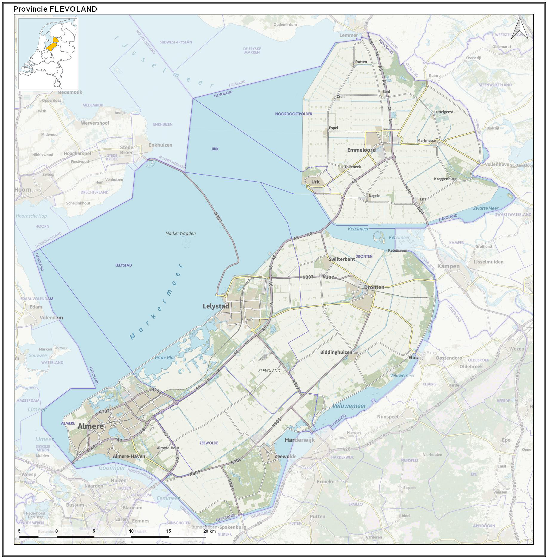
The Veluwemeer (Dutch) or Lake Veluwe is a bordering lake in the Netherlands, between the provinces of Flevoland on the west side and Gelderland on the east side. It is a narrow lake that stretches from south-west to north-east. South of Harderwijk the lake becomes ''het Wolderwijd'' and North of Elburg ''het Drontermeer''. The name of the lake comes from the Veluwe region in Gelderland of which the lake is on the western boundary. The lake is not natural and is one of several lakes known as the Randmeren formed in 1957 when the Flevopolder was created. It has a surface area of over 30 square kilometres and is fairly shallow with an average depth of 1.55 m. It is popular amongst tourists during the summer for recreation on the water or beach. See also *List of lakes *Bordering lakes In the Netherlands, the bordering lakes (in Dutch: ''Randmeren'') are a chain of lakes which separate the Flevopolder and Noordoostpolder from the ancient lands of the provinces of Gelderland, Utrec ... [...More Info...] [...Related Items...] OR: [Wikipedia] [Google] [Baidu] |
Dronten
Dronten () is a municipality and a town in the central Netherlands, in the province of Flevoland. It had a population of in . History Plans for the municipality of Dronten were made in the early half of the 1950s; real plans for the town of Dronten (the municipality's center) were revealed in 1958. The foundations for the town were laid in 1960. Right from the start there was a discussion whether Dronten was to become a town or a city. The first plans assumed 15,000 inhabitants, while later plans foresaw a growth to 30,000 inhabitants. The first plans for the municipality assumed ten smaller villages situated around the central town (in this case, Dronten). The number of villages was reduced because of increased motorized traffic and experiences gained in developing the Noordoostpolder, where a similar municipality had already been built. Eventually, it was decided that there were to be two smaller villages (Biddinghuizen and Swifterbant) and one larger town (Dronten). On 1 J ... [...More Info...] [...Related Items...] OR: [Wikipedia] [Google] [Baidu] |
Bordering Lakes
In the Netherlands, the bordering lakes (in Dutch: ''Randmeren'') are a chain of lakes which separate the Flevopolder and Noordoostpolder from the ancient lands of the provinces of Gelderland, Utrecht, Overijssel and Friesland.''Wateralmanak 2009: Vaargegevens'', ANWB, 2009p. 329/ref> Strictly speaking, these 'lakes' are not separated from each other, but are a continuous body of water between the old land and the new ''polder'' lands, consisting of lakes divided by straits, dams, locks, or in some cases just a bridge over narrow water. The purpose of these lakes is to isolate the water management of the polder land from that of the neighbouring old land. When a polder is created, the ground level within it is below that of the surrounding area. If the polder is connected directly to the old land, the groundwater level in the old land falls, which causes the soil to dry out.Tijdshrift van het Koninklijk Nederlandsch Aardrijkskundig Genootschap, 1964p. 24/ref> This was observed in ... [...More Info...] [...Related Items...] OR: [Wikipedia] [Google] [Baidu] |
Wolderwijd
The Wolderwijd is a bordering lake situated in the Netherlands, created in 1967 by the gaining of land in Southern Flevoland. It is one of four Veluwe bordering lakes. On the northern and western bank it is encompassed by the municipality of Zeewolde, in the Province of Flevoland, and on the southern and eastern bank it is encompassed by the municipality of Harderwijk in the Province of Gelderland. As the bordering lakes of Flevoland are strictly speaking one mass of water there are no exact markers on where the Wolderwijd ends and the adjacent lakes start. In the west near Strand Horst the Wolderwijd becomes the Nuldernauw and in the east at the aqueduct at the provincial road N302 it becomes the Veluwemeer. Use The lake was created as a buffer between the old land of the Veluwe and the newly created Flevopolder, to ensure that the water level of the Veluwe would not drop. The lake receives water from the neighboring Veluwemeer and several streams and sluices. An additional so ... [...More Info...] [...Related Items...] OR: [Wikipedia] [Google] [Baidu] |
Harderwijk
Harderwijk (; Dutch Low Saxon: ) is a municipality and city of the Netherlands. It is served by the Harderwijk railway station. Its population centres are Harderwijk and Hierden. Harderwijk is on the western boundary of the Veluwe. The southeastern half of the municipality is largely forests. History Harderwijk received city rights from Count Otto II of Guelders in 1231. A defensive wall surrounding the city was completed by the end of that century. The oldest part of the city is near where the streets Hoogstraat and Grote Poortstraat now are. Around 1315 the city was expanded southwards, which included the construction of what is now called the Grote Kerk (Great Church). A second, northward expansion took place around 1425. Particularly along the west side of town, much of the wall still exists but often not in entirely original form. That also goes for the only remaining city gate, the Vischpoort (Fish Gate). Between 1648 and 1811, the University of Harderwijk operate ... [...More Info...] [...Related Items...] OR: [Wikipedia] [Google] [Baidu] |
Bordering Lake
In the Netherlands, the bordering lakes (in Dutch: ''Randmeren'') are a chain of lakes which separate the Flevopolder and Noordoostpolder from the ancient lands of the provinces of Gelderland, Utrecht, Overijssel and Friesland.''Wateralmanak 2009: Vaargegevens'', ANWB, 2009p. 329/ref> Strictly speaking, these 'lakes' are not separated from each other, but are a continuous body of water between the old land and the new '' polder'' lands, consisting of lakes divided by straits, dams, locks, or in some cases just a bridge over narrow water. The purpose of these lakes is to isolate the water management of the polder land from that of the neighbouring old land. When a polder is created, the ground level within it is below that of the surrounding area. If the polder is connected directly to the old land, the groundwater level in the old land falls, which causes the soil to dry out.Tijdshrift van het Koninklijk Nederlandsch Aardrijkskundig Genootschap, 1964p. 24/ref> This was observed ... [...More Info...] [...Related Items...] OR: [Wikipedia] [Google] [Baidu] |
Elburg
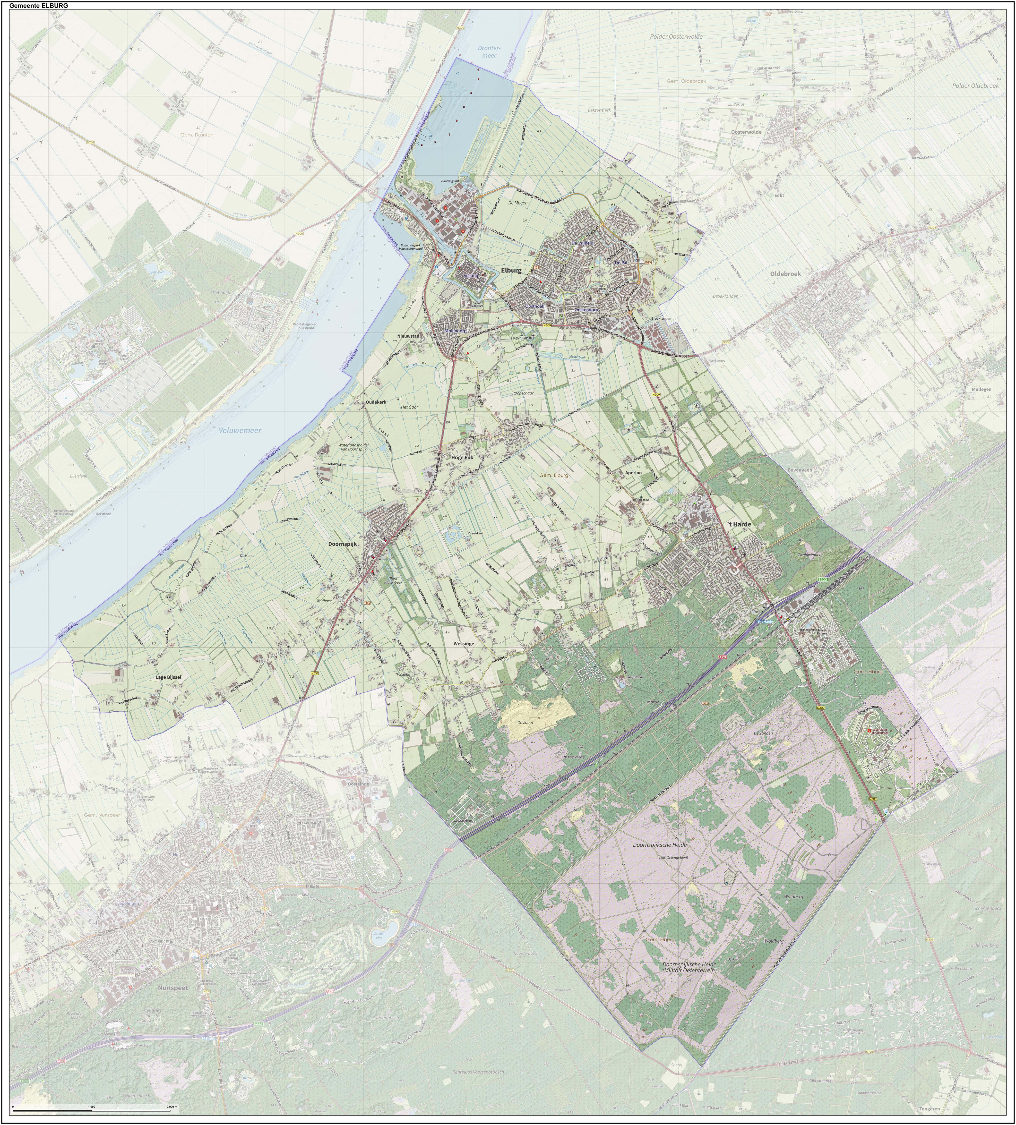
Elburg () is a municipality and a city in the province of Gelderland, Netherlands. History There is evidence of a Neolithic settlement at Elburg consisting of stone tools and pottery shards. From Roman times there are names and shards of earthenware which suggest that there was an army camp at the site of Elburg. The earliest extant written record of Elburg is from 796 AD. Between 1392 and 1396 Elburg was rebuilt with a moat and a city wall, together with a gridiron street plan. This rapid rebuilding was expensive, indicating that Elburg was reasonably affluent in medieval times. Several records of Elburg date back to the 14th century. Elburg was granted town status probably by Count Otto II In the 13th century. There is a record that Elburg got its fishing right granted in 1313. In 1367 the city was recorded as a member of the Hanseatic League. At the end of the 16th century new moats and higher ramparts were built because of the improved war-techniques. Throughout the centur ... [...More Info...] [...Related Items...] OR: [Wikipedia] [Google] [Baidu] |
Lakes Of The Netherlands
The Netherlands Environmental Assessment Agency published in 2010 a map of surface water bodies in the Netherlands. It distinguishes over 20 different types. There are water bodies with salty, brackish and sweet water; natural and artificial lakes by size, peat puddles and fens. The combined surface of the lakes larger than 50 hectares is 2,500 square kilometers. A comprehensive list of past and present lakes in the Netherlands is not available, selected lists are. Groups of lakes There are several groups of lakes or lake systems that are frequently described as a whole. Examples are: * Frisian Lakes, a group of 24 lakes in the province of Friesland * Borderling lakes, a body of water surrounding the Flevopolder often divided in ten parts or lakes Lakes The following is a list of lakes of the Netherlands. Ancient lakes The waterscape of the Netherlands is in continuous change. The following is a list of historical lakes in the Netherlands: * Haarlemmermeer * Lake A ... [...More Info...] [...Related Items...] OR: [Wikipedia] [Google] [Baidu] |
Flevoland
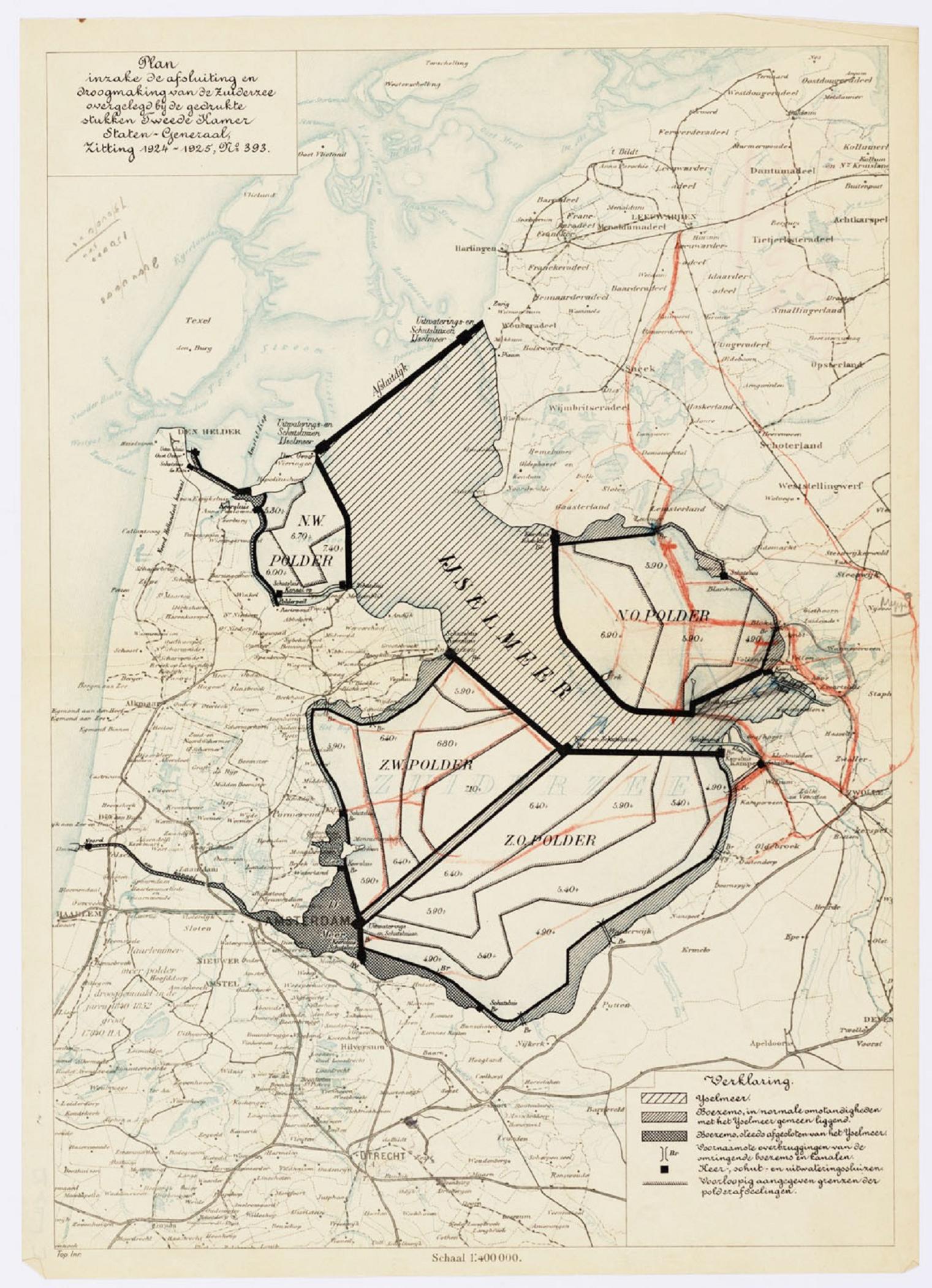
Flevoland () is the twelfth and youngest province of the Netherlands, established in 1986, when the southern and eastern Flevopolders, together with the Noordoostpolder, were merged into one provincial entity. It is in the centre of the country in the former Zuiderzee, which was turned into the freshwater IJsselmeer by the closure of the Afsluitdijk in 1932. Almost all of the land belonging to Flevoland was reclaimed in the 1950s and 1960s while splitting the Markermeer and Bordering lakes from the IJsselmeer. As to dry land, it is the smallest province of the Netherlands at , but not gross land as that includes much of the waters of the fresh water lakes (meres) mentioned. The province has a population of 423,021 as of January 2020 and consists of six municipalities. Its capital is Lelystad and its most populous city is Almere, which forms part of the Randstad and has grown to become the seventh largest city of the country. Flevoland is bordered in the extreme north by Fr ... [...More Info...] [...Related Items...] OR: [Wikipedia] [Google] [Baidu] |
IJsselmeer
The IJsselmeer (; fy, Iselmar, nds-nl, Iesselmeer), also known as Lake IJssel in English, is a closed off inland bay in the central Netherlands bordering the provinces of Flevoland, North Holland and Friesland. It covers an area of with an average depth of . The river IJssel flows into the IJsselmeer. History Two thousand years ago Pomponius Mela, a Roman geographer, mentioned a complex of lakes at the current location of the IJsselmeer. He called it '' Lacus Flevo''. Over the centuries, the lake banks crumbled away due to flooding and wave action and the lake, now called the Almere, grew considerably. During the 12th and 13th centuries, storm surges and rising sea levels flooded large areas of land between the lake and the North Sea, turning the lake into a bay of the North Sea, called the Zuiderzee. The Zuiderzee continued to be a threat to the Dutch, especially when northwesterly storms funnel North Sea waters towards the English Channel, creating very high tides ... [...More Info...] [...Related Items...] OR: [Wikipedia] [Google] [Baidu] |
Eutrophic
Eutrophication is the process by which an entire body of water, or parts of it, becomes progressively enriched with minerals and nutrients, particularly nitrogen and phosphorus. It has also been defined as "nutrient-induced increase in phytoplankton productivity". Water bodies with very low nutrient levels are termed oligotrophic and those with moderate nutrient levels are termed mesotrophic. Advanced eutrophication may also be referred to as dystrophic and hypertrophic conditions. Eutrophication can affect freshwater or salt water systems. In freshwater ecosystems it is almost always caused by excess phosphorus. In coastal waters on the other hand, the main contributing nutrient is more likely to be nitrogen, or nitrogen and phosphorus together. This depends on the location and other factors. When occurring naturally, eutrophication is a very slow process in which nutrients, especially phosphorus compounds and organic matter, accumulate in water bodies. These nutrients derive ... [...More Info...] [...Related Items...] OR: [Wikipedia] [Google] [Baidu] |
Netherlands
) , anthem = ( en, "William of Nassau") , image_map = , map_caption = , subdivision_type = Sovereign state , subdivision_name = Kingdom of the Netherlands , established_title = Before independence , established_date = Spanish Netherlands , established_title2 = Act of Abjuration , established_date2 = 26 July 1581 , established_title3 = Peace of Münster , established_date3 = 30 January 1648 , established_title4 = Kingdom established , established_date4 = 16 March 1815 , established_title5 = Liberation Day , established_date5 = 5 May 1945 , established_title6 = Kingdom Charter , established_date6 = 15 December 1954 , established_title7 = Caribbean reorganisation , established_date7 = 10 October 2010 , official_languages = Dutch , languages_type = Regional languages , languages_sub = yes , languages = , languages2_type = Recognised languages , languages2_sub = yes , languages2 = , demonym = Dutch , capital = Amsterdam , largest_city = capital , ... [...More Info...] [...Related Items...] OR: [Wikipedia] [Google] [Baidu] |


